Category:Old maps of Nanjing
Jump to navigation
Jump to search
Media in category "Old maps of Nanjing"
The following 37 files are in this category, out of 37 total.
-

-
 View of Nanking, 1683.jpg 725 × 1,078; 166 KB
-
 View of Nanking, 1685.jpg 630 × 900; 422 KB
-
 Routes du Kiang-Nan - btv1b52505950j (11 of 46).jpg 18,589 × 2,022; 3.9 MB
-
 Nanjing 1927 AMS-WO,20191215.jpg 1,130 × 760; 564 KB
-
 Nanjing 1927 AMS-WO,20191216.jpg 635 × 321; 144 KB
-
 Nanjing 1927 AMS-WO.jpg 5,206 × 4,336; 7.1 MB
-
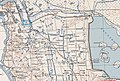
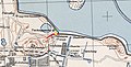
 Map of Nanjing, 1929 - Jiangxin Island shaded in green.jpg 455 × 524; 270 KB
-
 Yangtze Delta.jpg 2,164 × 2,643; 713 KB
-
 1932 Hochi Map of Shanghai, China - Geographicus - Shanghai-hochi-1932.jpg 3,000 × 2,003; 1.22 MB
-
-
 320 of 'China, during the War and since the Peace' (11038688153).jpg 1,984 × 1,267; 425 KB
-
 Border of Nanjing.jpg 640 × 798; 199 KB
-
 Du Halde - Description de la Chine - Villes de la province de Kiang nan.jpg 2,724 × 3,152; 2.71 MB
-
 Du Halde, map of Nanjing.jpg 1,036 × 1,150; 554 KB
-
 EB9 Nanking.png 2,498 × 2,092; 3.65 MB
-
 The Ming Dynasty map of Nanjing,copying Chen Yi.jpg 640 × 486; 95 KB
-
 Nanjing DonghuaGate3.jpg 1,024 × 768; 734 KB
-
 Nanjing in Ming Dynasty.jpg 1,086 × 767; 110 KB
-
 Nankin 1912.jpg 1,691 × 2,004; 605 KB
-
 Nanking & Chin-Keang-foo.jpg 3,679 × 2,132; 767 KB
-
 Old map of nanjing,20190922.png 849 × 564; 1.16 MB
-
 Old map of nanjing.01,20190922.png 609 × 532; 786 KB
-
 Qing jun wei gong Jinling tu. LOC gm71005033.jpg 17,901 × 11,445; 23.63 MB
-
 Qing jun wei gong Jinling tu. LOC gm71005033.tif 17,901 × 11,445; 586.16 MB
-
 The Eastern Jin Dynasty map of Nanjing,by Chen Yi.jpg 640 × 440; 93 KB
-
 The Southern Tang Dynasty map of Nanjing.jpg 640 × 476; 73 KB
-
 The Sui Dynasty Dynasty map of Nanjing,by Chen Yi.jpg 640 × 485; 70 KB
-
 The Yuan Dynasty map of Nanjing,by Chen Yi.jpg 640 × 444; 71 KB
-
 War Damage In The Nanking Area 1937 69.gif 746 × 1,033; 143 KB
-
 乾隆初年江宁府城图.jpg 701 × 482; 221 KB
-
 亚新地学社1936年《袖珍中华全图》--05南京市.jpg 1,541 × 2,148; 648 KB
-
 南京城市全圖-上海商務印書館-1928.jpg 9,993 × 13,604; 27.18 MB
-
 南京市實測新圖-武昌亞新地學社-1936.jpg 6,000 × 8,274; 14.7 MB
-
 南京最新全圖-上海中華書局-1930.jpg 12,296 × 17,056; 32.65 MB
-
 最新首都城市全圖-南京共和書局-1928.jpg 7,542 × 10,762; 12.96 MB
-
 首都幹路定名圖.jpg 650 × 753; 131 KB


_-_Geographicus_-_Shanghai-uk-1932.jpg)
.jpg)


.jpg)