Category:Old maps of Mahoning County, Ohio
Jump to navigation
Jump to search
Subcategories
This category has the following 5 subcategories, out of 5 total.
Media in category "Old maps of Mahoning County, Ohio"
The following 2 files are in this category, out of 2 total.
-
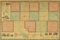
 Map of Mahoning County, Ohio - showing the original lots and farm LOC 2012592376.jpg 18,837 × 12,788; 29.18 MB
-
 Map of Mahoning County, Ohio - showing the original lots and farm LOC 2012592376.tif 18,837 × 12,788; 689.19 MB
