Category:Old maps of Cockaigne
Jump to navigation
Jump to search
Subcategories
This category has only the following subcategory.
Media in category "Old maps of Cockaigne"
The following 10 files are in this category, out of 10 total.
-
 1694 - Johann Baptist Homann "Schlarraffenlandes" (Accurata Utopiæ Tabula).jpg 6,873 × 5,720; 8.68 MB
-
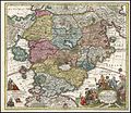 Accurata Utopiae Tabula.jpg 750 × 647; 243 KB
-
 Ca. 1700 allegorical map of Cockaigne.jpg 14,302 × 12,457; 39.09 MB
-
 Ca. 1725 allegorical map of Cockaigne by Johann Baptist Homann.jpg 14,073 × 12,074; 32.59 MB
-

-
 Homann Schlarraffenlandes 1694 Cornell CUL PJM 1015 01.jpg 6,873 × 5,720; 6.23 MB
-
 Lurconia-Schlaraffenland.jpg 570 × 374; 247 KB
-
 Niccolò Nelli, The Land of Cockaigne, 1564, NGA 48501.jpg 4,000 × 3,148; 12.07 MB
-
 Homann Schlaraffenland.jpg 400 × 246; 43 KB
-
 Schlaraffenland - no-nb krt 00932.jpg 8,726 × 7,490; 22.54 MB
.jpg)


