Category:Old maps of Chester
Jump to navigation
Jump to search
Subcategories
This category has the following 2 subcategories, out of 2 total.
Media in category "Old maps of Chester"
The following 24 files are in this category, out of 24 total.
-
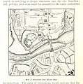 128 of 'Chester in the Plantagenet and Tudor Reigns. (Illustrated.)' (11304488656).jpg 1,418 × 1,431; 639 KB
-
 The Country Palatine of Chester with its Hundreds, (BM 1864,1114.34).jpg 2,500 × 1,921; 1.61 MB
-
 Chester (BM 1868,0822.5924).jpg 2,500 × 1,359; 608 KB
-
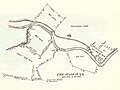 Pusey 1730 Map.jpg 2,022 × 1,512; 368 KB
-
 Chester (BM 1874,1212.571).jpg 2,500 × 2,025; 1.33 MB
-
 EW(1884) p.242 - Chester (left) - A + C Black (pub).jpg 1,225 × 1,902; 596 KB
-
 EW(1884) p.242 - Chester (merged) - A + C Black (pub).jpg 2,192 × 1,808; 1.42 MB
-
 EW(1884) p.243 - Chester (right) - A + C Black (pub).jpg 1,225 × 1,902; 635 KB
-
 Bbstreet.jpg 626 × 440; 329 KB
-
 20 of '(Our own country. Descriptive, historical, pictorial.)' (11292941514).jpg 1,490 × 1,092; 416 KB
-

-

-

-

-
 A plan of the city of Chester.jpg 2,516 × 1,944; 4.68 MB
-
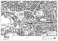
 Chester & Saltney RJD 16.jpg 2,694 × 1,688; 630 KB
-
 Gresty's new illustrated Plan of the ancient city of Chester - btv1b8439027b.jpg 9,058 × 7,182; 9.64 MB
-
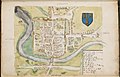
 Map of Chester (William Smith 1588).jpg 864 × 595; 325 KB
-
 Ordnance Survey One-Inch Sheet 43 Chester, Published 1924.jpg 11,809 × 8,809; 44.84 MB
-
 Plan of Chester 02684.jpg 2,381 × 1,924; 4.41 MB
-
 Plan of Chester.jpg 2,416 × 2,461; 5.32 MB
-
 The city of Chester, Pennsylvania 1885. LOC gm71005375.jpg 9,488 × 7,616; 16.44 MB
-
 William Smith Harley MS 1046 f172 Chester birds eye view.jpg 2,000 × 1,661; 1.24 MB
-
 William Smith Harley MS 1046 f173 Chester map.jpg 2,000 × 1,287; 900 KB
%27_(11304488656).jpg)
.jpg)
.jpg)

.jpg)
_p.242_-_Chester_(left)_-_A_%2B_C_Black_(pub).jpg)
_p.242_-_Chester_(merged)_-_A_%2B_C_Black_(pub).jpg)
_p.243_-_Chester_(right)_-_A_%2B_C_Black_(pub).jpg)

%27_(11292941514).jpg)
.jpg)
.jpg)
%27_(11286299196).jpg)


.jpg)


