Category:Old maps of Ardennes (department)
Jump to navigation
Jump to search
Departments of Metropolitan France: Ain [01] · Aisne [02] · Allier [03] · Alpes-de-Haute-Provence [04] · Hautes-Alpes [05] · Alpes-Maritimes [06] · Ardèche [07] · Ardennes [08] · Ariège [09] · Aube [10] · Aude [11] · Aveyron [12] · Bouches-du-Rhône [13] · Calvados [14] · Cantal [15] · Charente [16] · Charente-Maritime [17] · Cher [18] · Corrèze [19] · Corse-du-Sud [2A]† · Haute-Corse [2B]† · Côte-d’Or [21] · Côtes-d'Armor [22] · Creuse [23] · Dordogne [24] · Doubs [25] · Drôme [26] · Eure [27] · Eure-et-Loir [28] · Finistère [29] · Gard [30] · Haute-Garonne [31] · Gers [32] · Gironde [33] · Hérault [34] · Ille-et-Vilaine [35] · Indre [36] · Indre-et-Loire [37] · Isère [38] · Jura [39] · Landes [40] · Loir-et-Cher [41] · Loire [42] · Haute-Loire [43] · Loire-Atlantique [44] · Loiret [45] · Lot [46] · Lot-et-Garonne [47] · Lozère [48] · Maine-et-Loire [49] · Manche [50] · Marne [51] · Haute-Marne [52] · Mayenne [53] · Meurthe-et-Moselle [54] · Meuse [55] · Morbihan [56] · Moselle [57] · Nièvre [58] · Nord [59] · Oise [60] · Orne [61] · Pas-de-Calais [62] · Puy-de-Dôme [63] · Pyrénées-Atlantiques [64] · Hautes-Pyrénées [65] · Pyrénées-Orientales [66] · Bas-Rhin [67] · Haut-Rhin [68] · departmental district of the Rhône [69] · Haute-Saône [70] · Saône-et-Loire [71] · Sarthe [72] · Savoie [73] · Haute-Savoie [74] · Paris [75] · Seine-Maritime [76] · Seine-et-Marne [77] · Yvelines [78] · Deux-Sèvres [79] · Somme [80] · Tarn [81] · Tarn-et-Garonne [82] · Var [83] · Vaucluse [84] · Vendée [85] · Vienne [86] · Haute-Vienne [87] · Vosges [88] · Yonne [89] · Territoire de Belfort [90] · Essonne [91] · Hauts-de-Seine [92] · Seine-Saint-Denis [93] · Val-de-Marne [94] · Val-d'Oise [95]
Overseas departments and regions: Guadeloupe [971] · Martinique [972] · French Guiana [973] · Réunion [974] · Mayotte [976]
Overseas collectivities: Saint Pierre and Miquelon [975] · Saint Barthélemy [977] · Saint-Martin [978] · Wallis and Futuna [986] · French Polynesia [987] · French Southern and Antarctic Lands [984]+
Sui generis territories: New Caledonia [988] · Clipperton Island [989]+
Use the appropriate category for maps showing all or a large part of Ardennes. See subcategories for smaller areas:
| If the map shows | Category to use |
|---|---|
| Ardennes on a recently created map | Category:Maps of Ardennes (department) or its subcategories |
| Ardennes on a map created more than 70 years ago | Category:Old maps of Ardennes (department) or its subcategories |
| the history of Ardennes on a recently created map | Category:Maps of the history of Ardennes (department) or its subcategories |
| the history of Ardennes on a map created more than 70 years ago | Category:Old maps of the history of Ardennes (department) or its subcategories |
Subcategories
This category has the following 3 subcategories, out of 3 total.
Media in category "Old maps of Ardennes (department)"
The following 44 files are in this category, out of 44 total.
-
 "Les souverainetez de Sedan et de Raucourt et la prevosté de Doncheri." (22228898096).jpg 3,694 × 2,934; 2.19 MB
-
-

-

-
 20 la principauté de Sedan Davanne-Chappier.jpg 1,230 × 848; 466 KB
-
 21 la citadelle de Sedan Davanne-Chappier.jpg 1,260 × 876; 501 KB
-

-
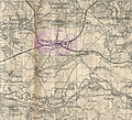 Amagne-Lucquy-FR-08-carte1935.jpg 1,480 × 1,346; 929 KB
-
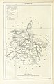
 Ardennes-carte Trousset-01.jpg 2,388 × 3,352; 1.23 MB
-
 Attigny-FR-08-carte de 1935-A.jpg 3,648 × 2,736; 1.97 MB
-
 Baâlons(1935)-02.jpg 1,642 × 1,034; 1.29 MB
-
 Baâlons-FR-08-carte des environs-mai 1940.jpg 3,388 × 2,684; 2.22 MB
-
 Carte d'État-major de la France, Feuille Givet N.O.jpg 24,803 × 13,868; 86.58 MB
-
 Carte d'État-major de la France, Feuille Givet S.O.jpg 24,803 × 13,789; 102.01 MB
-
 Carte d'État-major de la France, Feuille Rocroi S.E.jpg 23,386 × 13,641; 94.91 MB
-
 Carte du département des Ardennes - 1790-1793.tif 5,442 × 6,189; 96.41 MB
-
 Carte du département des Ardennes - 1800.tif 11,572 × 7,165; 237.27 MB
-
 Carte routière du département des Ardennes - 1854.jpg 10,765 × 7,647; 12.03 MB
-
 Carte routière du département des Ardennes et des environs en 1842.jpg 8,697 × 7,887; 9.49 MB
-
 CFDA autour de Vendresse.original.jpg 2,759 × 2,600; 1.84 MB
-
 Charleville-FR-08-carte-mai 1940-A 01.JPG 3,568 × 2,688; 3.01 MB
-
 Charleville-FR-08-carte-mai 1940-A 02.JPG 3,568 × 2,688; 2.88 MB
-
 Château-Porcien-FR-08-carte de 1935-B (Nandin).jpg 1,320 × 2,145; 710 KB
-
 Château-Porcien-FR-08-carte de 1935-B.jpg 3,648 × 2,736; 2.42 MB
-
-
 Ecordal(1935)-2.jpg 1,518 × 1,201; 522 KB
-
 Germigny-Pend-la-Pie-FR-08-situation géographique.jpg 3,648 × 2,736; 5.63 MB
-
 Le Petit Parisien-19 mai 1940-quatrième page.jpg 2,503 × 3,415; 1.65 MB
-
 Les Souverainetez de Sedan et Raucourt et la Prevosté de Doncheri (5120557357).jpg 2,000 × 1,690; 3.55 MB
-
 Map - Special Collections University of Amsterdam - OTM- HB-KZL I 2 A 8 (77).jpg 10,656 × 7,992; 30.45 MB
-
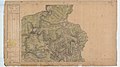
 Montmarin-FR-08-carte1935.jpg 3,344 × 2,028; 1.92 MB
-
 Omgeving Charleville-Mézières 1920.CFDA.jpg 6,129 × 3,527; 7.63 MB
-
 Omgeving Charleville-Mézières 1920.jpg 6,129 × 3,527; 12.77 MB
-
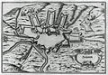
 Plan de Sedan 1728 349.JPG 2,831 × 1,905; 878 KB
-
 Pointe de Givet-19 mai 1940-NB.jpg 1,900 × 2,833; 1.78 MB
-
 Pointe de Givet-19 mai 1940-VR.jpg 1,900 × 2,833; 1.55 MB
-
 Pointe de Givet-19 mai 1940.jpg 1,900 × 2,833; 1.27 MB
-
 Rethel-FR-08-carte de 1935-A.jpg 3,648 × 2,736; 1.87 MB
-
 Rethel-FR-08-carte de 1935-B.jpg 3,648 × 2,736; 2.1 MB
-
 Rethel-FR-08-carte de 1935-C.jpg 3,648 × 2,736; 2.15 MB
-
 The Quarterly journal of the Geological Society of London (1881) (14584106579).jpg 1,614 × 2,176; 349 KB
-

-
 Ville-sur-Vence-carte d'état major.jpg 735 × 445; 144 KB
-
 Atlas national portatif de la France 1792 (105093430).jpg 6,924 × 5,597; 6.09 MB
.jpg)
%27_(11113059525).jpg)
%27_(11084834866).jpg)
_-_Geographicus_-_Ardennes-levasseur-1852.jpg)


-02.jpg)


.jpg)

_-_Fonds_Ancely_-_B315556101_A_LEVASSEUR_011.jpg)
-2.jpg)


.jpg)
.jpg)


_(14584106579).jpg)
.jpg)

.jpg)