Category:Old maps of Île de Ré
Jump to navigation
Jump to search
Media in category "Old maps of Île de Ré"
The following 23 files are in this category, out of 23 total.
-
 Atlante Veneto Volume 2 022.jpg 7,375 × 10,280; 7.03 MB
-

-

-
 Battle of Saint-Martin-de-Ré, Île de Ré and La Rochelle, 1625 RCIN 722017 (cropped).jpg 1,524 × 1,072; 883 KB
-
 Battle of Saint-Martin-de-Ré, Île de Ré and La Rochelle, 1625 RCIN 722017.jpg 1,700 × 2,250; 1.78 MB
-
 Battle of Saint-Martin-de-Ré, Île de Ré and La Rochelle, 1625 RCIN 722018.a.jpg 2,250 × 1,763; 1.72 MB
-
 Battle of Saint-Martin-de-Ré, Île de Ré and La Rochelle, 1625 RCIN 722018.b.jpg 1,635 × 2,000; 793 KB
-

-
 Fort de La Pree 1722 map.jpg 256 × 406; 33 KB
-
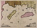
 Ile de Re in the Chart of the Road of Basque 1757.jpg 2,589 × 1,984; 621 KB
-
 Insulae Diui Martini et Vliarus vulgo l'isle de Re et Oleron - CBT 5879439.jpg 5,888 × 4,451; 7.14 MB
-
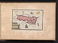
 Isle de Rhé.jpg 625 × 963; 273 KB
-
 Ivr54 19761700276x p.jpg 709 × 484; 89 KB
-

-

-
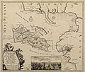
 Kaart van Ile de Ré Carte de l'isle de Ré (titel op object), BI-B-FM-090-42.jpg 3,524 × 2,612; 1.16 MB
-
 Le petit Neptune françois- or, the French coasting pilot Fleuron T220771-8.png 3,264 × 1,837; 236 KB
-
 Plan La Rochelle et environs, 1773, Nicolas Chalmandrier, BNF Gallica.jpg 8,564 × 6,128; 43.38 MB
-
 Plans des ports de France (1777) - Ré-Olleron-Aunis.jpg 6,682 × 9,495; 7.43 MB
-
 Redoute de Sablanceau 1722.jpg 255 × 404; 23 KB
-
 Île de Ré, 1696 RCIN 724086.jpg 2,000 × 1,708; 1.34 MB
-
 Île de Ré-FR-17-carte d'auto-taxi-1.jpg 3,300 × 2,123; 2.74 MB
-
 Île de Ré-FR-17-plan 1936-a.jpg 4,284 × 2,740; 3.12 MB


.jpg)


_Les_Forces_de_l%27Europe,_Asie,_Afrique_et_Amerique_Comme_aussi_les_Cartes_des_C%C3%B4tes_de_France_et_d%27Espagne_(serietitel_op_o,_RP-P-OB-83.035-74.jpg)
_Les_Forces_de_l%27Europe,_Asie,_Afrique_et_Amerique,_ou_description_des_principales_villes_avec_leurs_fortifications._De,_RP-P-OB-83.034-246.jpg)
,_BI-B-FM-090-42.jpg)


_-_R%C3%A9-Olleron-Aunis.jpg)


