Category:Old, Northamptonshire
Jump to navigation
Jump to search
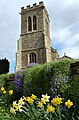
English: Old (originally "Wold") is a village in the West Northamptonshire district of the county of Northamptonshire in England. It is near the village of Walgrave, and has a church, hotel, village hall, pub and park. It was once home to the delivery company Knights of Old, but they are now based in Kettering.
village and civil parish in Northamptonshire, United Kingdom  | |||||
| Upload media | |||||
| Instance of | |||||
|---|---|---|---|---|---|
| Location | West Northamptonshire, Northamptonshire, East Midlands, England | ||||
| Population |
| ||||
| Area |
| ||||
 | |||||
Media in category "Old, Northamptonshire"
The following 50 files are in this category, out of 50 total.
-
 Benches in the shade of a tree, Old (geograph 3540514).jpg 4,320 × 3,240; 3.77 MB
-
 Broughton Road, near Broughton - geograph.org.uk - 5860513.jpg 1,024 × 768; 218 KB
-
 Broughton Road, near Old - geograph.org.uk - 5860480.jpg 1,024 × 768; 276 KB
-
 Broughton Road, near Old - geograph.org.uk - 5860482.jpg 1,024 × 768; 224 KB
-
 Broughton Road, near Walgrave - geograph.org.uk - 5860500.jpg 1,024 × 768; 234 KB
-
 Cherry Hill - geograph.org.uk - 3449918.jpg 640 × 478; 77 KB
-
 Cycle path near Mawsley Village - geograph.org.uk - 5860519.jpg 1,024 × 768; 302 KB
-
 Field gate near Mawsley Village - geograph.org.uk - 5861156.jpg 1,024 × 768; 341 KB
-
 Field near Broughton, Northamptonshire - geograph.org.uk - 5860510.jpg 1,024 × 768; 235 KB
-
 Field near Walgrave - geograph.org.uk - 5860498.jpg 1,024 × 768; 199 KB
-
 Footpath to Mawsley from Old - geograph.org.uk - 5536699.jpg 640 × 640; 123 KB
-
 Footpath to Mawsley from Old - geograph.org.uk - 5536700.jpg 640 × 640; 121 KB
-
 Footpath to Mawsley from Old - geograph.org.uk - 5536702.jpg 640 × 640; 116 KB
-
 Footpath to Mawsley from Old - geograph.org.uk - 5536703.jpg 640 × 640; 131 KB
-
 Footpath to Old from Mawsley - geograph.org.uk - 5536704.jpg 640 × 640; 111 KB
-
 Grange Farmhouse in the village of Old - geograph.org.uk - 5321011.jpg 800 × 583; 186 KB
-
 Loddington Way, Mawsley Village - geograph.org.uk - 5861132.jpg 1,024 × 768; 198 KB
-
 Lorry depot near Broughton, Northamptonshire - geograph.org.uk - 5860508.jpg 1,024 × 768; 209 KB
-
 Mill Lane - geograph.org.uk - 6192587.jpg 1,024 × 684; 360 KB
-
 Mill Lane - geograph.org.uk - 6192588.jpg 1,024 × 684; 386 KB
-
 Mill Lane, near Mawsley - geograph.org.uk - 5861144.jpg 1,024 × 768; 347 KB
-
 New houses in Old - geograph.org.uk - 6192578.jpg 1,024 × 684; 427 KB
-
 Old (geograph 1796187).jpg 640 × 480; 76 KB
-
 Old church - geograph.org.uk - 5089668.jpg 480 × 640; 50 KB
-
 Road junction and grass triangle - geograph.org.uk - 5462252.jpg 800 × 600; 125 KB
-
 Road junction near Broughton - geograph.org.uk - 5860517.jpg 1,024 × 768; 264 KB
-
 Road junction near Mawsley Village - geograph.org.uk - 6192596.jpg 1,024 × 684; 419 KB
-
 Road junction near Walgrave, Northamptonshire - geograph.org.uk - 5860493.jpg 1,024 × 768; 186 KB
-
 Road north from Mawlsey Village - geograph.org.uk - 6192622.jpg 1,024 × 684; 474 KB
-
 Rural road at Mawsley, Northamptonshire - geograph.org.uk - 5861137.jpg 1,024 × 768; 279 KB
-
 Scaldwell Road, Old - geograph.org.uk - 5089671.jpg 480 × 640; 48 KB
-
 St Andrew's Church in Old - geograph.org.uk - 5321005.jpg 526 × 800; 123 KB
-
 St Andrew, Old - geograph.org.uk - 5092371.jpg 900 × 618; 444 KB
-
 St Andrew, Old - geograph.org.uk - 5092372.jpg 900 × 568; 574 KB
-
 Temporary traffic lights near Broughton - geograph.org.uk - 5860515.jpg 1,024 × 768; 262 KB
-
 The Prince of Wales - Faxton End, Old - geograph.org.uk - 5382187.jpg 1,600 × 1,200; 555 KB
-
 The sign says WOLD - geograph.org.uk - 5088803.jpg 480 × 640; 44 KB
-
 The White Horse in Old - geograph.org.uk - 5321000.jpg 800 × 506; 84 KB
-
 The White Horse Inn - geograph.org.uk - 60791.jpg 640 × 480; 129 KB
-
 The White Horse, Old (geograph 3540509).jpg 4,320 × 3,240; 3.88 MB
-
 The White Horse, Old - geograph.org.uk - 5089669.jpg 640 × 480; 52 KB
-
 Towards Lamport - geograph.org.uk - 5089670.jpg 480 × 640; 31 KB
-
 Transport company in Old - geograph.org.uk - 5462250.jpg 800 × 600; 144 KB
-
 Walgrave Road at Cherry Hill, Old - geograph.org.uk - 5320986.jpg 800 × 537; 142 KB
-

-
 Cherry Hill, Old. - geograph.org.uk - 436368.jpg 640 × 480; 89 KB
-
 Gateway to Open Countryside. - geograph.org.uk - 436358.jpg 640 × 480; 94 KB
-
 Kites Hall Farm. - geograph.org.uk - 365771.jpg 640 × 480; 140 KB
-
 Old Lodge. - geograph.org.uk - 365779.jpg 640 × 480; 107 KB
-
 Towards Mawsley - geograph.org.uk - 377589.jpg 640 × 538; 92 KB
.jpg)


.jpg)


.jpg)


