Category:Okunoshima
Jump to navigation
Jump to search
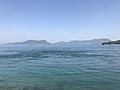
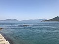
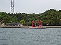
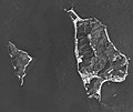
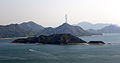
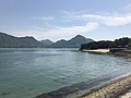
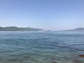
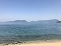
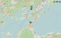
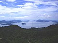
English: Ōkunoshima island in Takehara, Hiroshima, Japan.

Japanese island with a population of feral rabbits Ostrov Okunošima  | |||||
| Upload media | |||||
| Instance of | |||||
|---|---|---|---|---|---|
| Part of | |||||
| Located in protected area | |||||
| Location | Takehara, Hiroshima Prefecture, Japan | ||||
| Located in or next to body of water | |||||
| Owned by | |||||
| Has part(s) | |||||
| Significant event |
| ||||
| Width |
| ||||
| Length |
| ||||
| Area |
| ||||
 | |||||
Subcategories
This category has the following 7 subcategories, out of 7 total.
C
K
O
- Okunoshima Lighthouse (9 F)
- Okunoshima Poison Gas Museum (10 F)
- Okunoshima Power Station (16 F)
P
- Port of Okunoshima (31 F)
R
- Rabbits in Okunoshima (22 F)
Media in category "Okunoshima"
The following 112 files are in this category, out of 112 total.
-
 Beach near former pier of Okunoshima Island.jpg 4,032 × 3,024; 2.84 MB
-
 Cycas revoluta in front of Okunoshima Resort Hotel.jpg 4,032 × 3,024; 4.24 MB
-
 Kokunoshima Island and Ikunoshima Island from Okunoshima Island 2.jpg 3,999 × 2,999; 2.33 MB
-
 Kokunoshima Island and Ikunoshima Island from Okunoshima Island.jpg 3,975 × 2,981; 3.98 MB
-
 Kokunoshima Island and Takehara Thermal Power Station from Okunoshima Island.jpg 4,025 × 3,019; 1.86 MB
-
 Kokunoshima Island from Okunoshima Island.jpg 3,987 × 2,990; 2.49 MB
-
 Koneshima Island and Ikuchijima Island from Okunoshima Campsite 2.jpg 4,027 × 3,020; 2.28 MB
-
 Koneshima Island and Ikuchijima Island from Okunoshima Campsite 3.jpg 4,003 × 3,002; 2.27 MB
-
 Koneshima Island and Ikuchijima Island from Okunoshima Campsite.jpg 4,026 × 3,019; 2.43 MB
-
 Liquidambar formosana in front of site of laboratory on Okunoshima Island.jpg 3,989 × 2,992; 4.52 MB
-
 Liquidambar formosana near Pier No.1 of Okunoshima Island.jpg 3,912 × 2,934; 2.5 MB
-
 Matsushima Island, Ikunoshima Island and Kokunoshima Island from Okunoshima Island 2.jpg 4,017 × 3,013; 2.27 MB
-
 Matsushima Island, Ikunoshima Island and Kokunoshima Island from Okunoshima Island.jpg 4,000 × 3,000; 2.5 MB
-
 Mihara Seto.jpg 5,184 × 3,456; 5.71 MB
-
 Mount Sambonenoki on Omishima Island from Okunoshima Campsite.jpg 4,032 × 3,024; 2.73 MB
-
 Mount Sambonenoki on Omishima Island from Okunoshima Island 2.jpg 4,032 × 3,024; 2.59 MB
-
 Mount Sambonenoki on Omishima Island from Okunoshima Island.jpg 3,992 × 2,994; 2.64 MB
-
 Ohkuno Island aerial photograph.jpg 3,341 × 2,563; 899 KB
-
 Okuno , Tadanoumi 1948.jpg 2,553 × 2,352; 798 KB
-
 Okuno island ferry waiting room.jpg 3,648 × 2,736; 6.59 MB
-
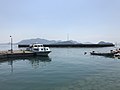
 Okuno island port.jpg 3,648 × 2,736; 6.6 MB
-
 Okuno island Visitor Center.jpg 3,648 × 2,736; 7.04 MB
-
 Okunojima 002.JPG 1,280 × 960; 284 KB
-
 Okunojima jinja Shrine.jpg 3,872 × 2,592; 2.8 MB
-
 Okunoshima & Kokunoshima 1947.jpg 778 × 702; 107 KB
-
 Okunoshima & Kokunoshima 1948.jpg 941 × 733; 122 KB
-
 Okunoshima & Kokunoshima 1964.jpg 832 × 669; 136 KB
-
 Okunoshima & Kokunoshima 1981.jpg 3,162 × 2,663; 1.39 MB
-
 Okunoshima & Kokunoshima 2006.jpg 1,038 × 874; 202 KB
-
 Okunoshima 1962.jpg 1,659 × 2,331; 922 KB
-
 Okunoshima 2.JPG 3,834 × 1,999; 2.29 MB
-
 Okunoshima banner.JPG 3,834 × 548; 747 KB
-
 Okunoshima Beach and Mount Sambonenoki on Omishima Island.jpg 4,032 × 3,024; 2.64 MB
-
 Okunoshima camp site 2021-08 ac.jpg 5,863 × 3,899; 2.94 MB
-
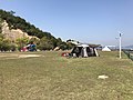 Okunoshima Campsite 20180429.jpg 4,032 × 3,024; 4.16 MB
-
 Okunoshima Island Visitor Center 20180429.jpg 3,953 × 2,965; 3.85 MB
-
 Okunoshima Island, Omishima Island and Kokunoshima Island from Tadanoumi Port.jpg 4,014 × 3,011; 1.79 MB
-
 OKUNOSHIMA Island.png 693 × 565; 366 KB
-
 Okunoshima shuttle bus 2021-08 ac (1).jpg 5,907 × 3,928; 4.52 MB
-
 Okunoshima shuttle bus 2021-08 ac (2).jpg 5,369 × 3,569; 3.09 MB
-
 Okunoshima Visitor Center 2021-08 ac (1).jpg 5,863 × 3,899; 3.14 MB
-
 Okunoshima Visitor Center 2021-08 ac (2).jpg 5,839 × 3,883; 2.22 MB
-
 Okunoshima.JPG 2,867 × 1,238; 851 KB
-
 Okunoshima.jpg 375 × 400; 21 KB
-
 Omishima Island and Okunoshima Island from train of Kure Line 2.jpg 3,995 × 2,997; 2.27 MB
-
 Omishima Island and Okunoshima Island from train of Kure Line 3.jpg 3,995 × 2,997; 2.27 MB
-
 Omishima Island and Okunoshima Island from train of Kure Line 4.jpg 3,990 × 2,992; 2.29 MB
-
 Omishima Island and Okunoshima Island from train of Kure Line.jpg 3,965 × 2,974; 1.63 MB
-
 Omishima Island and Osaki-Kamijima Island from ship of Omishima Ferry 2.jpg 3,960 × 2,970; 2.17 MB
-
 Omishima Island and Osaki-Kamijima Island from ship of Omishima Ferry.jpg 3,927 × 2,945; 2.09 MB
-
 Omishima Island and Rock near Okunoshima Campsite.jpg 3,994 × 2,995; 2.61 MB
-
 Omishima Island from Okunoshima Campsite 2.jpg 4,032 × 3,024; 2.53 MB
-
 Omishima Island from Okunoshima Campsite.jpg 4,032 × 3,024; 2.96 MB
-
 Omishima Island, Ikunoshima Island and Okunoshima Island from ship of Omishima Ferry.jpg 4,006 × 3,004; 2.47 MB
-
 Omishima Island, Okunoshima Island and Osaki-Kamijima Island from train of Kure Line.jpg 4,032 × 3,024; 1.96 MB
-
 Omishima Island, Osaki-Kamijima Island and Okunoshima Island from ship of Omishima Ferry.jpg 4,019 × 3,014; 2.47 MB
-
 Ookunozima-2.jpg 781 × 592; 479 KB
-
 Ookunozima.jpg 4,318 × 2,081; 1.52 MB
-
 Osaki-Kamijima Island from Okunoshima Island 2.jpg 4,032 × 3,024; 2.28 MB
-
 Osaki-Kamijima Island from Okunoshima Island.jpg 4,016 × 3,012; 2.35 MB
-
 Osaki-Kamijima Island, Ikunoshima Island and Abashima Island from train of Kure Line.jpg 4,032 × 3,024; 1.83 MB
-
 Pier of Tadanoumi Port.jpg 3,960 × 2,970; 2.08 MB
-
 Rock near Okunoshima Campsite.jpg 3,972 × 2,979; 3.46 MB
-
 Ruins of Batteries in Ōkunoshima.JPG 2,272 × 1,704; 2.49 MB
-
 Sculptures of rabbit ears near Pier No.1 of Okunoshima Island.jpg 4,004 × 3,003; 2.53 MB
-
 Ship "the 3rd Omishima" at Tadanoumi Port.jpg 3,978 × 2,983; 2.87 MB
-
 Site of laboratory on Okunoshima Island.jpg 4,003 × 3,002; 4.55 MB
-
 Site of Sangenya Poison Gas Storehouse near Okunoshima Resort Hotel.jpg 4,032 × 3,024; 5.96 MB
-
 Square in front of Okunoshima Resort Hotel 2.jpg 3,995 × 2,996; 3.94 MB
-
 Square in front of Okunoshima Resort Hotel.jpg 4,032 × 3,024; 3.48 MB
-
 Tadanoumi Port 20180429-10.jpg 3,982 × 2,987; 2.13 MB
-
 Tadanoumi Port 20180429-12.jpg 3,947 × 2,961; 1.85 MB
-
 Tadanoumi Port 20180429-4.jpg 4,014 × 3,010; 2.11 MB
-
 View from ship of Omishima Ferry (northwest) 2.jpg 4,032 × 3,024; 2.79 MB
-
 View from ship of Omishima Ferry (northwest).jpg 4,011 × 3,009; 2.5 MB
-
 View near Okunoshima Poison Gas Museum.jpg 4,032 × 3,024; 4.38 MB
-
 View near Okunoshima Resort Hotel.jpg 4,032 × 3,024; 4.14 MB
-
 View near Pier No.1 of Okunoshima Island 2.jpg 3,918 × 2,939; 3.99 MB
-
 View near Pier No.1 of Okunoshima Island.jpg 4,032 × 3,024; 2.96 MB
-
 View near Pier No.2 of Okunoshima Island 2.jpg 3,978 × 2,983; 3.17 MB
-
 View near Pier No.2 of Okunoshima Island.jpg 4,032 × 3,024; 6.24 MB
-
 View near site of Okunoshima Thermal Power Station.jpg 4,032 × 3,024; 3.93 MB
-
 View of Hiroshima Factory of Imabari Shipbuilding from Okunoshima Island 2.jpg 4,015 × 3,011; 2.32 MB
-
 View of Hiroshima Factory of Imabari Shipbuilding from Okunoshima Island.jpg 3,978 × 2,983; 2.63 MB
-
 View of Koneshima Island and Ikuchijima Island from Okunoshima Island 2.jpg 4,003 × 3,002; 2.44 MB
-
 View of Koneshima Island and Ikuchijima Island from Okunoshima Island.jpg 4,012 × 3,009; 2.38 MB
-
 View of Koneshima Island and Ikuchijima Island near Pier No.2 of Okunoshima Island.jpg 3,995 × 2,996; 2.28 MB
-
 View of Omishima Island and Ikuchijima Island from Okunoshima Island.jpg 3,985 × 2,989; 2.6 MB
-
 View of Omishima Island near Okunoshima Campsite.jpg 4,010 × 3,008; 2.7 MB
-
 View of Sagishima Island and Koneshima Island from Okunoshima Island 2.jpg 4,010 × 3,007; 2.47 MB
-
 View of Sagishima Island and Koneshima Island from Okunoshima Island.jpg 3,974 × 2,980; 2.43 MB
-
 View of site of South Lighthouse on Okunoshima Island 2.jpg 4,032 × 3,024; 4.5 MB
-
 View of site of South Lighthouse on Okunoshima Island.jpg 3,962 × 2,972; 3.39 MB
-
 Wisteria pergola in front of Okunoshima Poison Gas Museum.jpg 4,032 × 3,024; 4.48 MB
-
 Ōkuno Island.jpg 4,032 × 3,024; 6.5 MB
-
 のすたるじー - panoramio.jpg 3,264 × 1,952; 1.65 MB
-
 ビジターセンター前 - panoramio.jpg 3,264 × 2,448; 2.68 MB
-
 三原瀬戸航路の灯台と芸予要塞の位置.png 934 × 586; 503 KB
-
 北部砲台観測所跡.jpg 3,000 × 2,002; 2.7 MB
-
 北部砲台跡.jpg 3,000 × 2,002; 1.83 MB
-
 大三島方向 - panoramio.jpg 3,264 × 2,448; 2.44 MB
-
 大久野島 - panoramio (1).jpg 4,000 × 3,000; 3.07 MB
-
 大久野島 - panoramio.jpg 4,000 × 3,000; 2.67 MB
-
 大久野島 P7255473.jpg 2,560 × 1,920; 984 KB
-
 大久野島 P7265823.jpg 2,560 × 1,920; 1.04 MB
-
 大久野島と大三島 - panoramio.jpg 3,264 × 2,448; 2.3 MB
-
 大久野島北部砲台跡説明板.jpg 3,264 × 2,448; 2.09 MB
-
 大久野島海水浴場 - panoramio.jpg 3,872 × 2,592; 2.79 MB
-
 大久野島海水浴場.jpg 3,872 × 2,592; 2.78 MB
-
 瀬戸内海 - panoramio.jpg 3,264 × 2,448; 1.5 MB
-
 火薬庫跡 - 7420140204.jpg 3,000 × 2,002; 5.91 MB
-
 自動交換機室跡.jpg 3,000 × 2,000; 1.73 MB


.jpg)


.jpg)
.jpg)
.jpg)
.jpg)
_2.jpg)
.jpg)