Category:Okanagan dry forests
Jump to navigation
Jump to search
temperate coniferous forest ecoregion in British Columbia, Canada and Washington, United States   | |||||
| Upload media | |||||
| Instance of | |||||
|---|---|---|---|---|---|
| Location |
| ||||
 | |||||
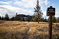
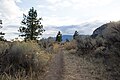
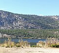
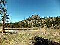
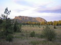
English: The Okanogan Dry Forests Ecoregion is a designated ecoregion by WWF and One Earth. It is classified as a Temperate Conifer Forests Biome. It is one of two ecoregions in the Northwest Intermountain Conifer Forests Bioregion, with the other member being the Fraser Plateau and Basin Conifer Forests Ecoregion. This is a collection of photos that best represent the Okanagan dry forests ecoregion of British Columbia and Washington.
Media in category "Okanagan dry forests"
The following 25 files are in this category, out of 25 total.
-
 Okanagan dry forests map.svg 1,712 × 1,992; 337 KB
-
 2019-06 Kalamalka Lake Provincial Park (41).jpg 5,472 × 3,648; 4.91 MB
-
 Bellevue Valley - panoramio.jpg 2,560 × 1,920; 1.19 MB
-
 East toward Limby - panoramio.jpg 4,928 × 3,264; 5.42 MB
-
 Forest Fire Damage - panoramio.jpg 2,560 × 1,920; 1.58 MB
-
 Green Mountain - panoramio (1).jpg 4,484 × 2,992; 4.99 MB
-
 Hiking to McIntyre Bluff 06.jpg 5,472 × 3,648; 18.73 MB
-
 Hiking to McIntyre Bluff 08.jpg 5,472 × 3,648; 9.95 MB
-
 Hiking to McIntyre Bluff 10.jpg 5,472 × 3,648; 11.63 MB
-
 Hills above Kickwillie Loop - Vernon - BC - Canada (16897119301) (2).jpg 3,648 × 2,736; 3.34 MB
-
 Kal Lake, Okanogan BC.jpg 5,184 × 3,456; 7.67 MB
-
 Kanada (32262893333).jpg 2,265 × 2,045; 974 KB
-
 Mahoney Lake Ecological Reserve, Okanagan, BC.jpg 2,048 × 1,536; 2.11 MB
-
 Mount Boucherie north face.jpg 2,560 × 1,920; 963 KB
-
 Nature's colour palette, Kalamalka Lake.jpg 3,281 × 2,344; 11.22 MB
-
 Okanagan Sandstorm - panoramio.jpg 2,560 × 1,920; 1.05 MB
-
 Old Trestle Remnant - panoramio.jpg 2,560 × 1,920; 1.47 MB
-
 Oregon Grape flowering in the shade of Ponderosa Pines at Skaha Bluffs Park.jpg 4,608 × 3,456; 7.08 MB
-
 Osoyoos-Tal - der wärmste Ort Kanadas inkl. Wüste (15901819667).jpg 4,608 × 3,072; 7.94 MB
-
 Overlooking the Boulderfields of Kelowna.png 3,840 × 2,160; 18.58 MB
-

-
 Shrubland-forest transition near Osoyoos.jpg 4,096 × 3,084; 2.55 MB
-
 Vernon - panoramio (2).jpg 2,816 × 2,112; 1.85 MB
-
 Vernon View - Cliff - panoramio.jpg 2,816 × 2,112; 2.19 MB
-
 Winter Cabin - panoramio.jpg 3,872 × 2,581; 3.76 MB
.jpg)


.jpg)


_(2).jpg)

.jpg)


.jpg)

_(2).jpg)
.jpg)


Categories:
- Northwest Intermountain Conifer Forests Bioregion
- List of Terrestrial Ecoregions (One Earth)
- Temperate Conifer Forests Biome (One Earth)
- Ecoregions of Canada (One Earth)
- Terrestrial Ecoregions of Northern America (One Earth)
- Okanagan
- Nature of Okanogan County, Washington
- Ferry County, Washington
- Stevens County, Washington
- Ecoregions of Canada (WWF)
- Ecoregions of the United States (WWF)
- WWF ecoregions by name