Category:October 2007 in Leicestershire
Jump to navigation
Jump to search
Deutsch: Bilder, die im Oktober 2007 in Leicestershire aufgenommen worden sind. Bitte beachten Sie, dass dies weder das Datum des Uploads noch das Datum des Scannens eines Fotos ist.
English: Images/pictures taken in Leicestershire during October 2007. Note this is not the date of the upload, nor the date a photo was scanned.
Español: Fotografías o imágenes tomadas en Leicestershire durante octubre 2007. No es la fecha de subida ni escaneo, sino la fecha en que las fotografías o imágenes se crearon.
Esperanto: Bildoj faritaj en Leicestershire en oktobro 2007. Tio ne estas la dato, kiam la bildoj estis alŝutitaj aŭ skanitaj.
Français : Photographies ou images prises en Leicestershire durant octobre 2007. Ce n'est pas la date du téléchargement ou du scan.
Galego: Fotografías ou imaxes tomadas en Leicestershire durante outubro 2007. Non é a data de subida nin escaneamento, senón a data na que se crearon as fotografías ou imaxes.
Italiano: Fotografie o immagini scattate a Leicestershire nel ottobre 2007. Nota bene: la data non si riferisce né a quella di upload né a quella in cui la foto è stata digitalizzata.
Norsk bokmål: Bilder tatt i Leicestershire i løpet av oktober 2007. Merk at dette ikke er datoen for opplasting, eller når et bilde har blitt skannet.
Norsk nynorsk: Bilete teke i Leicestershire i løpet av oktober 2007. Merk at dette ikkje er datoen for opplasting, eller når eit bilete har vorte skanna.
Русский: Изображения, сделанные в Leicestershire в течение октябрь 2007 (не дата загрузки изображения).
Українська: Зображення, зроблені в Leicestershire протягом жовтень 2007. Зауважте, що це не дата завантаження чи дата сканування фотографії.
| October 2006 | ← | October 2007 | → | October 2008 | |||||||
| Jan | Feb | Mar | Apr | May | Jun | Jul | Aug | Sep | Oct | Nov | Dec |
| 8 | 19 | 12 | 59 | 8 | 49 | 49 | 31 | 44 | 44 | 28 | 7 |
|---|---|---|---|---|---|---|---|---|---|---|---|
Media in category "October 2007 in Leicestershire"
The following 43 files are in this category, out of 43 total.
-
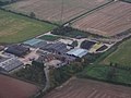 Field Farm - geograph.org.uk - 595195.jpg 640 × 480; 54 KB
-
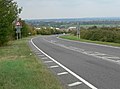 A6 east of Market Harborough - geograph.org.uk - 580044.jpg 640 × 475; 97 KB
-

-
 Bentleys - geograph.org.uk - 591804.jpg 640 × 428; 78 KB
-
 Breedon Lockup - geograph.org.uk - 584992.jpg 640 × 560; 142 KB
-
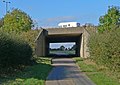
 Bridge 1, Grand Union Canal (Welford Arm) - geograph.org.uk - 592064.jpg 640 × 480; 120 KB
-
 Coalville crossing signal box.jpg 1,251 × 1,600; 248 KB
-
 Kettering Road leaving Market Harborough - geograph.org.uk - 579759.jpg 640 × 473; 101 KB
-
 Main Street, Stathern - geograph.org.uk - 592055.jpg 640 × 427; 78 KB
-
 Meadow Lane Playing Fields - geograph.org.uk - 584299.jpg 640 × 480; 74 KB
-
 Mile post in Thorpe Arnold - geograph.org.uk - 676879.jpg 483 × 640; 123 KB
-
 Motorway bridge supports - geograph.org.uk - 594159.jpg 498 × 640; 106 KB
-
 Rockingham Road railway bridge - geograph.org.uk - 579757.jpg 640 × 456; 90 KB
-
 Shackerstone Station - geograph.org.uk - 590709.jpg 640 × 428; 105 KB
-
 Shackerstone Station - geograph.org.uk - 592385.jpg 428 × 640; 97 KB
-
-
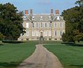 Stanford Hall.jpg 640 × 520; 115 KB
-
 Starlings on the wire - geograph.org.uk - 592408.jpg 640 × 427; 72 KB
-
 The A14 passes under the M1 - geograph.org.uk - 594152.jpg 640 × 424; 113 KB
-
 The Cherry Tree - geograph.org.uk - 580053.jpg 640 × 438; 97 KB
-
 The Oat Hill - geograph.org.uk - 580060.jpg 640 × 464; 87 KB
-
 The Royalist - geograph.org.uk - 580109.jpg 640 × 436; 100 KB
-
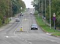
 Uppingham Road, East Norton - geograph.org.uk - 601111.jpg 640 × 392; 61 KB
-
 View from North Road - geograph.org.uk - 597367.jpg 640 × 448; 90 KB
-
 Village sign, Stathern - geograph.org.uk - 592605.jpg 640 × 532; 146 KB
-
 Village sign, Stathern - geograph.org.uk - 592644.jpg 640 × 579; 126 KB
-
 War Memorial - geograph.org.uk - 587208.jpg 640 × 455; 158 KB
-
 'Making a Place', Bede Park - geograph.org.uk - 585340.jpg 428 × 640; 108 KB
-
 Bede Park - geograph.org.uk - 586279.jpg 640 × 428; 95 KB
-
 Bridge 45, Station Road - geograph.org.uk - 597605.jpg 640 × 480; 67 KB
-
 Bus stop in Loddington - geograph.org.uk - 601089.jpg 640 × 500; 115 KB
-
 Cows near West Langton Road - geograph.org.uk - 587855.jpg 640 × 425; 94 KB
-
 Dairy herd near Launde Abbey - geograph.org.uk - 600183.jpg 640 × 473; 84 KB
-
 Faircharm Trading Estate - geograph.org.uk - 586243.jpg 640 × 428; 88 KB
-

-
 Gallows Hill Bridge - geograph.org.uk - 579683.jpg 640 × 473; 141 KB
-
 House in Loddington, Leicestershire - geograph.org.uk - 601090.jpg 640 × 513; 120 KB
-
 Leicestershire countryside - geograph.org.uk - 601118.jpg 640 × 443; 96 KB
-
 Leicestershire Round to Rearsby Mill - geograph.org.uk - 584626.jpg 640 × 480; 107 KB
-
 October afternoon shadows - geograph.org.uk - 587820.jpg 640 × 426; 25 KB
-
 Rocky outcrop by Coppice Plantation - geograph.org.uk - 591379.jpg 640 × 429; 104 KB
-
 Rocky outcrops in Bradgate Park - geograph.org.uk - 591330.jpg 640 × 429; 109 KB
-


_-_geograph.org.uk_-_592064.jpg)


