Category:Obere Havel-Wasserstraße
Jump to navigation
Jump to search
| Object location | | View all coordinates using: OpenStreetMap |
|---|
canal in Germany | |||||
| Upload media | |||||
| Instance of |
| ||||
|---|---|---|---|---|---|
| Location |
| ||||
| Mouth of the watercourse | |||||
| Drainage basin | |||||
 | |||||
Deutsch: Die Obere Havel-Wasserstraße (OHW) ist eine Bundeswasserstraße in den Bundesländern Brandenburg und Mecklenburg-Vorpommern, die über eine Länge von 97,4 km hauptsächlich den staugeregelten Oberlauf der Havel mit vielen Seen umfasst
Subcategories
This category has the following 24 subcategories, out of 24 total.
B
- Baalensee (9 F)
D
- Drewensee (5 F)
E
- Ellbogensee (4 F)
G
- Großer Priepertsee (3 F)
- Großer Wentowsee (22 F)
K
- Kleiner Wentowsee (12 F)
M
R
- Röblinsee (15 F)
S
- Schleuse Bischofswerder (6 F)
- Schleuse Bredereiche (4 F)
- Schleuse Liebenwalde (5 F)
- Schleuse Steinhavel (1 F)
- Schleuse Wesenberg (4 F)
- Schleuse Zehdenick (10 F)
- Schleuse Fürstenberg/Havel (6 F)
- Schwedtsee (14 F)
- Stolpsee (7 F)
T
V
W
- Wangnitzsee (1 F)
- Wentowkanal (4 F)
- Woblitzsee (7 F)
Z
Media in category "Obere Havel-Wasserstraße"
The following 2 files are in this category, out of 2 total.
-
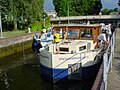
 RK 0408 5882 Schleuse Zehdenick.jpg 1,200 × 900; 444 KB
-
 RK 0408 5885 Schleuse Zehdenick.jpg 1,200 × 900; 432 KB

