Category:Norton Bavant
Jump to navigation
Jump to search
village in United Kingdom  | |||||
| Upload media | |||||
| Instance of | |||||
|---|---|---|---|---|---|
| Location | Wiltshire, South West England, England | ||||
| official website | |||||
 | |||||
English: Norton Bavant is a village and parish in the County of Wiltshire, in the south west of England.
Nederlands: Norton Bavant is een dorp (village) en civil parish in de unitary authority Wiltshire, in het Engelse graafschap Wiltshire. De civil parish telt
Subcategories
This category has the following 2 subcategories, out of 2 total.
A
S
- Scratchbury Camp (40 F)
Media in category "Norton Bavant"
The following 147 files are in this category, out of 147 total.
-

-
 2011 , A36 Warminster bypass, eastern end looking west - geograph.org.uk - 2256787.jpg 4,378 × 2,270; 2.79 MB
-
 2011 , B3414 near Norton Bavant - geograph.org.uk - 2305374.jpg 3,989 × 2,923; 7.25 MB
-
 2011 , B3414 west from a railway bridge - geograph.org.uk - 2255400.jpg 3,605 × 2,217; 2.94 MB
-
 2011 , Cropped field near North Farm - geograph.org.uk - 2581096.jpg 4,432 × 2,353; 2.78 MB
-
 2011 , Fields belonging to North Farm - geograph.org.uk - 2581170.jpg 4,320 × 2,050; 2.59 MB
-
 2011 , Lane to North Farm - geograph.org.uk - 2255387.jpg 4,752 × 3,168; 5.52 MB
-
 2011 , Lane to North Farm - geograph.org.uk - 2256766.jpg 4,063 × 2,569; 3.89 MB
-
 2011 , Local train heading for Warminster - geograph.org.uk - 2305391.jpg 2,268 × 2,562; 5.03 MB
-
 2011 , Military Range boundary marker - geograph.org.uk - 2581258.jpg 4,288 × 2,466; 3.83 MB
-
 2011 , Military Range, along the perimeter fence - geograph.org.uk - 2581149.jpg 3,637 × 2,817; 4.03 MB
-
 2011 , Minor road to Heytesbury - geograph.org.uk - 2256776.jpg 1,600 × 1,067; 638 KB
-
 2011 , North east between Scratchbury Hill and Middle Hill - geograph.org.uk - 2255426.jpg 4,648 × 2,197; 3.96 MB
-
 2011 , North east over the Military Range - geograph.org.uk - 2569877.jpg 4,690 × 2,145; 3.73 MB
-
 2011 , North Farm surrounded by fields - geograph.org.uk - 2253372.jpg 4,715 × 2,670; 4.05 MB
-
 2011 , North West at the bottom of Scratchbury Hill - geograph.org.uk - 2256761.jpg 4,165 × 2,633; 5.03 MB
-
 2011 , North west from the A36 - geograph.org.uk - 2256798.jpg 4,289 × 2,920; 5.97 MB
-
 2011 , Railway bridge identification plate - geograph.org.uk - 2255365.jpg 1,600 × 1,067; 596 KB
-
 2011 , Railway bridge on the line to Warminster - geograph.org.uk - 2256804.jpg 4,752 × 3,168; 5.08 MB
-
 2011 , Railway line to Salisbury - geograph.org.uk - 2255347.jpg 3,468 × 2,503; 3.61 MB
-
 2011 , Railway near Heytesbury - geograph.org.uk - 2256780.jpg 3,668 × 2,509; 3.09 MB
-
 2011 , Railway North to Warminster - geograph.org.uk - 2252196.jpg 3,618 × 2,640; 3.27 MB
-
 2011 , Road on the Military Range perimeter - geograph.org.uk - 2581114.jpg 3,651 × 2,278; 2.09 MB
-
 2011 , Track to the Military Range - geograph.org.uk - 2581080.jpg 4,752 × 3,168; 4.47 MB
-
 2011 , Up train to Warminster - geograph.org.uk - 2299007.jpg 2,953 × 2,405; 4.98 MB
-
 2011 , View west at the foot of Scratchbury Hill - geograph.org.uk - 2252215.jpg 4,013 × 2,333; 2.15 MB
-
 2011 , West from a track leading to the Military Range - geograph.org.uk - 2569861.jpg 4,481 × 2,244; 3.19 MB
-
 All Saints Church, Norton Bavant - geograph.org.uk - 3373201.jpg 4,000 × 3,000; 3.33 MB
-
 All Saints, Norton Bavant, altar - geograph.org.uk - 3673463.jpg 640 × 480; 62 KB
-

-

-
 All Saints, Norton Bavant, font - geograph.org.uk - 3673470.jpg 640 × 480; 82 KB
-

-
 All Saints, Norton Bavant, lectern - geograph.org.uk - 3673472.jpg 480 × 640; 47 KB
-

-

-

-

-

-
 All Saints, Norton Bavant, memorial (14) - geograph.org.uk - 3673435.jpg 640 × 480; 102 KB
-

-

-

-

-

-

-

-

-

-

-

-

-

-

-

-

-

-

-

-

-

-

-

-
 All Saints, Norton Bavant, organ - geograph.org.uk - 3673471.jpg 480 × 640; 54 KB
-
 All Saints, Norton Bavant, pulpit - geograph.org.uk - 3673413.jpg 480 × 640; 57 KB
-

-

-

-

-

-

-

-

-

-

-

-

-

-
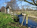
 Beehive, Norton Bavant - geograph.org.uk - 975607.jpg 480 × 640; 164 KB
-
 Bench Mark, All Saints Church - geograph.org.uk - 2307458.jpg 480 × 640; 84 KB
-
 Byway near Middle Hill - geograph.org.uk - 1206579.jpg 640 × 480; 206 KB
-
 Byway near Norton Bavant - geograph.org.uk - 1206689.jpg 640 × 480; 164 KB
-
 Byway to Middleton Farm - geograph.org.uk - 1206648.jpg 640 × 482; 204 KB
-
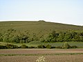
 Cotley Hill (geograph 1900204).jpg 2,304 × 1,704; 1.75 MB
-
 Cotley Hill - geograph.org.uk - 1238257.jpg 640 × 480; 56 KB
-
 Cotley Hill - geograph.org.uk - 5083940.jpg 640 × 480; 96 KB
-
 Detail, All Saints Church - geograph.org.uk - 2307473.jpg 481 × 640; 94 KB
-
 Drive, Norton Bavant - geograph.org.uk - 974224.jpg 640 × 480; 123 KB
-
 Farm Track - geograph.org.uk - 1640165.jpg 640 × 426; 64 KB
-
 Farmland - geograph.org.uk - 1640184.jpg 640 × 426; 62 KB
-
 Freight Train at Norton Bavant - geograph.org.uk - 3841926.jpg 1,024 × 682; 958 KB
-
 George VI postbox, Norton Bavant - geograph.org.uk - 974182.jpg 480 × 640; 114 KB
-
 Imber Range - geograph.org.uk - 1640080.jpg 640 × 426; 90 KB
-
 Imber Range - geograph.org.uk - 1640086.jpg 640 × 426; 74 KB
-
 Imber Range boundary at North Farm - geograph.org.uk - 1313036.jpg 640 × 426; 99 KB
-
 Imber Range Path - geograph.org.uk - 1206697.jpg 640 × 481; 165 KB
-
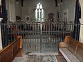
 Inside All Saints, Norton Bavant (I) - geograph.org.uk - 3673454.jpg 480 × 640; 58 KB
-

-

-

-
 Inside All Saints, Norton Bavant (V) - geograph.org.uk - 3673460.jpg 640 × 480; 71 KB
-
-

-
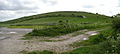
 Middle Hill - geograph.org.uk - 1900233.jpg 2,304 × 1,704; 1.1 MB
-

-
 Milepost, Norton Bavant - geograph.org.uk - 1211771.jpg 640 × 482; 202 KB
-
 Milepost, Norton Bavant - geograph.org.uk - 1212453.jpg 640 × 481; 188 KB
-
 Milestone near Norton Bavant - geograph.org.uk - 2307498.jpg 480 × 640; 95 KB
-
 Minor road near Norton Bavant - geograph.org.uk - 2307516.jpg 640 × 480; 59 KB
-
 New crop - geograph.org.uk - 1640168.jpg 640 × 426; 77 KB
-
 New crop - geograph.org.uk - 1640177.jpg 640 × 426; 70 KB
-
 North Farm Panorama 1 - geograph.org.uk - 1639446.jpg 640 × 251; 49 KB
-
 North Farm Panorama 2 - geograph.org.uk - 1639517.jpg 640 × 210; 39 KB
-
 North Farm Panorama 3 - geograph.org.uk - 1639524.jpg 640 × 317; 63 KB
-
 North Farm Panorama 4 - geograph.org.uk - 1639560.jpg 640 × 316; 176 KB
-
 Norton Plantation - geograph.org.uk - 110844.jpg 640 × 480; 68 KB
-
 Ordnance Survey Cut Mark with Bolt - geograph.org.uk - 3373211.jpg 4,000 × 3,000; 5.18 MB
-
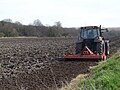
 Plough near Norton Bavant - geograph.org.uk - 1206718.jpg 640 × 482; 151 KB
-
 Railway Bridge near Warminster - geograph.org.uk - 1238271.jpg 640 × 480; 94 KB
-
 Railway line near Norton Bavant - geograph.org.uk - 1206619.jpg 640 × 480; 195 KB
-
 Railway line near Norton Bavant - geograph.org.uk - 1206632.jpg 640 × 481; 191 KB
-
 Recorder House at Norton Bavant - geograph.org.uk - 111527.jpg 640 × 480; 175 KB
-
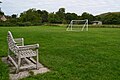 Recreation ground at Norton Bavant - geograph.org.uk - 5893728.jpg 1,024 × 683; 204 KB
-
 River Wylye at Norton Bavant.jpg 640 × 480; 159 KB
-
 River Wylye, Norton Bavant - geograph.org.uk - 2316917.jpg 640 × 480; 79 KB
-
 Rush hour in Norton Bavant - geograph.org.uk - 3659200.jpg 640 × 480; 90 KB
-
 Scratchbury geograph-1640912-by-Roger-Gittins.jpg 640 × 288; 46 KB
-
 Scratchbury geograph-1900230-by-Neil-Owen.jpg 2,304 × 1,704; 1.58 MB
-
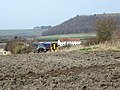
 Soil preparation near Norton Bavant - geograph.org.uk - 1211734.jpg 640 × 480; 145 KB
-
 Strip Lynchets - geograph.org.uk - 1640978.jpg 640 × 208; 33 KB
-

-
 Track to Imber - geograph.org.uk - 1640152.jpg 640 × 426; 57 KB
-
 Track to North Farm - geograph.org.uk - 1640179.jpg 640 × 426; 62 KB
-
 Track to North Farm - geograph.org.uk - 1640906.jpg 640 × 426; 68 KB
-
 View to West Hill Farm - geograph.org.uk - 1640158.jpg 640 × 426; 60 KB
-
 Warminster Turning - geograph.org.uk - 5915150.jpg 1,600 × 1,082; 372 KB
-

-
 A36 Warminster bypass eastbound - geograph.org.uk - 1422916.jpg 640 × 516; 130 KB
-
 A36 Warminster bypass heading west - geograph.org.uk - 1422913.jpg 640 × 506; 144 KB
-
 By-way from Middleton to Imber Range - geograph.org.uk - 409586.jpg 640 × 480; 73 KB
-
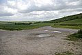
 Dead ground, south of Imber Road - geograph.org.uk - 300365.jpg 640 × 480; 129 KB
-

-

-
 Scratchbury Hill - geograph.org.uk - 111086.jpg 640 × 480; 70 KB
-

-
 The road from Imber - geograph.org.uk - 300368.jpg 640 × 480; 82 KB
-
 View towards Bishopstrow Down - geograph.org.uk - 409594.jpg 640 × 480; 81 KB


_-_geograph.org.uk_-_3673411.jpg)
_-_geograph.org.uk_-_3673430.jpg)
_-_geograph.org.uk_-_3673431.jpg)
_-_geograph.org.uk_-_3673432.jpg)
_-_geograph.org.uk_-_3673433.jpg)
_-_geograph.org.uk_-_3673435.jpg)
_-_geograph.org.uk_-_3673436.jpg)
_-_geograph.org.uk_-_3673437.jpg)
_-_geograph.org.uk_-_3673438.jpg)
_-_geograph.org.uk_-_3673439.jpg)
_-_geograph.org.uk_-_3673441.jpg)
_-_geograph.org.uk_-_3673412.jpg)
_-_geograph.org.uk_-_3673442.jpg)
_-_geograph.org.uk_-_3673444.jpg)
_-_geograph.org.uk_-_3673445.jpg)
_-_geograph.org.uk_-_3673443.jpg)
_-_geograph.org.uk_-_3673464.jpg)
_-_geograph.org.uk_-_3673467.jpg)
_-_geograph.org.uk_-_3673440.jpg)
_-_geograph.org.uk_-_3673425.jpg)
_-_geograph.org.uk_-_3673466.jpg)
_-_geograph.org.uk_-_3673415.jpg)
_-_geograph.org.uk_-_3673419.jpg)
_-_geograph.org.uk_-_3673421.jpg)
_-_geograph.org.uk_-_3673423.jpg)
_-_geograph.org.uk_-_3673426.jpg)
_-_geograph.org.uk_-_3673428.jpg)
_-_geograph.org.uk_-_3673429.jpg)


_-_geograph.org.uk_-_3673416.jpg)
_-_geograph.org.uk_-_3673417.jpg)


_-_geograph.org.uk_-_3673446.jpg)
_-_geograph.org.uk_-_3673447.jpg)
_-_geograph.org.uk_-_3673449.jpg)
_-_geograph.org.uk_-_3673450.jpg)
_-_geograph.org.uk_-_3673451.jpg)
_-_geograph.org.uk_-_3673452.jpg)
_-_geograph.org.uk_-_3673453.jpg)


.jpg)


_-_geograph.org.uk_-_3673454.jpg)
_-_geograph.org.uk_-_3673456.jpg)
_-_geograph.org.uk_-_3673457.jpg)
_-_geograph.org.uk_-_3673458.jpg)
_-_geograph.org.uk_-_3673460.jpg)
_-_geograph.org.uk_-_3673459.jpg)
_-_geograph.org.uk_-_3673468.jpg)


