Category:North Wheatley
Jump to navigation
Jump to search
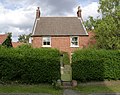
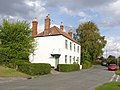
English: North Wheatley is a village and former civil parish in Nottinghamshire, England. At the time of the 2001 census it had a population of 489. It is located 6 miles north-east of Retford. The village has a number of 17th century brick houses. The Old Hall on Low Street/Church Hill is dated 1673, with the arms of the Cartwright family. The parish church of St Peter and St Paul was restored in 1896. Many farms in the area have dovecotes, either as free-standing buildings or above farm buildings.
village and former civil parish in Nottinghamshire, UK  | |||||
| Upload media | |||||
| Instance of |
| ||||
|---|---|---|---|---|---|
| Location |
| ||||
| official website | |||||
 | |||||
Subcategories
This category has the following 2 subcategories, out of 2 total.
P
Media in category "North Wheatley"
The following 49 files are in this category, out of 49 total.
-
 Bar Gate Farm, North Wheatley - geograph.org.uk - 3188733.jpg 1,024 × 768; 180 KB
-
 Bargate Farmhouse - geograph.org.uk - 4191233.jpg 1,280 × 960; 496 KB
-
 Barn on Low Street, North Wheatley - geograph.org.uk - 3188672.jpg 1,024 × 768; 127 KB
-
 Church Hill North Wheatley - geograph.org.uk - 2052458.jpg 640 × 427; 83 KB
-
 Church Hill, North Wheatley - geograph.org.uk - 2688603.jpg 640 × 480; 76 KB
-
 Cultivation lines - geograph.org.uk - 484890.jpg 640 × 428; 107 KB
-
 Farm, North Wheatley - geograph.org.uk - 2688605.jpg 640 × 480; 64 KB
-
 Farmland near North Wheatley - geograph.org.uk - 2688455.jpg 640 × 480; 81 KB
-
 Farmland near Wheatley Wood Farm - geograph.org.uk - 483315.jpg 640 × 427; 89 KB
-
 Farmland, North Wheatley - geograph.org.uk - 2688599.jpg 640 × 480; 67 KB
-

-

-
 Jasmine Cottage. Low Street - geograph.org.uk - 4190170.jpg 1,280 × 1,014; 449 KB
-
 Main Road ahead at North Wheatley - geograph.org.uk - 2052437.jpg 640 × 474; 98 KB
-
 Methodist church, North Wheatley - geograph.org.uk - 3188681.jpg 1,024 × 768; 152 KB
-
 Muspit (or Muspitt) Lane - geograph.org.uk - 483294.jpg 640 × 427; 110 KB
-
 North and South Wheatley Post Office - geograph.org.uk - 483310.jpg 640 × 427; 137 KB
-
 North Wheatley - geograph.org.uk - 2463237.jpg 640 × 427; 91 KB
-
 North Wheatley farmland - geograph.org.uk - 2453220.jpg 640 × 427; 86 KB
-
 Old Hall Farm, Church Hill, North Wheatley - geograph.org.uk - 3188703.jpg 1,024 × 768; 141 KB
-
 Old Mill Farm - geograph.org.uk - 4191235.jpg 1,280 × 960; 523 KB
-
 Old Mill Farmhouse - geograph.org.uk - 4191232.jpg 1,280 × 931; 396 KB
-
 Pigeoncote at Plum Tree Farm - geograph.org.uk - 4190214.jpg 1,280 × 960; 490 KB
-
 Pigeoncote at West Moor Farm - geograph.org.uk - 4190177.jpg 1,280 × 960; 410 KB
-
 Plum Tree Farmhouse - geograph.org.uk - 4190179.jpg 1,280 × 941; 592 KB
-

-
 The Manor House, North Wheatley (geograph 3188692).jpg 1,024 × 768; 180 KB
-
 The Old Hall, corner of Low Street and Church Hill, North Wheatley (geograph 3838327).jpg 3,776 × 2,520; 4.32 MB
-
 The Old Hall, North Wheatley - geograph.org.uk - 3188717.jpg 1,024 × 768; 199 KB
-
 The Old Plough - geograph.org.uk - 4190220.jpg 1,280 × 959; 338 KB
-
 Top Pasture Lane North Wheatley - geograph.org.uk - 268288.jpg 640 × 480; 64 KB
-
 Village cricket (geograph 2463222).jpg 640 × 427; 91 KB
-
 Wood Lane, North Wheatley - geograph.org.uk - 3188608.jpg 1,024 × 768; 199 KB
-
 Cornfield and fingerpost - geograph.org.uk - 484895.jpg 640 × 427; 98 KB
-
 Cows in the Field overlooking Clarborough - geograph.org.uk - 265397.jpg 640 × 480; 103 KB
-

-
 Fieldclose to Sturton High House - geograph.org.uk - 267370.jpg 640 × 480; 117 KB
-
 Gateposts and Avenue - geograph.org.uk - 202213.jpg 640 × 480; 139 KB
-
 Lane to Clarborough Nature Reserve - geograph.org.uk - 266222.jpg 640 × 480; 126 KB
-
 Ploughing in progress - geograph.org.uk - 561680.jpg 640 × 421; 182 KB
-
-
 Short cut - geograph.org.uk - 484894.jpg 640 × 427; 118 KB
-
 Sign post to Whinleys Farm - geograph.org.uk - 265435.jpg 640 × 480; 62 KB
-

-
 Strawberry fields forever - geograph.org.uk - 561438.jpg 640 × 428; 198 KB
-
 Sun Inn - geograph.org.uk - 202214.jpg 640 × 480; 77 KB
-
 Superfluous sign^ - geograph.org.uk - 483296.jpg 640 × 427; 123 KB
-
 Track to Clarborough Grange - geograph.org.uk - 202211.jpg 640 × 480; 107 KB
-
 Tree on a Hill - geograph.org.uk - 202217.jpg 640 × 480; 98 KB


_Lane_-_geograph.org.uk_-_483294.jpg)


_towards_North_Wheatley_-_geograph.org.uk_-_2688453.jpg)
.jpg)
.jpg)


.jpg)


