Category:North Tamerton
Jump to navigation
Jump to search
human settlement in United Kingdom  Eglwys Sant Denis, North Tamerton | |||||
| Upload media | |||||
| Instance of | |||||
|---|---|---|---|---|---|
| Location | Cornwall, South West England, England | ||||
| Elevation above sea level |
| ||||
 | |||||
Subcategories
This category has the following 2 subcategories, out of 2 total.
B
- Tamerton Bridge, Cornwall (4 F)
D
Media in category "North Tamerton"
The following 54 files are in this category, out of 54 total.
-
 Alpaca, in garden, near Trebarrow - geograph.org.uk - 1006183.jpg 640 × 480; 105 KB
-
 Barn near Affaland Wood - geograph.org.uk - 5001762.jpg 1,920 × 993; 695 KB
-
 Cornwall-Devon border - geograph.org.uk - 742801.jpg 640 × 480; 126 KB
-
 Cottage near North Tamerton - geograph.org.uk - 606555.jpg 480 × 640; 108 KB
-
 Ditches near Shepherds Bush Farm - geograph.org.uk - 682004.jpg 640 × 480; 113 KB
-
 Driveway to Vacye - geograph.org.uk - 599290.jpg 600 × 450; 102 KB
-
 Elger Wood - geograph.org.uk - 4865808.jpg 3,002 × 1,745; 1,023 KB
-
 End of the track - geograph.org.uk - 1191367.jpg 640 × 360; 112 KB
-
 Entrance to North Tamerton - geograph.org.uk - 3404377.jpg 640 × 452; 110 KB
-
 Farm buildings at Dolsdon - geograph.org.uk - 4922607.jpg 1,600 × 800; 145 KB
-
 Field at Dolsdon - geograph.org.uk - 3690750.jpg 640 × 480; 47 KB
-
 Field entrance, Affaland Moor - geograph.org.uk - 5002200.jpg 1,920 × 1,215; 803 KB
-
 Field near West Venton - geograph.org.uk - 5001770.jpg 1,920 × 1,255; 718 KB
-
 Field of maize, Trebarrow - geograph.org.uk - 1006162.jpg 640 × 480; 118 KB
-
 Junction north of Venton - geograph.org.uk - 4865979.jpg 1,920 × 1,280; 990 KB
-
 Looking north to the church of St Denis - geograph.org.uk - 3417055.jpg 750 × 562; 122 KB
-
 Looking towards Westcott - geograph.org.uk - 697931.jpg 640 × 480; 85 KB
-
 Looking up towards Hollafrench - geograph.org.uk - 599297.jpg 600 × 450; 114 KB
-

-
 Maize crop - geograph.org.uk - 1006171.jpg 640 × 480; 143 KB
-
 Maize crop, near Trebarrow - geograph.org.uk - 1005038.jpg 640 × 480; 122 KB
-
 Meadow by the Tamar - geograph.org.uk - 5001724.jpg 3,068 × 1,609; 1.26 MB
-
 Milestone - Launceston 8 - geograph.org.uk - 4450566.jpg 480 × 640; 141 KB
-
 Milestone north of Dolsdon - geograph.org.uk - 4922603.jpg 1,600 × 1,599; 305 KB
-
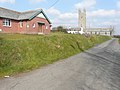
 North Tamerton Methodist Church - geograph.org.uk - 608593.jpg 640 × 423; 47 KB
-
 Ogbeare Hall - geograph.org.uk - 606523.jpg 640 × 369; 49 KB
-

-

-
 Pond on Affaland Moor - geograph.org.uk - 5001791.jpg 3,064 × 1,915; 1.41 MB
-
 River Tamar above Tamerton Bridge.jpg 3,655 × 2,684; 3.96 MB
-
 Road across Affaland Moor - geograph.org.uk - 4865995.jpg 1,920 × 1,081; 677 KB
-
 Road at Venton - geograph.org.uk - 5001777.jpg 1,920 × 1,280; 935 KB
-
 Road junction north of Hollafrench - geograph.org.uk - 599292.jpg 600 × 450; 114 KB
-
 Road near Tamerton Bridge - geograph.org.uk - 5001375.jpg 1,920 × 1,280; 924 KB
-
 Road past Davies Farm - geograph.org.uk - 5001748.jpg 1,920 × 1,072; 545 KB
-
 Road, Affaland Moor - geograph.org.uk - 5002125.jpg 1,920 × 1,280; 755 KB
-
 Roadside near Hornacott - geograph.org.uk - 606473.jpg 640 × 487; 94 KB
-
 Row of trees near Tamerton Town - geograph.org.uk - 715894.jpg 640 × 480; 117 KB
-
 Rushy meadow by the Tamar - geograph.org.uk - 5001612.jpg 1,920 × 1,193; 799 KB
-
 Tamar at Tamerton Bridge - geograph.org.uk - 5001571.jpg 2,048 × 3,072; 1.34 MB
-
 Tamerton Bridge, North Tamerton.jpg 3,719 × 2,708; 4.17 MB
-

-
 The tower of St Denis' church - geograph.org.uk - 3424175.jpg 750 × 562; 141 KB
-
 Track to Haydon Farm, North Tamerton - geograph.org.uk - 1005051.jpg 640 × 480; 104 KB
-
 West of Deer Bridge - geograph.org.uk - 599286.jpg 600 × 450; 104 KB
-
 Wilsworthy Cross - geograph.org.uk - 4922595.jpg 1,600 × 1,200; 337 KB
-
 Eastcott Arms - geograph.org.uk - 606536.jpg 640 × 475; 93 KB
-
 Field at Lower Trebarrow - geograph.org.uk - 608565.jpg 640 × 480; 81 KB
-
 Field near Hornacott Farm - geograph.org.uk - 606494.jpg 640 × 458; 69 KB
-
 Field near Old Shop - geograph.org.uk - 608581.jpg 640 × 351; 50 KB
-
 Lane to Week St Mary - geograph.org.uk - 498509.jpg 480 × 640; 136 KB
-
 Ogbeare plantations from the north - geograph.org.uk - 608574.jpg 640 × 457; 80 KB
-
 Track to Beardon - geograph.org.uk - 608764.jpg 640 × 480; 100 KB
-
 Uplands - geograph.org.uk - 681951.jpg 640 × 480; 78 KB


