Category:North Barrule
Jump to navigation
Jump to search
565m high mountain in Isle of Man  | |||||
| Upload media | |||||
| Instance of | |||||
|---|---|---|---|---|---|
| Location | Isle of Man, Irish Sea | ||||
| Elevation above sea level |
| ||||
 | |||||
Media in category "North Barrule"
The following 24 files are in this category, out of 24 total.
-
 Above Glen Auldyn - Isle of Man - geograph.org.uk - 31589.jpg 640 × 441; 98 KB
-
 Barrule. Isle of Man. - geograph.org.uk - 32221.jpg 640 × 480; 162 KB
-
 Cairn on Clagh Ouyr - geograph.org.uk - 1063463.jpg 640 × 410; 147 KB
-
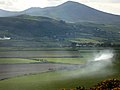
 Farmland west of Maughold Head - geograph.org.uk - 1118149.jpg 640 × 398; 52 KB
-
 Hall Caine's grave, Maughold, Isle of Man.JPG 683 × 1,024; 288 KB
-

-
 North Barrule - geograph.org.uk - 4861.jpg 498 × 640; 89 KB
-
 North Barrule from Clagh Ouyr - geograph.org.uk - 1063916.jpg 640 × 414; 177 KB
-
 North Barrule from Maughold Village.jpg 3,350 × 4,462; 6.81 MB
-

-
 North Barrule from the north - geograph.org.uk - 38065.jpg 640 × 427; 120 KB
-
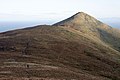
 North Barrule summit pyramid, IOM. - geograph.org.uk - 38.jpg 640 × 408; 64 KB
-
 North Barrule, IOM. - geograph.org.uk - 36.jpg 640 × 427; 69 KB
-
 North Barrule.jpeg 4,032 × 3,024; 1.39 MB
-

-
 Skyhill farm. Isle of Man - geograph.org.uk - 35237.jpg 640 × 480; 132 KB
-
 Slieau Freoaghane - geograph.org.uk - 649405.jpg 640 × 427; 90 KB
-
 Snaefell and North Barrule - geograph.org.uk - 490628.jpg 640 × 480; 50 KB
-
 Stunted trees on North Barrule - geograph.org.uk - 446432.jpg 640 × 480; 60 KB
-
 Summit of North Barrule - geograph.org.uk - 1317589.jpg 640 × 480; 63 KB
-
 Summit of North Barrule - geograph.org.uk - 501564.jpg 640 × 480; 77 KB
-
 The summit of North Barrule - IOM - geograph.org.uk - 39.jpg 640 × 374; 39 KB
-
 Trig Point on North Barrule - geograph.org.uk - 2145459.jpg 1,024 × 768; 179 KB
-


.jpg)


