Category:Noordterp (Schokland)
Jump to navigation
Jump to search
| Object location | | View all coordinates using: OpenStreetMap |
|---|
 | |||||
| Upload media | |||||
| Instance of | |||||
|---|---|---|---|---|---|
| Location | Noordoostpolder, Flevoland, Netherlands | ||||
| Street address |
| ||||
| Heritage designation |
| ||||
 | |||||
|
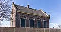
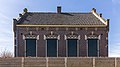
This is a category about rijksmonument number 46033
|
| Address |
|
Subcategories
This category has the following 2 subcategories, out of 2 total.
M
- Misthoornhuisje Schokland (20 F)
P
- Pioniersbruid (Schokland) (4 F)
Media in category "Noordterp (Schokland)"
The following 66 files are in this category, out of 66 total.
-
 Ens - rijksmonument 46033 - Noordterp 20120812.jpg 800 × 432; 138 KB
-
 Schokland. UNESCO-Werelderfgoed 01.jpg 4,026 × 3,020; 13.88 MB
-
 Schokland. UNESCO-Werelderfgoed 02.jpg 2,911 × 2,911; 5.77 MB
-
 Schokland. UNESCO-Werelderfgoed 03.jpg 1,691 × 3,359; 4.32 MB
-
 Schokland. UNESCO-Werelderfgoed 04.jpg 2,491 × 3,321; 5.84 MB
-
 Schokland. UNESCO-Werelderfgoed 05.jpg 2,418 × 3,274; 5.96 MB
-
 Schokland. UNESCO-Werelderfgoed 06.jpg 3,525 × 3,203; 8.55 MB
-
 Schokland. UNESCO-Werelderfgoed 07.jpg 4,601 × 3,451; 12.96 MB
-
 Schokland. UNESCO-Werelderfgoed 08.jpg 4,481 × 2,866; 11.04 MB
-
 Schokland. UNESCO-Werelderfgoed 09.jpg 4,855 × 3,094; 13.82 MB
-
 Schokland. UNESCO-Werelderfgoed 10.jpg 5,119 × 2,226; 10.96 MB
-
 Schokland. UNESCO-Werelderfgoed 13.jpg 4,892 × 2,783; 12.61 MB
-
 Schokland. UNESCO-Werelderfgoed 14.jpg 4,909 × 3,273; 13.64 MB
-
 Schokland. UNESCO-Werelderfgoed 15.jpg 5,117 × 2,899; 13.5 MB
-
 Schokland. UNESCO-Werelderfgoed 16.jpg 5,184 × 1,951; 8.34 MB
-
 Schokland. UNESCO-Werelderfgoed 17.jpg 4,483 × 3,362; 12.85 MB
-
 Schokland. UNESCO-Werelderfgoed 18.jpg 4,012 × 3,371; 12.57 MB
-
 Schokland. UNESCO-Werelderfgoed 19.jpg 3,977 × 3,347; 12.13 MB
-
 Schokland. UNESCO-Werelderfgoed 20.jpg 4,515 × 3,386; 10.8 MB
-
 Schokland. UNESCO-Werelderfgoed 21.jpg 5,179 × 3,453; 14.42 MB
-
 Schokland. UNESCO-Werelderfgoed 22.jpg 5,184 × 3,456; 15.5 MB
-
 Schokland. UNESCO-Werelderfgoed 23.jpg 5,184 × 3,456; 14 MB
-
 Schokland. UNESCO-Werelderfgoed 24.jpg 4,608 × 3,456; 8.48 MB
-
 Schokland. UNESCO-Werelderfgoed 27.jpg 4,585 × 3,439; 14.09 MB
-
 Schokland. UNESCO-Werelderfgoed 28.jpg 5,183 × 2,137; 9.82 MB
-
 Schokland. UNESCO-Werelderfgoed 29.jpg 4,608 × 3,456; 14.76 MB
-
 Schokland. UNESCO-Werelderfgoed 30.jpg 4,759 × 3,421; 16.22 MB
-
 Schokland. UNESCO-Werelderfgoed 31.jpg 5,144 × 2,345; 11.21 MB
-
 Schokland. UNESCO-Werelderfgoed 32.jpg 5,139 × 3,426; 10.05 MB
-
 Schokland. UNESCO-Werelderfgoed 33.jpg 2,953 × 3,348; 9.52 MB
-
 Schokland. UNESCO-Werelderfgoed 34.jpg 5,118 × 2,753; 7.8 MB
-
 Schokland. UNESCO-Werelderfgoed 37.jpg 2,533 × 3,377; 5.52 MB
-
 Schokland. UNESCO-Werelderfgoed 38.jpg 5,183 × 2,005; 12.03 MB
-
 Schokland. UNESCO-Werelderfgoed 39.jpg 5,181 × 1,718; 7.65 MB
-
 Schokland. UNESCO-Werelderfgoed 40.jpg 4,982 × 3,322; 13.84 MB
-
 Schokland. UNESCO-Werelderfgoed 41.jpg 5,106 × 3,404; 13.14 MB
-
 Schokland. UNESCO-Werelderfgoed actm 05.jpg 5,012 × 2,680; 9.67 MB
-
 Schokland. UNESCO-Werelderfgoed actm 06.jpg 4,205 × 2,646; 7.16 MB
-
 Schokland. UNESCO-Werelderfgoed actm 07.jpg 4,796 × 2,661; 8.48 MB
-
 Schokland. UNESCO-Werelderfgoed actm 08.jpg 3,477 × 956; 2.55 MB
-
 Schokland. UNESCO-Werelderfgoed actm 12.jpg 5,169 × 2,831; 11.06 MB
-
 Schokland. UNESCO-Werelderfgoed actm 13.jpg 5,053 × 3,226; 12.53 MB
-
 Schokland. UNESCO-Werelderfgoed actm 14.jpg 2,921 × 3,397; 4.87 MB
-
 Schokland. UNESCO-Werelderfgoed actm 22.jpg 5,105 × 3,129; 13.85 MB
-
 Schokland. UNESCO-Werelderfgoed actm 23.jpg 5,003 × 2,873; 11.23 MB
-
 Schokland. UNESCO-Werelderfgoed actm 24.jpg 5,122 × 3,154; 10.39 MB
-
 Schokland. UNESCO-Werelderfgoed actm 25.jpg 5,137 × 2,973; 7.25 MB
-
 Schokland. UNESCO-Werelderfgoed actm 26.jpg 5,162 × 3,456; 15.98 MB
-
 Schokland. UNESCO-Werelderfgoed actm 27.jpg 5,184 × 3,390; 14.36 MB
-
 Schokland. UNESCO-Werelderfgoed actm 28.jpg 5,050 × 3,367; 13.31 MB
-
 Schokland. UNESCO-Werelderfgoed actm 29.jpg 4,761 × 3,044; 8.16 MB
-
 Schokland. UNESCO-Werelderfgoed actm 30.jpg 2,867 × 3,179; 5.02 MB
-
 Schokland. UNESCO-Werelderfgoed actm 31.jpg 2,743 × 3,347; 6.63 MB
-
 Schokland. UNESCO-Werelderfgoed actm 32.jpg 5,078 × 3,254; 8.73 MB
-
 Schokland. UNESCO-Werelderfgoed actm 33.jpg 5,118 × 3,346; 14.64 MB
-
 Schokland. UNESCO-Werelderfgoed actm 35.jpg 5,184 × 2,313; 11.06 MB
-
 Schokland. UNESCO-Werelderfgoed actm 36.jpg 5,153 × 2,853; 11.63 MB
-
 Schokland. UNESCO-Werelderfgoed actm 37.jpg 4,963 × 2,855; 13.15 MB
-
 Schokland. UNESCO-Werelderfgoed actm 38.jpg 5,183 × 2,049; 9.81 MB
-
 Schokland. UNESCO-Werelderfgoed actm 39.jpg 2,581 × 3,422; 6.74 MB
-
 Schokland. UNESCO-Werelderfgoed actm 40.jpg 4,301 × 3,082; 8.41 MB
-
 Schokland. UNESCO-Werelderfgoed actm 41.jpg 4,296 × 3,347; 6.07 MB
-
 Schokland. UNESCO-Werelderfgoed actm 42.jpg 5,126 × 3,415; 10.16 MB
-
 Schokland. UNESCO-Werelderfgoed actm AM.jpg 4,990 × 3,073; 11.63 MB
-

-


