Category:Noordersluis (De Veenhoop)
Jump to navigation
Jump to search
| Object location | | View all coordinates using: OpenStreetMap |
|---|
_61.jpg) | |||||
| Upload media | |||||
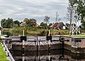
| Location | Smallingerland, Friesland, Netherlands | ||||
|---|---|---|---|---|---|
 | |||||
Media in category "Noordersluis (De Veenhoop)"
The following 3 files are in this category, out of 3 total.
-
 2023 De Feanhoop, brêge Noarderslûs.jpg 2,967 × 1,974; 1.73 MB
-
 Natuurgebied Petgatten De Feanhoop. 19-10-2020. (actm.) 60.jpg 5,074 × 2,421; 9.75 MB
-
 Natuurgebied Petgatten De Feanhoop. 19-10-2020. (actm.) 61.jpg 4,408 × 3,149; 11.49 MB

_60.jpg)