Category:Nieuwstraat 17, Breda
Jump to navigation
Jump to search
| Object location | | View all coordinates using: OpenStreetMap |
|---|
 | |||||
| Upload media | |||||
| Instance of |
| ||||
|---|---|---|---|---|---|
| Location | Breda, North Brabant, Netherlands | ||||
| Street address |
| ||||
| Located on street | |||||
| Heritage designation |
| ||||
 | |||||
|
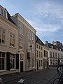
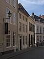
This is a category about rijksmonument number 10263
|
| Address |
|
Media in category "Nieuwstraat 17, Breda"
The following 6 files are in this category, out of 6 total.
-
 Breda Nieuwstraat15.jpg 2,736 × 3,648; 4.71 MB
-
 Breda Nieuwstraat17.jpg 2,736 × 3,648; 5.35 MB
-
 Gevelwand - Breda - 20324664 - RCE.jpg 891 × 1,200; 162 KB
-
 Voorgevel - Breda - 20041414 - RCE.jpg 861 × 1,200; 234 KB
-
 Voorgevel - Breda - 20041415 - RCE.jpg 788 × 1,200; 215 KB
-
 Voorgevel - Breda - 20041416 - RCE.jpg 788 × 1,200; 202 KB


