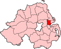
Category:Newtownabbey Borough Council
Jump to navigation
Jump to search
| Object location | | View all coordinates using: OpenStreetMap |
|---|
administrative territorial entity of the United Kingdom | |||||
| Upload media | |||||
| Instance of |
| ||||
|---|---|---|---|---|---|
| Location | Antrim and Newtownabbey, Northern Ireland | ||||
| Capital | |||||
| Area |
| ||||
| Religion or worldview | |||||
| Replaced by |
| ||||
| official website | |||||
 | |||||
Subcategories
This category has the following 2 subcategories, out of 2 total.
N
R
Media in category "Newtownabbey Borough Council"
The following 33 files are in this category, out of 33 total.
-
B513 - geograph.org.uk - 1099942.jpg 640 × 480; 46 KB
-
Belfast Lough, Whitehouse Park - geograph.org.uk - 5759798.jpg 640 × 427; 354 KB
-
Bowling Green, Whiteabbey - geograph.org.uk - 1754625.jpg 640 × 382; 105 KB
-
Coole Park, Glengormley - geograph.org.uk - 1394120.jpg 640 × 480; 92 KB
-
Cotton Mount - geograph.org.uk - 1536257.jpg 640 × 479; 49 KB
-
Countryside near Doagh - geograph.org.uk - 1586581.jpg 640 × 480; 52 KB
-
Cow, Sheeplair - geograph.org.uk - 1580860.jpg 640 × 480; 61 KB
-
Cycle path to Belfast - geograph.org.uk - 1163695.jpg 640 × 480; 58 KB
-
Farm near Doagh - geograph.org.uk - 1586587.jpg 640 × 480; 45 KB
-
Farmland near Doagh - geograph.org.uk - 1586589.jpg 640 × 480; 56 KB
-
Lake, Mossley Mills - geograph.org.uk - 1599027.jpg 640 × 480; 77 KB
-
M5 towards Belfast - geograph.org.uk - 5759660.jpg 640 × 427; 354 KB
-
Motorway underpass near Whitehouse - geograph.org.uk - 1754995.jpg 640 × 428; 82 KB
-
Nbclogo roundabout.jpg 1,000 × 453; 464 KB
-
Newtownabbey Borough Council (01), September 2009.JPG 4,272 × 2,848; 5.89 MB
-
Newtownabbey Borough Council (02), September 2009.JPG 2,848 × 4,272; 2.92 MB
-
Newtownabbey Borough Council (03), September 2009.JPG 2,848 × 4,272; 6.09 MB
-
Rathcoole - geograph.org.uk - 1629194.jpg 640 × 371; 385 KB
-
Rushpark flats, Whitehouse - geograph.org.uk - 1754584.jpg 531 × 377; 103 KB
-
Sheep in the snow, Straid - geograph.org.uk - 1724588.jpg 3,648 × 2,736; 1.56 MB
-
St Patrick's Church - geograph.org.uk - 1102020.jpg 640 × 480; 92 KB
-
Texaco Garage - geograph.org.uk - 1099120.jpg 640 × 480; 62 KB
-
The Larne line at Coleman's Corner - geograph.org.uk - 723092.jpg 640 × 404; 74 KB
-
The Lisglass Road near Straid - geograph.org.uk - 730073.jpg 640 × 388; 81 KB
-
The Loughshore path at Jordanstown - geograph.org.uk - 1780681.jpg 640 × 373; 93 KB
-
The Trench - geograph.org.uk - 1536278.jpg 640 × 479; 75 KB
-
Valley View - geograph.org.uk - 568966.jpg 640 × 480; 60 KB
-
Whiteabbey, former A2 - geograph.org.uk - 5850485.jpg 1,024 × 768; 207 KB


