Category:Newport and Carisbrooke
Jump to navigation
Jump to search
civil parish on the Isle of Wight, in England, UK  | |||||
| Upload media | |||||
| Instance of | |||||
|---|---|---|---|---|---|
| Location | Isle of Wight, South East England, England | ||||
 | |||||
Subcategories
This category has the following 8 subcategories, out of 8 total.
A
- Apesdown (4 F)
B
C
N
P
- Parkhurst Forest (23 F)
- Parkhurst Methodist Chapel (3 F)
S
- Seaclose Park (4 F)
Pages in category "Newport and Carisbrooke"
This category contains only the following page.
Media in category "Newport and Carisbrooke"
The following 200 files are in this category, out of 708 total.
(previous page) (next page)-
 "The most enchanting place" (1) - geograph.org.uk - 3168656.jpg 480 × 640; 73 KB
-
 "The most enchanting place" (2) - geograph.org.uk - 3168658.jpg 640 × 480; 93 KB
-
 "The most enchanting place" (3) - geograph.org.uk - 3168662.jpg 640 × 480; 110 KB
-
 106 Colours-1.jpg 1,806 × 2,490; 1.18 MB
-
 1961 Leyland Leopard - geograph.org.uk - 5602608.jpg 640 × 424; 99 KB
-
 66-68 High Street - geograph.org.uk - 5676476.jpg 665 × 1,000; 672 KB
-
 66-68 High Street, Carisbrooke - geograph.org.uk - 5469139.jpg 640 × 480; 127 KB
-
 99p Store, High Street - geograph.org.uk - 4702287.jpg 480 × 640; 78 KB
-
 A footpath crosses over Burnt House Lane - geograph.org.uk - 2653403.jpg 800 × 600; 209 KB
-
 A leafy stretch on Calbourne Road - geograph.org.uk - 5130245.jpg 640 × 480; 166 KB
-
-
 A-Plan Insurance in the High Street - geograph.org.uk - 4699419.jpg 480 × 640; 60 KB
-
 A3054 Fairlee Road - geograph.org.uk - 5130847.jpg 640 × 480; 113 KB
-
 Age UK in the High Street - geograph.org.uk - 4701687.jpg 640 × 480; 109 KB
-
 Agricultural activity, Gunville - geograph.org.uk - 5130828.jpg 640 × 480; 119 KB
-
 Alas, it all ended in tears - geograph.org.uk - 4701696.jpg 640 × 480; 85 KB
-
 Alexandra Terrace - geograph.org.uk - 2688799.jpg 3,264 × 2,448; 1.66 MB
-
 Alexandra Terrace - geograph.org.uk - 2688809.jpg 3,264 × 2,448; 1.84 MB
-
 Allotment garden near Hunny Hill - geograph.org.uk - 6178118.jpg 3,812 × 2,767; 2.67 MB
-
 Allotments in Alvington Road - geograph.org.uk - 4708454.jpg 640 × 480; 73 KB
-
 Along Carisbrooke Road - geograph.org.uk - 5194084.jpg 640 × 427; 130 KB
-
 Amplifon, High Street - geograph.org.uk - 4702279.jpg 480 × 640; 76 KB
-

-

-

-
-
 Apollo Theatre, Newport - geograph.org.uk - 5133196.jpg 640 × 480; 125 KB
-
-

-
 Artwork - geograph.org.uk - 2688638.jpg 3,264 × 2,448; 1.71 MB
-
 B ^ M, High Street - geograph.org.uk - 5944611.jpg 640 × 480; 61 KB
-
 B3401 Calbourne Road - geograph.org.uk - 5130228.jpg 640 × 480; 106 KB
-
 Bakery in Pyle Street - geograph.org.uk - 4702930.jpg 480 × 640; 65 KB
-
 Bambini gelato, High Street - geograph.org.uk - 4702299.jpg 480 × 640; 63 KB
-
 Barclays, St James' Square - geograph.org.uk - 4702912.jpg 480 × 640; 45 KB
-
 Bargeman's Rest - geograph.org.uk - 5602610.jpg 640 × 424; 62 KB
-
 Bath Travel, High Street - geograph.org.uk - 4702277.jpg 480 × 640; 76 KB
-
 Bedford Place, Carisbrooke Road - geograph.org.uk - 5450746.jpg 1,000 × 665; 786 KB
-
 Bellecroft House - geograph.org.uk - 5676480.jpg 1,000 × 665; 837 KB
-
 Betty Haunt Lane in 1988 - geograph.org.uk - 2763507.jpg 1,004 × 683; 141 KB
-
 Bikes in the High Street - geograph.org.uk - 4698291.jpg 480 × 640; 63 KB
-
 Bishops Insurance, High Street - geograph.org.uk - 4701691.jpg 480 × 640; 77 KB
-
 Bitesize, St James' Square - geograph.org.uk - 4702915.jpg 480 × 640; 64 KB
-
 Blacklands Lane, the bridge over Palmer's Brook - geograph.org.uk - 5918548.jpg 3,923 × 2,942; 4.08 MB
-
 Blacks, High Street, Isle of Wight - geograph.org.uk - 4699418.jpg 480 × 640; 76 KB
-
 Blue plaque in Pyle Street - geograph.org.uk - 4702936.jpg 640 × 559; 73 KB
-
 Bonmarché in the High Street - geograph.org.uk - 4698287.jpg 480 × 640; 79 KB
-
 Books 2 Love, Pyle Street - geograph.org.uk - 4702929.jpg 480 × 640; 75 KB
-
 Bowcombe Barn Farmland - geograph.org.uk - 3115375.jpg 4,572 × 2,920; 4.99 MB
-
 Bowcombe Down - geograph.org.uk - 5676471.jpg 1,000 × 665; 780 KB
-
 Bowcombe, New Park Farm - geograph.org.uk - 6302462.jpg 5,169 × 3,446; 3.7 MB
-
 Bowcombe, The Blacksmith's Arms - geograph.org.uk - 6239497.jpg 4,670 × 3,114; 2.61 MB
-
 Briddlesford Lodge Farm - geograph.org.uk - 5678329.jpg 1,000 × 665; 806 KB
-
 Briddlesford Lodge Farm - geograph.org.uk - 5678334.jpg 1,000 × 665; 712 KB
-
 Bridleway to Little Pan - geograph.org.uk - 3036023.jpg 1,000 × 750; 561 KB
-

-
 Brookside, Blackwater Road - geograph.org.uk - 5130042.jpg 640 × 428; 103 KB
-
 Building site, Newport - geograph.org.uk - 5130058.jpg 640 × 428; 115 KB
-
 Bus at stop F, Newport bus station - geograph.org.uk - 5151656.jpg 640 × 480; 157 KB
-
 Bus in Pyle Street - geograph.org.uk - 5942934.jpg 640 × 480; 56 KB
-
 Bus in the High Street - geograph.org.uk - 3669299.jpg 640 × 480; 59 KB
-
 Bus line-up at Newport - geograph.org.uk - 6259866.jpg 1,024 × 576; 294 KB
-
 Bus stop in Whitcombe Road - geograph.org.uk - 3667663.jpg 640 × 480; 75 KB
-
 Bust of King Charles I - geograph.org.uk - 4110307.jpg 531 × 800; 91 KB
-
 Calbourne Road, B3401 - geograph.org.uk - 5422379.jpg 640 × 480; 97 KB
-
 Camp Hill Prison - geograph.org.uk - 5505948.jpg 3,565 × 1,978; 1.63 MB
-

-
 Card Factory, High Street - geograph.org.uk - 4702303.jpg 640 × 480; 93 KB
-
 Carisbrooke - geograph.org.uk - 5694557.jpg 1,000 × 665; 961 KB
-
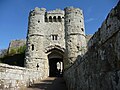 Carisbrooke Castle - geograph.org.uk - 5383507.jpg 3,456 × 2,592; 4.28 MB
-
 Carisbrooke Castle - geograph.org.uk - 5383514.jpg 3,456 × 2,592; 4.69 MB
-
 Carisbrooke Castle - geograph.org.uk - 5383518.jpg 3,456 × 2,592; 4.35 MB
-
 Carisbrooke Castle - geograph.org.uk - 5383521.jpg 3,456 × 2,592; 4.32 MB
-
 Carisbrooke Castle - geograph.org.uk - 5383538.jpg 3,456 × 2,592; 4.46 MB
-
 Carisbrooke Castle - geograph.org.uk - 5383539.jpg 3,456 × 2,592; 4.17 MB
-
 Carisbrooke Castle - geograph.org.uk - 5383542.jpg 3,456 × 2,592; 5.16 MB
-
 Carisbrooke Castle - geograph.org.uk - 5383544.jpg 3,456 × 2,592; 4.33 MB
-
 Carisbrooke Castle - geograph.org.uk - 5383572.jpg 3,456 × 2,592; 4.64 MB
-
 Carisbrooke Castle - geograph.org.uk - 5383598.jpg 3,456 × 2,592; 4.23 MB
-
 Carisbrooke Castle - geograph.org.uk - 5383604.jpg 3,456 × 2,592; 6.39 MB
-
 Carisbrooke Castle - geograph.org.uk - 5383613.jpg 3,456 × 2,592; 4.34 MB
-
 Carisbrooke Castle - geograph.org.uk - 5383617.jpg 3,456 × 2,592; 4.59 MB
-
 Carisbrooke Castle - geograph.org.uk - 5383619.jpg 3,456 × 2,592; 4.26 MB
-
 Carisbrooke Castle - geograph.org.uk - 5464824.jpg 640 × 428; 100 KB
-
 Carisbrooke Castle - geograph.org.uk - 5676474.jpg 1,000 × 665; 962 KB
-
 Carisbrooke Castle - geograph.org.uk - 5683367.jpg 640 × 427; 66 KB
-
 Carisbrooke Castle - geograph.org.uk - 5683370.jpg 640 × 427; 99 KB
-
 Carisbrooke Castle - geograph.org.uk - 5694719.jpg 665 × 1,000; 844 KB
-
 Carisbrooke Castle - geograph.org.uk - 5696048.jpg 1,000 × 665; 917 KB
-
 Carisbrooke Castle - geograph.org.uk - 5696054.jpg 1,000 × 665; 725 KB
-
 Carisbrooke Castle - geograph.org.uk - 5696058.jpg 1,000 × 665; 930 KB
-
 Carisbrooke Castle - geograph.org.uk - 5836545.jpg 640 × 480; 77 KB
-
 Carisbrooke Castle Car Park - geograph.org.uk - 6284939.jpg 7,092 × 4,727; 7.28 MB
-
 Carisbrooke Castle IOW - geograph.org.uk - 5536671.jpg 810 × 540; 284 KB
-
 Carisbrooke Castle tiltyard - geograph.org.uk - 5694771.jpg 1,000 × 665; 790 KB
-
 Carisbrooke Castle tiltyard - geograph.org.uk - 5696077.jpg 1,000 × 665; 778 KB
-
 Carisbrooke Castle tiltyard - geograph.org.uk - 5696083.jpg 1,000 × 665; 709 KB
-
 Carisbrooke Castle western bastion - geograph.org.uk - 5383491.jpg 3,456 × 2,592; 4.58 MB
-
 Carisbrooke Castle western bastion - geograph.org.uk - 5383495.jpg 3,456 × 2,592; 4.37 MB
-
 Carisbrooke Castle, 'Room with a view' in the keep - geograph.org.uk - 6285675.jpg 6,754 × 4,502; 7.64 MB
-
 Carisbrooke Castle, Path to the keep - geograph.org.uk - 6285669.jpg 6,909 × 4,606; 7.7 MB
-

-
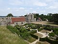
 Carisbrooke Castle, St. Great Hall and Museum, Wellhouse - geograph.org.uk - 6285665.jpg 6,443 × 4,295; 6.04 MB
-

-
 Carisbrooke Castle, Steps leading up to the keep - geograph.org.uk - 6285672.jpg 6,465 × 4,310; 6.97 MB
-
 Carisbrooke Cemetery - geograph.org.uk - 5694786.jpg 1,000 × 665; 795 KB
-
 Carisbrooke church - geograph.org.uk - 4109626.jpg 800 × 531; 151 KB
-
 Carisbrooke from the castle keep - geograph.org.uk - 6284932.jpg 6,380 × 4,255; 7.71 MB
-
 Carisbrooke Priory bus stop, northbound - geograph.org.uk - 5469170.jpg 640 × 480; 108 KB
-
 Carisbrooke Road - geograph.org.uk - 2688750.jpg 3,264 × 2,448; 1.8 MB
-
 Carisbrooke Road - geograph.org.uk - 5194082.jpg 640 × 415; 117 KB
-
 Carisbrooke Road - geograph.org.uk - 5448450.jpg 1,000 × 665; 838 KB
-
 Carisbrooke Road - geograph.org.uk - 5676478.jpg 1,000 × 665; 818 KB
-
 Carphone Warehouse, High Street - geograph.org.uk - 4702313.jpg 480 × 640; 82 KB
-
 Cash Recycle in the High Street - geograph.org.uk - 4701678.jpg 480 × 640; 93 KB
-
 Castle from Froglands Lane - geograph.org.uk - 3643336.jpg 4,000 × 3,000; 4.83 MB
-
 Castle Hill - geograph.org.uk - 5694552.jpg 665 × 1,000; 858 KB
-
 Castle Hill - geograph.org.uk - 5696085.jpg 1,000 × 665; 935 KB
-
 Castle Hill, footpath - geograph.org.uk - 5382782.jpg 1,600 × 1,200; 767 KB
-
 Castle Road and Carisbrooke Road - geograph.org.uk - 5195532.jpg 640 × 427; 108 KB
-
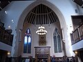
 Chapel of St Nicholas, Carisbrooke Castle - geograph.org.uk - 5696066.jpg 1,000 × 665; 1,003 KB
-
 Chapel of St Nicholas, Carisbrooke Castle - geograph.org.uk - 5696071.jpg 1,000 × 665; 859 KB
-
 Chapel of St. Nicholas - geograph.org.uk - 3119408.jpg 4,264 × 2,845; 4.45 MB
-
 Chapel Street Car Park - geograph.org.uk - 5942913.jpg 640 × 480; 38 KB
-
 Charity shop in St James's Street - geograph.org.uk - 5946319.jpg 480 × 640; 65 KB
-
 Charity shop in Town Lane - geograph.org.uk - 4702960.jpg 640 × 480; 91 KB
-
 Chippie in St James's Street - geograph.org.uk - 5946318.jpg 480 × 640; 82 KB
-
 Church in Castle Street - geograph.org.uk - 3666070.jpg 466 × 640; 60 KB
-
 Church Litten - geograph.org.uk - 5195891.jpg 640 × 427; 122 KB
-
 Church Litten, Newport - geograph.org.uk - 4635458.jpg 1,200 × 799; 302 KB
-
 Church ^ Gardens - geograph.org.uk - 3111825.jpg 4,516 × 2,816; 4.72 MB
-
 Clatterford from Carisbrooke - geograph.org.uk - 3115373.jpg 4,592 × 3,056; 5.53 MB
-
 Clatterford from castle car park - geograph.org.uk - 5382785.jpg 3,456 × 2,592; 4.15 MB
-

-
 Clinopodium menthifolium (Wood Calamint) - geograph.org.uk - 5310768.jpg 665 × 1,000; 644 KB
-

-
-
 Co-Operative bank, High Street - geograph.org.uk - 4702296.jpg 480 × 640; 63 KB
-

-
 Coat of arms in St Thomas Square - geograph.org.uk - 3168011.jpg 480 × 640; 79 KB
-
 Collapsing ship - geograph.org.uk - 5875642.jpg 640 × 480; 93 KB
-
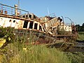 Collapsing Ship - Island Harbour - geograph.org.uk - 5876464.jpg 640 × 480; 109 KB
-
 Combley Road - geograph.org.uk - 3323156.jpg 640 × 480; 69 KB
-
 Comicoffee, Pyle Street - geograph.org.uk - 5946268.jpg 480 × 640; 62 KB
-
 Congregational Church, Pyle Street - geograph.org.uk - 5943900.jpg 640 × 480; 55 KB
-
 Convenience store in Pyle Street - geograph.org.uk - 5942932.jpg 640 × 480; 89 KB
-

-
 Corner shop, High Street, Newport - geograph.org.uk - 5133219.jpg 640 × 480; 111 KB
-
 Costa, St James Square - geograph.org.uk - 4702900.jpg 480 × 640; 55 KB
-
 Cottages on Bowcombe Road - geograph.org.uk - 5465112.jpg 640 × 480; 140 KB
-
 Countess Isabella's window - geograph.org.uk - 3117522.jpg 1,917 × 2,880; 3.95 MB
-
 Cow Lane climbing towards Bowcombe Wood - geograph.org.uk - 5683495.jpg 640 × 427; 145 KB
-
 Cowslips, Mount Joy Cemetery, Carisbrooke - geograph.org.uk - 5491182.jpg 4,000 × 3,000; 1.94 MB
-
 Cox's Corner bus stop, southbound - geograph.org.uk - 5469240.jpg 480 × 640; 150 KB
-
 Cranbourn Rest, St James's Street - geograph.org.uk - 5946280.jpg 640 × 480; 62 KB
-
 Crockshop ^ Ralphs, St James's Street - geograph.org.uk - 5946303.jpg 640 × 480; 105 KB
-
 Cyclists on the B3401 - geograph.org.uk - 5130218.jpg 640 × 428; 132 KB
-
 Daniells Harrison, High Street - geograph.org.uk - 4701690.jpg 480 × 640; 67 KB
-
 Davidoff, Pyle Street - geograph.org.uk - 5946262.jpg 480 × 640; 77 KB
-
 Descent from the keep, Carisbrooke Castle - geograph.org.uk - 6294400.jpg 683 × 1,024; 282 KB
-
 Deterioration of PS Ryde - geograph.org.uk - 5558150.jpg 4,000 × 3,000; 2.51 MB
-
 Domino's, St James's Street - geograph.org.uk - 5946321.jpg 640 × 480; 57 KB
-
 Doorway entrance to the keep - geograph.org.uk - 2312194.jpg 1,636 × 2,521; 399 KB
-
 Down Lane - geograph.org.uk - 5676473.jpg 1,000 × 665; 852 KB
-
 Dragonfly, St James's Street - geograph.org.uk - 5946311.jpg 480 × 640; 55 KB
-
 Driving Test Centre - geograph.org.uk - 4634988.jpg 1,200 × 799; 423 KB
-

-
-

-

-

-

-

-

-

-

-
-

-

-

-

-

-

-

-

-

-
 Easyweigh, Pyle Street - geograph.org.uk - 5946260.jpg 480 × 640; 82 KB
-
 Edinburgh Woollen Mill, High Street - geograph.org.uk - 4702281.jpg 480 × 640; 85 KB
-
 Electricity substation - geograph.org.uk - 5438646.jpg 1,000 × 665; 1.08 MB
-

-

-
 Esplanade Car Sales - geograph.org.uk - 4634929.jpg 1,200 × 799; 294 KB
-

-
 Fairlee Road, A3054 - geograph.org.uk - 5130889.jpg 640 × 428; 106 KB
-
 Farmfayre, St James's Street - geograph.org.uk - 5946314.jpg 480 × 640; 56 KB
-

-
 Fields between Carisbrooke and Parkhurst Forest - geograph.org.uk - 6178116.jpg 3,657 × 2,681; 3.09 MB
-
 Fields north of North Fairlee Road - geograph.org.uk - 5130871.jpg 640 × 480; 120 KB
-
 Fields on Bowcombe Down - geograph.org.uk - 5684796.jpg 640 × 427; 80 KB
-
 Football pitch, Newport IOW - geograph.org.uk - 3307070.jpg 1,600 × 1,251; 432 KB
_-_geograph.org.uk_-_3168656.jpg)
_-_geograph.org.uk_-_3168658.jpg)
_-_geograph.org.uk_-_3168662.jpg)


_-_geograph.org.uk_-_4727109.jpg)
_-_geograph.org.uk_-_4727114.jpg)
_-_geograph.org.uk_-_4727117.jpg)
_-_geograph.org.uk_-_4727125.jpg)


_-_geograph.org.uk_-_5310768.jpg)


_-_geograph.org.uk_-_4058533.jpg)
_-_geograph.org.uk_-_4060382.jpg)
_-_geograph.org.uk_-_4058535.jpg)
_-_geograph.org.uk_-_4060373.jpg)
_-_geograph.org.uk_-_4060384.jpg)
_-_geograph.org.uk_-_4060375.jpg)
_-_geograph.org.uk_-_4060376.jpg)
_-_geograph.org.uk_-_4060377.jpg)
_-_geograph.org.uk_-_4060378.jpg)
_-_geograph.org.uk_-_4060380.jpg)
_-_geograph.org.uk_-_4658688.jpg)
_-_geograph.org.uk_-_4658689.jpg)
_-_geograph.org.uk_-_4658693.jpg)
_-_geograph.org.uk_-_4658697.jpg)
_-_geograph.org.uk_-_4658724.jpg)
_-_geograph.org.uk_-_4658699.jpg)
_-_geograph.org.uk_-_4658717.jpg)
_-_geograph.org.uk_-_4658719.jpg)
_-_geograph.org.uk_-_4658722.jpg)
_-_geograph.org.uk_-_4658727.jpg)


