Category:Newland, Cornwall
Jump to navigation
Jump to search
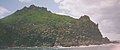
island, off Pentire Point, Cornwall, England  | |||||
| Upload media | |||||
 | |||||
Media in category "Newland, Cornwall"
The following 18 files are in this category, out of 18 total.
-
 Boundary wall on Stepper Point headland - geograph.org.uk - 1700303.jpg 640 × 480; 100 KB
-
 Camel estuary from St Jidgey.jpg 6,624 × 1,792; 2.8 MB
-
 Cliff top south of Butter Hole - geograph.org.uk - 1700428.jpg 640 × 480; 93 KB
-

-
 Island - panoramio (16).jpg 3,244 × 1,846; 779 KB
-
 Newland - geograph.org.uk - 29608.jpg 640 × 486; 101 KB
-
 Newland Island - geograph.org.uk - 106733.jpg 640 × 265; 38 KB
-
 Newland Island - geograph.org.uk - 1700374.jpg 418 × 640; 37 KB
-
 Newland Island from Pentire Point - geograph.org.uk - 226078.jpg 640 × 480; 55 KB
-
 Newland Island, Cornwall - geograph.org.uk - 1086056.jpg 640 × 512; 87 KB
-
 NewlandIslandCornwall.jpg 700 × 414; 79 KB
-
 Old quarry at Stepper Point (2) - geograph.org.uk - 1466348.jpg 640 × 425; 97 KB
-

-
 River Camel estuary - geograph.org.uk - 930045.jpg 640 × 457; 121 KB
-
 RiverCamelEstuaryLookingSeawardCornwallUK.jpg 640 × 392; 47 KB
-
 Sands near Hawker Cove at low water - geograph.org.uk - 1466395.jpg 640 × 417; 64 KB
-
 The Camel Estuary - geograph.org.uk - 106715.jpg 640 × 360; 40 KB
-
 Trebetherick Point from Brea Hill - geograph.org.uk - 1651582.jpg 640 × 480; 66 KB


.jpg)


_-_geograph.org.uk_-_1466348.jpg)


