Category:New York State Route 17
Jump to navigation
Jump to search
 | number: | (seventeen) |
|---|---|---|
| State highways in New York (state): | 2 · 3 · 5 · 7 · 8 · 10 · 12 · 13 · 14 · 15 · 16 · 17 · 18 · 19 · 21 · 22 · 23 · 24 · 25 · 26 · 27 · 28 · 29 · 30 · 31 · 32 · 33 · 34 · 35 · 36 · 37 |
highway in the Southern Tier of New York  | |||||
| Upload media | |||||
| Instance of | |||||
|---|---|---|---|---|---|
| Location | New York | ||||
| Transport network | |||||
| Owned by | |||||
| Maintained by | |||||
| Has part(s) |
| ||||
| Inception |
| ||||
| Length |
| ||||
| |||||
English: Media related to New York State Route 17.
Subcategories
This category has the following 10 subcategories, out of 10 total.
*
- New York State Route 17A (278 F)
- New York State Route 17B (144 F)
- New York State Route 17F (4 F)
- New York State Route 17J (2 F)
- New York State Route 17K (37 F)
- New York State Route 17M (14 F)
G
- George F. Baker High School (3 F)
R
- Red Apple Rest (5 F)
- Roscoe Diner (5 F)
Media in category "New York State Route 17"
The following 107 files are in this category, out of 107 total.
-
 16 at Detour 17.jpg 1,119 × 888; 112 KB
-

-

-

-

-

-

-
 426 at Findley Lake interchange.jpg 971 × 804; 85 KB
-
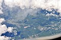
 Aerial - Dahlia Road NW of Liberty, NY 01 (9614078168).jpg 4,288 × 2,848; 4.31 MB
-
 Aerial - Dahlia Road NW of Liberty, NY 01 - white balanced (9614090424).jpg 4,288 × 2,848; 9.77 MB
-
 Aerial - Liberty, NY from SW 01 (9614061820).jpg 4,288 × 2,848; 4.89 MB
-
 Aerial - Liberty, NY from SW 01 - white balanced (9614072432).jpg 4,288 × 2,848; 9.12 MB
-
 Aerial - Liberty, NY from SW 02 (9614045404).jpg 4,288 × 2,848; 4.26 MB
-
 Aerial - Liberty, NY from SW 02 - white balanced (9610820311).jpg 4,288 × 2,848; 8.86 MB
-
 Aerial - Liberty, NY from SW 03 (9610793985).jpg 4,288 × 2,848; 4.13 MB
-
 Aerial - Liberty, NY from SW 03 - white balanced (9614040098).jpg 4,288 × 2,848; 9.04 MB
-
 Aerial - Livingston Manor, NY from SW 01 (9637923545).jpg 4,288 × 2,848; 4.53 MB
-
 Aerial - Livingston Manor, NY from SW 01 - white balanced & 50pct equalized (9637966501).jpg 4,288 × 2,848; 10.42 MB
-
 Aerial - Livingston Manor, NY from SW 01 - white balanced (9641178708).jpg 4,288 × 2,848; 7.74 MB
-
 Aerial - Livingston Manor, NY from SW 02 (9641081598).jpg 4,288 × 2,848; 4.29 MB
-
 Aerial - Livingston Manor, NY from SW 02 - white balanced & 50pct equalized (9637883309).jpg 4,288 × 2,848; 9.14 MB
-
 Aerial - Livingston Manor, NY from SW 02 - white balanced (9641097962).jpg 4,288 × 2,848; 6.8 MB
-
 Aerial - Monticello Raceway & north on NY Route 17 - 01 (9610860601).jpg 4,288 × 2,848; 4.14 MB
-
 Aerial - Monticello Raceway & north on NY Route 17 - 01 - white balanced (9610866727).jpg 4,288 × 2,848; 4.65 MB
-
 Aerial - Roscoe, NY from south 01 (9641131078).jpg 4,288 × 2,848; 4.81 MB
-
 Aerial - Roscoe, NY from south 01 - white balanced (9641149536).jpg 4,288 × 2,848; 8.27 MB
-
 Aerial - Route 17 about 1.5 miles east of Hancock, NY from SSW 01 (9637762427).jpg 4,288 × 2,848; 4.13 MB
-

-
 Aerial - Route 17 about 5 miles east of Hancock, NY from SW 01 (9637794299).jpg 4,288 × 2,848; 4.18 MB
-

-
 Aerial - Route 17 west of Livingston Manor, NY from WSW 01 (9637835437).jpg 4,288 × 2,848; 4.27 MB
-
 Aerial - Route 17 west of Livingston Manor, NY from WSW 01A (9637824811).jpg 4,288 × 2,848; 6.63 MB
-
 AVRWesternTerminus1.jpg 1,600 × 1,200; 773 KB
-
 AVRWesternTerminus2.jpg 1,600 × 1,200; 789 KB
-
 Bluestone Wind Project, NY 17 wb, July 2023.jpg 2,091 × 1,599; 879 KB
-
 Catskills Regional Medical Center, from NY 17 wb (1), July 2023.jpg 1,042 × 782; 232 KB
-
 Catskills Regional Medical Center, from NY 17 wb (2), July 2023.jpg 1,822 × 1,366; 596 KB
-
 Covered I-86 shield at the interchange between NY 17 and I 84.jpg 3,264 × 1,836; 1.57 MB
-
 Deposit, New York - 4476192954.jpg 1,024 × 768; 305 KB
-
 Downtown Sloatsburg.JPG 800 × 600; 110 KB
-
 END! NY 59.jpg 470 × 800; 67 KB
-
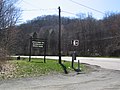
 Enterance ramp to Allegany State Park from 17.JPG 1,600 × 1,200; 199 KB
-
 Former NY 17 in Parksville.jpg 3,264 × 2,448; 1.71 MB
-
 Galleria at Crystal Run.jpg 902 × 294; 100 KB
-
 I-287 I-87.jpg 1,536 × 1,735; 911 KB
-
 I-81 nb NY, approaching exit 4A, Aug 2022.jpg 2,772 × 2,079; 1.23 MB
-
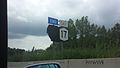
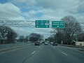
 I-81, NY 17, to I-86 shields, Aug 2022.jpg 2,842 × 2,152; 1.01 MB
-
 I81NY17Merge2.jpg 3,264 × 2,448; 1.2 MB
-
 Interstate 84 Newburgh.jpg 2,048 × 1,536; 957 KB
-
 Junction Pool from NY 17.jpg 3,357 × 2,418; 2.01 MB
-
 New York Route 17 map.svg 815 × 668; 9.41 MB
-
 New York State Route 206 - 4324009064.jpg 1,024 × 768; 316 KB
-
 New York State Route 352 - 12011182906.jpg 3,072 × 2,304; 782 KB
-
 New York State Route 363 - 4327803384.jpg 640 × 480; 71 KB
-
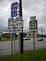 New York State Route 415 - 4328544553.jpg 768 × 1,024; 132 KB
-
 New York State Route 415 - 4329278220.jpg 640 × 480; 36 KB
-
 New York State Route 415.jpg 1,024 × 768; 156 KB
-
 New York State Route 434 - 4329405141.jpg 640 × 480; 29 KB
-
 New York State Route 434 - 4330138976.jpg 640 × 480; 69 KB
-
 NY 17 blinker in Tuxedo.JPG 2,816 × 2,112; 3.54 MB
-
 NY 17 heading northbound through Southfields.jpg 2,048 × 1,536; 417 KB
-
 NY 17 wb approaching Hale Eddy, July 2023.jpg 2,820 × 2,126; 1.25 MB
-
 NY 17 wb in Hale Eddy (1), July 2023.jpg 3,510 × 1,946; 1.28 MB
-
 NY 17 wb in Hale Eddy (2), July 2023.jpg 3,480 × 2,162; 1.29 MB
-
 NY 17-17A jct from Orange CR 106.jpg 1,024 × 768; 185 KB
-
 NY 17J topo.PNG 794 × 581; 1.1 MB
-
 NY 17M at Brookview Farm, Chester, NY.jpg 3,258 × 2,265; 5.31 MB
-
 NY 21 from Interstate 86 and NY 17.JPG 1,600 × 1,200; 180 KB
-
 NY 280 at NY 17.jpg 1,198 × 900; 118 KB
-
 NY 282 north.jpg 1,270 × 1,038; 121 KB
-
 NY 32WoodburyCommons.jpg 3,264 × 2,448; 1.72 MB
-
 NY 417 east in Bolivar.jpg 1,024 × 768; 177 KB
-
 NY 434 west at NY 17 exit 65.jpg 1,600 × 1,200; 293 KB
-
 NY 8-NY 10 exit on NY 17.jpg 3,264 × 2,448; 1.61 MB
-
 NY-17 (1927).svg 516 × 600; 4 KB
-
 NY-17.svg 600 × 600; 3 KB
-
 NY17 and NY17A junction.jpg 3,072 × 2,304; 2.99 MB
-
 NY17 Future I-86.jpg 2,048 × 1,536; 1.88 MB
-
 NY17KExit.jpg 3,264 × 2,448; 1.92 MB
-
 NY17RandomTrafficLight.jpg 3,264 × 2,448; 2.05 MB
-
 NY30Exit.jpg 3,264 × 2,448; 1.86 MB
-
 NY41Exit.jpg 3,264 × 2,448; 1.36 MB
-
 NY52&NY55Exit2.jpg 3,264 × 2,448; 1.87 MB
-
 NY52Exit.jpg 3,264 × 2,448; 2.06 MB
-
 NY7Junction.jpg 3,264 × 2,448; 1.45 MB
-
 Old NY 17 through Red House.jpg 3,648 × 2,736; 2.88 MB
-
 Parksville Panorama.jpg 3,616 × 880; 741 KB
-
 PennDOT NY 17 assembly.jpg 1,024 × 768; 304 KB
-
 Red House Bridge August 2015.jpg 4,608 × 3,456; 6.25 MB
-
 Rockland CR 72 eastern begin.jpg 1,600 × 1,200; 434 KB
-
 Rockland CR 72 eastern terminus.jpg 1,600 × 1,200; 765 KB
-
 Route 17 Allegany County NY.JPG 2,592 × 1,944; 1.92 MB
-
 Sloat House, Sloatsburg, NY.jpg 1,988 × 1,474; 1.13 MB
-
 South end of NY 8 and NY 10.jpg 1,600 × 1,200; 372 KB
-
 SR 17 NY.jpg 1,194 × 836; 283 KB
-
 State border sign on NY 17.jpg 420 × 443; 273 KB
-
 Sullivan 174 at 17.jpg 1,600 × 1,200; 504 KB
-
 TO NY 21.jpg 1,147 × 1,771; 214 KB
-
 U.S. Route 6 in New York (state) U.S. Route 6 in New York (25987008702).jpg 4,608 × 3,456; 7.07 MB
-
 U.S. Route 6 in New York (state) U.S. Route 6 in New York (25987026522).jpg 4,608 × 3,456; 7.62 MB
-
 U.S. Route 6 in New York (state) U.S. Route 6 in New York (26013204811).jpg 4,608 × 3,456; 7.06 MB
-
 U.S. Route 6 in New York (state) U.S. Route 6 in New York (26053632006).jpg 4,608 × 3,456; 7.64 MB
-
 U.S. Route 6 in New York (state) U.S. Route 6 in New York (26053633956).jpg 4,608 × 3,456; 7.75 MB
-
 U.S. Route 6 in New York (state) U.S. Route 6 in New York (26079540065).jpg 4,608 × 3,456; 6.99 MB
-
 US Route 6 - New York - 6829067715.jpg 2,048 × 1,536; 1.46 MB
-
 US209ExitNY17.jpg 3,264 × 2,448; 1.67 MB
-
 Yankeelake.jpg 4,032 × 3,024; 6.68 MB


_just_south_of_Interstate_87_(New_York_State_Thruway)_within_Hillburn_Village_in_the_Town_of_Ramapo,_Rockland_County,_New_York.jpg)
_just_north_of_Exit_15_(Interstate_287,_New_Jersey_Route_17_south,_New_Jersey)_in_Hillburn,_Town_of_Ramapo,_Rockland_County,_New_York.jpg)


.jpg)
.jpg)
.jpg)
.jpg)
.jpg)
.jpg)
.jpg)
.jpg)
.jpg)
.jpg)
.jpg)
.jpg)
.jpg)
.jpg)
.jpg)
.jpg)
.jpg)
.jpg)
.jpg)
.jpg)
.jpg)
.jpg)
.jpg)
.jpg)


,_July_2023.jpg)
,_July_2023.jpg)


,_July_2023.jpg)
,_July_2023.jpg)


.svg)


_U.S._Route_6_in_New_York_(25987008702).jpg)
_U.S._Route_6_in_New_York_(25987026522).jpg)
_U.S._Route_6_in_New_York_(26013204811).jpg)
_U.S._Route_6_in_New_York_(26053632006).jpg)
_U.S._Route_6_in_New_York_(26053633956).jpg)
_U.S._Route_6_in_New_York_(26079540065).jpg)


