Category:Netheravon
Jump to navigation
Jump to search
Nederlands: Netheravon is een dorp (village) en civil parish in de unitary authority Wiltshire, in het Engelse graafschap Wiltshire. De civil parish telt
village and civil parish in Wiltshire, United Kingdom  | |||||
| Upload media | |||||
| Instance of | |||||
|---|---|---|---|---|---|
| Location | Wiltshire, South West England, England | ||||
 | |||||
Subcategories
This category has the following 5 subcategories, out of 5 total.
A
- All Saints Church, Netheravon (16 F)
D
- The Dog and Gun, Netheravon (2 F)
H
- Netheravon House (4 F)
N
- Netheravon Dovecote (1 F)
R
- RAF Netheravon (56 F)
Media in category "Netheravon"
The following 97 files are in this category, out of 97 total.
-
 A345 approaching Netheravon - geograph.org.uk - 6328439.jpg 640 × 480; 71 KB
-
 A345 Salisbury Road - geograph.org.uk - 5669834.jpg 640 × 428; 89 KB
-
 A345 Salisbury Road, Netheravon - geograph.org.uk - 5669830.jpg 640 × 428; 116 KB
-

-
 Barley, Netheravon - geograph.org.uk - 453563.jpg 640 × 480; 173 KB
-
 Barley, Netheravon - geograph.org.uk - 456898.jpg 640 × 480; 158 KB
-
 Blackball Firs - geograph.org.uk - 524919.jpg 640 × 480; 195 KB
-
 Bridleway, Wexland Farm - geograph.org.uk - 1057068.jpg 640 × 480; 89 KB
-
 Bus img 9047 (15689932154).jpg 3,072 × 2,304; 1.8 MB
-
 Byway near Lavington Folly - geograph.org.uk - 1934061.jpg 640 × 480; 194 KB
-
 Byway near Wexland Farm - geograph.org.uk - 1055880.jpg 640 × 426; 72 KB
-
 Byway near Wexland Farm - geograph.org.uk - 1057009.jpg 640 × 535; 89 KB
-
 Cattle near Netheravon - geograph.org.uk - 1934072.jpg 640 × 479; 178 KB
-
 Cattle, Netheravon Down - geograph.org.uk - 457157.jpg 640 × 480; 124 KB
-

-
 Downland and plantation, Enford - geograph.org.uk - 6151139.jpg 1,024 × 768; 240 KB
-
 Downland, Netheravon - geograph.org.uk - 6151129.jpg 1,024 × 768; 258 KB
-
 Downland, Netheravon - geograph.org.uk - 6151133.jpg 1,024 × 768; 220 KB
-
 Downland, tracks and plantations, Netheravon - geograph.org.uk - 6151120.jpg 1,024 × 768; 206 KB
-

-
 Fallen bales on Figheldean Field - geograph.org.uk - 362423.jpg 640 × 480; 99 KB
-
 Farm buildings on Figheldean Field - geograph.org.uk - 362420.jpg 640 × 480; 94 KB
-
 Farmland and houses, Coombe - geograph.org.uk - 396915.jpg 640 × 480; 137 KB
-
 Farmland and houses, Netheravon - geograph.org.uk - 2915226.jpg 640 × 480; 171 KB
-
 Fields next to the Avon - geograph.org.uk - 4475939.jpg 640 × 480; 65 KB
-
 Figheldean New Buildings - geograph.org.uk - 362404.jpg 640 × 480; 113 KB
-
 Figheldean New Buildings - geograph.org.uk - 362410.jpg 640 × 480; 111 KB
-

-
 Flush bracket on Trig Pillar - geograph.org.uk - 1180398.jpg 480 × 640; 178 KB
-
 Footpath to Choulston Farm - geograph.org.uk - 362635.jpg 640 × 480; 151 KB
-
 Grassland near Corfe End Lakes - geograph.org.uk - 6328438.jpg 800 × 600; 128 KB
-
 Grazing and woodland south of Netheravon - geograph.org.uk - 6328444.jpg 800 × 600; 112 KB
-
 Junction of byways, Netheravon - geograph.org.uk - 1057021.jpg 640 × 438; 84 KB
-

-
 Netheravon churchyard. - geograph.org.uk - 1830502.jpg 640 × 457; 219 KB
-
 Netheravon Down - geograph.org.uk - 457147.jpg 640 × 480; 131 KB
-
 Netheravon Down - geograph.org.uk - 457150.jpg 640 × 480; 132 KB
-
 Netheravon Hall - geograph.org.uk - 1830504.jpg 640 × 457; 196 KB
-
 Netheravon House (2) (geograph 6390179).jpg 4,320 × 3,240; 2.94 MB
-
 Netheravon House (3) - geograph.org.uk - 6390181.jpg 4,320 × 3,240; 2.39 MB
-
 Netheravon House (4) - geograph.org.uk - 6390182.jpg 4,320 × 3,240; 2.69 MB
-
 Netheravon House, the stable block - geograph.org.uk - 5393022.jpg 1,024 × 797; 210 KB
-
 Netheravon Sewage Treatment Works - geograph.org.uk - 362640.jpg 640 × 480; 112 KB
-
 Netheravon, the post office - geograph.org.uk - 2831515.jpg 640 × 481; 51 KB
-
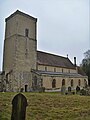
 Parish church (1) - geograph.org.uk - 6389557.jpg 4,320 × 3,240; 2.49 MB
-
 Parish church (10) - geograph.org.uk - 6389576.jpg 4,320 × 3,240; 2.97 MB
-
 Parish church (11) - geograph.org.uk - 6389578.jpg 3,167 × 4,223; 2.49 MB
-
 Parish church (2) - geograph.org.uk - 6389559.jpg 3,240 × 4,320; 2.28 MB
-
 Parish church (3) - geograph.org.uk - 6389560.jpg 4,320 × 3,240; 2.89 MB
-
 Parish church (4) - geograph.org.uk - 6389562.jpg 4,320 × 3,240; 3.36 MB
-
 Parish church (5) - geograph.org.uk - 6389565.jpg 4,320 × 3,240; 2.7 MB
-
 Parish church (6) - geograph.org.uk - 6389569.jpg 4,320 × 3,240; 3.83 MB
-
 Parish church (7) (geograph 6389572).jpg 4,320 × 3,240; 3.86 MB
-
 Parish church (8) - geograph.org.uk - 6389573.jpg 3,240 × 4,320; 2.29 MB
-
 Parish church (9) - geograph.org.uk - 6389575.jpg 3,107 × 4,143; 2.13 MB
-
 Pasture, Netheravon - geograph.org.uk - 6151114.jpg 1,024 × 768; 235 KB
-
 Pill box on Figheldean Field - geograph.org.uk - 362414.jpg 640 × 480; 89 KB
-

-
 Power line across brown field - geograph.org.uk - 5670130.jpg 640 × 480; 139 KB
-

-

-
 Salisbury Plain, east of Netheravon - geograph.org.uk - 710839.jpg 640 × 480; 96 KB
-
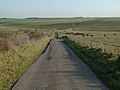
 Salisbury Road (A345) - geograph.org.uk - 6328445.jpg 800 × 600; 134 KB
-
 Salisbury Road (A345), Netheravon - geograph.org.uk - 6328443.jpg 800 × 576; 91 KB
-
 Sign for the Dog ^ Gun, Netheravon - geograph.org.uk - 6328441.jpg 506 × 800; 73 KB
-
 Stables at Netheravon House, window detail - geograph.org.uk - 5391077.jpg 818 × 1,024; 199 KB
-
 Stonehenge Ales, Mill Road, Netheravon - geograph.org.uk - 4955269.jpg 861 × 1,024; 162 KB
-
 Stream beside Lower Road, Netheravon - geograph.org.uk - 4346855.jpg 640 × 427; 119 KB
-
 The Dog ^ Gun, Netheravon - geograph.org.uk - 6328440.jpg 800 × 601; 101 KB
-
 The Orange Way in Wiltshire (269) - geograph.org.uk - 3442885.jpg 782 × 800; 208 KB
-
 The Orange Way in Wiltshire (270) - geograph.org.uk - 3442890.jpg 800 × 539; 121 KB
-
 The Orange Way in Wiltshire (271) - geograph.org.uk - 3442895.jpg 600 × 800; 110 KB
-
 The Orange Way in Wiltshire (273) - geograph.org.uk - 3443078.jpg 800 × 600; 100 KB
-
 The Orange Way in Wiltshire (274) - geograph.org.uk - 3443092.jpg 800 × 600; 80 KB
-
 The Orange Way in Wiltshire (275) - geograph.org.uk - 3443095.jpg 800 × 600; 151 KB
-
 Track and downland, Netheravon - geograph.org.uk - 2915148.jpg 640 × 480; 131 KB
-
 Track and downland, Netheravon - geograph.org.uk - 2915188.jpg 640 × 480; 109 KB
-
 Track and downland, Netheravon - geograph.org.uk - 6151125.jpg 1,024 × 768; 195 KB
-
 Track and farmland, Netheravon - geograph.org.uk - 6151107.jpg 1,024 × 768; 208 KB
-
 Track, downland and plantation, Netheravon - geograph.org.uk - 6151122.jpg 1,024 × 768; 207 KB
-
 Track, downland and plantation, Netheravon - geograph.org.uk - 6151128.jpg 1,024 × 768; 249 KB
-
 Track, downland and plantation, Netheravon - geograph.org.uk - 6151135.jpg 1,024 × 768; 212 KB
-
 Track, grassland and plantations, Netheravon - geograph.org.uk - 6151117.jpg 1,024 × 768; 133 KB
-

-

-
 View over farmland to line of trees - geograph.org.uk - 5669828.jpg 640 × 480; 125 KB
-
 Army track - geograph.org.uk - 303212.jpg 640 × 479; 92 KB
-
 Byway near Netheravon - geograph.org.uk - 303154.jpg 640 × 479; 97 KB
-
 Downland, Figheldean - geograph.org.uk - 453598.jpg 640 × 480; 127 KB
-
 Downland, Netheravon - geograph.org.uk - 453577.jpg 640 × 480; 144 KB
-
 Grassland above Fittleton - geograph.org.uk - 394037.jpg 640 × 480; 107 KB
-
 River Avon at Fittleton - geograph.org.uk - 363273.jpg 640 × 480; 133 KB
-
 River Avon at Netheravon - geograph.org.uk - 303161.jpg 640 × 480; 94 KB
-

-
 Salisbury Plain - geograph.org.uk - 208581.jpg 640 × 480; 51 KB
-
 View across to Netheravon Down - geograph.org.uk - 303201.jpg 640 × 479; 92 KB
-
 Wexland Farm - geograph.org.uk - 303186.jpg 640 × 480; 98 KB


.jpg)


_(geograph_6390179).jpg)
_-_geograph.org.uk_-_6390181.jpg)
_-_geograph.org.uk_-_6390182.jpg)


_-_geograph.org.uk_-_6389557.jpg)
_-_geograph.org.uk_-_6389576.jpg)
_-_geograph.org.uk_-_6389578.jpg)
_-_geograph.org.uk_-_6389559.jpg)
_-_geograph.org.uk_-_6389560.jpg)
_-_geograph.org.uk_-_6389562.jpg)
_-_geograph.org.uk_-_6389565.jpg)
_-_geograph.org.uk_-_6389569.jpg)
_(geograph_6389572).jpg)
_-_geograph.org.uk_-_6389573.jpg)
_-_geograph.org.uk_-_6389575.jpg)


_-_geograph.org.uk_-_6328445.jpg)
,_Netheravon_-_geograph.org.uk_-_6328443.jpg)


_-_geograph.org.uk_-_3442885.jpg)
_-_geograph.org.uk_-_3442890.jpg)
_-_geograph.org.uk_-_3442895.jpg)
_-_geograph.org.uk_-_3443078.jpg)
_-_geograph.org.uk_-_3443092.jpg)
_-_geograph.org.uk_-_3443095.jpg)


