Category:Nepomuk wayside chapel, Langenrohr
Jump to navigation
Jump to search
| Object location | | View all coordinates using: OpenStreetMap |
|---|
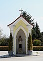
building in Langenrohr, Austria  | |||||
| Upload media | |||||
| Instance of | |||||
|---|---|---|---|---|---|
| Location | Langenrohr, Tulln District, Lower Austria, Austria | ||||
| Heritage designation | |||||
 | |||||
Deutsch: Johannes-Nepomuk-Wegkapelle in der niederösterreichischen Marktgemeinde Langenrohr.
Media in category "Nepomuk wayside chapel, Langenrohr"
The following 4 files are in this category, out of 4 total.
-
 Langenrohr - Nepomuk-Wegkapelle.JPG 1,671 × 2,362; 2.77 MB
-
 Langenrohr 8836-windgerade.JPG 3,256 × 4,744; 5.12 MB
-
 Langenrohr 8836.JPG 3,456 × 5,184; 5.59 MB
-
 Langenrohr 8840.JPG 3,456 × 5,184; 5.56 MB


