Category:Nan Fung Plaza, Hong Kong
Jump to navigation
Jump to search
| Object location | | View all coordinates using: OpenStreetMap |
|---|
中文:南豐廣場
Private housing estate in Hong Kong  | |||||
| Upload media | |||||
| Instance of | |||||
|---|---|---|---|---|---|
| Location | Sai Kung District, New Territories, Hong Kong, PRC | ||||
| official website | |||||
 | |||||
Subcategories
This category has the following 7 subcategories, out of 7 total.
Media in category "Nan Fung Plaza, Hong Kong"
The following 11 files are in this category, out of 11 total.
-

-
 Hkuu (2).JPG 4,000 × 2,248; 4.22 MB
-
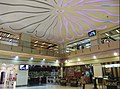 Nan Fung Plaza Centre Void 2018(left side) 2011(right side).jpg 3,255 × 2,417; 1.9 MB
-
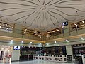 Nan Fung Plaza Centre Void 2018.jpg 3,264 × 2,448; 2.85 MB
-
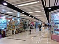 Nan Fung Plaza Corridor - 1.jpg 3,264 × 2,448; 3.31 MB
-
 Nan Fung Plaza Corridor - 2.jpg 3,264 × 2,448; 3.84 MB
-
 Nan Fung Plaza Corridor - 3.jpg 3,064 × 2,260; 3.73 MB
-
 Nan Fung Plaza Feature floor.jpg 2,448 × 3,264; 2.29 MB
-
 Nan Fung Plaza Shop directory 2018.jpg 2,198 × 2,930; 4.74 MB
-
 Nan Fung Plaza Shop signage.jpg 3,050 × 2,287; 3.22 MB
-
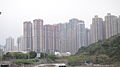
 Nan Fung Plaza.jpg 1,600 × 1,200; 524 KB

.JPG)
_2011(right_side).jpg)


