Category:Nailstone
Jump to navigation
Jump to search
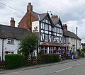
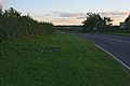
English: Nailstone is a village and civil parish in the Hinckley and Bosworth district of Leicestershire, England, situated to the west of Leicester and north-east of Market Bosworth. According to the 2001 census the parish had a population of 521.
village and civil parish in Leicestershire, UK  | |||||
| Upload media | |||||
| Instance of | |||||
|---|---|---|---|---|---|
| Location | Hinckley and Bosworth, Leicestershire, East Midlands, England | ||||
 | |||||
Subcategories
This category has the following 2 subcategories, out of 2 total.
B
- Belcher's Bar (5 F)
N
Media in category "Nailstone"
The following 108 files are in this category, out of 108 total.
-
 A cow on a footpath - geograph.org.uk - 4620717.jpg 1,920 × 1,080; 669 KB
-
 A447 towards Nailstone - geograph.org.uk - 5046098.jpg 640 × 480; 74 KB
-
 All Saints Church, Nailstone - geograph.org.uk - 4620987.jpg 1,920 × 1,080; 650 KB
-
 All Saints Church, Nailstone - geograph.org.uk - 5046109.jpg 480 × 640; 75 KB
-
 All Saints Church, Nailstone - geograph.org.uk - 542662.jpg 640 × 400; 83 KB
-
 Approaching Nailstone - geograph.org.uk - 542659.jpg 640 × 379; 85 KB
-
 Arable land near Nailstone Wiggs - geograph.org.uk - 2181114.jpg 1,024 × 768; 246 KB
-
 B582 Grange Lane - geograph.org.uk - 2181127.jpg 1,024 × 768; 209 KB
-
 B585 Wood Road towards Coalville - geograph.org.uk - 3534417.jpg 3,655 × 2,780; 3.15 MB
-
 B585 Wood Road towards Coalville - geograph.org.uk - 3534447.jpg 4,000 × 3,000; 4.79 MB
-
 Bagworth Road - geograph.org.uk - 3946318.jpg 4,161 × 2,097; 3.11 MB
-
 Bagworth Road - geograph.org.uk - 5046112.jpg 640 × 480; 55 KB
-
 Bagworth Road, Nailstone - geograph.org.uk - 542661.jpg 640 × 447; 93 KB
-
 Belcher's Bar - geograph.org.uk - 6087539.jpg 3,776 × 2,520; 3.97 MB
-
 Brick building at The Limes - geograph.org.uk - 3534409.jpg 2,281 × 1,675; 1.26 MB
-
 Bus img 9043 (16010050500).jpg 2,528 × 1,896; 2.21 MB
-
 Church Meadow and Memorial Garden - geograph.org.uk - 542663.jpg 581 × 640; 160 KB
-
 Church Meadow and Memorial Garden - geograph.org.uk - 542666.jpg 640 × 451; 131 KB
-
 Crop field and hedgerow - geograph.org.uk - 5046099.jpg 640 × 480; 68 KB
-
 Crop field and hedgerow - geograph.org.uk - 5046110.jpg 640 × 480; 86 KB
-
 Crop field off Lount Road - geograph.org.uk - 4503068.jpg 640 × 480; 54 KB
-
 Crop field off Wood Road (A585) - geograph.org.uk - 5046121.jpg 640 × 480; 62 KB
-

-
 Crop of oil seed rape south of Wood Road - geograph.org.uk - 3534594.jpg 4,000 × 3,000; 3.54 MB
-
 Elmside Farm, Nailstone - geograph.org.uk - 253784.jpg 640 × 427; 68 KB
-
 Entering the National Forest - geograph.org.uk - 5046116.jpg 640 × 480; 57 KB
-
 Entrance to Lodge Farm - geograph.org.uk - 5046118.jpg 640 × 480; 52 KB
-
 Farmland and tree along Wood Road - geograph.org.uk - 3534440.jpg 2,803 × 2,238; 2.13 MB
-
 Farmland near Nailstone Wiggs - geograph.org.uk - 3534469.jpg 3,744 × 2,949; 3.99 MB
-
 Farmland off the B585 - geograph.org.uk - 5046117.jpg 640 × 480; 71 KB
-
 Field barn and farmland near Carlton - geograph.org.uk - 4617194.jpg 1,920 × 1,080; 672 KB
-
 Footpath along Wood Road - geograph.org.uk - 3534455.jpg 4,000 × 3,000; 3.51 MB
-
 Footpath to Battram - geograph.org.uk - 3534617.jpg 3,607 × 2,938; 3.34 MB
-
 Footpath to Grange Lane - geograph.org.uk - 2181631.jpg 1,024 × 768; 282 KB
-
 Footpath to Hollow Farm and Ibstock Road - geograph.org.uk - 3523968.jpg 3,881 × 2,810; 3.19 MB
-
 Footpath to Nailstone - geograph.org.uk - 2181135.jpg 1,024 × 768; 205 KB
-
 Footpath to Nailstone - geograph.org.uk - 3523824.jpg 3,453 × 2,608; 2.85 MB
-
 Footpath to Nailstone - geograph.org.uk - 4490929.jpg 640 × 480; 69 KB
-
 Gate and farmland along Barton Lane - geograph.org.uk - 3534377.jpg 2,754 × 2,225; 2.15 MB
-
 Gleniden at Belcher's Bar - geograph.org.uk - 3523996.jpg 3,370 × 2,491; 2.52 MB
-
 Hercules over Osbaston Hollow - geograph.org.uk - 3534368.jpg 2,464 × 1,742; 1.47 MB
-
 Hinckley Road at Nailstone - geograph.org.uk - 2181159.jpg 1,024 × 768; 220 KB
-
 Hinckley Road at Osbaston Hollow - geograph.org.uk - 3543580.jpg 2,333 × 1,901; 1.26 MB
-
 Hinckley Road in Nailstone - geograph.org.uk - 3543592.jpg 3,315 × 2,512; 2.35 MB
-
 Hollow Farm near Nailstone Gorse - geograph.org.uk - 3523837.jpg 2,965 × 2,202; 2.05 MB
-
 House along Bagworth Road in Nailstone - geograph.org.uk - 3534398.jpg 2,901 × 2,224; 2.36 MB
-
 House on Main Street, Nailstone - geograph.org.uk - 5046107.jpg 640 × 480; 54 KB
-
 Houses on Bagworth Road - geograph.org.uk - 2181139.jpg 1,024 × 768; 244 KB
-
 Houses on Wood Road - geograph.org.uk - 3946301.jpg 4,608 × 2,938; 5.33 MB
-
 Ibstock Road (A447) - geograph.org.uk - 5046097.jpg 640 × 480; 58 KB
-
 Ibstock Road (A447) - geograph.org.uk - 5046100.jpg 640 × 480; 75 KB
-
 Ibstock Road (A447) - geograph.org.uk - 5046104.jpg 640 × 480; 63 KB
-
 Lines on the field, lines in the sky - geograph.org.uk - 4620556.jpg 1,920 × 1,080; 617 KB
-
 Lount Road - geograph.org.uk - 2344110.jpg 1,024 × 581; 91 KB
-
 Lount Road - geograph.org.uk - 4503070.jpg 640 × 480; 50 KB
-

-
 Main Street (geograph 2181197).jpg 1,024 × 767; 202 KB
-
 Main Street, Nailstone - geograph.org.uk - 253781.jpg 640 × 427; 74 KB
-
 Main Street, Nailstone - geograph.org.uk - 542669.jpg 640 × 410; 93 KB
-
 Main Street, Nailstone - geograph.org.uk - 542678.jpg 640 × 447; 99 KB
-
 Funny chimney - geograph.org.uk - 416234.jpg 640 × 480; 115 KB
-
 Nailstone Ford - geograph.org.uk - 3267447.jpg 3,872 × 2,592; 2.38 MB
-
 Nailstone Nut & Squirrel (geograph 2978652).jpg 480 × 640; 195 KB
-
 Nailstone Road - geograph.org.uk - 4503075.jpg 640 × 480; 59 KB
-
 Nailstone village sign - geograph.org.uk - 3533256.jpg 1,704 × 1,280; 920 KB
-
 Nailstone village sign along Hinckley Road - geograph.org.uk - 3543588.jpg 3,535 × 2,514; 2.61 MB
-
 North along the B585 Wood Road - geograph.org.uk - 3534537.jpg 3,802 × 2,452; 2.66 MB
-
 Oak Tree House Farm - geograph.org.uk - 4490932.jpg 640 × 480; 47 KB
-
 Oil seed rape crop near The Limes - geograph.org.uk - 3534424.jpg 2,969 × 2,541; 2.35 MB
-
 Old school building (geograph 2181626).jpg 1,024 × 768; 199 KB
-
 On the 159, Nailstone, Leicestershire (8259460748).jpg 2,880 × 1,623; 1.72 MB
-
 Roberts Coaches YJ06 YPU in Nailstone (8259459322).jpg 2,880 × 1,623; 1.9 MB
-
 Sign for the Bulls Head, Nailstone - geograph.org.uk - 5046105.jpg 349 × 640; 48 KB
-
 Silage clamp near Grange Lane - geograph.org.uk - 2181642.jpg 1,024 × 768; 260 KB
-
 South along the B585 Wood Road - geograph.org.uk - 3534600.jpg 2,717 × 2,136; 1.92 MB
-
 The Bulls Head, Nailstone - geograph.org.uk - 5046106.jpg 640 × 480; 52 KB
-
 The Cinamon Tree Indian Restaurant - geograph.org.uk - 5046128.jpg 640 × 399; 49 KB
-
 The Elms in Nailstone - geograph.org.uk - 3534387.jpg 2,468 × 1,878; 1.34 MB
-
 The Gate Inn along Hinckley Road - geograph.org.uk - 3543575.jpg 3,730 × 2,504; 2.79 MB
-
 The Nut and Squirrel - geograph.org.uk - 542673.jpg 640 × 568; 116 KB
-

-
 Tractors at work on Hollow Farm - geograph.org.uk - 4633256.jpg 1,920 × 1,080; 665 KB
-
 Verges along Hinckley Road - geograph.org.uk - 3543583.jpg 2,526 × 2,208; 1.69 MB
-
 Vero's Lane. Nailstone - geograph.org.uk - 5046101.jpg 640 × 480; 80 KB
-
 View east from Green Lane - geograph.org.uk - 3522154.jpg 3,471 × 2,830; 3.09 MB
-
 View north across the fields - geograph.org.uk - 3534336.jpg 3,305 × 2,201; 2.32 MB
-
 View towards Bardon Hill - geograph.org.uk - 3543600.jpg 2,736 × 2,157; 1.91 MB
-
 Welcome to Nailstone - geograph.org.uk - 542681.jpg 640 × 480; 130 KB
-
 Wiggs Farm - geograph.org.uk - 2181087.jpg 1,024 × 745; 265 KB
-
 Wood Road (B585) - geograph.org.uk - 5046120.jpg 640 × 480; 66 KB
-
 Wood Road (B585) - geograph.org.uk - 5046126.jpg 640 × 480; 70 KB
-
 Wood Road near Nailstone Wiggs - geograph.org.uk - 3946312.jpg 3,365 × 1,939; 2.57 MB
-
 Wood Road near The Limes - geograph.org.uk - 3946307.jpg 4,590 × 2,607; 4.51 MB
-
 A447, Ibstock Road - geograph.org.uk - 253766.jpg 640 × 427; 73 KB
-
 A447, Ibstock Road, Nailstone - geograph.org.uk - 253788.jpg 640 × 427; 78 KB
-
 Bagworth Road near Nailstone - geograph.org.uk - 261697.jpg 640 × 427; 63 KB
-
 Barton Lane - geograph.org.uk - 768399.jpg 640 × 480; 65 KB
-
 Farmland at Crown Farm - geograph.org.uk - 261696.jpg 640 × 427; 75 KB
-
 Farmland on Nailstone Road - geograph.org.uk - 253794.jpg 640 × 427; 67 KB
-
 Houses on Nailstone Road - geograph.org.uk - 253795.jpg 640 × 427; 99 KB
-
 Nailstone Gorse - geograph.org.uk - 261695.jpg 640 × 427; 67 KB
-
 Nailstone Grange - geograph.org.uk - 542648.jpg 640 × 465; 100 KB
-
 Occupation Road, Nailstone - geograph.org.uk - 253783.jpg 640 × 427; 95 KB
-
 Public footpath to Nailstone - geograph.org.uk - 542646.jpg 640 × 460; 109 KB
-
 Quadruped lawnmower - geograph.org.uk - 158841.jpg 640 × 425; 74 KB
-
 The B582 Grange Road, Leicestershire - geograph.org.uk - 542651.jpg 640 × 520; 107 KB
-
 View south along B585 - geograph.org.uk - 158843.jpg 640 × 480; 64 KB
-
 Wheat field - geograph.org.uk - 174896.jpg 640 × 480; 82 KB


.jpg)


_-_geograph.org.uk_-_5046121.jpg)
_-_geograph.org.uk_-_5046102.jpg)


_-_geograph.org.uk_-_5046097.jpg)
_-_geograph.org.uk_-_5046100.jpg)
_-_geograph.org.uk_-_5046104.jpg)


.jpg)


.jpg)


.jpg)
.jpg)
.jpg)


_-_geograph.org.uk_-_5046120.jpg)
_-_geograph.org.uk_-_5046126.jpg)


