Category:Mouth of Sénia
Jump to navigation
Jump to search
| Object location | | View all coordinates using: OpenStreetMap |
|---|
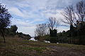
river mouth in Vinaròs, Spain  | |||||
| Upload media | |||||
| Instance of | |||||
|---|---|---|---|---|---|
| Location | |||||
| Heritage designation |
| ||||
| Area |
| ||||
 | |||||
Català: Desembocadura del riu de la Sénia (Vinaròs)
|
This is a category with photos about a wetland in Catalonia, Spain, with id: IZHC-20002205
|
|
This is a category with photos about a wetland in the Land of Valencia, Spain, with id: CZHCV-15
|
This is a category about a building listed in the Valencian heritage register as Bé de Rellevància Local (BRL) under the reference 12.03.138-030. |
Media in category "Mouth of Sénia"
The following 12 files are in this category, out of 12 total.
-
 Desembocadura del riu de la Sénia despres de molts dies de pluja..JPG 7,848 × 1,856; 4.59 MB
-
 Desembocadura del riu de la Sénia.JPG 4,912 × 3,264; 6.41 MB
-
 Desembocadura Riu Senia 1.JPG 4,912 × 3,264; 5.5 MB
-
 Desembocadura Riu Senia 2.JPG 4,912 × 3,264; 7.16 MB
-
 Desembocadura Riu Senia 3.JPG 4,912 × 3,264; 4.66 MB
-
 Desembocadura Riu Senia vist desde Alcanar.JPG 4,912 × 3,264; 5.84 MB
-
 ElSénia.jpg 1,200 × 1,600; 209 KB
-
 Panoramica Riu Senia vist desde Vinaros.JPG 6,318 × 1,856; 3.1 MB
-
 Riu Senia - panoramio - carlos corzo.jpg 2,048 × 1,536; 1.07 MB
-
 Riu Senia al tocar la platja.JPG 4,912 × 3,264; 6.47 MB
-
 Sòl de riu.jpg 1,200 × 1,600; 192 KB
-
 Vista de Sòl de Riu 2.JPG 480 × 640; 170 KB


