Category:Morston
Jump to navigation
Jump to search
village in the United Kingdom  | |||||
| Upload media | |||||
| Instance of | |||||
|---|---|---|---|---|---|
| Location | North Norfolk, Norfolk, East of England, England | ||||
| Area |
| ||||
| official website | |||||
 | |||||
Subcategories
This category has the following 6 subcategories, out of 6 total.
A
- Anchor Inn, Morston (3 F)
H
- Hotels in Morston (1 F)
M
- Maps of Morston (1 F)
R
- Morston Hall (1 F)
- Restaurants in Morston (1 F)
Media in category "Morston"
The following 200 files are in this category, out of 401 total.
(previous page) (next page)-
 A149 at Morston village boundary - geograph.org.uk - 3618213.jpg 640 × 481; 63 KB
-
 A149 Morston Chase towards Morston - geograph.org.uk - 5616559.jpg 800 × 644; 144 KB
-
 A149 near Blakeney Downs - geograph.org.uk - 3618217.jpg 640 × 481; 46 KB
-
 A149, Norfolk coast road - geograph.org.uk - 4815600.jpg 1,600 × 1,200; 204 KB
-
 A149, Norfolk coast road - geograph.org.uk - 4815662.jpg 1,600 × 1,200; 261 KB
-
 Abandoned Petronella - geograph.org.uk - 4815656.jpg 1,600 × 1,200; 235 KB
-
 Across Morston Salt Marshes - geograph.org.uk - 928095.jpg 426 × 640; 85 KB
-
 Across Morston Salt Marshes - geograph.org.uk - 928102.jpg 640 × 428; 96 KB
-
 Across Morston Salt Marshes - geograph.org.uk - 928105.jpg 434 × 640; 90 KB
-
 Across the fields to Morston Downs - geograph.org.uk - 4158804.jpg 1,024 × 683; 312 KB
-
 All Saints Church - Morston, Norfolk - geograph.org.uk - 5911422.jpg 1,024 × 669; 109 KB
-
 All Saints church at Morston - geograph.org.uk - 5616793.jpg 800 × 626; 104 KB
-
 All Saints Church, Morston - geograph.org.uk - 5559109.jpg 640 × 480; 49 KB
-
 All Saints Church, Morston - geograph.org.uk - 5965815.jpg 1,600 × 1,064; 532 KB
-
 All Saints Parish Church Morston - geograph.org.uk - 6189244.jpg 4,608 × 3,456; 3.84 MB
-
 All Saints Parish Church, Morston - geograph.org.uk - 6193642.jpg 1,024 × 750; 215 KB
-
 Anchor Inn at Morston - geograph.org.uk - 5616783.jpg 800 × 457; 87 KB
-
 Anchor Inn, Morston - geograph.org.uk - 6193641.jpg 1,024 × 768; 159 KB
-
 Arable land south of Morston - geograph.org.uk - 1970760.jpg 640 × 480; 59 KB
-
 Beach area at Morston Meals - geograph.org.uk - 5291054.jpg 4,000 × 3,000; 1.32 MB
-
 Beach, Blakeney Point - geograph.org.uk - 1405393.jpg 640 × 480; 31 KB
-
 Binham Lane, Morston - geograph.org.uk - 1970754.jpg 640 × 480; 79 KB
-
 Blakeney Downs - geograph.org.uk - 5996417.jpg 3,456 × 2,592; 3.99 MB
-
 Blakeney Harbour from Morston Meals - geograph.org.uk - 5991746.jpg 1,600 × 1,200; 428 KB
-
 Blakeney Marshes - geograph.org.uk - 2022161.jpg 800 × 531; 123 KB
-
 Blakeney Pit - geograph.org.uk - 1965073.jpg 1,280 × 960; 173 KB
-
 Blakeney Pit - geograph.org.uk - 5641797.jpg 640 × 425; 21 KB
-
 Blakeney Point Quayside 2005 - geograph.org.uk - 5229968.jpg 2,560 × 1,920; 1.76 MB
-
 Blakeney Road - geograph.org.uk - 5559112.jpg 640 × 480; 61 KB
-
 Blakeney Road towards Blakeney - geograph.org.uk - 5616807.jpg 800 × 623; 96 KB
-
 Blakeney Road-A149 in 1986 - geograph.org.uk - 2238151.jpg 1,123 × 784; 132 KB
-
 Boats along the creek at low tide - geograph.org.uk - 1115622.jpg 640 × 427; 293 KB
-
 Boats at Freshes Creek - geograph.org.uk - 5615674.jpg 800 × 510; 67 KB
-
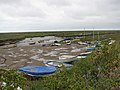
 Boats at Morston - geograph.org.uk - 2809538.jpg 480 × 640; 57 KB
-
 Boats at Morston Creek - geograph.org.uk - 2565294.jpg 4,000 × 3,000; 3.5 MB
-
 Boats at Morston Greens - geograph.org.uk - 952657.jpg 640 × 480; 94 KB
-
 Boats at Morston Quay - geograph.org.uk - 1062738.jpg 640 × 426; 60 KB
-
 Boats at Morston Quay, northwards - geograph.org.uk - 1390415.jpg 640 × 480; 91 KB
-
 Boats at Morston Quay, southwards - geograph.org.uk - 1390416.jpg 640 × 480; 83 KB
-
 Boats in Morston Creek - geograph.org.uk - 853779.jpg 427 × 640; 91 KB
-
 Boats in Morston Creek - geograph.org.uk - 853792.jpg 640 × 427; 82 KB
-
 Boats moored at Freshes Creek - geograph.org.uk - 5615793.jpg 800 × 520; 95 KB
-
 Boats, Morston Marshes - geograph.org.uk - 3845807.jpg 640 × 430; 43 KB
-
 Boats, Morston Quay - geograph.org.uk - 3845808.jpg 640 × 430; 42 KB
-
 Boggy section of Morston Marches - geograph.org.uk - 3845743.jpg 640 × 430; 52 KB
-
 Boy's Own - geograph.org.uk - 5848582.jpg 5,472 × 3,648; 2.35 MB
-
 Bridge over Creek, Morston, Norfolk - geograph.org.uk - 2101862.jpg 1,024 × 681; 273 KB
-
 Bridge over Creek, Morston, Norfolk - geograph.org.uk - 2101867.jpg 1,024 × 681; 285 KB
-
 Bridleway to Morston Salt Marshes - geograph.org.uk - 5559116.jpg 640 × 480; 116 KB
-
 Building at Morston Quay - geograph.org.uk - 3845810.jpg 640 × 413; 37 KB
-
 Byway off the A149 - geograph.org.uk - 4038237.jpg 640 × 430; 87 KB
-
 Byway to Morston - geograph.org.uk - 5931145.jpg 1,600 × 1,200; 389 KB
-
 Byway, Morston - geograph.org.uk - 4038238.jpg 640 × 470; 79 KB
-
 Byway, Morston Marshes - geograph.org.uk - 3845753.jpg 640 × 430; 44 KB
-

-
 Campsite at Stiffkey - geograph.org.uk - 208493.jpg 640 × 480; 123 KB
-
 Car Park, Morston, Norfolk - geograph.org.uk - 2101859.jpg 1,024 × 681; 222 KB
-
 Caravans, Morston - geograph.org.uk - 5559096.jpg 640 × 480; 76 KB
-
 Channel in Morston Meals - geograph.org.uk - 5291057.jpg 3,992 × 2,994; 1.02 MB
-
 Coastal path at Morston - geograph.org.uk - 3601195.jpg 3,264 × 2,448; 2.08 MB
-
 Conservation area, no public access - geograph.org.uk - 5996398.jpg 3,456 × 2,592; 3.88 MB
-
 Cottage, Morston - geograph.org.uk - 4038230.jpg 640 × 430; 83 KB
-
 Creek, Morston Marshes - geograph.org.uk - 3845802.jpg 640 × 430; 65 KB
-
 Creek, Morston Marshes - geograph.org.uk - 3852818.jpg 640 × 430; 42 KB
-
 Creek, Morston, Norfolk - geograph.org.uk - 2101881.jpg 1,024 × 681; 262 KB
-
 Crop field and hedgerow near Morston - geograph.org.uk - 5559062.jpg 640 × 480; 74 KB
-
 Crop field east of Morston - geograph.org.uk - 5559113.jpg 640 × 480; 60 KB
-
 Dinghy park at Morston Quay - geograph.org.uk - 943392.jpg 640 × 442; 145 KB
-

-
 Dinghy with outboard - geograph.org.uk - 2083515.jpg 3,648 × 2,736; 5.29 MB
-
 Disused runways at RAF Langham - geograph.org.uk - 4038842.jpg 640 × 480; 129 KB
-
 Drain at Morston - geograph.org.uk - 5374378.jpg 2,640 × 3,520; 4.06 MB
-
 Drainage ditch near Morston - geograph.org.uk - 4815647.jpg 1,600 × 1,200; 229 KB
-
 Dry pond, Morston - geograph.org.uk - 5930165.jpg 1,600 × 1,200; 507 KB
-
 Dune management - geograph.org.uk - 1568367.jpg 640 × 480; 154 KB
-
 Entering Blakeney - geograph.org.uk - 5559114.jpg 640 × 480; 78 KB
-
 Entrance to Quay Lane Morston - geograph.org.uk - 1773636.jpg 1,475 × 1,229; 381 KB
-
 Environment Agency 110922 094417.jpg 4,288 × 2,848; 3.81 MB
-
 Environment Agency 110922 094420.jpg 4,288 × 2,848; 3.82 MB
-
 Evening at Morston Quay - geograph.org.uk - 1258712.jpg 640 × 506; 62 KB
-
 Fallen tower, Morston Marshes - geograph.org.uk - 3852935.jpg 640 × 430; 51 KB
-
 Falling tide in Blakeney Harbour - geograph.org.uk - 5291059.jpg 4,000 × 3,000; 1.1 MB
-
 Falling tide, Morston Quay - geograph.org.uk - 1258718.jpg 640 × 455; 52 KB
-
 Farm track leading north - geograph.org.uk - 1024656.jpg 640 × 407; 116 KB
-
 Farm track off Morston Chase - geograph.org.uk - 5559055.jpg 640 × 480; 94 KB
-
 Farmland behind Morston Marshes - geograph.org.uk - 3852909.jpg 640 × 430; 39 KB
-
 Farmland behind the seawall - geograph.org.uk - 3845900.jpg 640 × 430; 35 KB
-
 Farmland behind the seawall - geograph.org.uk - 3845921.jpg 640 × 430; 38 KB
-
 Farmland, Morston Chase - geograph.org.uk - 4038305.jpg 640 × 430; 65 KB
-
 Farmland, Morston Chase - geograph.org.uk - 4038327.jpg 640 × 430; 35 KB
-
 Farmland, Morston Chase - geograph.org.uk - 4038330.jpg 640 × 430; 54 KB
-
 Farmland, Morston Downs - geograph.org.uk - 3852930.jpg 640 × 382; 34 KB
-
 Farmland, Morston, Norfolk - geograph.org.uk - 2106175.jpg 1,024 × 681; 203 KB
-
 Field and hedgerow, Morston - geograph.org.uk - 5559110.jpg 640 × 480; 56 KB
-
 Field by Morston - geograph.org.uk - 5930169.jpg 1,600 × 1,200; 566 KB
-
 Field by Norfolk Coast Path - geograph.org.uk - 5102427.jpg 1,600 × 1,200; 533 KB
-
 Field drain - geograph.org.uk - 3852837.jpg 640 × 412; 33 KB
-
 Final footbridge into the marshes - geograph.org.uk - 3152569.jpg 1,024 × 768; 271 KB
-
 Footbridge on Morston Salt Marshes - geograph.org.uk - 853814.jpg 427 × 640; 98 KB
-
 Footbridge to the marshes - geograph.org.uk - 853768.jpg 640 × 427; 92 KB
-
 Footpath and bridleway junction at the top of the steps - geograph.org.uk - 5949521.jpg 4,608 × 3,456; 3.92 MB
-

-
 Footpath to Blakeney, Norfolk - geograph.org.uk - 2106170.jpg 1,024 × 681; 222 KB
-
 Footpath to Blakeney, Norfolk - geograph.org.uk - 2106174.jpg 1,024 × 681; 239 KB
-
 Footpath to Kettle Hill - geograph.org.uk - 4815610.jpg 1,600 × 1,200; 270 KB
-
 Footpath to Kettle Hill - geograph.org.uk - 4815615.jpg 1,600 × 1,200; 240 KB
-

-
 Freshes Creek - geograph.org.uk - 3841303.jpg 640 × 430; 36 KB
-
 Freshes Creek - geograph.org.uk - 3841309.jpg 640 × 430; 45 KB
-
 Freshes Creek - geograph.org.uk - 3841315.jpg 640 × 430; 41 KB
-
 Freshes Creek - geograph.org.uk - 5641769.jpg 640 × 425; 43 KB
-
 Freshes Creek from coastal path toward Stiffkey Greens - geograph.org.uk - 5949631.jpg 4,608 × 3,456; 3.66 MB
-

-
 Gate, Morston Chase - geograph.org.uk - 4038298.jpg 640 × 489; 41 KB
-
 Gated farm track off Morston Chase - geograph.org.uk - 5559059.jpg 640 × 480; 85 KB
-
 Good Courage - geograph.org.uk - 3559808.jpg 4,608 × 3,456; 4.78 MB
-
 Green Hairstreak, Morston Greens - geograph.org.uk - 5991731.jpg 1,600 × 1,594; 327 KB
-
 Grey Plover, Morston Creek - geograph.org.uk - 6009357.jpg 1,600 × 1,228; 384 KB
-
 Hedge, Garret Hill - geograph.org.uk - 4038280.jpg 640 × 353; 29 KB
-
 Her Majesty ll - geograph.org.uk - 5848602.jpg 5,472 × 3,648; 2.53 MB
-
 High and Dry - geograph.org.uk - 3559791.jpg 4,608 × 3,456; 4.57 MB
-
 High and dry - geograph.org.uk - 3841308.jpg 640 × 430; 42 KB
-
 High and dry - geograph.org.uk - 3841313.jpg 640 × 430; 54 KB
-
 High tide at Morston Greens - geograph.org.uk - 2118869.jpg 1,600 × 1,200; 841 KB
-
 High tide over the byway - geograph.org.uk - 2118879.jpg 1,600 × 1,200; 653 KB
-
 House behind the seawall - geograph.org.uk - 3845799.jpg 640 × 430; 56 KB
-
 House on Morston Chase, Morston - geograph.org.uk - 5559095.jpg 640 × 480; 74 KB
-
 Houses near Morston Quay - geograph.org.uk - 1062739.jpg 640 × 431; 91 KB
-
-

-
 Lake, east of Stiffkey - geograph.org.uk - 6193640.jpg 1,024 × 736; 170 KB
-
 Landing stage - to thin air - geograph.org.uk - 853812.jpg 640 × 427; 93 KB
-
 Landing stage, Morston Quay - geograph.org.uk - 853785.jpg 427 × 640; 88 KB
-
 Landing stages at Morston Quay - geograph.org.uk - 853760.jpg 427 × 640; 94 KB
-
 Landing stages on Morston Creek - geograph.org.uk - 5613436.jpg 800 × 559; 122 KB
-
 Landing stages, Morston Quay - geograph.org.uk - 1258715.jpg 640 × 478; 55 KB
-
 Landing the mussels - geograph.org.uk - 2119592.jpg 1,600 × 1,200; 935 KB
-
 Langham Road toward Morston - geograph.org.uk - 6138225.jpg 4,608 × 3,456; 5.7 MB
-
 Langham Road towards Morston - geograph.org.uk - 5930176.jpg 1,600 × 1,200; 406 KB
-
 Late sun on a tidal creek - geograph.org.uk - 3152554.jpg 815 × 1,024; 318 KB
-
 Looking across Freshes Creek - geograph.org.uk - 3841307.jpg 640 × 430; 51 KB
-
 Low tide in Morston Creek - geograph.org.uk - 1970708.jpg 640 × 480; 82 KB
-
 Low tide, Morston Creek - geograph.org.uk - 3152588.jpg 1,024 × 768; 217 KB
-

-
 Many posts make Morston Quay - geograph.org.uk - 5848590.jpg 5,472 × 3,648; 2.54 MB
-
 Many small boats at Morston Quay - geograph.org.uk - 5848562.jpg 5,472 × 3,648; 3.4 MB
-
 Marsh Samphire - Glasswort - geograph.org.uk - 1390419.jpg 640 × 480; 228 KB
-
 Moorings on Morston Creek - geograph.org.uk - 2083535.jpg 640 × 480; 88 KB
-
 Morston - 2013 - geograph.org.uk - 4082337.jpg 3,648 × 2,736; 1.18 MB
-
 Morston - geograph.org.uk - 4038234.jpg 640 × 272; 39 KB
-
 Morston and Blakeney Point area - geograph.org.uk - 696361.jpg 640 × 480; 66 KB
-
 Morston car park - geograph.org.uk - 3165137.jpg 1,600 × 1,200; 619 KB
-
 Morston Chase (A149) - geograph.org.uk - 5559057.jpg 640 × 480; 53 KB
-
 Morston Chase (A149) - geograph.org.uk - 5559060.jpg 640 × 480; 85 KB
-
 Morston Chase, looking towards Garret Hill - geograph.org.uk - 5996402.jpg 3,456 × 2,592; 3.93 MB
-
 Morston Church - geograph.org.uk - 5850700.jpg 1,600 × 995; 365 KB
-
 Morston Crab Stall - geograph.org.uk - 2996013.jpg 640 × 459; 55 KB
-
 Morston Creek - geograph.org.uk - 3152575.jpg 768 × 1,024; 213 KB
-
 Morston Creek - geograph.org.uk - 3845815.jpg 640 × 430; 45 KB
-
 Morston Creek - geograph.org.uk - 3845824.jpg 640 × 430; 49 KB
-
 Morston Creek - geograph.org.uk - 3845828.jpg 640 × 430; 56 KB
-
 Morston Creek - geograph.org.uk - 3845895.jpg 640 × 430; 46 KB
-
 Morston Creek - geograph.org.uk - 3852917.jpg 640 × 430; 40 KB
-
 Morston Creek - geograph.org.uk - 4047931.jpg 640 × 479; 62 KB
-
 Morston Creek - geograph.org.uk - 4249853.jpg 4,912 × 2,760; 4.09 MB
-
 Morston Creek - geograph.org.uk - 5374353.jpg 4,000 × 3,000; 4.46 MB
-
 Morston Creek - geograph.org.uk - 5641778.jpg 640 × 425; 49 KB
-
 Morston Creek - geograph.org.uk - 5848571.jpg 5,472 × 3,648; 3.15 MB
-
 Morston Creek - geograph.org.uk - 788423.jpg 640 × 480; 43 KB
-
 Morston Creek - geograph.org.uk - 848270.jpg 640 × 320; 94 KB
-
 Morston Creek - geograph.org.uk - 848275.jpg 640 × 480; 132 KB
-
 Morston Creek - geograph.org.uk - 848277.jpg 640 × 356; 96 KB
-
 Morston Creek - geograph.org.uk - 848288.jpg 640 × 480; 149 KB
-
 Morston Creek - geograph.org.uk - 848290.jpg 640 × 374; 110 KB
-
 Morston Creek - geograph.org.uk - 853771.jpg 640 × 427; 77 KB
-
 Morston Creek at Low Tide - geograph.org.uk - 473886.jpg 640 × 480; 101 KB
-
 Morston Creek at low water - geograph.org.uk - 853796.jpg 427 × 640; 89 KB
-
 Morston Creem, Morston Quay - geograph.org.uk - 3845822.jpg 640 × 430; 55 KB
-
 Morston Downs - geograph.org.uk - 3852944.jpg 640 × 430; 35 KB
-
 Morston Downs - geograph.org.uk - 3852947.jpg 640 × 405; 29 KB
-
 Morston East Bank Outfall - geograph.org.uk - 4027636.jpg 1,200 × 1,600; 701 KB
-
 Morston Greens - geograph.org.uk - 952670.jpg 640 × 576; 137 KB
-
 Morston Greens - geograph.org.uk - 952684.jpg 640 × 480; 94 KB
-
 Morston Harbour - geograph.org.uk - 5084553.jpg 5,184 × 3,456; 4.27 MB
-
 Morston Marshes - geograph.org.uk - 3841325.jpg 640 × 430; 49 KB
-
 Morston Marshes - geograph.org.uk - 3841327.jpg 640 × 430; 45 KB
-
 Morston Marshes - geograph.org.uk - 3841329.jpg 640 × 430; 36 KB
-
 Morston Marshes - geograph.org.uk - 3845724.jpg 640 × 430; 40 KB
-
 Morston Marshes - geograph.org.uk - 3845726.jpg 640 × 430; 44 KB
-
 Morston Marshes - geograph.org.uk - 3845740.jpg 640 × 430; 55 KB
-
 Morston Marshes - geograph.org.uk - 3845742.jpg 640 × 430; 37 KB
-
 Morston Marshes - geograph.org.uk - 3845746.jpg 640 × 430; 56 KB
-
 Morston Marshes - geograph.org.uk - 3845750.jpg 640 × 430; 39 KB
-
 Morston Marshes - geograph.org.uk - 3845752.jpg 640 × 430; 41 KB
-
 Morston Marshes - geograph.org.uk - 3845763.jpg 640 × 430; 37 KB
-
 Morston Marshes - geograph.org.uk - 3845765.jpg 640 × 430; 39 KB
-
 Morston Marshes - geograph.org.uk - 3845775.jpg 640 × 430; 51 KB
-
 Morston Marshes - geograph.org.uk - 3845797.jpg 640 × 430; 51 KB
-
 Morston Marshes - geograph.org.uk - 3852838.jpg 640 × 430; 33 KB
-
 Morston Marshes - geograph.org.uk - 3852842.jpg 640 × 430; 32 KB


_-_geograph.org.uk_-_5559057.jpg)
_-_geograph.org.uk_-_5559060.jpg)


