Category:Monk Bar
Jump to navigation
Jump to search
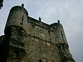
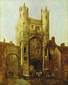
English: Defensive gate in York dating from early C14, barbican removed 1825. Part of Grade I listed City walls from Bootham Bar to Layerthorpe (qv).
| Object location | | View all coordinates using: OpenStreetMap |
|---|
Medieval gateway in York, England .jpg) | |||||
| Upload media | |||||
| Instance of | |||||
|---|---|---|---|---|---|
| Part of | |||||
| Made from material | |||||
| Location | York city walls, York, City of York, North Yorkshire, Yorkshire and the Humber, England | ||||
| Commissioned by | |||||
| Inception |
| ||||
| Height |
| ||||
| Different from | |||||
 | |||||
Media in category "Monk Bar"
The following 81 files are in this category, out of 81 total.
-
 Apotropaeic figurines - geograph.org.uk - 766383.jpg 640 × 427; 54 KB
-
 Arch in Monk Bar.JPG 4,608 × 3,440; 3.93 MB
-
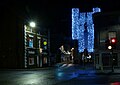
 Christmas lights at Monk Bar York.jpg 2,509 × 2,509; 2.01 MB
-
 City walls and moat, York.jpg 2,048 × 1,536; 2.27 MB
-
 Cycleway at Monk Bar, York - geograph.org.uk - 4179413.jpg 1,024 × 768; 122 KB
-
 Goodramgate, York - geograph.org.uk - 5655295.jpg 1,600 × 1,064; 654 KB
-
 Keystones pub & Monk Bar York.jpg 4,587 × 3,440; 6.24 MB
-
 Monk Bar - geograph.org.uk - 1110758.jpg 579 × 640; 88 KB
-
 Monk Bar - geograph.org.uk - 1807418.jpg 2,606 × 2,105; 1.65 MB
-
 Monk Bar - geograph.org.uk - 5273890.jpg 640 × 426; 72 KB
-
 Monk Bar - geograph.org.uk - 5273961.jpg 426 × 640; 69 KB
-
 Monk Bar - geograph.org.uk - 5273965.jpg 426 × 640; 78 KB
-
 Monk Bar - geograph.org.uk - 5310442.jpg 1,000 × 1,437; 202 KB
-
 Monk Bar - geograph.org.uk - 5626021.jpg 1,280 × 910; 313 KB
-
 Monk Bar - geograph.org.uk - 62752.jpg 640 × 421; 282 KB
-
 Monk Bar - geograph.org.uk - 6343816.jpg 480 × 640; 82 KB
-
 Monk Bar - geograph.org.uk - 766367.jpg 427 × 640; 64 KB
-
 Monk Bar - geograph.org.uk - 766377.jpg 427 × 640; 60 KB
-
 Monk Bar 1.jpg 2,448 × 3,264; 2.13 MB
-
 Monk Bar 2.jpg 2,448 × 3,264; 2.51 MB
-
 Monk Bar at dusk - geograph.org.uk - 1083165.jpg 640 × 484; 99 KB
-
 Monk Bar from the East.jpg 2,596 × 3,461; 3.35 MB
-
 Monk Bar from west.jpg 3,456 × 4,608; 3.16 MB
-
 Monk Bar Gatehouse 1 (7189156951).jpg 2,658 × 4,398; 7.74 MB
-
 Monk Bar Gatehouse 2 (7189155305).jpg 3,324 × 4,746; 6.67 MB
-
 Monk Bar Gatehouse 3 (7374416316).jpg 5,184 × 3,456; 9.79 MB
-
 Monk Bar Gatehouse 4 (7374413778).jpg 3,057 × 5,010; 7.19 MB
-
 Monk Bar in the city of York.JPG 2,432 × 3,648; 3.01 MB
-
 Monk Bar in York - geograph.org.uk - 1437755.jpg 640 × 480; 82 KB
-
 Monk Bar on York city walls (1).JPG 4,608 × 3,440; 3.61 MB
-
 Monk Bar on York city walls (2).JPG 4,608 × 3,440; 2.8 MB
-
 Monk Bar on York city walls (3).JPG 4,608 × 3,440; 2.82 MB
-
 Monk Bar on York city walls (4).JPG 4,608 × 3,440; 4.23 MB
-
 Monk Bar on York city walls (5).JPG 4,608 × 3,440; 4.04 MB
-
 Monk Bar on York city walls (6).JPG 4,608 × 3,440; 4.34 MB
-
 Monk Bar on York city walls (7).JPG 4,608 × 3,440; 4.38 MB
-
 Monk Bar perspective 2004.JPG 800 × 600; 247 KB
-
 Monk Bar York.jpg 4,608 × 3,456; 6.12 MB
-
 Monk Bar, as viewed from Goodramgate.York - geograph.org.uk - 3484458.jpg 1,024 × 760; 226 KB
-
 Monk Bar, York - geograph.org.uk - 2521530.jpg 640 × 480; 73 KB
-
 Monk Bar, York - geograph.org.uk - 3484455.jpg 1,024 × 753; 219 KB
-
 Monk Bar, York - geograph.org.uk - 4882732.jpg 640 × 480; 78 KB
-
 Monk Bar, York - geograph.org.uk - 4978635.jpg 2,548 × 3,148; 1.79 MB
-
 Monk Bar, York - geograph.org.uk - 608509.jpg 435 × 640; 93 KB
-
 Monk Bar, York - geograph.org.uk - 608512.jpg 480 × 640; 73 KB
-
 Monk Bar, York YORAG-64.jpg 3,846 × 4,810; 4.17 MB
-
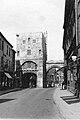 Monk Bar, York, about 1937 - geograph.org.uk - 4882634.jpg 643 × 961; 186 KB
-
 Monk Bar, York. - geograph.org.uk - 529314.jpg 480 × 640; 79 KB
-
 Monk Bar, York. - geograph.org.uk - 529318.jpg 480 × 640; 73 KB
-
 Monk Bar.jpg 1,500 × 1,294; 283 KB
-
 Monkbar, York - panoramio.jpg 863 × 1,100; 487 KB
-
 MonkBar.JPG 968 × 1,290; 861 KB
-
 Monkgate Bar (4406816310).jpg 1,549 × 2,323; 2.13 MB
-
 Monkgate Bar - geograph.org.uk - 4754519.jpg 480 × 640; 62 KB
-
 Monkgate Bar from the wall - geograph.org.uk - 4134794.jpg 768 × 1,024; 154 KB
-
 Monkgate Bar, Monkgate, York - geograph.org.uk - 4162839.jpg 473 × 640; 45 KB
-
 Porte Monk York 1.jpg 3,456 × 5,184; 6.87 MB
-
 Porte Monk York 10.jpg 3,456 × 5,184; 7.44 MB
-
 Porte Monk York 11.jpg 3,456 × 5,184; 6.01 MB
-
 Porte Monk York 12.jpg 3,456 × 5,184; 7.92 MB
-
 Porte Monk York 2.jpg 3,456 × 5,184; 6.44 MB
-
 Porte Monk York 3.jpg 3,456 × 5,184; 8.95 MB
-
 Porte Monk York 4.jpg 4,914 × 7,682; 33.53 MB
-
 Porte Monk York 5.jpg 3,456 × 5,184; 8.02 MB
-
 Porte Monk York 6.jpg 3,456 × 5,184; 5.26 MB
-
 Porte Monk York 7.jpg 5,184 × 3,456; 9.4 MB
-
 Porte Monk York 8.jpg 5,184 × 3,456; 8.36 MB
-
 Porte Monk York 9.jpg 3,456 × 5,184; 6.07 MB
-
 Richard III Museum in York - geograph.org.uk - 4776591.jpg 3,872 × 2,592; 4.32 MB
-
 Sculptures on Monk Bar.JPG 4,608 × 3,440; 3.59 MB
-
 Staircase to Monk Bar (1).JPG 4,608 × 3,440; 3.81 MB
-
 Staircase to Monk Bar (2).JPG 4,608 × 3,440; 4.02 MB
-
 York - panoramio (28).jpg 1,837 × 1,219; 964 KB
-
 York's walls (21) - geograph.org.uk - 5053344.jpg 1,920 × 2,560; 941 KB
-
 York's walls (22) - geograph.org.uk - 5053346.jpg 1,021 × 1,359; 390 KB
-
 York, Monkgate Bar - geograph.org.uk - 2204190.jpg 681 × 1,024; 165 KB
-
 York, ornamental ironwork at Monkgate Bar - geograph.org.uk - 2204194.jpg 1,024 × 681; 140 KB
-
 York, UK - panoramio (57).jpg 1,350 × 1,800; 528 KB
-
 York-16-Monk Bar-2011-gje.jpg 3,456 × 4,386; 2.6 MB
-
 York-18-Monk Bar-2011-gje.jpg 5,184 × 3,456; 4.66 MB
-
 YorkQuizBook.jpg 697 × 980; 918 KB


.jpg)
.jpg)
.jpg)


.JPG)
.JPG)
.JPG)
.JPG)
.JPG)
.JPG)
.JPG)


.jpg)


.JPG)
.JPG)
.jpg)
_-_geograph.org.uk_-_5053344.jpg)
_-_geograph.org.uk_-_5053346.jpg)


.jpg)


