Category:Molchner Stolln
Jump to navigation
Jump to search
| Object location | | View all coordinates using: OpenStreetMap |
|---|
| (Wikidata) |
mine in Germany  | |||||
| Upload media | |||||
| Instance of | |||||
|---|---|---|---|---|---|
| Location | Pobershau, Marienberg, Erzgebirgskreis, Saxony, Germany | ||||
| Street address |
| ||||
| Heritage designation | |||||
| official website | |||||
 | |||||
Media in category "Molchner Stolln"
The following 22 files are in this category, out of 22 total.
-
 32202-Silberstraße -1999-Leporello -Brück & Sohn Kunstverlag.jpg 1,235 × 21,311; 12.53 MB
-
 32372-Pobershau-2000-6-teilig-Brück & Sohn Kunstverlag.jpg 3,512 × 2,500; 4.82 MB
-
 Lichterspitze Gasthaus Molchener Stolln.jpg 3,000 × 4,000; 2.51 MB
-
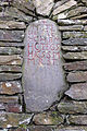 Molchner Stolln - Grenzstein von 1733.jpg 2,968 × 4,459; 4.22 MB
-
 Molchner Stolln - Zugang zum Spatgang (1).jpg 3,592 × 4,560; 5.32 MB
-
 Molchner Stolln - Zugang zum Spatgang (2).jpg 3,136 × 4,584; 4.66 MB
-
 Molchner Stolln - Zugang zum Spatgang (3).jpg 3,543 × 4,584; 4.9 MB
-
 Molchner Stolln - Zugang zum Spatgang (4).jpg 3,672 × 4,896; 5.17 MB
-
 Molchner Stolln - Zugang zum Spatgang (5).jpg 3,543 × 3,429; 3.21 MB
-
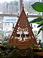
 Pobershau Molchener Stolln Weihnachten 2014.jpg 2,314 × 3,445; 1.33 MB
-
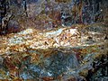 Pobershau Molchner Stolln Erzgang.JPG 1,280 × 960; 507 KB
-

-
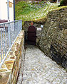
 PobershauTieferMolchener.jpg 2,048 × 1,536; 2.09 MB
-
 Schaubergwerk Molchner Stolln (1).jpg 4,954 × 3,536; 3.57 MB
-
 Schaubergwerk Molchner Stolln (2).jpg 4,696 × 3,568; 3.64 MB
-
 Schaubergwerk Molchner Stolln (3).jpg 4,507 × 3,552; 3.16 MB
-
 Schaubergwerk Molchner Stolln (4).jpg 4,528 × 3,224; 4.11 MB
-
 Schaubergwerk Molchner Stolln (5).jpg 4,752 × 3,600; 3.7 MB
-
 Schaubergwerk Molchner Stolln (6).jpg 4,874 × 3,543; 3.98 MB
-
 Schaubergwerk Molchner Stolln (7).jpg 4,768 × 3,549; 3.73 MB
-
 Schaubergwerk Molchner Stolln (8).jpg 4,563 × 3,543; 3.18 MB
-
 Schaubergwerk Pobershau.jpg 4,000 × 3,000; 5.76 MB


.jpg)
.jpg)
.jpg)
.jpg)
.jpg)


.jpg)
.jpg)
.jpg)
.jpg)
.jpg)
.jpg)
.jpg)
.jpg)
