Category:Milltown, Derbyshire
Jump to navigation
Jump to search
English: Milltown is a village in Derbyshire, England. It is located 1 mile south east of Ashover and is part of Ashover civil parish. To the north of the village is Milltown Quarry, now closed. The Ashover Light Railway ran through Milltown.
village in United Kingdom  | |||||
| Upload media | |||||
| Instance of | |||||
|---|---|---|---|---|---|
| Location | Ashover, North East Derbyshire, Derbyshire, East Midlands, England | ||||
 | |||||
Subcategories
This category has the following 3 subcategories, out of 3 total.
F
- Fallgate railway station (1 F)
M
- Milltown Pinfold (2 F)
- Miners Arms, Milltown (3 F)
Media in category "Milltown, Derbyshire"
The following 29 files are in this category, out of 29 total.
-
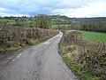
 Country Lane near Milltown - geograph.org.uk - 2219928.jpg 3,296 × 2,472; 1.04 MB
-

-
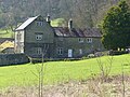
 Farm building near Milltown - geograph.org.uk - 2335065.jpg 1,600 × 1,200; 386 KB
-

-
 Horses in field adjoining Overton Hall - geograph.org.uk - 348114.jpg 640 × 480; 149 KB
-
 Lane side barn between Milltown and Fallgate - geograph.org.uk - 1978370.jpg 1,024 × 796; 526 KB
-
 Milltown from the Ashover Hay ridge - geograph.org.uk - 2878059.jpg 1,024 × 768; 225 KB
-
 Milltown Quarry - geograph.org.uk - 1855664.jpg 800 × 600; 141 KB
-
 Milltown quarry and countryside beyond - geograph.org.uk - 1979313.jpg 1,024 × 768; 480 KB
-
 Quarry View - geograph.org.uk - 743798.jpg 640 × 480; 106 KB
-
 Quarry View Near Fallgate - geograph.org.uk - 744263.jpg 640 × 480; 121 KB
-
 Raven House and Garden - geograph.org.uk - 329557.jpg 640 × 480; 120 KB
-
 Ravensnest Farm, Milltown 01.jpg 4,000 × 3,000; 4.57 MB
-
 View across fields to Overton - geograph.org.uk - 330400.jpg 640 × 480; 86 KB
-
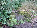 Cocking Tor - Woodland Spring - geograph.org.uk - 348715.jpg 640 × 480; 188 KB
-
 Gin Lane - geograph.org.uk - 347786.jpg 640 × 480; 121 KB
-
 Gin Lane - View of Ashover Hay - geograph.org.uk - 347787.jpg 640 × 480; 121 KB
-
 Gin Lane and Cocking Tor - geograph.org.uk - 347322.jpg 640 × 480; 104 KB
-
 Milltown - Farm Buildings - geograph.org.uk - 330373.jpg 640 × 480; 124 KB
-
 Overton - Cottage and Pond - geograph.org.uk - 347449.jpg 640 × 480; 152 KB
-
 Overton - Flagstone Footpath - geograph.org.uk - 347782.jpg 640 × 480; 141 KB
-
 Overton - Path to Cottages - geograph.org.uk - 348132.jpg 640 × 480; 142 KB
-
 Overton - Unofficial Sign - geograph.org.uk - 347783.jpg 640 × 480; 168 KB
-
 Overton Camp - View from Cocking Tor - geograph.org.uk - 347437.jpg 480 × 640; 131 KB
-
 Overton Camp - View from Gin Lane - geograph.org.uk - 347464.jpg 640 × 480; 159 KB
-
 Overton Camp - View from Gin Lane - geograph.org.uk - 348714.jpg 640 × 480; 127 KB
-
 Ravensnest Farm - geograph.org.uk - 347357.jpg 640 × 480; 117 KB
-
 Ravensnest Sign and Lane to Cocking Tor - geograph.org.uk - 347340.jpg 640 × 480; 121 KB
-
 View across fields to Greenfield Farm - geograph.org.uk - 330426.jpg 640 × 480; 104 KB


