Category:Milestones in London
Jump to navigation
Jump to search
Ceremonial counties of England: Bedfordshire · Berkshire · Buckinghamshire · Cambridgeshire · Cheshire · Cornwall · Cumbria · Derbyshire · Devon · Dorset · Durham · East Riding of Yorkshire · East Sussex · Essex · Gloucestershire · Greater London · Greater Manchester · Hampshire · Herefordshire · Hertfordshire · Kent · Lancashire · Leicestershire · Lincolnshire · Merseyside · Norfolk · North Yorkshire · Northamptonshire · Northumberland · Nottinghamshire · Oxfordshire · Rutland · Shropshire · Somerset · South Yorkshire · Staffordshire · Suffolk · Surrey · Tyne and Wear · Warwickshire · West Midlands · West Sussex · West Yorkshire · Wiltshire · Worcestershire
City-counties: Bristol ·
Former historic counties:
Other former counties:
City-counties: Bristol ·
Former historic counties:
Other former counties:

Subcategories
This category has the following 15 subcategories, out of 15 total.
L
- Leytonstone Obelisk (23 F)
M
- Milestone, Bexley Road (10 F)
- Millennium Mileposts in London (16 F)
R
- Roehampton Mounting Block (19 F)
Media in category "Milestones in London"
The following 200 files are in this category, out of 288 total.
(previous page) (next page)-
 2 Miles to Farnbo - geograph.org.uk - 2721550.jpg 1,024 × 733; 259 KB
-
 2022-03-05 Lee Navigation milestone - 6 miles from Old Ford Locks.jpg 2,352 × 3,137; 3.06 MB
-
 5 mile marker, Paddington Branch, Grand Union Canal (geograph 4598925).jpg 3,648 × 2,736; 4.38 MB
-
 Ancient direction sign on Robin Hood Gate (geograph 4535733).jpg 2,304 × 1,728; 821 KB
-
 Braunston 81 miles (geograph 5557582).jpg 426 × 640; 124 KB
-
 Canal milepost - Braunston 92 (geograph 4817859).jpg 3,648 × 2,736; 3.46 MB
-
 City of Westminster Milestone, South Kensington (geograph 4338336).jpg 2,272 × 1,704; 1 MB
-
 Clapham Common, milestone - geograph.org.uk - 1401937.jpg 640 × 480; 109 KB
-
 Clapham Common, milestone - geograph.org.uk - 1401982.jpg 640 × 480; 118 KB
-

-
 Duke's Meadows way marker with stars and map, 2002.jpg 1,920 × 2,560; 4.15 MB
-
-
 Engraved stone at Mortlake.jpg 1,552 × 2,592; 1.41 MB
-
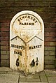
 Finchley milestone.jpg 3,000 × 4,000; 4.15 MB
-
 Grand Union Canal, south end of Broad Water (geograph 6431830).jpg 1,024 × 768; 315 KB
-
 Ham Gate, Richmond Park (geograph 5041637).jpg 640 × 480; 78 KB
-
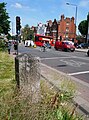
 High Road (A121) towards Epping (geograph 6206983).jpg 800 × 600; 178 KB
-
 High Street, Green Street Green (geograph 5078295).jpg 640 × 480; 80 KB
-
 Hounslow milestone - geograph.org.uk - 1612837.jpg 640 × 480; 96 KB
-
 Kingston Road Milestone (geograph 6586855).jpg 6,016 × 4,512; 5.59 MB
-
 Marker Stone on Charlton Park Road near Woolwich.jpg 3,448 × 4,592; 13.41 MB
-
 Mile Marker outside Royal Geographical Society.jpg 3,456 × 4,608; 3.79 MB
-
 Milepost along the Grand Union Canal towpath (geograph 4627331).jpg 800 × 600; 175 KB
-
 Milepost by Grand Union Canal (geograph 5566841).jpg 426 × 640; 130 KB
-
 Milepost by Grand Union Canal (geograph 6604139).jpg 1,024 × 684; 302 KB
-
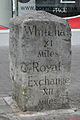
 Milepost in Windrush Square, Brixton denoting 4 miles to the Royal Exchange.jpg 2,736 × 3,648; 3.55 MB
-

-
 Milepost outside Number 173 Uxbridge Road, West Ealing (01).jpg 3,094 × 4,281; 10.87 MB
-
 Milepost outside Number 173 Uxbridge Road, West Ealing (02).jpg 4,161 × 3,157; 10.69 MB
-
 Milepost, Uxbridge Road, Ealing Common.jpg 2,448 × 3,264; 3.6 MB
-
 Milestone (geograph 3582716).jpg 477 × 640; 197 KB
-
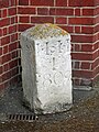
 Milestone affixed to Number 34, Eltham High Street (01).jpg 4,269 × 3,223; 8.99 MB
-
 Milestone affixed to Number 34, Eltham High Street (02).jpg 2,921 × 4,236; 8.22 MB
-
 Milestone affixed to Number 34, Eltham High Street (03).jpg 3,163 × 4,234; 9.39 MB
-
 Milestone affixed to Number 34, Eltham High Street.jpg 4,592 × 3,448; 13.98 MB
-
 Milestone along Bromley High Street (01).jpg 2,915 × 3,559; 6.62 MB
-
 Milestone along Bromley High Street (02).jpg 2,893 × 4,171; 8.39 MB
-
 Milestone along London Road, Morden (01).jpg 4,592 × 3,448; 16.48 MB
-
 Milestone along London Road, Morden (02).jpg 3,448 × 4,592; 16.43 MB
-
 Milestone along Tubbenden Lane, Orpington (01).jpg 4,348 × 3,187; 14.75 MB
-
 Milestone along Tubbenden Lane, Orpington (02).jpg 3,448 × 4,592; 16.91 MB
-
 Milestone along Tubbenden Lane, Orpington (03).jpg 4,592 × 3,448; 18.12 MB
-
 Milestone along Tubbenden Lane, Orpington (04).jpg 3,448 × 4,592; 16.52 MB
-
 Milestone along Tubbenden Lane, Orpington (05).jpg 3,047 × 4,176; 16.17 MB
-
 Milestone along Tubbenden Lane, Orpington (06).jpg 4,464 × 3,338; 17.56 MB
-
 Milestone at Riverside Cottages (geograph 6260172).jpg 1,024 × 768; 306 KB
-

-
 Milestone by the Grand Union Canal below Widewater Lock (geograph 6269332).jpg 768 × 1,024; 239 KB
-
 Milestone by the Grand Union Canal west of Harefield (geograph 6266494).jpg 768 × 1,024; 346 KB
-
 Milestone dated 1741 on Bath Road near Colnbrook (geograph 6446323).jpg 5,456 × 3,632; 4.34 MB
-
 Milestone in Camberwell London SE5.jpg 1,883 × 2,608; 2.55 MB
-
 Milestone in Clapham aug 21.jpg 3,024 × 4,032; 7.07 MB
-
 Milestone in Hurst Road, Bexley (01).jpg 3,448 × 4,592; 12.69 MB
-
 Milestone in Park Hill, Croydon - geograph.org.uk - 2322143.jpg 1,818 × 2,715; 3.31 MB
-

-
 Milestone on Bath Road, Longford (geograph 6447426).jpg 3,632 × 5,456; 3.76 MB
-
 Milestone on Brighton Road, Sutton, London.jpg 3,750 × 5,625; 8.22 MB
-
 Milestone on Cheam Road, Sutton, London.jpg 3,750 × 5,625; 8.15 MB
-
 Milestone on Clapham Common North Side (South Face - 01).jpg 3,348 × 4,497; 17.57 MB
-
 Milestone on Clapham Common North Side (Southeast Corner).jpg 4,592 × 3,448; 16.59 MB
-
 Milestone on Clapham Common North Side (Southeast View - 01).jpg 3,448 × 4,592; 16.61 MB
-
 Milestone on Clapham Common North Side (Southwest View - 01).jpg 3,448 × 4,592; 17.06 MB
-
 Milestone on Clapham Common South Side (01).jpg 3,448 × 4,592; 14.7 MB
-
 Milestone on Clapham Common South Side (02).jpg 3,237 × 4,297; 13.3 MB
-
 Milestone on Clapham Common South Side (03).jpg 4,248 × 3,158; 11.73 MB
-
 Milestone on Clapham Common South Side (04).jpg 3,348 × 4,513; 13.41 MB
-
 Milestone on Clapham Common South Side (05).jpg 4,295 × 3,322; 12.98 MB
-
 Milestone on High Road (A121) (geograph 6206978).jpg 713 × 800; 246 KB
-
 Milestone on High Road (geograph 4332146).jpg 640 × 480; 148 KB
-
 Milestone on Highgate West Hill opposite Holly Lodge Gardens, December 2022.jpg 3,024 × 4,032; 6.01 MB
-
 Milestone on Holders Hill Road, Hendon, August 2021.jpg 3,024 × 4,032; 6.42 MB
-
 Milestone on Regents Park Road - geograph.org.uk - 212656.jpg 480 × 640; 101 KB
-
 Milestone on Shooter's Hill Road.jpg 3,448 × 4,592; 16.23 MB
-
 Milestone on Shooters Hill Road (geograph 5754492).jpg 1,024 × 768; 313 KB
-
 Milestone on Sutton High Street.jpg 2,887 × 4,330; 5.36 MB
-
 Milestone on the A4 outside Heathrow Central Travelodge (geograph 6447531).jpg 3,632 × 5,456; 3.12 MB
-
 Milestone on the A4 outside Heathrow Central Travelodge (geograph 6447536).jpg 5,456 × 3,632; 2.08 MB
-

-
 Milestone on Upper Richmond Road, Barnes (01).jpg 4,592 × 3,448; 17.18 MB
-
 Milestone on Upper Richmond Road, Barnes (02).jpg 3,448 × 4,592; 16.66 MB
-
 Milestone on Upper Richmond Road, Barnes (03).jpg 2,927 × 4,052; 12.08 MB
-
 Milestone on Upper Richmond Road, Barnes (04).jpg 2,910 × 3,923; 10.38 MB
-
 Milestone on Upper Richmond Road, Barnes (05).jpg 3,073 × 4,239; 13.69 MB
-
 Milestone on Upper Richmond Road, Barnes (06).jpg 4,287 × 3,136; 10.95 MB
-
 Milestone outside number 296, London N3 closeup.jpg 2,448 × 3,264; 2.65 MB
-
 Milestone outside number 296, London N3.jpg 3,264 × 2,448; 3.46 MB
-
 Milestone outside number 362, A22.jpg 2,268 × 4,032; 4.96 MB
-
 Milestone outside the Milestone Hotel on Kensington Road, May 2018.jpg 5,304 × 7,952; 25.91 MB
-
 Milestone South of Chessington (geograph 6408323).jpg 3,657 × 2,439; 7.56 MB
-
 Milestone, 756 Fulham Road, Fulham, London, September 2016 01.jpg 3,456 × 4,608; 8.65 MB
-
 Milestone, 756 Fulham Road, Fulham, London, September 2016 02.jpg 3,456 × 4,608; 8.78 MB
-
 Milestone, 756 Fulham Road, Fulham, London, September 2016 03.jpg 3,456 × 4,608; 8.73 MB
-
 Milestone, Bath Rd (geograph 6587198).jpg 1,024 × 684; 317 KB
-
 Milestone, Bath Rd (geograph 6587250).jpg 1,024 × 684; 246 KB
-
 Milestone, Church End, Finchley (geograph 3751607).jpg 1,280 × 1,905; 2.74 MB
-
 Milestone, Farnborough (geograph 6811757).jpg 684 × 1,024; 242 KB
-
 Milestone, Haverstock Hill. NW3 - geograph.org.uk - 1534273.jpg 480 × 640; 129 KB
-
 Milestone, High Street, Bromley (geograph 4638376).jpg 2,272 × 1,704; 905 KB
-
 Milestone, Kensington (geograph 4597935).jpg 640 × 634; 117 KB
-
 Milestone, Knightsbridge, London - geograph.org.uk - 1590514.jpg 480 × 640; 137 KB
-
 Milestone, Regent's Canal (geograph 6647611).jpg 684 × 1,024; 201 KB
-
 Milestone, Sutton (geograph 6670953).jpg 768 × 1,024; 331 KB
-
 Milestone, Sutton High Street (geograph 4003999).jpg 640 × 427; 270 KB
-
-
 Moorgate, Jugged Hare (geograph 3861811).jpg 1,024 × 768; 150 KB
-
 North Finchley High Road milestone 2.jpg 3,264 × 2,448; 2.77 MB
-
 North Finchley High Road milestone.jpg 2,448 × 3,264; 2.15 MB
-
 Old Bridge Marker by Glade Lane, Southall (geograph 6035306).jpg 800 × 600; 181 KB
-
 Old canal milestone - 10 miles (geograph 5252410).jpg 3,648 × 2,736; 5.69 MB
-
 Old Commemorative Marker at Monken Hadley (geograph 6093774).jpg 720 × 960; 117 KB
-
 Old milemarker (geograph 6098348).jpg 600 × 800; 210 KB
-

-
 Old milemarker by the Grand Union Canal, Hanwell (geograph 6076658).jpg 600 × 800; 216 KB
-

-
 Old milemarker by the Grand Union Canal, Southall (geograph 6083697).jpg 600 × 800; 180 KB
-

-

-
 Old Milemarker on Robin Hood Gate, Richmond Park (geograph 6061474).jpg 1,742 × 1,186; 287 KB
-
 Old milemarker west of Harefield (geograph 6076475).jpg 427 × 640; 76 KB
-
 Old Mileplate by Kingston Gate, Richmond Park (geograph 6083837).jpg 1,777 × 1,173; 292 KB
-
 Old Mileplate by Richmond Gate, Richmond Park (geograph 6083870).jpg 1,543 × 1,138; 171 KB
-
 Old Mileplate by Roehampton Gate, Richmond Park (geograph 6072392).jpg 1,730 × 1,174; 348 KB
-

-
 Old Milepost (geograph 3635102).jpg 768 × 1,024; 174 KB
-
 Old Milepost (geograph 3635114).jpg 1,024 × 768; 186 KB
-
 Old Milepost (geograph 6097702).jpg 877 × 1,329; 175 KB
-
 Old Milepost (geograph 6097778).jpg 1,346 × 2,121; 513 KB
-
 Old Milepost (geograph 6098080).jpg 744 × 1,079; 87 KB
-
 Old Milepost (geograph 6114896).jpg 975 × 1,575; 162 KB
-
 Old Milepost (geograph 6114943).jpg 1,536 × 2,048; 612 KB
-
 Old Milepost by Church Farmhouse Museum, Hendon (geograph 6048030).jpg 896 × 1,222; 164 KB
-
-

-
 Old Milepost by the A11, Bow Road, Poplar parish (geograph 6050478).jpg 531 × 800; 122 KB
-
 Old Milepost by the A222, Hurst Road, Bexley parish (geograph 6061161).jpg 657 × 1,024; 459 KB
-
 Old Milepost by the A3006, Bath Road, Hounslow parish (geograph 6050946).jpg 913 × 1,260; 227 KB
-
 Old Milepost by the A304, Fulham Road, Fulham (geograph 6093787).jpg 1,173 × 1,771; 269 KB
-
 Old Milepost by the A306, Rocks Lane, Barnes (geograph 6035972).jpg 423 × 640; 301 KB
-
-
 Old Milepost by the A315, London Road, Isleworth (geograph 6056236).jpg 525 × 700; 377 KB
-
 Old Milepost by the A315, Staines Road, Hounslow Heath (geograph 6115248).jpg 890 × 1,382; 186 KB
-
 Old Milepost by the A4020, Uxbridge Road, Ealing Parish (geograph 6038783).jpg 1,338 × 1,909; 438 KB
-

-
 Old Milepost by the A598, Finchley Road, Hendon (geograph 5602582).jpg 618 × 1,024; 129 KB
-
 Old Milepost by the A598, Regent's Park Road, Finchley (geograph 5602587).jpg 647 × 1,024; 214 KB
-
 Old Milepost by the B2173, Maidstone Road, Ruxley (geograph 6056484).jpg 889 × 1,243; 215 KB
-
 Old Milepost by the B269, Selsdon and Sanderstead parish (geograph 6050233).jpg 1,081 × 1,716; 244 KB
-

-

-

-
 Old Milepost, A4020 (former A40), Uxbridge Road, Ealing (geograph 6044096).jpg 714 × 1,024; 177 KB
-
 Old Milestone (geograph 3507361).jpg 768 × 1,024; 380 KB
-
 Old Milestone (geograph 3507370).jpg 1,024 × 768; 255 KB
-
 Old Milestone (geograph 6096127).jpg 525 × 700; 357 KB
-
 Old Milestone (geograph 6096218).jpg 621 × 955; 464 KB
-
 Old Milestone (geograph 6096293).jpg 433 × 640; 68 KB
-
 Old Milestone (geograph 6096298).jpg 739 × 1,190; 167 KB
-
 Old Milestone (geograph 6096308).jpg 477 × 800; 146 KB
-
 Old Milestone (geograph 6097821).jpg 672 × 1,024; 392 KB
-
 Old Milestone (geograph 6097858).jpg 711 × 1,005; 115 KB
-
 Old Milestone (geograph 6098333).jpg 1,213 × 1,657; 678 KB
-
 Old Milestone (geograph 6098547).jpg 1,035 × 1,333; 190 KB
-
 Old Milestone (geograph 6098560).jpg 480 × 640; 246 KB
-
 Old Milestone (geograph 6098587).jpg 739 × 1,065; 104 KB
-
 Old Milestone (geograph 6098674).jpg 403 × 644; 69 KB
-
 Old Milestone (geograph 6099261).jpg 637 × 943; 99 KB
-
 Old Milestone (geograph 6114606).jpg 525 × 700; 374 KB
-
 Old Milestone (geograph 6114630).jpg 1,061 × 1,565; 152 KB
-
 Old Milestone (geograph 6114996).jpg 1,029 × 1,629; 173 KB
-
 Old Milestone (geograph 6115194).jpg 1,018 × 1,672; 222 KB
-
 Old Milestone (geograph 6115209).jpg 1,029 × 1,468; 184 KB
-
 Old Milestone (geograph 6115266).jpg 1,565 × 975; 180 KB
-
 Old Milestone (geograph 6115283).jpg 1,179 × 1,115; 117 KB
-
 Old Milestone (geograph 6115352).jpg 1,083 × 1,661; 171 KB
-
-

-
 Old Milestone A308, Hampton Court Road (geograph 7012068).jpg 577 × 1,024; 195 KB
-
 Old Milestone by A235, Purley Memorial Hospital grounds (geograph 6102676).jpg 1,098 × 1,394; 260 KB
-
 Old Milestone by Dulwich Village, Camberwell and Dulwich parish (geograph 6049494).jpg 1,239 × 1,704; 419 KB
-
 Old Milestone by Ewell Road, Esher parish (geograph 6051220).jpg 818 × 1,177; 170 KB
-
 Old Milestone by Ewell Road, Tolworth (geograph 6038423).jpg 828 × 1,142; 121 KB
-
 Old Milestone by Lower Terrace, Hampstead parish (geograph 6094180).jpg 775 × 1,264; 174 KB
-
 Old Milestone by Mottingham Lane, Mottingham (geograph 6095939).jpg 620 × 1,024; 136 KB
-

-
 Old Milestone by Park Road, Isleworth Cemetery (geograph 6035512).jpg 525 × 700; 309 KB
-
 Old Milestone by Pinner Road, Pinner Parish (geograph 6037642).jpg 1,178 × 1,701; 352 KB
-
 Old Milestone by Rotherhithe Street, Rotherhithe (geograph 6072590).jpg 1,158 × 1,704; 326 KB
-
-

-
 Old Milestone by the A2, Shooters Hill Road, Blackheath (geograph 6035940).jpg 720 × 1,024; 132 KB
-
 Old Milestone by the A20, Lee High Road (geograph 6037991).jpg 861 × 1,384; 515 KB
-
 Old Milestone by the A205, Upper Richmond Road West, East Sheen (geograph 6068740).jpg 1,009 × 1,405; 333 KB
-
 Old Milestone by the A205, Upper Richmond Road, Roehampton (geograph 6047961).jpg 1,101 × 1,706; 241 KB
-
 Old Milestone by the A207, Shooters Hill, (geograph 6038920).jpg 704 × 1,024; 107 KB
-
 Old Milestone by the A207, Shooters Hill, Eltham parish (geograph 6072009).jpg 709 × 1,024; 461 KB
-

-
 Old Milestone by the A21, Bromley Common, Bromley Parish (geograph 6037434).jpg 676 × 1,024; 416 KB
-
-
 Old Milestone by the A210, Bexley Road, Avery Hill (geograph 6048051).jpg 674 × 1,024; 500 KB
-
 Old Milestone by the A210, Eltham Road (geograph 6037244).jpg 720 × 1,024; 355 KB


.jpg)
.jpg)
.jpg)
.jpg)
.jpg)


.jpg)
.jpg)
_towards_Epping_(geograph_6206983).jpg)
.jpg)

.jpg)


.jpg)
.jpg)
.jpg)


.jpg)
.jpg)

.jpg)
.jpg)
.jpg)
.jpg)

.jpg)
.jpg)
.jpg)
.jpg)
.jpg)
.jpg)
.jpg)
.jpg)
.jpg)
.jpg)
.jpg)

.jpg)
.jpg)
.jpg)


.jpg)

.jpg)
.jpg)


.jpg)
.jpg)
.jpg)
.jpg)
.jpg)
.jpg)
.jpg)
.jpg)
.jpg)
_(geograph_6206978).jpg)
.jpg)


.jpg)

.jpg)
.jpg)

.jpg)
.jpg)
.jpg)
.jpg)
.jpg)
.jpg)


.jpg)


.jpg)
.jpg)
.jpg)
.jpg)

.jpg)
.jpg)

.jpg)
.jpg)
.jpg)
.jpg)
.jpg)


.jpg)
.jpg)
.jpg)
.jpg)
.jpg)
.jpg)
.jpg)
.jpg)
.jpg)
.jpg)
.jpg)
.jpg)
.jpg)
.jpg)
.jpg)
.jpg)
.jpg)
.jpg)
.jpg)
.jpg)
.jpg)
.jpg)
.jpg)
.jpg)
.jpg)
.jpg)
.jpg)
.jpg)
.jpg)
.jpg)
.jpg)
.jpg)
.jpg)
.jpg)
.jpg)
.jpg)
.jpg)
.jpg)
.jpg)
.jpg)
.jpg)
,_Ealing_Common_-_geograph.org.uk_-_6120072.jpg)
,_Ealing_Common_-_geograph.org.uk_-_6120073.jpg)
,_Uxbridge_Road,_Ealing_(geograph_6044096).jpg)
.jpg)
.jpg)
.jpg)
.jpg)
.jpg)
.jpg)
.jpg)
.jpg)
.jpg)
.jpg)
.jpg)
.jpg)
.jpg)
.jpg)
.jpg)
.jpg)
.jpg)
.jpg)
.jpg)
.jpg)
.jpg)
.jpg)
.jpg)
_by_the_A315,_Staines_Road,_Bedfont_Green_(geograph_6614243).jpg)
_by_the_A315,_Staines_Road,_Bedfont_Green_(geograph_6614252).jpg)
.jpg)
.jpg)
.jpg)
.jpg)
.jpg)
.jpg)
.jpg)
.jpg)
.jpg)
.jpg)
.jpg)
.jpg)
.jpg)
.jpg)
.jpg)
.jpg)
.jpg)
.jpg)
.jpg)
.jpg)
.jpg)
.jpg)
.jpg)
.jpg)