Category:Milehouse, Plymouth
Jump to navigation
Jump to search
human settlement in United Kingdom  | |||||
| Upload media | |||||
| Instance of | |||||
|---|---|---|---|---|---|
| Location |
| ||||
 | |||||
Subcategories
This category has only the following subcategory.
M
- Milehouse bus depot, Plymouth (334 F)
Media in category "Milehouse, Plymouth"
The following 109 files are in this category, out of 109 total.
-
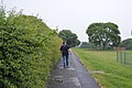
 A footpath off Lyndhurst Road, Plymouth - geograph.org.uk - 4184823.jpg 1,600 × 1,200; 1.81 MB
-
 A3064 - geograph.org.uk - 5009253.jpg 640 × 426; 50 KB
-
 A386 - geograph.org.uk - 4449598.jpg 640 × 400; 68 KB
-
 A386 - geograph.org.uk - 5009262.jpg 640 × 426; 52 KB
-
 A386 - geograph.org.uk - 5568202.jpg 640 × 426; 43 KB
-
 A386 - geograph.org.uk - 5572349.jpg 640 × 426; 64 KB
-
 A386 - geograph.org.uk - 5572351.jpg 640 × 426; 69 KB
-
 A386 - geograph.org.uk - 5687836.jpg 640 × 426; 68 KB
-
 A386 and Central Park - geograph.org.uk - 4449325.jpg 640 × 426; 67 KB
-
 A386, A3064 junction - geograph.org.uk - 5009266.jpg 640 × 426; 61 KB
-
 Alma Rd - geograph.org.uk - 5687837.jpg 640 × 461; 75 KB
-
 Approaching roundabout, A3064 - geograph.org.uk - 5687823.jpg 640 × 426; 58 KB
-
 B3396 - geograph.org.uk - 5021870.jpg 640 × 426; 47 KB
-
 B3396 - geograph.org.uk - 5658559.jpg 640 × 335; 53 KB
-
 Back in the day - geograph.org.uk - 3957288.jpg 4,000 × 2,664; 4.53 MB
-
 Beaumont Rd - geograph.org.uk - 5778832.jpg 640 × 426; 61 KB
-
 Beckley Point seen from Central Park - geograph.org.uk - 5976981.jpg 1,024 × 681; 110 KB
-
 Bend, Wolseley Rd - geograph.org.uk - 5687825.jpg 640 × 457; 101 KB
-
 Block of flats - geograph.org.uk - 5572345.jpg 640 × 426; 89 KB
-
 Browning Rd - geograph.org.uk - 5658577.jpg 640 × 426; 72 KB
-
 Browning Rd - geograph.org.uk - 5778834.jpg 640 × 426; 69 KB
-
 Bus Depot - geograph.org.uk - 3957137.jpg 4,000 × 2,664; 1.87 MB
-
 Bus Depot - geograph.org.uk - 5568200.jpg 640 × 426; 72 KB
-
 Bus depot - geograph.org.uk - 5658554.jpg 640 × 426; 56 KB
-
 Bus depot - geograph.org.uk - 5687832.jpg 640 × 430; 53 KB
-
 Bus Depot, Milehouse - geograph.org.uk - 5009255.jpg 640 × 426; 50 KB
-
 Central Park - geograph.org.uk - 4449283.jpg 640 × 468; 88 KB
-
 Central Park - geograph.org.uk - 4449313.jpg 640 × 426; 97 KB
-
 Central Park - geograph.org.uk - 4449316.jpg 640 × 426; 94 KB
-
 Central Park - geograph.org.uk - 4449320.jpg 640 × 426; 89 KB
-
 Central Park - geograph.org.uk - 5592182.jpg 640 × 426; 98 KB
-
 Central Park - geograph.org.uk - 5687830.jpg 640 × 426; 45 KB
-
 Central Park - geograph.org.uk - 5976983.jpg 1,024 × 681; 167 KB
-
 Central Park - geograph.org.uk - 5976988.jpg 1,024 × 681; 151 KB
-
 Central park - geograph.org.uk - 5976990.jpg 1,024 × 681; 137 KB
-
 Central reservation, A386 - geograph.org.uk - 4449327.jpg 640 × 426; 70 KB
-
 Church of St Bartholomew - geograph.org.uk - 5009261.jpg 640 × 426; 44 KB
-
 Citybus Depot - geograph.org.uk - 5778825.jpg 640 × 425; 63 KB
-
 Citybus Depot - geograph.org.uk - 5778828.jpg 640 × 425; 59 KB
-
 Citybus Garage - geograph.org.uk - 5592176.jpg 640 × 310; 44 KB
-
 Clouds over Home Park - geograph.org.uk - 4909763.jpg 1,024 × 768; 115 KB
-
 Earl of Plymouth - geograph.org.uk - 5009251.jpg 640 × 426; 54 KB
-
 Entrance to Plymouth Life Centre - geograph.org.uk - 4449333.jpg 640 × 426; 83 KB
-
 Esso Garage, Outlands Road - geograph.org.uk - 4909895.jpg 1,024 × 768; 158 KB
-
 First 32761 WJ55CRX (18773089988).jpg 3,456 × 4,608; 6.62 MB
-
 First 32803 T803LLC (16753862849).jpg 3,288 × 2,766; 4.38 MB
-
 First 32853 HIG1512 (16940088335).jpg 3,414 × 2,591; 5.54 MB
-
 First 33421 WA08MVF (16753868509).jpg 4,608 × 3,456; 6.61 MB
-
 First 48221 W821PFB (16317682084).jpg 4,293 × 2,178; 4.69 MB
-
 First 48262 W602PAF (16753858989).jpg 4,560 × 2,295; 5.43 MB
-
 Football Stadium - geograph.org.uk - 3957127.jpg 4,000 × 2,664; 2.09 MB
-
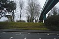 Footbridge over the A386 - geograph.org.uk - 4449594.jpg 640 × 426; 81 KB
-
 Footpath - geograph.org.uk - 5572347.jpg 640 × 425; 73 KB
-
 Footpath into St Boniface Park - geograph.org.uk - 4184799.jpg 1,600 × 1,200; 1.34 MB
-
 Footpath, Central Park - geograph.org.uk - 5009259.jpg 640 × 426; 43 KB
-
 Former Plymouth Tramway Office - geograph.org.uk - 5687829.jpg 640 × 426; 56 KB
-
 Home Park - geograph.org.uk - 2149445.jpg 640 × 480; 62 KB
-
 Home Park Park and Ride and Stadium - geograph.org.uk - 4449337.jpg 640 × 426; 51 KB
-
 Home Park Stadium - geograph.org.uk - 4449339.jpg 640 × 426; 68 KB
-
 Jubileestreetparty.jpg 900 × 600; 140 KB
-

-
 Leaving the stadium - geograph.org.uk - 4995030.jpg 640 × 480; 87 KB
-
 Mayflower Drive - geograph.org.uk - 4449330.jpg 640 × 426; 51 KB
-
 Milehouse Rd, B3369 - geograph.org.uk - 5021878.jpg 640 × 426; 44 KB
-
 Milehouse Rd, B3369 - geograph.org.uk - 5021881.jpg 640 × 426; 40 KB
-
 Montpelier Road, Plymouth - geograph.org.uk - 4184805.jpg 1,600 × 1,200; 1.33 MB
-
 Old sunken road in Central Park, Plymouth - geograph.org.uk - 4185797.jpg 1,200 × 1,600; 1.77 MB
-
 Open space at the north of Central Park, Plymouth - geograph.org.uk - 4185795.jpg 1,600 × 1,200; 1.66 MB
-
 Outland Road (A386), Plymouth - geograph.org.uk - 4184834.jpg 1,600 × 1,200; 1.52 MB
-
 Path across Central Park - geograph.org.uk - 5976977.jpg 1,024 × 681; 170 KB
-
 Plymouth , Alma Road, A386 - geograph.org.uk - 4612519.jpg 4,288 × 2,848; 4.39 MB
-
 Plymouth , Alma Road, A386 - geograph.org.uk - 4612520.jpg 4,288 × 2,848; 5.18 MB
-
 Plymouth , Central Park - geograph.org.uk - 2238414.jpg 4,288 × 2,848; 5.23 MB
-
 Plymouth , Central Park - geograph.org.uk - 2238422.jpg 4,288 × 2,848; 6.26 MB
-
 Plymouth , Central Park - Houses on the Hillside - geograph.org.uk - 2238432.jpg 4,288 × 2,848; 6.51 MB
-
 Plymouth , Central Park - Houses on the Hillside - geograph.org.uk - 2238438.jpg 4,288 × 2,848; 5.6 MB
-
 Plymouth , Central Park - Houses on the Hillside - geograph.org.uk - 2238445.jpg 4,288 × 2,848; 5.51 MB
-
 Plymouth , Central Park - Path - geograph.org.uk - 2238501.jpg 4,288 × 2,848; 6.24 MB
-
 Plymouth , Central Park - Path ^ Construction Site - geograph.org.uk - 2238455.jpg 4,288 × 2,848; 6.81 MB
-
 Plymouth , Central Park Leisure Pool - geograph.org.uk - 2238527.jpg 4,288 × 2,848; 4.16 MB
-
 Plymouth , Central Park Path - geograph.org.uk - 2238521.jpg 4,288 × 2,848; 7 MB
-
 Plymouth , Gilbert Lane Construction Huts - geograph.org.uk - 2238467.jpg 4,288 × 2,848; 4.34 MB
-
 Plymouth , Home Park Football Stadium - geograph.org.uk - 2238475.jpg 4,288 × 2,848; 5.16 MB
-
 Plymouth , Home Park Football Stadium - geograph.org.uk - 2238483.jpg 4,288 × 2,848; 5.14 MB
-
 Plymouth , Home Park Football Stadium - geograph.org.uk - 2238513.jpg 4,288 × 2,848; 5.96 MB
-
 Plymouth , Home Park Football Stadium Turnstiles - geograph.org.uk - 2238470.jpg 4,288 × 2,848; 4.17 MB
-
 Plymouth Citybus 056 WA51ACU (16929896051).jpg 4,432 × 2,200; 5.61 MB
-
 Plymouth Citybus 065 WJ52GOH (15653463622).jpg 3,326 × 1,595; 3.34 MB
-
 Plymouth Citybus 373 PF06ENO (16761116220).jpg 4,122 × 2,142; 5.18 MB
-
 Plymouth Citybus Headquarters 1, Milehouse Road - geograph.org.uk - 2089275.jpg 1,600 × 1,200; 387 KB
-
 Plymouth Corporation Tramways - geograph.org.uk - 5658557.jpg 640 × 426; 56 KB
-

-

-
 Plymouth Life Centre - geograph.org.uk - 4449336.jpg 640 × 426; 43 KB
-
 Plymouth Life Centre from Staddon Heights (0814).jpg 4,288 × 2,848; 5.05 MB
-
 Ponsonby Rd - geograph.org.uk - 5658550.jpg 640 × 426; 61 KB
-
 Ponsonby Rd - geograph.org.uk - 5778822.jpg 640 × 425; 60 KB
-
 Road junction - geograph.org.uk - 3957282.jpg 4,000 × 2,664; 3.92 MB
-

-
 Roundabout, A3064 - geograph.org.uk - 5009249.jpg 640 × 426; 60 KB
-
 Seagrave Rd - geograph.org.uk - 5572343.jpg 640 × 426; 68 KB
-
 St Levan Rd - geograph.org.uk - 5767939.jpg 640 × 392; 56 KB
-
 Tesco Extra - geograph.org.uk - 5572339.jpg 640 × 426; 61 KB
-
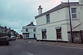
 The Britannia Inn - geograph.org.uk - 5009269.jpg 640 × 426; 62 KB
-
 The Britannia Inn - geograph.org.uk - 5009272.jpg 640 × 426; 51 KB
-
 The Britannia Inn - geograph.org.uk - 5572350.jpg 640 × 426; 74 KB
-
 The Jobcentre office in St Levan Road - geograph.org.uk - 6140821.jpg 1,024 × 768; 164 KB
-
 The Punchbowl, Premier Stores - geograph.org.uk - 5687827.jpg 640 × 426; 56 KB
-
 View from Mount Pleasant - NE - geograph.org.uk - 5400378.jpg 640 × 426; 78 KB


.jpg)
.jpg)
.jpg)
.jpg)
.jpg)
.jpg)


,_Plymouth_-_geograph.org.uk_-_4184834.jpg)


.jpg)
.jpg)
.jpg)


.jpg)


