Category:Middleton-on-the-Wolds
Jump to navigation
Jump to search
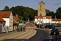
English: Middleton-on-the-Wolds is a village and civil parish on the Yorkshire Wolds in the East Riding of Yorkshire, England. It is situated on the A614 road mid way between Driffield and Market Weighton.
village in East Riding of Yorkshire, UK  | |||||
| Upload media | |||||
| Instance of | |||||
|---|---|---|---|---|---|
| Location | Middleton, East Riding of Yorkshire, Yorkshire and the Humber, England | ||||
 | |||||
Subcategories
This category has the following 3 subcategories, out of 3 total.
H
- Hedges in Middleton-on-the-Wolds (14 F)
T
- Trees in Middleton-on-the-Wolds (14 F)
Media in category "Middleton-on-the-Wolds"
The following 200 files are in this category, out of 250 total.
(previous page) (next page)-
 "Disused" Chalk pit - geograph.org.uk - 47551.jpg 640 × 480; 90 KB
-

-
 A snowy day - geograph.org.uk - 6972.jpg 640 × 480; 98 KB
-
 A wolds View - geograph.org.uk - 252099.jpg 640 × 480; 113 KB
-
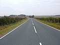
 A614 (geograph 5429799).jpg 640 × 426; 47 KB
-
 A614 - geograph.org.uk - 252095.jpg 640 × 480; 109 KB
-
 A614 - geograph.org.uk - 5429793.jpg 640 × 426; 46 KB
-
 A614 - geograph.org.uk - 5429800.jpg 640 × 426; 44 KB
-
 A614 from Middleton Wold Cottages - geograph.org.uk - 4465203.jpg 1,024 × 742; 297 KB
-
 A614 Middleton Wold - geograph.org.uk - 252094.jpg 640 × 480; 107 KB
-
 A614 Passing High Plantation - geograph.org.uk - 236889.jpg 640 × 426; 117 KB
-
 A614 towards Howden - geograph.org.uk - 1541063.jpg 640 × 480; 87 KB
-
 A614 towards Howden - geograph.org.uk - 1541072.jpg 640 × 480; 58 KB
-
 A614, Middleton on the Wolds - geograph.org.uk - 5429795.jpg 640 × 426; 79 KB
-
 A614, Middleton on the Wolds - geograph.org.uk - 5429798.jpg 640 × 400; 53 KB
-
 Access road to the A614 - geograph.org.uk - 4465246.jpg 1,024 × 768; 444 KB
-
 Access Track - geograph.org.uk - 279019.jpg 640 × 480; 77 KB
-

-
 Alongside the A614 - geograph.org.uk - 5898030.jpg 1,024 × 768; 236 KB
-
 Approaching the B1248, Station Road - geograph.org.uk - 2389598.jpg 800 × 600; 220 KB
-
 Autumn colours in Prickett's Hollow - geograph.org.uk - 6323498.jpg 1,024 × 768; 480 KB
-
 Autumn on the Yorkshire Wolds - geograph.org.uk - 4250355.jpg 4,608 × 3,456; 4.71 MB
-
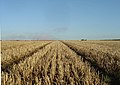 Autumn stubble - geograph.org.uk - 250863.jpg 640 × 454; 125 KB
-
 B1248 north of Lund - geograph.org.uk - 1445622.jpg 640 × 489; 180 KB
-
 B1248 towards Bainton - geograph.org.uk - 1496373.jpg 640 × 480; 53 KB
-
 B1248 towards Bainton - geograph.org.uk - 1496403.jpg 640 × 480; 72 KB
-
 Behind the hedge - geograph.org.uk - 4293528.jpg 1,024 × 768; 135 KB
-
 Behind the hedge - geograph.org.uk - 4321021.jpg 1,024 × 768; 185 KB
-
 Bend in the bridleway from nowhere - geograph.org.uk - 4293557.jpg 1,024 × 768; 164 KB
-
 Beverley Road - geograph.org.uk - 5251044.jpg 640 × 480; 80 KB
-
 Bridleway to nowhere - geograph.org.uk - 4293543.jpg 1,024 × 768; 155 KB
-
 Bridleway to nowhere - geograph.org.uk - 4293551.jpg 1,024 × 768; 165 KB
-
 Bridleway, Middleton Wold - geograph.org.uk - 1541080.jpg 640 × 480; 102 KB
-
 Burnby Wold Trig Point - geograph.org.uk - 448042.jpg 640 × 480; 156 KB
-

-
 Cemetery, Middleton-on-the-Wolds - geograph.org.uk - 5251074.jpg 640 × 480; 80 KB
-
 Chapel Lane - geograph.org.uk - 2098566.jpg 1,024 × 768; 116 KB
-
 Chapel Lane - geograph.org.uk - 582527.jpg 640 × 480; 78 KB
-
 Church of St Andrew - geograph.org.uk - 5429796.jpg 426 × 640; 58 KB
-

-
 Corrugated iron shed, Mount Pleasant - geograph.org.uk - 4321089.jpg 1,024 × 768; 253 KB
-
 Could have been a Pond - geograph.org.uk - 4465219.jpg 1,024 × 768; 566 KB
-
 Crossroads on the B1248 - geograph.org.uk - 6349457.jpg 1,024 × 667; 103 KB
-
 Derelict cottage, South Street - geograph.org.uk - 4321007.jpg 1,024 × 768; 179 KB
-
 Descending to Loaningdale Bottom (geograph 6299155).jpg 1,024 × 768; 123 KB
-
 Dew pond on a wolds farm - geograph.org.uk - 4465242.jpg 1,024 × 768; 403 KB
-
 Disused pit - geograph.org.uk - 4321033.jpg 1,024 × 768; 311 KB
-
 Disused pit and East Field - geograph.org.uk - 5252693.jpg 1,024 × 768; 189 KB
-
 Disused pit and field edge - geograph.org.uk - 5643334.jpg 1,024 × 755; 760 KB
-
 Disused pit on north side of Warter Road - geograph.org.uk - 5643333.jpg 1,024 × 764; 831 KB
-
 Disused Railway Line - geograph.org.uk - 6868.jpg 640 × 480; 117 KB
-
 East of Middleton on the Wolds - geograph.org.uk - 1176382.jpg 640 × 534; 196 KB
-
 East towards Kilnwick - geograph.org.uk - 2389573.jpg 800 × 600; 301 KB
-
 Elizabeth II postbox on Station Road, Middleton-on-the-Wolds - geograph.org.uk - 5249463.jpg 2,848 × 2,136; 1.42 MB
-
 Elizabeth II postbox, Middleton-on-the-Wolds Post Office - geograph.org.uk - 5250171.jpg 1,324 × 2,701; 849 KB
-
 Entering Middleton on the Wolds along Beverley Road - geograph.org.uk - 4187155.jpg 4,608 × 3,456; 3.91 MB
-

-
 Entering Middleton-on-the-Wolds - geograph.org.uk - 5251054.jpg 640 × 480; 63 KB
-
 Entrance to Wold House Farm (geograph 7040084).jpg 1,024 × 669; 183 KB
-
 Farm access road to A614 - geograph.org.uk - 4465228.jpg 1,024 × 756; 584 KB
-
 Farm buildings near Kilnwick (geograph 6349452).jpg 1,024 × 686; 137 KB
-
 Farm Buildings near Middleton Lodge - geograph.org.uk - 7515.jpg 640 × 480; 99 KB
-
 Farm Buildings, Middleton Lodge - geograph.org.uk - 1519022.jpg 640 × 480; 70 KB
-
 Farm buildings, Mount Pleasant - geograph.org.uk - 4321086.jpg 1,024 × 768; 212 KB
-

-
 Farm Machinery at Middleton Wold - geograph.org.uk - 236930.jpg 640 × 426; 142 KB
-
 Farm track near Kipling House Farm - geograph.org.uk - 5898017.jpg 1,024 × 768; 185 KB
-
 Farm track to Wold Dyke Farm - geograph.org.uk - 3629921.jpg 1,024 × 768; 142 KB
-
 Farmland north of Lund - geograph.org.uk - 1445760.jpg 640 × 515; 193 KB
-
 Farmland Opposite Kipling House - geograph.org.uk - 237125.jpg 640 × 426; 105 KB
-
 Farmland, Middleton Wold - geograph.org.uk - 1541085.jpg 640 × 480; 62 KB
-
 Farmland, Middleton Wold - geograph.org.uk - 1541093.jpg 640 × 480; 69 KB
-
 Farmland, Middleton Wold - geograph.org.uk - 1543067.jpg 640 × 480; 100 KB
-

-
 Field edge toward woodland - geograph.org.uk - 4434521.jpg 4,600 × 3,446; 5.15 MB
-
 Field Entrance off Beverley Road - geograph.org.uk - 1496322.jpg 640 × 456; 55 KB
-
 Field entrance off Beverley Road - geograph.org.uk - 5251046.jpg 640 × 480; 57 KB
-
 Field north of Lund - geograph.org.uk - 1445759.jpg 640 × 465; 185 KB
-
 Field path (geograph 6009971).jpg 1,024 × 768; 156 KB
-
 Field track - geograph.org.uk - 4321072.jpg 1,024 × 768; 187 KB
-
 Fields alongside fox covert - geograph.org.uk - 4187163.jpg 4,608 × 3,456; 4.06 MB
-
 Fields near Middleton-on-The-Wolds - geograph.org.uk - 6389763.jpg 1,024 × 768; 214 KB
-
 Fields north of Beverley Road - geograph.org.uk - 4187179.jpg 4,608 × 3,456; 3.6 MB
-
 Fields on Middleton Wold - geograph.org.uk - 3421397.jpg 640 × 618; 188 KB
-
 Footpath above Middleton Grange - geograph.org.uk - 8270.jpg 640 × 480; 91 KB
-
 Footpath and trees - geograph.org.uk - 4321105.jpg 1,024 × 768; 174 KB
-
 Footpath near Middleton on the Wolds - geograph.org.uk - 1176397.jpg 466 × 640; 193 KB
-
 Footpath near Middleton on the Wolds - geograph.org.uk - 1176411.jpg 507 × 640; 218 KB
-
 Footpath to Grange Farm - geograph.org.uk - 1519002.jpg 640 × 480; 86 KB
-
 Footpath to Middleton - geograph.org.uk - 4321143.jpg 1,024 × 768; 234 KB
-
 Footpath to Mount Pleasant from Beverley Road - geograph.org.uk - 4187173.jpg 4,608 × 3,456; 6.15 MB
-
 Footpath toward Middleton Grange Farm (geograph 5643324).jpg 1,024 × 767; 429 KB
-
 Front Street Court - geograph.org.uk - 582532.jpg 640 × 408; 62 KB
-
 Front Street, Middleton-on-the-Wolds - geograph.org.uk - 5251085.jpg 640 × 480; 61 KB
-
 Front Street, Middleton-on-the-Wolds - geograph.org.uk - 582510.jpg 640 × 480; 78 KB
-

-
 Frosty road - geograph.org.uk - 4293564.jpg 1,024 × 768; 151 KB
-
 Frozen trough and baled straw - geograph.org.uk - 4321148.jpg 1,024 × 768; 245 KB
-
 Goodmanham Road - geograph.org.uk - 1519043.jpg 640 × 480; 90 KB
-
 Goodmanham Road toward the A614 - geograph.org.uk - 4434510.jpg 4,608 × 3,456; 5.73 MB
-

-

-

-
 Horn Hill, chalk pit (aerial) - geograph.org.uk - 3128339.jpg 640 × 427; 54 KB
-
 Hornhill Top - geograph.org.uk - 110551.jpg 640 × 480; 196 KB
-
 Horsewold Farm - geograph.org.uk - 1541066.jpg 640 × 480; 54 KB
-
 Horsewold Farm - geograph.org.uk - 236920.jpg 640 × 426; 137 KB
-
 Horsewold Farm - geograph.org.uk - 252096.jpg 640 × 480; 141 KB
-
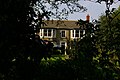 House on A614 at Middleton Wold - geograph.org.uk - 237129.jpg 640 × 426; 125 KB
-
 Houses on Church Hill - geograph.org.uk - 582520.jpg 640 × 480; 84 KB
-

-
 Kipling Cotes Derby Winning Post - geograph.org.uk - 5715634.jpg 1,024 × 768; 298 KB
-
 Kipling Cotes Race Course - geograph.org.uk - 1832668.jpg 640 × 480; 61 KB
-

-
 Kipling Cotes track - geograph.org.uk - 6299125.jpg 1,024 × 768; 227 KB
-
 Kipling House on A163 - geograph.org.uk - 236913.jpg 640 × 426; 134 KB
-
 Kiplingcoates Winning Post - geograph.org.uk - 2157134.jpg 3,000 × 4,000; 4.23 MB
-
 Kiplingcotes Derby Winning Post in sight - geograph.org.uk - 4250374.jpg 4,608 × 3,456; 5.9 MB
-
 Kiplingcotes Racecourse - geograph.org.uk - 2305086.jpg 1,024 × 768; 166 KB
-
 Looking back over the Kiplingcotes Racecourse - geograph.org.uk - 2305091.jpg 1,024 × 768; 163 KB
-
 Looking down on the drinkers - geograph.org.uk - 2098570.jpg 1,024 × 768; 109 KB
-
 Looking North West Near Wold House Farm - geograph.org.uk - 236916.jpg 640 × 426; 113 KB
-
 Lund to Bainton B1248 - geograph.org.uk - 1870746.jpg 2,816 × 2,112; 2.46 MB
-
 Methodist Church Middleton on the Wolds.jpg 432 × 280; 14 KB
-
 Middleton Grange Farm - geograph.org.uk - 6389752.jpg 1,024 × 768; 157 KB
-
 Middleton on the Wolds - geograph.org.uk - 7103.jpg 640 × 480; 94 KB
-
 Middleton on the Wolds Post Office - geograph.org.uk - 2098567.jpg 1,024 × 768; 123 KB
-
 Middleton on the Wolds UK parish locator map.svg 1,425 × 1,107; 1.68 MB
-
 Middleton on the Wolds.jpg 640 × 426; 122 KB
-
 Middleton parish boundary - geograph.org.uk - 250868.jpg 640 × 480; 139 KB
-
 Middleton Quarry - geograph.org.uk - 1496290.jpg 640 × 480; 59 KB
-
 Middleton Quarry, East Yorks - geograph.org.uk - 3421739.jpg 640 × 480; 202 KB
-

-
 Middleton Wold - geograph.org.uk - 1519053.jpg 640 × 480; 67 KB
-
 Middleton Wold - geograph.org.uk - 208949.jpg 640 × 480; 118 KB
-
 Middleton Wold - geograph.org.uk - 2333510.jpg 640 × 480; 66 KB
-
 Middleton Wold - geograph.org.uk - 270738.jpg 640 × 480; 138 KB
-
 Middleton Wood - geograph.org.uk - 1176459.jpg 473 × 640; 215 KB
-
 Middleton Wood - geograph.org.uk - 7692.jpg 640 × 480; 180 KB
-
 Middleton-on-the-Wolds - geograph.org.uk - 2115081.jpg 800 × 600; 199 KB
-
 Middleton-on-The-Wolds - geograph.org.uk - 3403446.jpg 781 × 1,024; 274 KB
-
 Middleton-on-the-Wolds - geograph.org.uk - 5251087.jpg 640 × 480; 65 KB
-
 Middleton-on-the-Wolds Post Office - geograph.org.uk - 5250172.jpg 2,848 × 2,136; 1.36 MB
-
 Middleton-on-the-Wolds railway station (site), Yorkshire (geograph 3519963).jpg 1,024 × 768; 205 KB
-

-
 Mineral Works - geograph.org.uk - 3235558.jpg 640 × 571; 198 KB
-

-
 Minor road to Kilnwick - geograph.org.uk - 3234667.jpg 640 × 427; 145 KB
-
 Minor road to Kilnwick - geograph.org.uk - 3958967.jpg 4,000 × 3,000; 3.14 MB
-
 Minor Road Towards Kilnwick - geograph.org.uk - 1496254.jpg 640 × 480; 85 KB
-
 Minor Road Towards Kilnwick - geograph.org.uk - 1496410.jpg 640 × 480; 68 KB
-
 Minor Road Towards Lund - geograph.org.uk - 1496316.jpg 640 × 480; 58 KB
-
 Minor Road Towards Middleton - geograph.org.uk - 1519013.jpg 640 × 480; 69 KB
-
 Minor Road Towards North Dalton - geograph.org.uk - 1496283.jpg 640 × 480; 44 KB
-
 Minor Road Towards Warter - geograph.org.uk - 1541101.jpg 640 × 480; 55 KB
-
 Minor Road Towards Warter - geograph.org.uk - 1541103.jpg 640 × 480; 68 KB
-
 Mount Pleasant Farm - geograph.org.uk - 110560.jpg 640 × 480; 125 KB
-
 Mount Pleasant Farm - geograph.org.uk - 4321092.jpg 1,024 × 768; 285 KB
-
 Mount Pleasant Farm, near Middleton - geograph.org.uk - 1176391.jpg 640 × 434; 177 KB
-
 NE of Middleton on-the-Wolds - geograph.org.uk - 110555.jpg 640 × 480; 198 KB
-
 New wind turbine - geograph.org.uk - 3629910.jpg 1,024 × 768; 144 KB
-
-
 Old pit with new trees - geograph.org.uk - 4293547.jpg 1,024 × 768; 227 KB
-
 On Middleton Wold, E. Yorks - geograph.org.uk - 3421365.jpg 518 × 640; 207 KB
-
 Path towards Farberry Plantation (geograph 6511732).jpg 1,600 × 1,065; 296 KB
-
 Pickering Park from Station Road - geograph.org.uk - 4187148.jpg 4,608 × 3,456; 3.05 MB
-
 Pigeon Cote Farm - geograph.org.uk - 4321014.jpg 1,024 × 768; 165 KB
-
 Plantation and field at Kipling House Farm - geograph.org.uk - 4250359.jpg 4,608 × 3,456; 5.87 MB
-
 Planting potatoes - geograph.org.uk - 8905.jpg 640 × 480; 125 KB
-
 Prickett Walk Plantation - geograph.org.uk - 6299121.jpg 1,015 × 1,024; 262 KB
-
 Prickett's Hollow - geograph.org.uk - 7686.jpg 640 × 480; 118 KB
-
 Ripening grain between Warter and Middleton - geograph.org.uk - 4601806.jpg 2,592 × 1,456; 2.99 MB
-
 Sheep at Grange Farm - geograph.org.uk - 3422093.jpg 640 × 504; 180 KB
-

-
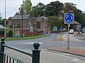
 Slow down, roundabout - geograph.org.uk - 2098564.jpg 1,024 × 768; 159 KB
-
 Snow beyond the trees - geograph.org.uk - 4321141.jpg 1,024 × 768; 319 KB
-
 Snowy field - geograph.org.uk - 4321137.jpg 1,024 × 768; 189 KB
-
 South Street, Middleton on the Wolds - geograph.org.uk - 1175882.jpg 640 × 510; 214 KB
-
 South-east of Middleton on the Wolds - geograph.org.uk - 1176441.jpg 426 × 640; 221 KB
-

-
 St Andrew's Church, Middleton-on-the-Wold - geograph.org.uk - 5466249.jpg 799 × 1,200; 294 KB
-
 St Andrew's Church, Middleton-on-the-Wold - geograph.org.uk - 5466254.jpg 378 × 1,200; 210 KB
-
 St Andrew's Church, Middleton-on-the-Wold - geograph.org.uk - 5467156.jpg 950 × 1,200; 581 KB
-
 St Andrew's Church, Middleton-on-the-Wold - geograph.org.uk - 5467161.jpg 407 × 1,200; 272 KB
-
 St Andrew's Church, Middleton-on-the-Wold - geograph.org.uk - 5467163.jpg 708 × 1,200; 442 KB
-
 St Andrew's Church, Middleton-on-the-Wold - geograph.org.uk - 5467188.jpg 771 × 1,200; 418 KB
-
 St Andrew's Church, Middleton-on-the-Wold - geograph.org.uk - 5467193.jpg 814 × 1,200; 432 KB
-
 St Andrew's Church, Middleton-on-the-Wold - geograph.org.uk - 5467197.jpg 1,200 × 799; 323 KB
-
 St Andrew's Church, Middleton-on-the-Wold - geograph.org.uk - 5467203.jpg 799 × 1,200; 340 KB
-
 St Andrew's Church, Middleton-on-the-Wold - geograph.org.uk - 5467207.jpg 773 × 1,200; 422 KB
-

-
 Station Road - geograph.org.uk - 3403478.jpg 1,024 × 783; 239 KB
-
 Station Road, Middleton on the Wolds - geograph.org.uk - 1175860.jpg 640 × 409; 200 KB
-
 Station Road, Middleton-on-the-Wolds - geograph.org.uk - 5249467.jpg 2,848 × 2,136; 1.46 MB
-
 Station Road, Middleton-on-The-Wolds - geograph.org.uk - 6389771.jpg 1,024 × 727; 179 KB
-
 Supplemental for SE9150 - geograph.org.uk - 59032.jpg 640 × 480; 93 KB
-
 Telephone box, Middleton-on-the-Wolds - geograph.org.uk - 5251089.jpg 640 × 480; 104 KB
-
 Telephone Exchange, Middleton-on-the-Wolds - geograph.org.uk - 3258113.jpg 3,072 × 2,304; 1.74 MB
-
 The A614 toward Holme on Spalding Moor - geograph.org.uk - 4465186.jpg 1,024 × 768; 384 KB
-


.jpg)


.jpg)


.jpg)

.jpg)


.jpg)


.jpg)


_(30433370076).jpg)


_-_geograph.org.uk_-_3128339.jpg)


,_Yorkshire_(geograph_3519963).jpg)


.jpg)


