Category:Metropolitan Borough of North Tyneside
Jump to navigation
Jump to search
metropolitan borough of Tyne and Wear, in North East England   .svg) | |||||
| Upload media | |||||
| Instance of | |||||
|---|---|---|---|---|---|
| Location | Tyne and Wear, North East England, England | ||||
| Located in or next to body of water | |||||
| Capital | |||||
| Legislative body |
| ||||
| Inception |
| ||||
| Population |
| ||||
| Area |
| ||||
| Replaces | |||||
| official website | |||||
 | |||||
Subcategories
This category has the following 20 subcategories, out of 20 total.
Media in category "Metropolitan Borough of North Tyneside"
The following 200 files are in this category, out of 2,942 total.
(previous page) (next page)-
 "Perfect" Chinese Takeaway - geograph.org.uk - 5063590.jpg 640 × 480; 225 KB
-
 "Rugged Landscape", Redburn Dene - geograph.org.uk - 4682890.jpg 640 × 480; 423 KB
-
 "Rugged Landscape", Redburn Dene - geograph.org.uk - 4682892.jpg 640 × 480; 415 KB
-
 "Sandcastles", Whitley Bay (2) - geograph.org.uk - 5550908.jpg 640 × 480; 46 KB
-
 "Sandcastles", Whitley Bay - geograph.org.uk - 5550902.jpg 640 × 480; 47 KB
-
 "Spirit of the Tyne" - geograph.org.uk - 4683101.jpg 640 × 480; 377 KB
-
 "The Cumberland Arms", Tynemouth - geograph.org.uk - 5832506.jpg 1,267 × 1,600; 597 KB
-
 "Tyne anew" - geograph.org.uk - 4683015.jpg 480 × 640; 361 KB
-
 "Welcome to Whitley Bay" - geograph.org.uk - 3334127.jpg 640 × 427; 257 KB
-

-
 'Blucher', Killingworth - geograph.org.uk - 4810967.jpg 4,000 × 3,000; 4.86 MB
-
-
 'Global Rainbow', Whitley Bay - geograph.org.uk - 2831241.jpg 1,024 × 769; 92 KB
-
 'Global Rainbow', Whitley Bay - geograph.org.uk - 2831263.jpg 1,024 × 641; 86 KB
-
 'Global Rainbow', Whitley Bay - geograph.org.uk - 2832413.jpg 1,024 × 641; 124 KB
-

-
 'Historic' gas substation, Buddle Street - geograph.org.uk - 3578368.jpg 1,024 × 768; 279 KB
-
 'Iron House', 5 Marden Terrace, Cullercoats - geograph.org.uk - 4746919.jpg 750 × 1,024; 211 KB
-

-
 'Pride of the Tyne' - geograph.org.uk - 5081625.jpg 640 × 480; 159 KB
-
 'Princess Seaways' passing up the River Tyne - geograph.org.uk - 3583285.jpg 1,024 × 768; 153 KB
-
 'Pulse', Four Lane Ends Metro Station - geograph.org.uk - 4745053.jpg 1,024 × 768; 206 KB
-
 'Shatila Art', Tynemouth Metro Station - geograph.org.uk - 4747004.jpg 1,024 × 768; 220 KB
-
 'Total Policing' - geograph.org.uk - 2956580.jpg 1,704 × 2,272; 2.63 MB
-

-

-

-
 (The rear of) Huntington Place, NE30 - geograph.org.uk - 4187700.jpg 640 × 480; 89 KB
-
 1 and 2, Lovaine Terrace, North Shields - geograph.org.uk - 5202004.jpg 1,040 × 689; 198 KB
-
 19th Century Cottages - geograph.org.uk - 2159748.jpg 640 × 427; 93 KB
-
 48 Percy Gardens - geograph.org.uk - 4828254.jpg 1,200 × 1,600; 342 KB
-
 65858 at Middle Engine - geograph.org.uk - 3733362.jpg 798 × 596; 269 KB
-
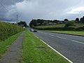
 A bend in Holystone Way (A191) - geograph.org.uk - 3583561.jpg 640 × 480; 64 KB
-
 A bend in Red House Drive - geograph.org.uk - 3583106.jpg 640 × 480; 57 KB
-
 A Big Sky - geograph.org.uk - 2991067.jpg 2,254 × 1,429; 1.55 MB
-
 A corner of Murton village - geograph.org.uk - 5063023.jpg 640 × 480; 272 KB
-
 A Fisheries Patrol vessel - geograph.org.uk - 5081617.jpg 640 × 480; 193 KB
-
 A pair of donkeys - geograph.org.uk - 2817793.jpg 640 × 480; 104 KB
-
 A selection of cranes - geograph.org.uk - 597025.jpg 640 × 425; 57 KB
-
 A sign calling for discretion - geograph.org.uk - 2619276.jpg 3,872 × 2,592; 4.11 MB
-
 A smuggler's cave, Cullercoats - geograph.org.uk - 5912453.jpg 2,702 × 3,837; 1.91 MB
-
 A Street Party in Newcastle, 2012 - geograph.org.uk - 4498731.jpg 3,805 × 2,854; 3.36 MB
-

-
 A view of the former Bull Ring Docks site (geograph 2367337).jpg 3,648 × 2,736; 1.56 MB
-
 A ^ P's Tyne yard - geograph.org.uk - 4109897.jpg 1,600 × 948; 199 KB
-
 A1 - A19 Junction - geograph.org.uk - 2578896.jpg 640 × 332; 31 KB
-
 A1 - geograph.org.uk - 4867230.jpg 1,024 × 768; 275 KB
-
 A1 at Seaton Burn - geograph.org.uk - 3762843.jpg 640 × 480; 57 KB
-
 A1 bridge over Coach Lane, Hazelrigg - geograph.org.uk - 5260704.jpg 4,000 × 3,000; 4.91 MB
-
 A1 bypassing Seaton Burn - geograph.org.uk - 4867239.jpg 1,024 × 768; 259 KB
-
 A1 southbound towards Newcastle - geograph.org.uk - 3058372.jpg 640 × 480; 73 KB
-
 A1-A19 junction, Seton Burn - geograph.org.uk - 4867236.jpg 1,024 × 768; 317 KB
-
 A167 Howdon Road, North Shields - geograph.org.uk - 5833584.jpg 1,024 × 724; 102 KB
-
 A187 approaching roundabout - geograph.org.uk - 2973750.jpg 640 × 480; 58 KB
-
 A187 Hadrian Road - geograph.org.uk - 5832360.jpg 1,024 × 795; 98 KB
-
 A187 heading west - geograph.org.uk - 2879483.jpg 640 × 480; 82 KB
-
 A187 heading west - geograph.org.uk - 2879595.jpg 640 × 480; 48 KB
-
 A187 Howdon Road - geograph.org.uk - 5832372.jpg 1,024 × 768; 110 KB
-
 A187 Saville Street, North Shields - geograph.org.uk - 5832381.jpg 1,024 × 745; 145 KB
-
 A187 spur - geograph.org.uk - 4866793.jpg 1,024 × 768; 247 KB
-
 A187 Tyne View Terrace - geograph.org.uk - 5832366.jpg 1,024 × 740; 96 KB
-
 A187-A193 junction - geograph.org.uk - 4866821.jpg 1,024 × 768; 314 KB
-
 A189 heading east - geograph.org.uk - 3584005.jpg 640 × 480; 67 KB
-
 A19 - geograph.org.uk - 3274983.jpg 640 × 360; 215 KB
-
 A19 bridge over Burradon Waggonway - geograph.org.uk - 4393654.jpg 4,000 × 3,000; 2.7 MB
-
 A19 heading north - geograph.org.uk - 3583734.jpg 640 × 480; 72 KB
-
 A19 looking northwards - geograph.org.uk - 4197721.jpg 640 × 480; 61 KB
-
 A19-A1058 Coast Road junction improvement - geograph.org.uk - 6026688.jpg 1,600 × 1,037; 330 KB
-
 A192 towards Earsdon - geograph.org.uk - 3058944.jpg 640 × 480; 67 KB
-

-
 A193 heading east - geograph.org.uk - 2973731.jpg 640 × 480; 46 KB
-
 A193 heading north - geograph.org.uk - 2974027.jpg 640 × 480; 50 KB
-
 A193 heading north - geograph.org.uk - 2974033.jpg 640 × 480; 66 KB
-
 A193 The Links at The Briar Dene - geograph.org.uk - 5832405.jpg 1,024 × 672; 79 KB
-
 A193 The Links, Whitley Bay - geograph.org.uk - 5832401.jpg 1,024 × 754; 99 KB
-
 A193 towards Seaton Sluice - geograph.org.uk - 2974036.jpg 640 × 480; 51 KB
-
 Aaaah...the Dome^ - geograph.org.uk - 4776928.jpg 640 × 480; 257 KB
-
 Abandoned Spade - geograph.org.uk - 2854579.jpg 1,676 × 2,026; 2.59 MB
-
 Abbots Way, North Tyneside - geograph.org.uk - 2697004.jpg 640 × 480; 49 KB
-
 Abbotsford Park, Monkseaton - geograph.org.uk - 6234561.jpg 1,024 × 768; 221 KB
-
 Above Long Sands, Tynemouth - geograph.org.uk - 6078209.jpg 895 × 1,024; 767 KB
-
 Abutement of Bridge, North Tyne, drawn by J.S. Kell.jpg 720 × 495; 142 KB
-
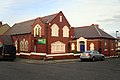 Acorn Community Church - geograph.org.uk - 3334128.jpg 640 × 427; 225 KB
-
 Across the causeway - geograph.org.uk - 3593154.jpg 640 × 428; 75 KB
-

-
 Across the Tyne from North Shields - geograph.org.uk - 3204232.jpg 1,024 × 681; 201 KB
-
 Activity at sea off South Shields - geograph.org.uk - 5199509.jpg 640 × 480; 34 KB
-
 Addington Drive - geograph.org.uk - 3582962.jpg 640 × 480; 58 KB
-
 Admiral Lord Collingwood - geograph.org.uk - 5378058.jpg 1,600 × 1,019; 160 KB
-

-
 Adventure Golf Course, Tynemouth - geograph.org.uk - 4835149.jpg 2,048 × 1,536; 1.24 MB
-
 After the harvester... - geograph.org.uk - 5064814.jpg 640 × 481; 321 KB
-
 After the storm - geograph.org.uk - 4776920.jpg 640 × 480; 316 KB
-
 After the storm - geograph.org.uk - 4777042.jpg 640 × 444; 246 KB
-
 After the storm - geograph.org.uk - 4777421.jpg 640 × 480; 288 KB
-
 After the storm - geograph.org.uk - 4777423.jpg 640 × 522; 328 KB
-
 After the storm - geograph.org.uk - 4777425.jpg 640 × 503; 255 KB
-
 Aidavita cruise liner enters the Tyne - geograph.org.uk - 5512319.jpg 5,289 × 2,913; 1.61 MB
-
 Air Cadets Recruitment - geograph.org.uk - 2858116.jpg 800 × 449; 96 KB
-
 Albert Edward Dock - geograph.org.uk - 3001648.jpg 640 × 480; 483 KB
-
 Albion Inn - geograph.org.uk - 2076557.jpg 2,951 × 2,405; 840 KB
-
 Aldi supermarket, Hillheads Road, Whitley Bay - geograph.org.uk - 5691294.jpg 2,000 × 1,500; 288 KB
-
 Aldi supermarket, Palmersville - geograph.org.uk - 5297180.jpg 2,000 × 1,500; 318 KB
-
 Alexander George, arrested for stealing a purse (28065712265).jpg 660 × 900; 154 KB
-
 Alexandra Cars - geograph.org.uk - 2543072.jpg 1,280 × 960; 1.07 MB
-
 Alfresco Living - geograph.org.uk - 2818693.jpg 2,224 × 1,258; 1.37 MB
-
 Algernon Place, Whitley Bay - geograph.org.uk - 2619167.jpg 3,872 × 2,592; 3.57 MB
-
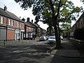
 Allendale Place crosses Front Street - geograph.org.uk - 2925329.jpg 1,500 × 986; 185 KB
-
 Allendale Place, NE30 (2) - geograph.org.uk - 4187696.jpg 640 × 480; 127 KB
-
 Allendale Place, NE30 - geograph.org.uk - 4187693.jpg 640 × 480; 96 KB
-

-
 Allotments - geograph.org.uk - 2834088.jpg 2,256 × 1,397; 1.75 MB
-
 Allotments on Clousden Drive, Longbenton - geograph.org.uk - 3767835.jpg 640 × 480; 122 KB
-
 Allotments on Clousden Drive, Longbenton - geograph.org.uk - 3767840.jpg 640 × 480; 122 KB
-
 Allotments west of Pier Road, NE30 - geograph.org.uk - 4130008.jpg 640 × 480; 138 KB
-
 Along Earsdon Road, Shiremoor - geograph.org.uk - 3056730.jpg 4,000 × 3,000; 3.57 MB
-
 Along the side of the Meadow - geograph.org.uk - 2990198.jpg 480 × 640; 143 KB
-
 Also for in-line skaters - geograph.org.uk - 3768607.jpg 640 × 480; 100 KB
-
 Alterations at the Station Hotel - geograph.org.uk - 3334148.jpg 640 × 480; 297 KB
-
 Ambulance on station at North Tyneside General Hospital - geograph.org.uk - 3053601.jpg 1,600 × 1,200; 323 KB
-
 Amec Way - geograph.org.uk - 5656119.jpg 1,024 × 768; 281 KB
-
 Amici Restaurant - geograph.org.uk - 3167270.jpg 4,608 × 3,456; 3.17 MB
-
 An Inviting Grassy Track - geograph.org.uk - 2978046.jpg 461 × 640; 101 KB
-
 Annitsford Newsagents - geograph.org.uk - 3060693.jpg 640 × 484; 73 KB
-
 Annitsford pond - geograph.org.uk - 5388761.jpg 640 × 480; 89 KB
-
 Apartment block, New Quay, North Shields - geograph.org.uk - 5152248.jpg 2,000 × 1,500; 434 KB
-

-
 Apartments, New Quay, North Shields - geograph.org.uk - 5152245.jpg 1,500 × 2,000; 492 KB
-
 Approaching High Barnes - geograph.org.uk - 5612913.jpg 2,000 × 1,500; 382 KB
-
 Approaching North Shields slipway - geograph.org.uk - 5123406.jpg 5,376 × 2,423; 1.59 MB
-
 Approaching the main roundabout, West Moor - geograph.org.uk - 3706892.jpg 1,024 × 767; 107 KB
-
 Arable field at High Barnes - geograph.org.uk - 5612919.jpg 2,000 × 1,500; 419 KB
-
 Arable field beside South Wellfield - geograph.org.uk - 5985658.jpg 2,000 × 1,333; 320 KB
-
 Arable field, north of West Holywell - geograph.org.uk - 5273316.jpg 2,000 × 1,500; 381 KB
-
 Arable field, Palmersville - geograph.org.uk - 5297177.jpg 2,000 × 1,500; 267 KB
-
 Arable land beside Rake Lane - geograph.org.uk - 5694740.jpg 2,000 × 1,500; 532 KB
-
 Arable land north of Killingworth - geograph.org.uk - 5652088.jpg 2,000 × 1,500; 425 KB
-
 Arable land, Burradon - geograph.org.uk - 4867200.jpg 1,024 × 768; 406 KB
-
 Arable land, Murton - geograph.org.uk - 5694763.jpg 2,000 × 1,500; 671 KB
-

-
 Archer Street (B1315) heading east - geograph.org.uk - 2973704.jpg 640 × 480; 44 KB
-
 Arches under Road - geograph.org.uk - 2818662.jpg 2,272 × 1,704; 1.92 MB
-
 Archway - geograph.org.uk - 4728182.jpg 640 × 480; 81 KB
-
 Archway, Rising Sun Country Park - geograph.org.uk - 3368753.jpg 640 × 480; 106 KB
-
 Aroma Cafe - geograph.org.uk - 3204183.jpg 1,024 × 768; 375 KB
-
 Art works, Redburn Dene - geograph.org.uk - 4682858.jpg 640 × 480; 544 KB
-
 ASDA at Wallsend - geograph.org.uk - 3029241.jpg 2,848 × 2,144; 1.52 MB
-
 Asda supermarket, Benton - geograph.org.uk - 5293749.jpg 2,000 × 1,500; 285 KB
-
 Ashwood Grove, Wideopen - geograph.org.uk - 3583812.jpg 640 × 480; 75 KB
-
 Aston Martin dealership, Cobalt Business Park - geograph.org.uk - 5375528.jpg 2,000 × 1,500; 337 KB
-
 Autumn leaves, Addington Crescent - geograph.org.uk - 3202597.jpg 640 × 480; 110 KB
-
 Autumn ploughing - geograph.org.uk - 3202434.jpg 640 × 480; 81 KB
-
 B ^ M Bargains, Whitley Bay - geograph.org.uk - 4843710.jpg 2,048 × 1,536; 1.02 MB
-
 B1317 - geograph.org.uk - 4867130.jpg 1,024 × 768; 337 KB
-
 B1317 heading north - geograph.org.uk - 3583718.jpg 640 × 480; 74 KB
-
 B1317 heading north - geograph.org.uk - 3583731.jpg 640 × 480; 73 KB
-
 B1318 heading north through Wideopen - geograph.org.uk - 3583800.jpg 640 × 480; 68 KB
-
 B1321 towards Seaton Burn - geograph.org.uk - 3060688.jpg 640 × 480; 76 KB
-
 B1322 heading north towards Seghill - geograph.org.uk - 3060666.jpg 640 × 480; 71 KB
-
 B1322 heading south - geograph.org.uk - 3060654.jpg 640 × 480; 79 KB
-
 B1322 towards Seghill - geograph.org.uk - 3060657.jpg 640 × 480; 87 KB
-
 Back lane behind Eastbourne Gardens, Whitley Bay - geograph.org.uk - 6234102.jpg 1,024 × 768; 176 KB
-
 Back lane off Eastbourne Gardens, Whitley Bay - geograph.org.uk - 6234554.jpg 1,024 × 768; 156 KB
-
 Back lane off Promenade, Whitley Bay - geograph.org.uk - 4745979.jpg 1,024 × 754; 125 KB
-
 Back passage in Howdon - geograph.org.uk - 5377008.jpg 6,000 × 4,000; 5.12 MB
-
 Backworth ambulance station - geograph.org.uk - 5269538.jpg 2,000 × 1,500; 359 KB
-
 Backworth Club - geograph.org.uk - 4728125.jpg 640 × 480; 74 KB
-
 Backworth Club, Backworth - geograph.org.uk - 5269546.jpg 2,000 × 1,500; 433 KB
-
 Backworth Colliery Railway - geograph.org.uk - 4866852.jpg 1,024 × 768; 311 KB
-
 Backworth Colliery Railway - geograph.org.uk - 4866869.jpg 1,024 × 768; 393 KB
-
 Backworth Post Office and shop - geograph.org.uk - 4867125.jpg 640 × 480; 97 KB
-
 Backworth Village Hall - geograph.org.uk - 4395173.jpg 4,000 × 3,000; 2.66 MB
-
 Backworth Village Hall - geograph.org.uk - 5269633.jpg 2,000 × 1,500; 572 KB
-
 Backworth Waggonway leading onto Fisher Lane - geograph.org.uk - 5258415.jpg 4,800 × 3,200; 6.15 MB
-
 Backworth War Memorial - geograph.org.uk - 4393701.jpg 3,000 × 4,000; 2.63 MB
-
 Backworth War Memorial - geograph.org.uk - 5269554.jpg 1,500 × 2,000; 551 KB
-
 Bales at Rising Sun Farm - geograph.org.uk - 5293480.jpg 2,000 × 1,500; 406 KB
-
 Ballast Hill - geograph.org.uk - 2076636.jpg 3,888 × 1,468; 623 KB
-
 Bamburgh Road - geograph.org.uk - 3583578.jpg 640 × 480; 53 KB
-
 Bamburgh Road, Longbenton - geograph.org.uk - 3767827.jpg 640 × 480; 70 KB
-
 Bandstand - geograph.org.uk - 2799000.jpg 1,930 × 1,480; 1.81 MB
-

-
 Barley near Briar Dene Farm - geograph.org.uk - 5106123.jpg 2,000 × 1,500; 705 KB
-
 Bath Terrace - geograph.org.uk - 4728178.jpg 640 × 480; 98 KB
-
 Bath Terrace, NE30 - geograph.org.uk - 4187691.jpg 640 × 480; 106 KB
-
 Battle Hill Drive - geograph.org.uk - 3582947.jpg 640 × 480; 62 KB
-
 Beach and rocks at Sharpness Point - geograph.org.uk - 4189122.jpg 640 × 480; 46 KB
-
 Beach at Cullercoats - geograph.org.uk - 2973996.jpg 640 × 480; 44 KB
-
 Beach at Whitley Bay - geograph.org.uk - 3593141.jpg 640 × 428; 77 KB
-
 Beach café at Whitley Sands - geograph.org.uk - 5551386.jpg 640 × 480; 85 KB
-
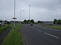
 Beach Road (A1058) - geograph.org.uk - 4043338.jpg 640 × 481; 294 KB
-
 Beach, Curry's Point - geograph.org.uk - 2974049.jpg 640 × 480; 67 KB
-
 Beach, King Edward's Bay, Tynemouth - geograph.org.uk - 5777340.jpg 2,000 × 1,333; 370 KB
-
 Beach, The Flats - geograph.org.uk - 2973855.jpg 640 × 480; 61 KB
-

-
 Beacon Centre, Saville Street, North Shields - geograph.org.uk - 3593482.jpg 1,024 × 768; 221 KB
-
 Beacon Hill School, Wallsend - geograph.org.uk - 5293735.jpg 2,000 × 1,500; 292 KB
-
-
 Beacon House, 1 Trinity Buildings, North Shields - geograph.org.uk - 3591975.jpg 1,024 × 768; 184 KB
-


_-_geograph.org.uk_-_5550908.jpg)


_-_geograph.org.uk_-_3578378.jpg)


_Huntington_Place,_NE30_-_geograph.org.uk_-_4187700.jpg)


_-_geograph.org.uk_-_3583561.jpg)


.jpg)


.jpg)


_-_geograph.org.uk_-_4187696.jpg)


_heading_east_-_geograph.org.uk_-_2973704.jpg)


_-_geograph.org.uk_-_4043338.jpg)


_-_geograph.org.uk_-_3591983.jpg)