Category:Metropolitan Borough of Calderdale
Jump to navigation
Jump to search

metropolitan borough in West Yorkshire, United Kingdom   | |||||
| Upload media | |||||
| Instance of | |||||
|---|---|---|---|---|---|
| Location | West Yorkshire, Yorkshire and the Humber, England | ||||
| Capital | |||||
| Legislative body |
| ||||
| Inception |
| ||||
| Population |
| ||||
| Area |
| ||||
| official website | |||||
 | |||||
Subcategories
This category has the following 31 subcategories, out of 31 total.
*
H
R
S
T
W
Media in category "Metropolitan Borough of Calderdale"
The following 80 files are in this category, out of 80 total.
-

-
 Bank Street car park, Brighouse - geograph.org.uk - 6349658.jpg 2,000 × 1,500; 1.68 MB
-
 Bank Street, Brighouse - geograph.org.uk - 6348896.jpg 2,000 × 1,500; 1.15 MB
-
 Brighouse Ambulance Station - geograph.org.uk - 6356724.jpg 2,000 × 1,240; 847 KB
-
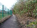
 Brighouse Footpath 64 (east branch) - geograph.org.uk - 6348371.jpg 2,000 × 1,500; 1.7 MB
-
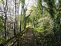
 Brighouse Footpath 64 (east branch) - geograph.org.uk - 6348376.jpg 2,000 × 1,501; 1.47 MB
-
 Brighouse Footpath 64 (east branch) from Footpath 64 - geograph.org.uk - 6348131.jpg 2,000 × 1,500; 1.83 MB
-
 Brighouse Footpath 64-1 - geograph.org.uk - 6348384.jpg 2,000 × 1,500; 1.55 MB
-
 Brighouse Methodist Church and Sunday School - geograph.org.uk - 6349797.jpg 2,000 × 2,000; 1.26 MB
-
 Brighouse Wood Row approaching Brighouse Wood Lane - geograph.org.uk - 6348796.jpg 2,000 × 1,330; 1.18 MB
-
 Calder Valley View, Sunnybank Road, Brighouse - geograph.org.uk - 6349623.jpg 2,000 × 1,333; 858 KB
-
 Christmas flowers, Church Lane, Brighouse - geograph.org.uk - 6354458.jpg 2,000 × 2,000; 1.8 MB
-
 Cottages and The Tower, Brighouse - geograph.org.uk - 6348813.jpg 2,000 × 2,000; 1.75 MB
-
 Derelict seat near Ganny Lock, Brighouse - geograph.org.uk - 6348880.jpg 2,000 × 1,500; 1.75 MB
-
 Disused gateway, Brookfoot Lane, Southowram - geograph.org.uk - 6347798.jpg 2,000 × 1,500; 1.13 MB
-
 Dumb Steeple - geograph.org.uk - 6347895.jpg 2,000 × 1,095; 2.78 MB
-
 Dumb Steeple - geograph.org.uk - 6347896.jpg 1,340 × 2,000; 4.14 MB
-
 Entrance to a subway under Ludenscheid Link, Brighouse - geograph.org.uk - 6349853.jpg 2,000 × 1,500; 1.88 MB
-

-
 Fatshedera flowers, Bradford Road subway, Brighouse - geograph.org.uk - 6350380.jpg 2,000 × 1,500; 946 KB
-
 Flood mark on a garden wall, Brighouse - geograph.org.uk - 6360178.jpg 2,000 × 1,497; 1.2 MB
-
 Footpath between the church and Waterloo Road, Brighouse - geograph.org.uk - 6346943.jpg 2,000 × 1,500; 1.66 MB
-
 Footpath from Halifax Road to Bank Street, Brighouse - geograph.org.uk - 6349661.jpg 2,000 × 1,500; 1.9 MB
-
 Footpath from Rydings Avenue to Halifax Road - geograph.org.uk - 6356710.jpg 2,000 × 1,500; 1.29 MB
-

-
 Former lane to Slead Sike Mill (Woollen), Brighouse - geograph.org.uk - 6347787.jpg 2,000 × 1,500; 1.38 MB
-

-
 Houses on the site of the Fire Station, Brighouse - geograph.org.uk - 6355560.jpg 2,000 × 1,198; 721 KB
-
 In Brighouse Churchyard - geograph.org.uk - 6355588.jpg 2,000 × 1,497; 1.82 MB
-
 In the churchyard, Brighouse - geograph.org.uk - 6355582.jpg 2,000 × 1,497; 1.67 MB
-
 Lamp post in a field, Brighouse - geograph.org.uk - 6348136.jpg 2,000 × 1,335; 1.47 MB
-
 Lane Head Hotel, Brighouse Wood Lane, Brighouse - geograph.org.uk - 6355492.jpg 2,000 × 1,335; 883 KB
-
 Lane off High Street, Brighouse - geograph.org.uk - 6356736.jpg 2,000 × 1,499; 1.52 MB
-
 Ludensceid Link. Brighouse - geograph.org.uk - 6350362.jpg 1,955 × 1,467; 1.38 MB
-

-
 Memorial seat decorated for Christmas, Brighouse - geograph.org.uk - 6347725.jpg 2,000 × 1,500; 1.02 MB
-
 Money-making trap. Bradford Road, Brighouse - geograph.org.uk - 6356783.jpg 2,000 × 1,501; 1,008 KB
-

-
 New office building, Bank Street, Brighouse - geograph.org.uk - 6348937.jpg 2,000 × 1,500; 926 KB
-
 New retail unit, Lawson Road, Brighouse - geograph.org.uk - 6350387.jpg 1,895 × 1,209; 913 KB
-

-
 Path junction off the end of Bank Street, Brighouse - geograph.org.uk - 6348887.jpg 2,000 × 1,500; 1.48 MB
-
 Path to St Martin's Church entrance, Brighouse - geograph.org.uk - 6356733.jpg 2,000 × 1,500; 1.69 MB
-
 Path to the canal off Bank Street, Brighouse - geograph.org.uk - 6348878.jpg 2,000 × 1,500; 1.86 MB
-
 Plant box next to the towpath, Brighouse - geograph.org.uk - 6355383.jpg 2,000 × 1,468; 1.2 MB
-

-
 Plants outside the Wellington Arcade, Brighouse - geograph.org.uk - 6354440.jpg 2,000 × 1,500; 931 KB
-
 Red Beck entering the River Calder - geograph.org.uk - 6348783.jpg 2,000 × 1,500; 954 KB
-
 Red Beck in the Brookfoot Business Park, Brighouse - geograph.org.uk - 6348138.jpg 2,000 × 1,500; 1.51 MB
-
 Ruined farm buildings at South Holme, Southowram - geograph.org.uk - 6354331.jpg 2,000 × 1,431; 927 KB
-
 Rydings Drive, blocked at Brighouse Wood Lane - geograph.org.uk - 6355470.jpg 2,000 × 1,500; 997 KB
-
 Rydings Hall Surgery, Brighouse - geograph.org.uk - 6355595.jpg 2,000 × 1,226; 861 KB
-
 Shop and Chinese takeaway, Halifax Road, Brighouse - geograph.org.uk - 6355545.jpg 2,000 × 1,230; 828 KB
-
 Stile on Brighouse Footpath 64 (east branch) - geograph.org.uk - 6348776.jpg 2,000 × 1,500; 1.02 MB
-
 Stile on Brighouse Footpath 64 (east branch) - geograph.org.uk - 6360136.jpg 2,000 × 1,500; 1.42 MB
-
 Street leading to Stoneleigh from Halifax Road, Brighouse - geograph.org.uk - 6355526.jpg 2,000 × 1,333; 1.07 MB
-
 Subway and ramp, Ludenscheid Link, Brighouse - geograph.org.uk - 6354392.jpg 2,000 × 1,500; 954 KB
-
 Sunnybank Terrace Footway, Brighouse - geograph.org.uk - 6355540.jpg 2,000 × 1,501; 1.44 MB
-
 Sunnybank Terrace, Brighouse - geograph.org.uk - 6355483.jpg 2,000 × 1,500; 1.13 MB
-
 T ^ R Motors, Upper Bonegate, Brighouse - geograph.org.uk - 6356776.jpg 2,000 × 1,419; 924 KB
-
 The end of Rydings Avenue, Brighouse - geograph.org.uk - 6355474.jpg 2,000 × 1,335; 738 KB
-

-
 The former Slead Sike Mill, Brighouse - geograph.org.uk - 6347795.jpg 2,000 × 1,500; 974 KB
-
 The lower part of Mill Hill Lane, Brighouse - geograph.org.uk - 6347805.jpg 2,000 × 1,504; 1.92 MB
-

-
 The Rydings and a tree in Rydings Park, Brighouse - geograph.org.uk - 6355566.jpg 2,000 × 1,500; 1.37 MB
-
 Tour de Yorkshire 2018 - geograph.org.uk - 6349349.jpg 1,024 × 587; 174 KB
-
 Tree near the ambulance station, Brighouse - geograph.org.uk - 6355557.jpg 2,000 × 1,454; 1.07 MB
-
 Tree, Brighouse Wood Lane, Brighouse - geograph.org.uk - 6356714.jpg 2,000 × 1,335; 864 KB
-
 Trees alongside Halifax Road, Brighouse - geograph.org.uk - 6347707.jpg 2,000 × 1,470; 1.14 MB
-
 Trees alongside the Brighouse bypass road - geograph.org.uk - 6350408.jpg 2,000 × 1,469; 937 KB
-
 Trees in the River Calder, Southowram - geograph.org.uk - 6347744.jpg 2,000 × 1,500; 1.21 MB
-
 Trees off Parsonage Lane, Brighouse - geograph.org.uk - 6349847.jpg 2,000 × 1,500; 1.73 MB
-
 Trees, Lawson Road, Brighouse - geograph.org.uk - 6350396.jpg 2,000 × 1,304; 942 KB
-
 Trees, Water Street, Brighouse - geograph.org.uk - 6356787.jpg 2,000 × 1,432; 1.17 MB
-

-
 Upper Bonegate, Brighouse - geograph.org.uk - 6356761.jpg 2,000 × 1,500; 1.35 MB
-
 Villa Bellissimo, Brighouse Wood Lane - geograph.org.uk - 6354342.jpg 2,000 × 1,500; 1.28 MB
-
 Weir on the River Calder, Southowram - geograph.org.uk - 6347760.jpg 2,000 × 1,500; 659 KB
-
 Wellington House, Brighouse - geograph.org.uk - 6354449.jpg 2,000 × 1,272; 856 KB


_-_geograph.org.uk_-_6348371.jpg)
_-_geograph.org.uk_-_6348376.jpg)
_from_Footpath_64_-_geograph.org.uk_-_6348131.jpg)


,_Brighouse_-_geograph.org.uk_-_6347787.jpg)


_-_geograph.org.uk_-_6348776.jpg)
_-_geograph.org.uk_-_6360136.jpg)


