Category:Meanders in Scotland
Jump to navigation
Jump to search
Subcategories
This category has the following 5 subcategories, out of 5 total.
Media in category "Meanders in Scotland"
The following 59 files are in this category, out of 59 total.
-
 A Meander in Glen Water - geograph.org.uk - 1345110.jpg 640 × 480; 600 KB
-
 Achnahaird - geograph.org.uk - 831630.jpg 640 × 405; 223 KB
-
 Another meander on Gallangad Burn - geograph.org.uk - 820754.jpg 640 × 480; 108 KB
-
 Ardoch Burn and forestry plantation - geograph.org.uk - 882060.jpg 640 × 480; 69 KB
-
 Bend in Overtoun Burn - geograph.org.uk - 830973.jpg 640 × 480; 116 KB
-
 Beoch Lane close to Upper Beoch - geograph.org.uk - 1230617.jpg 640 × 428; 58 KB
-
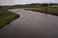
 Biggar Water joins the Tweed - geograph.org.uk - 1714766.jpg 1,600 × 1,061; 646 KB
-
 Braiding, Fruid Water - geograph.org.uk - 1178595.jpg 640 × 480; 100 KB
-
 Burn of Cochlie - geograph.org.uk - 1779054.jpg 640 × 404; 94 KB
-
 Cabrach Meander - geograph.org.uk - 1229190.jpg 640 × 427; 53 KB
-
 Camp Water - geograph.org.uk - 136176.jpg 640 × 480; 83 KB
-
 Chapelhill Farm, Peebles - geograph.org.uk - 149964.jpg 640 × 480; 278 KB
-
 Dalveen Lane , above Dalveen - geograph.org.uk - 1369037.jpg 640 × 480; 77 KB
-
 Developing oxbow lake - geograph.org.uk - 830965.jpg 640 × 480; 105 KB
-
 Following An Old Meander - geograph.org.uk - 578946.jpg 640 × 480; 115 KB
-
 Gimmenbie Burn - geograph.org.uk - 485952.jpg 640 × 480; 111 KB
-
 Glen Clova - geograph.org.uk - 1575425.jpg 640 × 480; 68 KB
-
-
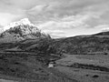
 Glen Geusachan and the Devils Point - geograph.org.uk - 10134.jpg 640 × 427; 64 KB
-
 Glen Gour and the River Gour - geograph.org.uk - 2376784.jpg 1,500 × 980; 1.18 MB
-
 Glen Lee - geograph.org.uk - 1779754.jpg 640 × 480; 101 KB
-
 Letters from England, River Forth.jpg 1,512 × 486; 267 KB
-
 Looking up the River North Esk - geograph.org.uk - 1204309.jpg 640 × 480; 121 KB
-
 Luggie Meander - geograph.org.uk - 1613200.jpg 640 × 480; 126 KB
-
 Meander on Gallangad Burn - geograph.org.uk - 820673.jpg 640 × 480; 87 KB
-
 Meander on Loch Humphrey Burn - geograph.org.uk - 684632.jpg 640 × 480; 67 KB
-
 Meander on the burn at Everton - geograph.org.uk - 1780055.jpg 640 × 429; 228 KB
-
 Meander on the River Isla - geograph.org.uk - 683009.jpg 640 × 430; 82 KB
-
 Meander on the Shortcleuch Water - geograph.org.uk - 1004339.jpg 640 × 480; 75 KB
-
 Meanders in Corrie Fee - geograph.org.uk - 656216.jpg 640 × 480; 73 KB
-
 Meanders on the Cessnock Water - geograph.org.uk - 637521.jpg 640 × 480; 95 KB
-
 Meanders on the Snar Water - geograph.org.uk - 191046.jpg 640 × 480; 58 KB
-
 Monument - geograph.org.uk - 353313.jpg 640 × 426; 71 KB
-
 Ox-bow - geograph.org.uk - 227437.jpg 640 × 435; 89 KB
-
 Oxbows in the Brora - geograph.org.uk - 601786.jpg 640 × 480; 106 KB
-
 River Ayr at Stair - geograph.org.uk - 1737322.jpg 3,872 × 2,592; 2.69 MB
-
 River Coupall. - geograph.org.uk - 139960.jpg 640 × 480; 75 KB
-
 River Forth near Stirling.jpg 800 × 599; 253 KB
-
 River Larig - geograph.org.uk - 355224.jpg 640 × 480; 170 KB
-
 River Nith Meander. - geograph.org.uk - 434175.jpg 640 × 480; 89 KB
-
 River South Esk. - geograph.org.uk - 117803.jpg 640 × 480; 59 KB
-
 River Spey from Craig Dhubh - panoramio.jpg 6,100 × 4,044; 3.28 MB
-
 Soon-to-be Oxbow lake in the Fee Burn - geograph.org.uk - 1558794.jpg 640 × 440; 102 KB
-
 The Kershope Burn - geograph.org.uk - 691724.jpg 640 × 480; 87 KB
-

-
 The River Ayr - geograph.org.uk - 569695.jpg 640 × 480; 97 KB
-

-
 View Along Strathgarry - geograph.org.uk - 555868.jpg 640 × 480; 110 KB
-

-
 Approaching meander in the River Clyde - geograph.org.uk - 1167896.jpg 640 × 480; 150 KB
-
 Duneaton Water - geograph.org.uk - 145231.jpg 640 × 480; 76 KB
-
 Eddleston Water - geograph.org.uk - 568023.jpg 640 × 480; 91 KB
-
 How did this happen^ - geograph.org.uk - 399847.jpg 640 × 480; 146 KB
-
 Meander in Tushielaw Burn - geograph.org.uk - 552981.jpg 640 × 480; 133 KB
-
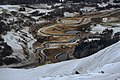
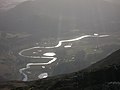 Meanders on the Spey - geograph.org.uk - 589045.jpg 640 × 479; 41 KB
-
 More meanders on the River Muick - geograph.org.uk - 576616.jpg 640 × 480; 115 KB
-
 River Don meander - geograph.org.uk - 632976.jpg 640 × 480; 91 KB
-
 The River Isla near Coupar Angus - geograph.org.uk - 7356.jpg 640 × 480; 163 KB
-
 The River Isla north of Coupar Angus - geograph.org.uk - 651008.jpg 640 × 426; 43 KB


.jpg)


