Category:May 2008 in North Yorkshire
Jump to navigation
Jump to search
Deutsch: Bilder, die im Mai 2008 in North Yorkshire aufgenommen worden sind. Bitte beachten Sie, dass dies weder das Datum des Uploads noch das Datum des Scannens eines Fotos ist.
English: Images/pictures taken in North Yorkshire during May 2008. Note this is not the date of the upload, nor the date a photo was scanned.
Español: Fotografías o imágenes tomadas en North Yorkshire durante mayo 2008. No es la fecha de subida ni escaneo, sino la fecha en que las fotografías o imágenes se crearon.
Esperanto: Bildoj faritaj en North Yorkshire en majo 2008. Tio ne estas la dato, kiam la bildoj estis alŝutitaj aŭ skanitaj.
Français : Photographies ou images prises en North Yorkshire durant mai 2008. Ce n'est pas la date du téléchargement ou du scan.
Galego: Fotografías ou imaxes tomadas en North Yorkshire durante maio 2008. Non é a data de subida nin escaneamento, senón a data na que se crearon as fotografías ou imaxes.
Italiano: Fotografie o immagini scattate a North Yorkshire nel maggio 2008. Nota bene: la data non si riferisce né a quella di upload né a quella in cui la foto è stata digitalizzata.
Norsk bokmål: Bilder tatt i North Yorkshire i løpet av mai 2008. Merk at dette ikke er datoen for opplasting, eller når et bilde har blitt skannet.
Norsk nynorsk: Bilete teke i North Yorkshire i løpet av mai 2008. Merk at dette ikkje er datoen for opplasting, eller når eit bilete har vorte skanna.
Русский: Изображения, сделанные в North Yorkshire в течение май 2008 (не дата загрузки изображения).
Українська: Зображення, зроблені в North Yorkshire протягом травень 2008. Зауважте, що це не дата завантаження чи дата сканування фотографії.
| May 2007 | ← | May 2008 | → | May 2009 | |||||||
| Jan | Feb | Mar | Apr | May | Jun | Jul | Aug | Sep | Oct | Nov | Dec |
| 132 | 133 | 124 | 106 | 170 | 192 | 124 | 157 | 83 | 58 | 93 | 52 |
|---|---|---|---|---|---|---|---|---|---|---|---|
Subcategories
This category has the following 2 subcategories, out of 2 total.
Media in category "May 2008 in North Yorkshire"
The following 168 files are in this category, out of 168 total.
-
 Richmond, Holy Trinity church - geograph.org.uk - 798910.jpg 640 × 480; 76 KB
-

-
 Richmond, Trinity Church Square - geograph.org.uk - 798908.jpg 640 × 480; 70 KB
-
 19thC Graffiti, Wainstones - geograph.org.uk - 828682.jpg 640 × 427; 308 KB
-
 Barden Bridge - geograph.org.uk - 823492.jpg 640 × 480; 290 KB
-

-

-

-
 Almost at The Dock - geograph.org.uk - 818298.jpg 640 × 480; 78 KB
-

-
 Angram Bottoms.jpg 640 × 420; 48 KB
-
 Apedale Road - geograph.org.uk - 791230.jpg 563 × 640; 123 KB
-
 Barley Basket - geograph.org.uk - 795672.jpg 640 × 426; 75 KB
-
 Bay Hotel with lobster pots - geograph.org.uk - 822456.jpg 427 × 640; 76 KB
-
 Bleaberry Gill - geograph.org.uk - 816066.jpg 640 × 480; 97 KB
-
 Blue Bank Farm - geograph.org.uk - 810463.jpg 640 × 480; 130 KB
-
 Bolton Abbey railway station in 2008.jpg 640 × 353; 125 KB
-
 Bridge at Iburndale - geograph.org.uk - 804756.jpg 640 × 480; 191 KB
-
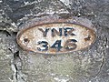 Bridge Number 346 - geograph.org.uk - 817083.jpg 640 × 479; 121 KB
-
 Bridge to Beck Hall BandB - geograph.org.uk - 831912.jpg 640 × 480; 133 KB
-
 Bridleway approaching Hecks Wood - geograph.org.uk - 810337.jpg 640 × 480; 156 KB
-
 Bridleway at Appletree Thwaite - geograph.org.uk - 814749.jpg 640 × 480; 81 KB
-
 Bridleway between Aislaby and Briggswath - geograph.org.uk - 804711.jpg 480 × 640; 153 KB
-
 Bridleway south of Lodge Farm - geograph.org.uk - 810330.jpg 640 × 480; 156 KB
-
 Bridleway through the trees - geograph.org.uk - 825687.jpg 480 × 640; 147 KB
-
 Bridleway to Groovebeck - geograph.org.uk - 791226.jpg 570 × 640; 157 KB
-
 Buttercup Delight - geograph.org.uk - 825512.jpg 640 × 480; 106 KB
-
 Cave Scar - geograph.org.uk - 824818.jpg 640 × 385; 154 KB
-
 Conistone Turf Road - geograph.org.uk - 797262.jpg 640 × 427; 216 KB
-

-
 Cottages by the beck, Thwaite - geograph.org.uk - 815890.jpg 640 × 487; 105 KB
-
 Cottages in Thwaite - geograph.org.uk - 815839.jpg 640 × 480; 106 KB
-
 Cottages on green adjacent to A684 - geograph.org.uk - 806508.jpg 640 × 495; 122 KB
-
 Crookrise Crag and Nettlehole Wood - geograph.org.uk - 788914.jpg 640 × 480; 71 KB
-
 Crowe's Shoot, Speeton Cliffs - geograph.org.uk - 814291.jpg 474 × 640; 82 KB
-
 Deal (^) flour mill Selby - geograph.org.uk - 805173.jpg 640 × 480; 70 KB
-
 Dew Pond. - geograph.org.uk - 1035914.jpg 640 × 480; 72 KB
-
 Dodd Fell - geograph.org.uk - 814045.jpg 640 × 478; 247 KB
-
 Dodd Fell and Duerley Bottom - geograph.org.uk - 814162.jpg 640 × 478; 229 KB
-
 Dry Stream Bed - geograph.org.uk - 817225.jpg 640 × 620; 144 KB
-
 Eskdale views from Lowther's Crag - geograph.org.uk - 810441.jpg 640 × 480; 179 KB
-
 EWSclass37.jpg 3,008 × 2,000; 776 KB
-
 Fairy Dale - geograph.org.uk - 1035932.jpg 640 × 480; 88 KB
-
 Fairy Stones above Fairy Dale. - geograph.org.uk - 1035927.jpg 640 × 480; 84 KB
-
 Field Barn, Heads Bank, Aysgarth - geograph.org.uk - 6353842.jpg 800 × 533; 135 KB
-
 Field Bluebells - geograph.org.uk - 812743.jpg 640 × 427; 334 KB
-
 Field edge - geograph.org.uk - 795896.jpg 640 × 480; 79 KB
-
 Field view - geograph.org.uk - 795920.jpg 640 × 480; 84 KB
-
 Fields of rape overpower the senses - geograph.org.uk - 795937.jpg 640 × 480; 104 KB
-
 Filey Holiday Camp railway station.JPG 2,032 × 1,524; 995 KB
-
 Filey, UK - panoramio.jpg 1,600 × 1,067; 666 KB
-
 Footbridge across the River Rye - geograph.org.uk - 829369.jpg 480 × 640; 169 KB
-
 Footbridge in the woods - geograph.org.uk - 803128.jpg 640 × 480; 185 KB
-
 Footbridge over Apedale Beck - geograph.org.uk - 808681.jpg 640 × 480; 149 KB
-
 Footbridge over Cragdale Water - geograph.org.uk - 812702.jpg 640 × 480; 151 KB
-
 Footbridge over Drain - geograph.org.uk - 817480.jpg 640 × 426; 106 KB
-
 Footbridge over East Gill at Cotterdale - geograph.org.uk - 819063.jpg 640 × 480; 137 KB
-

-
 Footbridge over Shore Gill - geograph.org.uk - 811375.jpg 480 × 640; 156 KB
-
 Footbridge over the River Esk - geograph.org.uk - 804715.jpg 640 × 475; 177 KB
-
 Footpath across moorland at Fair Plain - geograph.org.uk - 810451.jpg 640 × 480; 151 KB
-

-

-
 Footpath along margin of wheat field - geograph.org.uk - 830962.jpg 640 × 480; 115 KB
-
 Footpath approaching Gunnerside - geograph.org.uk - 810555.jpg 640 × 480; 83 KB
-
 Footpath Around Playing Fields - geograph.org.uk - 798245.jpg 427 × 640; 327 KB
-

-
 Footpath in Arkengarthdale - geograph.org.uk - 825576.jpg 640 × 480; 87 KB
-
 Footpath leading to New May Beck - geograph.org.uk - 804822.jpg 640 × 480; 157 KB
-
 Footpath reinforcements - geograph.org.uk - 796956.jpg 480 × 640; 116 KB
-
 Footpath through East Side Forest - geograph.org.uk - 819108.jpg 640 × 480; 140 KB
-

-
 Footpath to Highfields Farm - geograph.org.uk - 802586.jpg 480 × 640; 116 KB
-
 Footpath to West Burton - geograph.org.uk - 824827.jpg 640 × 480; 69 KB
-
 Footpath, Stalling Busk to Low Blea - geograph.org.uk - 812677.jpg 640 × 480; 127 KB
-
 Ford over Gayle Beck - geograph.org.uk - 809429.jpg 480 × 640; 98 KB
-
 Fore Gill - geograph.org.uk - 816977.jpg 640 × 480; 121 KB
-
 Fox Wynd - geograph.org.uk - 801700.jpg 640 × 479; 148 KB
-

-
 Great Ghyll, West Scrafton - geograph.org.uk - 1077753.jpg 600 × 450; 122 KB
-
 Hairdressers on Malpas Road - geograph.org.uk - 798257.jpg 427 × 640; 283 KB
-
 High Street (centre) in Redcar - geograph.org.uk - 797951.jpg 640 × 480; 104 KB
-
 High Street, Skipton - geograph.org.uk - 798916.jpg 640 × 480; 222 KB
-
 Ingramgate in Old Thirsk - geograph.org.uk - 801708.jpg 640 × 379; 74 KB
-
 Kempera Folds - geograph.org.uk - 819024.jpg 640 × 480; 80 KB
-
 A quiet moment on the A170 - geograph.org.uk - 801747.jpg 640 × 479; 112 KB
-
 Leeds and Liverpool Canal, Skipton - geograph.org.uk - 798947.jpg 640 × 480; 221 KB
-
 Linton Church across the Wharfe - geograph.org.uk - 820125.jpg 559 × 640; 232 KB
-
 Little and Large - geograph.org.uk - 795180.jpg 640 × 406; 95 KB
-
 'Little Green', Thirsk - geograph.org.uk - 812434.jpg 640 × 480; 91 KB
-
 Looking along an alley - geograph.org.uk - 818264.jpg 640 × 480; 76 KB
-
 Looking back towards the Laurel Inn - geograph.org.uk - 818291.jpg 640 × 480; 100 KB
-
 Looking down Swaledale - geograph.org.uk - 815766.jpg 640 × 480; 62 KB
-
 Looking down towards The Dock - geograph.org.uk - 818273.jpg 640 × 480; 86 KB
-
 Magpie Café, Whitby.jpg 2,816 × 2,112; 1.12 MB
-
 Manor Farm and houses at Duggleby. - geograph.org.uk - 3227485.jpg 1,151 × 863; 314 KB
-
 Marske tractors - geograph.org.uk - 795341.jpg 640 × 480; 183 KB
-
 Middle Washfold - geograph.org.uk - 816918.jpg 640 × 480; 151 KB
-
 Middlesbrough, The Empire - geograph.org.uk - 796553.jpg 640 × 480; 67 KB
-
 Moor Farm, Reighton - geograph.org.uk - 815218.jpg 466 × 640; 90 KB
-
 Muir Lea Stores, Robin Hood's Bay - geograph.org.uk - 818275.jpg 640 × 480; 106 KB
-

-
 No. 128 High Street - geograph.org.uk - 797948.jpg 480 × 640; 96 KB
-
 Northallerton North Yorkshire County Hall.jpg 640 × 427; 67 KB
-
 Nunnington gate.jpg 1,944 × 2,592; 1.92 MB
-
 Open farmland to north - geograph.org.uk - 908940.jpg 640 × 480; 72 KB
-
 Peasholm Park 1.JPG 2,272 × 1,704; 1.77 MB
-
 Peasholm Park 2.JPG 1,704 × 2,272; 1.19 MB
-
 Peasholm Park 3.JPG 1,704 × 2,272; 1.73 MB
-
 Peasholm Park 4.JPG 2,272 × 1,704; 1.31 MB
-
 Posts on the beach - geograph.org.uk - 795382.jpg 640 × 480; 164 KB
-
 Red Cliff Hole, Speeton Cliffs - geograph.org.uk - 814302.jpg 514 × 640; 100 KB
-
 Reeth, Arkle Beck - geograph.org.uk - 798195.jpg 640 × 480; 120 KB
-
 Reeth, Reeth Bridge - geograph.org.uk - 798194.jpg 640 × 480; 107 KB
-
 Reighton Manor House.jpg 640 × 460; 73 KB
-
 River Derwent near Gunby, East Yorks. - geograph.org.uk - 807974.jpg 640 × 362; 164 KB
-
 RNLI Donations fish - geograph.org.uk - 818304.jpg 480 × 640; 90 KB
-
 Road Junction - geograph.org.uk - 1329048.jpg 640 × 480; 55 KB
-
 Road junction at Ruswarp - geograph.org.uk - 810495.jpg 480 × 640; 149 KB
-
 Rotunda Museum Scarborough edit1.jpg 2,272 × 1,658; 2.42 MB
-
 Rotunda Museum Scarborough.jpg 2,272 × 1,704; 1.16 MB
-
 Row of houses - geograph.org.uk - 822440.jpg 640 × 427; 54 KB
-
 Ruined Sheepfold on Muker Side - geograph.org.uk - 817034.jpg 640 × 311; 76 KB
-
 Russells Farm Machinery - geograph.org.uk - 795176.jpg 640 × 427; 74 KB
-
 Sacred Heart RC Primary School - geograph.org.uk - 798244.jpg 640 × 384; 54 KB
-
 Semer Water Car Park - geograph.org.uk - 813241.jpg 640 × 387; 86 KB
-
 Sharp bend on Sutton Bank - geograph.org.uk - 801765.jpg 640 × 479; 109 KB
-
 Sheep Street, Skipton - geograph.org.uk - 798914.jpg 480 × 640; 196 KB
-
 Skipton Library.jpg 640 × 598; 225 KB
-
 Skipton Parish Church - geograph.org.uk - 824892.jpg 640 × 528; 259 KB
-
 South Carolina caravan park site - geograph.org.uk - 795887.jpg 640 × 480; 75 KB
-
 Speeton Cliffs - geograph.org.uk - 814313.jpg 640 × 402; 102 KB
-
 St Peter's Church, Reighton - geograph.org.uk - 815247.jpg 469 × 640; 104 KB
-
 St Peter's Church, Reighton - geograph.org.uk - 815251.jpg 459 × 640; 68 KB
-
 Staircase, Craven Court Shopping Centre - geograph.org.uk - 798922.jpg 480 × 640; 203 KB
-
 Staircase, Craven Court Shopping Centre - geograph.org.uk - 798937.jpg 480 × 640; 175 KB
-
 Steep section of Sutton Bank - geograph.org.uk - 801752.jpg 640 × 479; 144 KB
-
 Stream and tunnel, Robin Hood's Bay - geograph.org.uk - 818306.jpg 640 × 480; 105 KB
-
 Stream flowing out to sea - geograph.org.uk - 818308.jpg 640 × 480; 115 KB
-
 Stream in Hob Holes, Runswick Bay - geograph.org.uk - 1540585.jpg 427 × 640; 79 KB
-
 Swadford Street, Skipton - geograph.org.uk - 798901.jpg 640 × 480; 196 KB
-

-

-
 The canal system, Skipton - geograph.org.uk - 824938.jpg 640 × 435; 206 KB
-

-

-
 The Duke of York pub - geograph.org.uk - 832307.jpg 640 × 480; 96 KB
-
 The flat and fertile Vale of York - geograph.org.uk - 795925.jpg 640 × 480; 81 KB
-
 The Guy Fawkes Arms, Scotton - geograph.org.uk - 824949.jpg 640 × 434; 58 KB
-
 The Jolly Sailors pub - geograph.org.uk - 832108.jpg 640 × 480; 88 KB
-
 The Laurel Inn, Robin Hood's Bay - geograph.org.uk - 818269.jpg 640 × 480; 64 KB
-
 The Laurel Inn, Robin Hood's Bay - geograph.org.uk - 818277.jpg 640 × 480; 78 KB
-
 The Old Courthouse, Otley Street, Skipton - geograph.org.uk - 798931.jpg 640 × 480; 238 KB
-
 Thorpe Lodge (BandB) - bench and gardens - geograph.org.uk - 833902.jpg 640 × 480; 148 KB
-
 Thorpe Lodge (BandB) - bench in gardens - geograph.org.uk - 833915.jpg 640 × 480; 136 KB
-
 To the blue bridge - geograph.org.uk - 825520.jpg 460 × 640; 108 KB
-
 Tractor on Ridge Lane - geograph.org.uk - 802657.jpg 640 × 480; 171 KB
-
 Ugglebarnby village - geograph.org.uk - 810475.jpg 640 × 480; 161 KB
-
 Ugglebarnby village sign - geograph.org.uk - 810472.jpg 640 × 480; 176 KB
-
 Un-named Footbridge over the Arkle - geograph.org.uk - 825607.jpg 640 × 480; 130 KB
-
 Unused Footbridge over the River Wenning - geograph.org.uk - 817482.jpg 640 × 480; 143 KB
-
 Viking longhouse - geograph.org.uk - 816867.jpg 640 × 480; 109 KB
-
 Village Cricket Field - geograph.org.uk - 831004.jpg 640 × 480; 59 KB
-
 Wainstones - geograph.org.uk - 828686.jpg 640 × 427; 250 KB
-

-
 Welburn Reading Rooms - geograph.org.uk - 795659.jpg 640 × 426; 88 KB
-
 Winterburn Reservoir - geograph.org.uk - 802211.jpg 640 × 480; 101 KB
-


_-_geograph.org.uk_-_831955.jpg)


_flour_mill_Selby_-_geograph.org.uk_-_805173.jpg)


_in_Redcar_-_geograph.org.uk_-_797951.jpg)


_-_geograph.org.uk_-_818312.jpg)


_-_bench_and_gardens_-_geograph.org.uk_-_833902.jpg)
_-_bench_in_gardens_-_geograph.org.uk_-_833915.jpg)


