Category:May 2006 in Argyll and Bute
Jump to navigation
Jump to search
Council areas (municipalities) of Scotland: Aberdeen · Aberdeenshire · Angus · Argyll and Bute · Edinburgh · Glasgow · Highland · Orkney Islands · Renfrewshire · Scottish Borders ·
Deutsch: Bilder, die im Mai 2006 in Argyll and Bute aufgenommen worden sind. Bitte beachten Sie, dass dies weder das Datum des Uploads noch das Datum des Scannens eines Fotos ist.
English: Images/pictures taken in Argyll and Bute during May 2006. Note this is not the date of the upload, nor the date a photo was scanned.
Español: Fotografías o imágenes tomadas en Argyll and Bute durante mayo 2006. No es la fecha de subida ni escaneo, sino la fecha en que las fotografías o imágenes se crearon.
Esperanto: Bildoj faritaj en Argyll and Bute en majo 2006. Tio ne estas la dato, kiam la bildoj estis alŝutitaj aŭ skanitaj.
Français : Photographies ou images prises en Argyll and Bute durant mai 2006. Ce n'est pas la date du téléchargement ou du scan.
Galego: Fotografías ou imaxes tomadas en Argyll and Bute durante maio 2006. Non é a data de subida nin escaneamento, senón a data na que se crearon as fotografías ou imaxes.
Italiano: Fotografie o immagini scattate a Argyll and Bute nel maggio 2006. Nota bene: la data non si riferisce né a quella di upload né a quella in cui la foto è stata digitalizzata.
Norsk bokmål: Bilder tatt i Argyll and Bute i løpet av mai 2006. Merk at dette ikke er datoen for opplasting, eller når et bilde har blitt skannet.
Norsk nynorsk: Bilete teke i Argyll and Bute i løpet av mai 2006. Merk at dette ikkje er datoen for opplasting, eller når eit bilete har vorte skanna.
Русский: Изображения, сделанные в Argyll and Bute в течение май 2006 (не дата загрузки изображения).
Українська: Зображення, зроблені в Argyll and Bute протягом травень 2006. Зауважте, що це не дата завантаження чи дата сканування фотографії.
| May 2005 | ← | May 2006 | → | May 2007 | |||||||
| Jan | Feb | Mar | Apr | May | Jun | Jul | Aug | Sep | Oct | Nov | Dec |
| 45 | 108 | 32 | 36 | 63 | 42 | 56 | 34 | 9 | 29 | 8 | 12 |
|---|---|---|---|---|---|---|---|---|---|---|---|
Media in category "May 2006 in Argyll and Bute"
The following 63 files are in this category, out of 63 total.
-
 Disembarking the ferry at Luing - geograph.org.uk - 168765.jpg 640 × 480; 173 KB
-
 Ferry terminal at Luing - geograph.org.uk - 168772.jpg 640 × 480; 179 KB
-
 Luing Ferry - geograph.org.uk - 168769.jpg 640 × 480; 194 KB
-
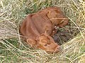 A new-born calf - geograph.org.uk - 168100.jpg 640 × 480; 193 KB
-
 Bagh na Doirlinne, Gigha - geograph.org.uk - 718106.jpg 640 × 480; 64 KB
-
 Bogh an Taillir - geograph.org.uk - 179135.jpg 640 × 480; 103 KB
-
 Breakwater Scalasaig, Colonsay - geograph.org.uk - 174284.jpg 640 × 480; 67 KB
-

-
 Coast Near Port na Ba - geograph.org.uk - 182976.jpg 640 × 480; 65 KB
-
 Coast Near to Rubha na Moine - geograph.org.uk - 181535.jpg 640 × 480; 83 KB
-
 Cullipool from the east - geograph.org.uk - 168978.jpg 640 × 480; 192 KB
-
 Dental Surgery, Oban - geograph.org.uk - 185188.jpg 640 × 480; 75 KB
-
 Dun by Shuna Sound - geograph.org.uk - 168883.jpg 640 × 480; 188 KB
-
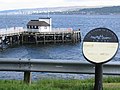
 Dunoon Pier - geograph.org.uk - 281639.jpg 640 × 467; 75 KB
-
 Dyke and Loch na Beiste - geograph.org.uk - 161909.jpg 640 × 480; 199 KB
-

-
 Fitba' in the park - geograph.org.uk - 190086.jpg 640 × 480; 66 KB
-
 Foreshore at Bagh na Cille - geograph.org.uk - 161991.jpg 640 × 480; 202 KB
-
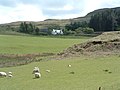 Frachadil farm - geograph.org.uk - 175893.jpg 640 × 480; 91 KB
-
 From Claonaig Pier - geograph.org.uk - 167763.jpg 640 × 445; 305 KB
-
 Gallanach - geograph.org.uk - 166364.jpg 640 × 480; 122 KB
-
 Gaodhail - geograph.org.uk - 175234.jpg 640 × 480; 122 KB
-
 Garvard Standing Stone - geograph.org.uk - 176454.jpg 640 × 427; 86 KB
-
 Gemmil - geograph.org.uk - 165700.jpg 640 × 480; 188 KB
-
 Glenforsa Airfield - geograph.org.uk - 175608.jpg 640 × 480; 65 KB
-

-
 Houses at Rubha nan Crann - geograph.org.uk - 642305.jpg 640 × 480; 93 KB
-
 Jersey, Culnadalloch - geograph.org.uk - 169742.jpg 640 × 480; 99 KB
-
 Jura Airstrip - geograph.org.uk - 164695.jpg 640 × 480; 190 KB
-
 Kerrera Ferry - geograph.org.uk - 184172.jpg 640 × 480; 92 KB
-
 Kilbrannan Sound. - geograph.org.uk - 180699.jpg 640 × 480; 108 KB
-
 Kilcreggan Pier - geograph.org.uk - 189218.jpg 640 × 480; 109 KB
-
 Kilcreggan Pier - geograph.org.uk - 189221.jpg 640 × 480; 93 KB
-
 KilmoryCastle(PatrickMackie)May2006.jpg 640 × 480; 193 KB
-
 Kiloran Bay and Carnan Eoin - geograph.org.uk - 175290.jpg 640 × 427; 66 KB
-
 Loch Long - geograph.org.uk - 190094.jpg 640 × 480; 92 KB
-
 MV Captayannis - geograph.org.uk - 1241375.jpg 640 × 427; 39 KB
-
 Near Uig - geograph.org.uk - 166298.jpg 640 × 480; 94 KB
-
 Port na Caillich - geograph.org.uk - 175774.jpg 640 × 480; 81 KB
-
 Precarious rocks - geograph.org.uk - 175771.jpg 640 × 480; 140 KB
-
 Rhuvaal Lighthouse, Islay - geograph.org.uk - 173029.jpg 640 × 480; 57 KB
-
 Roadside Verge, Mornish - geograph.org.uk - 182964.jpg 640 × 480; 158 KB
-
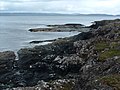
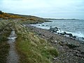
 Rocky foreshore - geograph.org.uk - 168879.jpg 640 × 480; 196 KB
-
 Rubh an Lionaidh - geograph.org.uk - 161971.jpg 640 × 480; 184 KB
-
 Rubha na Faoilinn - geograph.org.uk - 179117.jpg 640 × 480; 109 KB
-
 Rubha na Sroine - geograph.org.uk - 181555.jpg 640 × 480; 108 KB
-
 Ruined boathouse and slipway - geograph.org.uk - 165726.jpg 640 × 481; 190 KB
-
 Sanctuary ruins - geograph.org.uk - 189212.jpg 640 × 480; 101 KB
-
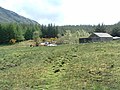
 Scallastle Farm - geograph.org.uk - 177023.jpg 640 × 480; 88 KB
-
 Seashore at Port Righ. - geograph.org.uk - 248686.jpg 640 × 480; 123 KB
-
-
 South-west shore of Luing - geograph.org.uk - 168905.jpg 640 × 480; 195 KB
-
 Toberonochy Harbour - geograph.org.uk - 168874.jpg 640 × 480; 192 KB
-
 Tractor - geograph.org.uk - 175948.jpg 640 × 480; 161 KB
-
 Unused postbox - geograph.org.uk - 165769.jpg 640 × 480; 122 KB
-
 Upper Gylen From the North - geograph.org.uk - 195653.jpg 640 × 480; 83 KB
-
 Varied landscape - geograph.org.uk - 175758.jpg 640 × 480; 133 KB
-
 View from the footpath - geograph.org.uk - 175749.jpg 480 × 640; 163 KB
-
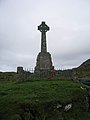 War Memorial at Scalasaig, Colonsay - geograph.org.uk - 175529.jpg 480 × 640; 50 KB
-

-
 Coast Below DerryCruaig - geograph.org.uk - 185159.jpg 640 × 480; 85 KB
-
-
 Triangulation pillar on Cnoc Iolairean - geograph.org.uk - 165093.jpg 640 × 480; 181 KB


May2006.jpg)


