Category:Maryport
Jump to navigation
Jump to search
town and civil parish in Cumbria, England, UK  | |||||
| Upload media | |||||
| Instance of | |||||
|---|---|---|---|---|---|
| Location | Allerdale, Cumbria, North West England, England | ||||
| Said to be the same as | Maryport (Wikimedia duplicated page, civil parish) | ||||
 | |||||
Deutsch: Maryport ist eine Stadt in der Grafschaft Cumbria im Norden von England. Die Stadt liegt am Solway Firth im Lake District in der Nähe von Workington.
English: Maryport is a town and civil parish within the Allerdale borough of Cumbria, England, in the historic county of Cumberland. It is located on the A596 road north of Workington, and is the southernmost town on the Solway Firth. Maryport railway station is on the Cumbrian Coast Line. The town is in the parliamentary constituency of Workington.
Polski: Maryport - miasto portowe w Wielkiej Brytanii, w Anglii, w regionie North West England, w hrabstwie Cumbria. W 2001r. miasto to zamieszkiwało 11 275 osób.
Română: Maryport este un oraş în comitatul Cumbria, regiunea North West, Anglia. Oraşul se află în districtul Allerdale.

Subcategories
This category has the following 11 subcategories, out of 11 total.
A
E
- Ellenborough, Cumbria (4 F)
- Ewanrigg (1 F)
M
- Maryport New Lighthouse (4 F)
- Maryport Old Lighthouse (7 F)
- Maryport railway station (5 F)
P
- Pubs in Maryport (13 F)
S
- Senhouse Museum (25 F)
- St Mary's Church, Maryport (3 F)
Media in category "Maryport"
The following 200 files are in this category, out of 551 total.
(previous page) (next page)-
 "A Fishy Tail" Sculpture, Maryport - geograph.org.uk - 3045593.jpg 1,024 × 768; 551 KB
-
 "Captain Nelson Tavern", South Quay, Maryport - geograph.org.uk - 3534028.jpg 1,200 × 757; 898 KB
-
 "Scots Guardsman" leaving Maryport - March 2017 - geograph.org.uk - 5328884.jpg 4,381 × 4,393; 2.61 MB
-
 'Firth House 2000', The Promenade - geograph.org.uk - 3247537.jpg 1,024 × 683; 137 KB
-
 'Ghost sign', Senhouse Street, Maryport - geograph.org.uk - 3534188.jpg 474 × 640; 278 KB
-
 1, North Quay, Maryport.jpg 3,535 × 2,424; 585 KB
-
 153317 leaving Maryport - October 2017 - geograph.org.uk - 5581604.jpg 1,250 × 822; 1.16 MB
-
 153352 leaving Maryport station - June 2017 - geograph.org.uk - 5434483.jpg 1,500 × 1,274; 2.27 MB
-
 156435 at Flimby station - June 2017 - geograph.org.uk - 5434522.jpg 1,500 × 996; 1.41 MB
-
 156444 approaching Maryport - July 2016 - geograph.org.uk - 5019606.jpg 1,250 × 801; 1 MB
-
 156469 approaching Maryport - March 2017 - geograph.org.uk - 5328899.jpg 6,075 × 3,835; 6.18 MB
-
 3, North Quay, Maryport.jpg 3,535 × 2,424; 567 KB
-
 37419 leaving Maryport - March 2017 - geograph.org.uk - 5328895.jpg 5,316 × 4,012; 3.78 MB
-

-

-
 A Chapel on Kirkby Street, Maryport - geograph.org.uk - 3124457.jpg 800 × 600; 291 KB
-
 A Fishy Tale - geograph.org.uk - 127184.jpg 640 × 480; 103 KB
-
 A Fishy Tale - geograph.org.uk - 6217435.jpg 640 × 480; 118 KB
-
 A fishy tale at Maryport - geograph.org.uk - 4036629.jpg 1,024 × 768; 230 KB
-
 A Fishy Tale, Maryport - geograph.org.uk - 5925020.jpg 640 × 480; 112 KB
-
 A Fishy Tale, Maryport - geograph.org.uk - 6330871.jpg 800 × 600; 145 KB
-
 A muddy estuary - geograph.org.uk - 1974989.jpg 3,872 × 2,475; 1.14 MB
-
 A tribute to the fishers of Maryport - geograph.org.uk - 5465346.jpg 1,200 × 800; 699 KB
-
 Abauna in Maryport - July 2016 - geograph.org.uk - 5019598.jpg 1,250 × 1,167; 1,016 KB
-
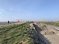
 Access track to the England Coastal Path, near Maryport - geograph.org.uk - 5779167.jpg 2,592 × 1,944; 1.45 MB
-
 Across The River Ellen - geograph.org.uk - 5628089.jpg 640 × 360; 79 KB
-
 Alauna as a Roman would say - geograph.org.uk - 5929174.jpg 1,600 × 1,069; 976 KB
-
 Anchor and mosaic seat, Maryport - geograph.org.uk - 3535512.jpg 1,200 × 803; 970 KB
-

-
 Approach to Maryport Station - geograph.org.uk - 2125867.jpg 640 × 482; 286 KB
-
 Archaeological dig site by Camp Farm trig point - geograph.org.uk - 3242350.jpg 1,024 × 683; 157 KB
-
 Argyle Terrace, Ellenborough Old Road - geograph.org.uk - 3353170.jpg 1,024 × 768; 110 KB
-
 B5300 April 2019 Closure.jpg 4,032 × 3,024; 4.26 MB
-
 Bank End - geograph.org.uk - 616185.jpg 640 × 480; 144 KB
-
 Bank End Farm - geograph.org.uk - 6330819.jpg 800 × 600; 58 KB
-
 Beach shelter near Maryport - geograph.org.uk - 6330831.jpg 800 × 600; 98 KB
-

-
 Benchmark on Christ Church - geograph.org.uk - 3248153.jpg 683 × 1,024; 255 KB
-

-
 Benchmark on corner of wall NNE of the Battery - geograph.org.uk - 3243182.jpg 683 × 1,024; 272 KB
-
 Benchmark on Ellen Bridge - geograph.org.uk - 3248846.jpg 1,024 × 683; 274 KB
-
 Benchmark on gate post next to ^76 High Street - geograph.org.uk - 3247802.jpg 683 × 1,024; 213 KB
-

-
 Benchmark on gatepost of house on The Promenade - geograph.org.uk - 3247515.jpg 683 × 1,024; 288 KB
-
 Benchmark on gatepost of North Grove House - geograph.org.uk - 3242052.jpg 683 × 1,024; 217 KB
-
 Benchmark on jetty step - geograph.org.uk - 3248036.jpg 1,024 × 683; 225 KB
-

-
 Benchmark on railway bridge, Ellenborough Road - geograph.org.uk - 3248099.jpg 683 × 1,024; 261 KB
-
 Benchmark on Shandon House, Camp Road - geograph.org.uk - 3241166.jpg 683 × 1,024; 235 KB
-
 Benchmark on St Mary's Church - geograph.org.uk - 3237511.jpg 683 × 1,024; 263 KB
-
 Benchmark on Station Street bridge - geograph.org.uk - 3238820.jpg 683 × 1,024; 249 KB
-

-

-
 Benchmark on the Roman Museum - geograph.org.uk - 3028192.jpg 683 × 1,024; 280 KB
-

-

-
 Benchmark on wall of Church Street - geograph.org.uk - 3241009.jpg 683 × 1,024; 293 KB
-
 Benchmark on wall of Pigeonwell Lonning - geograph.org.uk - 3028096.jpg 683 × 1,024; 216 KB
-
 Benchmark on ^100 High Street - geograph.org.uk - 3247715.jpg 683 × 1,024; 197 KB
-
 Benchmark on ^17 Kirkby Street - geograph.org.uk - 3247583.jpg 668 × 1,024; 166 KB
-
 Benchmark on ^2 Fleming Place - geograph.org.uk - 3247550.jpg 683 × 1,024; 155 KB
-
 Benchmark on ^47 Kirkby Street - geograph.org.uk - 3247601.jpg 683 × 1,024; 145 KB
-
 Benchmark on ^51 Wood Street - geograph.org.uk - 3026621.jpg 683 × 1,024; 171 KB
-
 Between Elizabeth and Campbell Docks, Maryport - geograph.org.uk - 3353123.jpg 1,024 × 768; 116 KB
-
 Blast those Maryport pirates - geograph.org.uk - 4036483.jpg 4,288 × 3,216; 662 KB
-
 Boats in Maryport - geograph.org.uk - 2020402.jpg 1,600 × 1,200; 599 KB
-
 Bradbury Avenue - geograph.org.uk - 5628099.jpg 640 × 421; 72 KB
-
 Bradbury Avenue, Netherton, Maryport - geograph.org.uk - 3353150.jpg 1,024 × 614; 99 KB
-
 Buchanan Terrace - geograph.org.uk - 6254936.jpg 6,000 × 4,000; 5.88 MB
-
 Building works on Sandy Lonning, Netherton - geograph.org.uk - 3353143.jpg 1,024 × 768; 114 KB
-
 Bungalow on Main Road (A596) - geograph.org.uk - 6330941.jpg 800 × 534; 68 KB
-
 Bungalows on Main Road, Risehow - geograph.org.uk - 3125426.jpg 800 × 600; 237 KB
-
 Butcher shop, Senhouse Street, Maryport - geograph.org.uk - 3535110.jpg 1,000 × 759; 782 KB
-
 Butchers Arms, Crosby Street, Maryport - June 2017 - geograph.org.uk - 5434674.jpg 1,500 × 1,233; 1.55 MB
-
 Buttermere Road, Maryport - geograph.org.uk - 5779156.jpg 2,592 × 1,944; 1,009 KB
-
 Campbell Dock, Maryport, near high tide - geograph.org.uk - 3353127.jpg 1,024 × 768; 138 KB
-
 Car sales on Main Road (A596) - geograph.org.uk - 6330906.jpg 800 × 525; 67 KB
-
 Cattle near Ellenborough - geograph.org.uk - 6254994.jpg 6,000 × 4,000; 3.82 MB
-
 Christ Church, King Street - geograph.org.uk - 3248171.jpg 683 × 1,024; 109 KB
-
 Christ Church, Maryport (1872) - geograph.org.uk - 3535139.jpg 1,000 × 669; 641 KB
-
 Christ Church, Maryport - geograph.org.uk - 526928.jpg 466 × 622; 103 KB
-
 Christ Church, Maryport - geograph.org.uk - 6330852.jpg 682 × 800; 71 KB
-
 Church Road - geograph.org.uk - 6255007.jpg 6,000 × 4,000; 3.85 MB
-
 Church Street - geograph.org.uk - 3241017.jpg 1,024 × 683; 136 KB
-
 Church Terrace, Maryport - geograph.org.uk - 5016674.jpg 2,000 × 1,500; 2.07 MB
-
 Clarinda Terrace - geograph.org.uk - 526875.jpg 640 × 480; 154 KB
-
 Cliffs above National Cycle Route 72 - geograph.org.uk - 6330827.jpg 800 × 600; 135 KB
-
 Cliffs, Maryport - geograph.org.uk - 6330838.jpg 800 × 552; 103 KB
-
 Club House, Maryport Golf Club - geograph.org.uk - 6330818.jpg 800 × 533; 53 KB
-
 Coastal Footpath, Maryport - geograph.org.uk - 4367167.jpg 3,264 × 2,448; 2.15 MB
-
 Coastal grassland near Maryport - geograph.org.uk - 6330884.jpg 800 × 600; 105 KB
-
 Coastguard station, Maryport - geograph.org.uk - 3536591.jpg 802 × 1,000; 778 KB
-
 Confused wind turbine. - panoramio.jpg 3,000 × 4,000; 4.68 MB
-
 Contrasting terraces, Lawson Street - geograph.org.uk - 3353138.jpg 1,024 × 768; 113 KB
-
 Convenience Store, Church Terrace, Maryport - geograph.org.uk - 5016650.jpg 2,000 × 1,500; 1.66 MB
-
 Crosby Street, Maryport - geograph.org.uk - 1975284.jpg 3,872 × 2,489; 3.14 MB
-
 Crosby Street, Maryport - geograph.org.uk - 3045596.jpg 1,024 × 768; 511 KB
-

-
 Crown Inn, Ellenborough, Maryport - October 2017 (2) - geograph.org.uk - 5581629.jpg 1,250 × 804; 1.31 MB
-

-

-
 Cumbrian Coast Line, Flimby - geograph.org.uk - 6330903.jpg 800 × 600; 87 KB
-

-

-
 Curzon Street shops, Maryport - geograph.org.uk - 3536599.jpg 748 × 1,000; 784 KB
-
 Derelict Methodist Church, Church Terrace, Maryport - geograph.org.uk - 5016653.jpg 1,500 × 2,000; 1.77 MB
-
 Derwent Avenue, Netherton, Maryport - geograph.org.uk - 3353155.jpg 1,024 × 768; 95 KB
-
 Direction sign at Alauna, Maryport - geograph.org.uk - 6217394.jpg 640 × 480; 81 KB
-
 Docks, Maryport - geograph.org.uk - 1269607.jpg 640 × 480; 61 KB
-
 Docks, Maryport - geograph.org.uk - 1269611.jpg 640 × 480; 65 KB
-
 Docks, Maryport - geograph.org.uk - 1269615.jpg 640 × 480; 67 KB
-
 Elbra Farm Close - geograph.org.uk - 6254954.jpg 6,000 × 4,000; 5.7 MB
-
 Elizabeth Dock bridge, Maryport (2007) - geograph.org.uk - 3535643.jpg 1,100 × 692; 738 KB
-
 Elizabeth Dock, Maryport - geograph.org.uk - 3353119.jpg 1,024 × 768; 112 KB
-
 Elizabeth Dock, Maryport - geograph.org.uk - 4601760.jpg 1,024 × 768; 153 KB
-
 Elizabeth Dock, Maryport - geograph.org.uk - 5016703.jpg 2,000 × 1,500; 1.37 MB
-
 Elizabeth Dock, Maryport - geograph.org.uk - 5492416.jpg 640 × 480; 66 KB
-
 Elizabeth Dock, Maryport - geograph.org.uk - 6089112.jpg 1,280 × 720; 390 KB
-
 Elizabeth Dock, Maryport - geograph.org.uk - 6089115.jpg 1,280 × 720; 364 KB
-
 Elizabeth Dock, Maryport - geograph.org.uk - 6089117.jpg 1,280 × 862; 569 KB
-
 Elizabeth Dock, Maryport - geograph.org.uk - 6089118.jpg 1,280 × 1,280; 617 KB
-
 Elizabeth II postbox on Main Road, Eagle Terrace - geograph.org.uk - 6331745.jpg 1,403 × 2,579; 755 KB
-
 Ellen Bridge - geograph.org.uk - 3248847.jpg 1,024 × 683; 212 KB
-
 Ellenborough Old Road, Netherton - geograph.org.uk - 3353166.jpg 1,024 × 768; 135 KB
-
 Ellenborough Place level crossing - geograph.org.uk - 3236750.jpg 1,024 × 683; 122 KB
-
 Ellenborough Road railway bridge - geograph.org.uk - 3248131.jpg 1,024 × 683; 161 KB
-
 Ellenborough Social Club - geograph.org.uk - 5016661.jpg 2,000 × 1,500; 1.49 MB
-
 England Coast Path View - geograph.org.uk - 5628109.jpg 640 × 404; 72 KB
-
 Entrance to Maryport Harbour - geograph.org.uk - 5492438.jpg 640 × 480; 78 KB
-
 Entrance to Senhouse Dock, Maryport - geograph.org.uk - 5925017.jpg 640 × 480; 59 KB
-
 Entrance, Maryport Post Office - geograph.org.uk - 3536612.jpg 736 × 1,200; 1.03 MB
-
 Ewanrigg Brow - geograph.org.uk - 6254985.jpg 5,838 × 3,895; 2.97 MB
-
 Fenhouse Street, Maryport - geograph.org.uk - 3458345.jpg 2,560 × 1,920; 2.02 MB
-
 Finger post, Maryport - geograph.org.uk - 6089108.jpg 1,280 × 1,280; 599 KB
-
 Fishing boat entering Maryport Harbour - geograph.org.uk - 4601751.jpg 1,024 × 768; 149 KB
-
 Fishing boat MT338 in Maryport - geograph.org.uk - 6183454.jpg 4,032 × 3,024; 1.95 MB
-
 Fishing boats at Maryport - geograph.org.uk - 5362187.jpg 3,264 × 2,448; 2.24 MB
-
 Fishing boats at Maryport - geograph.org.uk - 5362192.jpg 3,264 × 2,448; 2.26 MB
-
 Fishing nets, Maryport - geograph.org.uk - 3533705.jpg 1,000 × 669; 424 KB
-
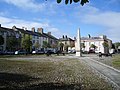
 Fleming Square in Maryport - geograph.org.uk - 6185868.jpg 3,899 × 2,925; 2.79 MB
-
 Fleming Square, Maryport - geograph.org.uk - 1975272.jpg 3,872 × 2,499; 3.91 MB
-
 Fleming Square, Maryport - geograph.org.uk - 3536470.jpg 1,200 × 821; 1.02 MB
-
 Fleming Square, Maryport - geograph.org.uk - 3582390.jpg 640 × 480; 166 KB
-
 Fleming Square, Maryport - geograph.org.uk - 527439.jpg 640 × 480; 206 KB
-
 Flimby Pie Shop - geograph.org.uk - 6330901.jpg 640 × 480; 54 KB
-
 Flimby Railway Station - geograph.org.uk - 5267084.jpg 640 × 438; 48 KB
-
 Flimby Railway Station - geograph.org.uk - 5267087.jpg 640 × 471; 72 KB
-
 Flimby Village Store - June 2017 - geograph.org.uk - 5434512.jpg 1,500 × 1,166; 1.24 MB
-
 Footbridge across harbour entrance, Maryport - geograph.org.uk - 3045569.jpg 1,024 × 768; 442 KB
-

-
 Footbridge and shoreline, Fothergill - geograph.org.uk - 5267855.jpg 640 × 425; 49 KB
-

-
 Foreshore towards Maryport Pier - geograph.org.uk - 6330836.jpg 800 × 600; 83 KB
-
 Former "Board Inn", Senhouse Street, Maryport - June 2017 - geograph.org.uk - 5434690.jpg 1,209 × 1,500; 1.21 MB
-
 Former "Broom Vaults", High Street, Maryport - June 2017 - geograph.org.uk - 5434453.jpg 1,354 × 1,500; 1.65 MB
-

-

-

-

-

-

-

-
 Former "Senhouse Arms", Maryport - October 2017 - geograph.org.uk - 5581500.jpg 1,250 × 834; 656 KB
-
 Former "Shakespear" pub, Maryport - October 2017 - geograph.org.uk - 5581512.jpg 1,122 × 1,250; 944 KB
-

-

-

-

-

-

-

-
 Former "Wheatsheaf Inn", Flimby - October 2017 - geograph.org.uk - 5581594.jpg 1,250 × 1,005; 1.51 MB
-
 Former Post Office In Rydal Avenue - geograph.org.uk - 5628092.jpg 640 × 398; 77 KB
-
 Former railway junction, Maryport Coastal Park - geograph.org.uk - 3353114.jpg 1,024 × 768; 166 KB
-
 Former railway line, Maryport Coastal Park - geograph.org.uk - 3353109.jpg 1,024 × 768; 168 KB
-
 Forth Engineering near Maryport - geograph.org.uk - 6330893.jpg 800 × 600; 93 KB
-
 Fredwood in Maryport - July 2016 - geograph.org.uk - 5019590.jpg 1,250 × 1,028; 1.06 MB
-
 Furnace Road, Gospel Hall, Maryport - geograph.org.uk - 526932.jpg 620 × 464; 165 KB
-
 Garages, Main Street, Ellenborough, Maryport - geograph.org.uk - 5016645.jpg 2,000 × 1,500; 1.55 MB
-
 Gavel Street, Maryport - geograph.org.uk - 3352926.jpg 1,024 × 768; 105 KB
-
 Glasson Industrial Estate, Maryport - geograph.org.uk - 3125414.jpg 800 × 600; 185 KB
-
 Golden Lion Hotel, Maryport - June 2017 (1) - geograph.org.uk - 5434460.jpg 869 × 1,500; 936 KB
-
 Golden Lion Hotel, Maryport - June 2017 (2) - geograph.org.uk - 5434462.jpg 1,500 × 1,405; 1.36 MB
-
 Gospel Hall, Furnace Road, Maryport (1861) - geograph.org.uk - 3534157.jpg 1,000 × 1,203; 1.51 MB
-
 Grass field on the edge of Maryport - geograph.org.uk - 5015673.jpg 2,000 × 1,500; 1.92 MB
-
 Group commemoration of Maryport's long history as a fishing port. - panoramio.jpg 2,706 × 1,553; 1.29 MB
-
 Gull at Maryport Promenade - geograph.org.uk - 5248775.jpg 3,221 × 1,980; 615 KB
-
 Gulls at Maryport Harbour - geograph.org.uk - 4806645.jpg 700 × 636; 178 KB
-
 Harbour lights - geograph.org.uk - 4036470.jpg 3,090 × 3,186; 357 KB
-
 Harbour mouth in Maryport - geograph.org.uk - 2020429.jpg 1,600 × 1,200; 548 KB
-

-
 Houses at the sea end of North Quay, Maryport - geograph.org.uk - 3353132.jpg 1,024 × 768; 132 KB
-
 Houses on Ellenborough Place - geograph.org.uk - 3352954.jpg 1,024 × 768; 104 KB
-
 Houses on Ellenborough Place, Maryport - geograph.org.uk - 3352942.jpg 1,024 × 614; 126 KB
-
 Houses on Main Road (A596) at Flimby - geograph.org.uk - 3125433.jpg 800 × 600; 242 KB
-

-

-
 Houses on Wallace Lane, Maryport - geograph.org.uk - 6330846.jpg 800 × 546; 70 KB
-

-


_-_geograph.org.uk_-_6330941.jpg)


_-_geograph.org.uk_-_6330906.jpg)


_-_geograph.org.uk_-_3535139.jpg)


_-_geograph.org.uk_-_5581623.jpg)
_-_geograph.org.uk_-_5581629.jpg)


_-_geograph.org.uk_-_3535643.jpg)


_-_geograph.org.uk_-_5581577.jpg)
_-_geograph.org.uk_-_5581583.jpg)
_-_geograph.org.uk_-_5581531.jpg)
_-_geograph.org.uk_-_5581536.jpg)
_-_geograph.org.uk_-_5581540.jpg)


_-_geograph.org.uk_-_5581400.jpg)
_-_geograph.org.uk_-_5581402.jpg)


_-_geograph.org.uk_-_5434474.jpg)


_-_geograph.org.uk_-_5434460.jpg)
_-_geograph.org.uk_-_5434462.jpg)
_-_geograph.org.uk_-_3534157.jpg)


_at_Flimby_-_geograph.org.uk_-_3125433.jpg)
,_Flimby_-_geograph.org.uk_-_6330902.jpg)


_joins_the_A596,_Main_Road_-_geograph.org.uk_-_3125418.jpg)

_-_geograph.org.uk_-_5581635.jpg)