Category:Maryland Route 182
Jump to navigation
Jump to search
 | number: | (one hundred eighty-two) |
|---|---|---|
| State highways in Maryland: | 162 · 165 · 166 · 168 · 169 · 170 · 171 · 172 · 173 · 174 · 175 · 176 · 177 · 178 · 179 · 180 · 181 · 182 · 185 · 186 · 187 · 188 · 189 · 190 · 191 · 192 · 193 · 194 · 195 · 196 · 197 · 198 · 200 · 201 · 202 |
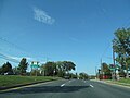
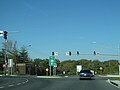
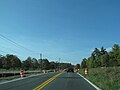
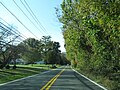
State highway in Montgomery County, Maryland, United States, known for most of its length as Layhill Road _just_north_of_Maryland_State_Route_200_(Intercounty_Connector)_in_Aspen_Hill,_Montgomery_County,_Maryland.jpg) View north along Maryland State Route 182 (Layhill Road) just north of Maryland State Route 200 (Intercounty Connector) in Aspen Hill, Montgomery County, Maryland  | |||||
| Upload media | |||||
| Instance of | |||||
|---|---|---|---|---|---|
| Location | Montgomery County, Maryland | ||||
| Transport network | |||||
| Connects with | |||||
| Owned by | |||||
| Maintained by | |||||
| Inception |
| ||||
| Length |
| ||||
| Terminus |
| ||||
 | |||||
Subcategories
This category has the following 2 subcategories, out of 2 total.
Media in category "Maryland Route 182"
The following 44 files are in this category, out of 44 total.
-
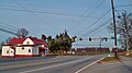 Downtown Norwood, Maryland.jpg 3,000 × 1,687; 1,006 KB
-
 Maryland Route 182 map.png 926 × 580; 39 KB
-
 Maryland State Route 182 - 5530796828.jpg 2,048 × 1,536; 873 KB
-
 Maryland State Route 182 - 5530797244.jpg 2,048 × 1,536; 916 KB
-
 Maryland State Route 182 - 5530797624.jpg 2,048 × 1,536; 1.07 MB
-
 Maryland State Route 182 - 8138130713.jpg 3,072 × 2,304; 746 KB
-
 Maryland State Route 182 - 8138131429.jpg 3,072 × 2,304; 923 KB
-
 Maryland State Route 182 - 8138131707.jpg 3,072 × 2,304; 787 KB
-
 Maryland State Route 182 - 8138132267.jpg 3,072 × 2,304; 624 KB
-
 Maryland State Route 182 - 8138132451.jpg 3,072 × 2,304; 598 KB
-
 Maryland State Route 182 - 8138132841.jpg 3,072 × 2,304; 664 KB
-
 Maryland State Route 182 - 8138133379.jpg 3,072 × 2,304; 881 KB
-
 Maryland State Route 182 - 8138134657.jpg 3,072 × 2,304; 485 KB
-
 Maryland State Route 182 - 8138134841.jpg 3,072 × 2,304; 569 KB
-
 Maryland State Route 182 - 8138135459.jpg 3,072 × 2,304; 985 KB
-
 Maryland State Route 182 - 8138136507.jpg 3,072 × 2,304; 1,009 KB
-
 Maryland State Route 182 - 8138137485.jpg 3,072 × 2,304; 553 KB
-
 Maryland State Route 182 - 8138137823.jpg 3,072 × 2,304; 995 KB
-
 Maryland State Route 182 - 8138138133.jpg 3,072 × 2,304; 926 KB
-
 Maryland State Route 182 - 8138138703.jpg 3,072 × 2,304; 917 KB
-
 Maryland State Route 182 - 8138139919.jpg 3,072 × 2,304; 623 KB
-
 Maryland State Route 182 - 8138140263.jpg 3,072 × 2,304; 1.23 MB
-
 Maryland State Route 182 - 8138141335.jpg 3,072 × 2,304; 901 KB
-
 Maryland State Route 182 - 8138142465.jpg 3,072 × 2,304; 513 KB
-
 Maryland State Route 182 - 8138162412.jpg 3,072 × 2,304; 813 KB
-
 Maryland State Route 182 - 8138163300.jpg 3,072 × 2,304; 943 KB
-
 Maryland State Route 182 - 8138164398.jpg 3,072 × 2,304; 837 KB
-
 Maryland State Route 182 - 8138165006.jpg 3,072 × 2,304; 929 KB
-
 Maryland State Route 182 - 8138165350.jpg 3,072 × 2,304; 917 KB
-
 Maryland State Route 182 - 8138165608.jpg 3,072 × 2,304; 880 KB
-
 Maryland State Route 182 - 8138165784.jpg 3,072 × 2,304; 540 KB
-
 Maryland State Route 182 - 8138166458.jpg 3,072 × 2,304; 960 KB
-
 Maryland State Route 182 - 8138167348.jpg 3,072 × 2,304; 1.05 MB
-
 Maryland State Route 182 - 8138168112.jpg 3,072 × 2,304; 1.06 MB
-
 Maryland State Route 182 - 8138168506.jpg 3,072 × 2,304; 884 KB
-
 Maryland State Route 182 - 8138169624.jpg 3,072 × 2,304; 837 KB
-
 Maryland State Route 182 - 8138170230.jpg 3,072 × 2,304; 889 KB
-
 Maryland State Route 182 - 8138170560.jpg 3,072 × 2,304; 675 KB
-
 Maryland State Route 182 - 8138170880.jpg 3,072 × 2,304; 1.19 MB
-
 Maryland State Route 182 - 8138171862.jpg 3,072 × 2,304; 1,022 KB
-
 Maryland State Route 182 - 8138172120.jpg 3,072 × 2,304; 777 KB
-
 Maryland State Route 182 - 8138173018.jpg 3,072 × 2,304; 989 KB
-
 Maryland State Route 182.jpg 2,048 × 1,536; 1.06 MB
-
 MD Route 182.svg 3,000 × 2,400; 11 KB


