Category:Maryhill, Washington
Jump to navigation
Jump to search
census designated place in Washington State, USA   | |||||
| Upload media | |||||
| Instance of | |||||
|---|---|---|---|---|---|
| Location | Klickitat County, Washington, Pacific Northwest, Washington, Pacific States Region | ||||
| Population |
| ||||
| Area |
| ||||
| Elevation above sea level |
| ||||
 | |||||
Subcategories
This category has the following 4 subcategories, out of 4 total.
M
- Maryhill Loops Road (30 F)
Media in category "Maryhill, Washington"
The following 19 files are in this category, out of 19 total.
-
 BNSF 4539 west.jpg 2,111 × 3,021; 3.62 MB
-
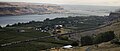
 Columbia River from Maryhill Stonehenge 01.jpg 4,288 × 2,848; 5.84 MB
-

-
 Mantis on a tan wall.jpg 4,288 × 2,848; 4.25 MB
-
 Maryhill Fall Freeride 2012- cowzers 1.jpg 2,000 × 1,500; 522 KB
-
 Maryhill from Maryhill Stonehenge 01.jpg 4,288 × 2,848; 6.25 MB
-
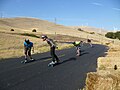
 Maryhill Loops Road - panoramio.jpg 1,024 × 941; 423 KB
-

-

-
 Maryhill WA.jpg 4,473 × 1,905; 4.17 MB
-
 Maryhill, Washington - windmills 01.jpg 4,288 × 2,848; 4.52 MB
-
 Maryhill, Washington - windmills 02.jpg 4,288 × 2,848; 4.85 MB
-
 Maryhill, Washington - windmills 03.jpg 4,288 × 2,848; 5.1 MB
-
 Maryhill, Washington.jpg 1,500 × 1,000; 1.28 MB
-
 Southern Pacific 4449, Deadheading Eastward at Maryhill, WA.jpg 4,000 × 2,657; 9.79 MB
-

-
 WAMap-doton-Maryhill b.png 300 × 202; 10 KB
-
 Wind turbines in fog.jpg 3,840 × 2,160; 1.42 MB
-
 Windmills near Maryhill.jpg 2,552 × 1,912; 1.88 MB


.jpeg)


.jpg)
.jpeg)


.jpeg)


