Category:Maryhill, Glasgow
Jump to navigation
Jump to search

suburb of Glasgow, Scotland, UK   | |||||
| Upload media | |||||
| Instance of | |||||
|---|---|---|---|---|---|
| Location |
| ||||
 | |||||
Subcategories
This category has the following 29 subcategories, out of 29 total.
B
- Bilsland Drive Aqueduct (7 F)
D
E
F
G
- Garrioch Viaduct (GCR) (6 F)
- Garrioch Viaduct (L&DR) (7 F)
- Gilshochill railway station (9 F)
I
K
- Kelbourne School, Glasgow (4 F)
- Kelvin Aqueduct (14 F)
M
- Maryhill Burgh Halls (9 F)
- Maryhill Library (7 F)
- Maryhill railway station (12 F)
- Maryhill Road Aqueduct (17 F)
N
R
S
W
- Walcheren Barracks (4 F)
- Wyndford (15 F)
Media in category "Maryhill, Glasgow"
The following 99 files are in this category, out of 99 total.
-
 A81 (Maryhill Road), Glasgow - geograph.org.uk - 2930330.jpg 640 × 480; 427 KB
-
 A81, Maryhill Road (geograph 2930342).jpg 640 × 480; 407 KB
-
 A81, Maryhill Road - geograph.org.uk - 6201296.jpg 1,600 × 1,184; 364 KB
-
 Acre Hall, Maryhill, Glasgow (geograph 4202976).jpg 800 × 480; 88 KB
-
 Acre Road flats - geograph.org.uk - 1220691.jpg 640 × 480; 123 KB
-
 Amisfield Street - geograph.org.uk - 4890399.jpg 640 × 353; 114 KB
-
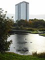
 Anniesland and Glasgow from the air (geograph 3716040).jpg 640 × 391; 115 KB
-
 Basin at Maryhill Locks, Forth & Clyde Canal (geograph 5570981).jpg 1,200 × 1,600; 431 KB
-
 Big Cat seen in Maryhill - geograph.org.uk - 4643119.jpg 2,636 × 2,960; 2 MB
-
 Big cat, Maryhill - geograph.org.uk - 5570874.jpg 1,200 × 1,600; 481 KB
-
 Black panther mural (geograph 6962629).jpg 1,205 × 1,600; 346 KB
-
 Buildings on Bilsland Drive (geograph 6214643).jpg 1,024 × 768; 243 KB
-
 CallumBooth.jpg 1,000 × 1,536; 355 KB
-
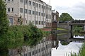 Canal - geograph.org.uk - 494264.jpg 640 × 424; 59 KB
-
 Collina Street - canal-side houses - geograph.org.uk - 6196191.jpg 3,264 × 2,448; 2.08 MB
-
 Construction Maryhill.jpg 2,592 × 1,936; 1.84 MB
-
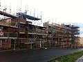 Construction.jpg 2,592 × 1,936; 1.41 MB
-
 Cowal Road - geograph.org.uk - 4889182.jpg 640 × 480; 168 KB
-
 Cowal Road, Maryhill (geograph 5570820).jpg 1,298 × 1,600; 476 KB
-
 Craigen Court, Shakespeare Street, Maryhill - geograph.org.uk - 5811343.jpg 1,600 × 1,071; 334 KB
-
 Derelict building, Maryhill Road - geograph.org.uk - 5894154.jpg 1,600 × 1,074; 415 KB
-
 Elephant and Bugle, Maryhill - geograph.org.uk - 545506.jpg 640 × 480; 67 KB
-
 Maryhill town flag.svg 1,000 × 600; 10 KB
-
 Flats at Maryhill Locks, Collina, Quadrant Maryhill (geograph 4571870).jpg 1,024 × 683; 151 KB
-
 Footbridge over the Maryhill Line - geograph.org.uk - 1547667.jpg 640 × 480; 96 KB
-
 Former Maryhill Tavern (geograph 6962643).jpg 1,421 × 1,600; 457 KB
-
 Forth and Clyde Canal at Ruchil Wharf (geograph 6961877).jpg 1,600 × 1,167; 441 KB
-
 Garrioch Road mini roundabout - geograph.org.uk - 4890471.jpg 640 × 480; 143 KB
-
 Gilshochill railway station, Glasgow (geograph 3373115).jpg 1,024 × 768; 220 KB
-
 Glasgow Branch off Forth Clyde Canal - geograph.org.uk - 50008.jpg 640 × 480; 96 KB
-
 Glasgow from the air (geograph 4598916).jpg 640 × 406; 149 KB
-
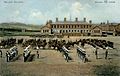
 Glasgow Girl's Industrial School, Maryhill.jpg 3,270 × 2,128; 6.21 MB
-

-
 Glasgow Maryhill ScottishParliamentConstituency.PNG 162 × 136; 3 KB
-
 Glasgow Maryhill ScottishParliamentConstituency.svg 162 × 143; 19 KB
-
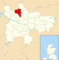 Glasgow wards 2017 no15 Maryhill.png 2,000 × 2,040; 504 KB
-
 Green Man at Gilshochill.jpg 3,024 × 4,032; 2.87 MB
-
 Harvey's Bar - Maryhill Road, Glasgow - geograph.org.uk - 4643118.jpg 4,608 × 3,456; 4.3 MB
-
 Hathaway Street (geograph 4890359).jpg 640 × 365; 109 KB
-
 Hathaway Street, Maryhill (geograph 5811271).jpg 1,600 × 1,500; 384 KB
-
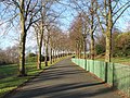 Heading uphill into Maryhill Park - geograph.org.uk - 948425.jpg 640 × 480; 121 KB
-
 Houses, Whitelaw Street, Glasgow - geograph.org.uk - 5570858.jpg 1,600 × 1,069; 376 KB
-
 Leyden Street, Maryhill - geograph.org.uk - 6198091.jpg 1,280 × 851; 438 KB
-
 Lochburn Gate apartments - geograph.org.uk - 5470781.jpg 1,600 × 1,200; 301 KB
-
 Looking up Collina Street.jpg 1,936 × 2,592; 1.58 MB
-
 Maryhill Barracks.jpg 800 × 509; 131 KB
-
 Maryhill Community Centre, Glasgow - geograph.org.uk - 4205925.jpg 800 × 600; 95 KB
-
 Maryhill Fox - geograph.org.uk - 604275.jpg 640 × 480; 126 KB
-
 Maryhill high flats from Arrochar Street - geograph.org.uk - 1220717.jpg 640 × 480; 126 KB
-
 Maryhill Locks flats and canal (geograph 7533261).jpg 4,160 × 3,120; 1.06 MB
-
 Maryhill Park - geograph.org.uk - 1517274.jpg 640 × 480; 96 KB
-
 Maryhill Park - geograph.org.uk - 1517285.jpg 640 × 480; 98 KB
-
 Maryhill Park - geograph.org.uk - 1517291.jpg 640 × 480; 93 KB
-
 Maryhill Park triangulation pillar - geograph.org.uk - 1517261.jpg 640 × 480; 130 KB
-
 Maryhill Road (A81) - geograph.org.uk - 2930337.jpg 640 × 480; 411 KB
-
 Maryhill Road (geograph 4890225).jpg 640 × 408; 119 KB
-
 Maryhill Road (geograph 6962622).jpg 1,600 × 1,200; 353 KB
-
 Maryhill Road - geograph.org.uk - 1203441.jpg 640 × 480; 69 KB
-
 Maryhill Road - geograph.org.uk - 6195484.jpg 1,024 × 683; 169 KB
-
 Maryhill Road - Glasgow - geograph.org.uk - 4643112.jpg 3,775 × 2,994; 2.52 MB
-
 Maryhill Road at Gairbraid (geograph 6323042).jpg 1,024 × 768; 211 KB
-
 Maryhill Road station (geograph 4890239).jpg 640 × 334; 85 KB
-
 Maryhill Road, Glasgow - geograph.org.uk - 3970557.jpg 3,456 × 5,184; 7.03 MB
-
 Maryhill Road, Glasgow - geograph.org.uk - 3970960.jpg 5,184 × 3,456; 6.91 MB
-
 Maryhill Road, Glasgow - geograph.org.uk - 6196390.jpg 3,264 × 2,448; 4.9 MB
-
 Maryhill Road, Maryhill - geograph.org.uk - 6198108.jpg 1,280 × 851; 509 KB
-
 Maryhill Tavern, Maryhill Road - geograph.org.uk - 5894179.jpg 1,272 × 1,600; 342 KB
-
 Maryhill trackbed, the Glasgow Central Railway. Maryhill Barracks Station site.jpg 4,896 × 2,752; 1.88 MB
-
 MaryhillMap1923.jpg 720 × 724; 147 KB
-
 MaryhillPortal.JPG 3,072 × 2,304; 3.05 MB
-
 New homes under construction (geograph 6962437).jpg 1,600 × 1,123; 509 KB
-
 New homes under construction (geograph 6962442).jpg 1,600 × 958; 395 KB
-
 Now leaving Glasgow - geograph.org.uk - 1220651.jpg 640 × 480; 146 KB
-
 Path through Acre - geograph.org.uk - 1655327.jpg 640 × 480; 104 KB
-
 Pathway by the River Kelvin (geograph 4205918).jpg 800 × 600; 139 KB
-
 River Kelvin - geograph.org.uk - 1515023.jpg 480 × 640; 125 KB
-
 River Kelvin from the Kelvin Aqueduct, Forth & Clyde Canal.JPG 4,494 × 3,298; 5.7 MB
-
 River of Words by Anoushka Havinden (detail).jpg 4,032 × 3,024; 6.78 MB
-
 ScottTiffoney1.jpg 1,017 × 990; 406 KB
-
 Shakespeare Street - geograph.org.uk - 1515008.jpg 640 × 480; 104 KB
-
 Shakespeare Street - geograph.org.uk - 4890390.jpg 640 × 480; 149 KB
-
 Siding trackbed, the Glasgow Central Railway. Maryhill Barracks Station site.jpg 4,896 × 2,752; 3.37 MB
-
 Stockingfield Junction Bridges approach, Forth and Clyde Canal, Maryhill, Glasgow.jpg 4,176 × 2,741; 2.47 MB
-
 Tennis courts, Maryhill Park (geograph 7057868).jpg 1,600 × 1,200; 515 KB
-
 Tesco Extra store on Maryhill Road, Glasgow (geograph 5856045).jpg 6,720 × 4,480; 6.79 MB
-
 Tesco, Maryhill Shopping Centre - geograph.org.uk - 545508.jpg 640 × 480; 58 KB
-
 The Viking (geograph 6961407).jpg 1,600 × 1,178; 356 KB
-
 Tower Block UK photo glw2-10 (Maryhill Collina St 1982).jpg 2,620 × 1,729; 691 KB
-
 Tower Block UK photo glw2-11 (Glenavon Maryhill 1982).jpg 2,625 × 1,734; 816 KB
-
 Tower Block UK photo glw2-13 (Maryhill Glenavon 1983).jpg 2,610 × 1,734; 879 KB
-
 Tower Block UK photo glw3-48 (Wyndford Plaque 1983).jpg 2,618 × 1,734; 737 KB
-
 Trig point, Maryhill Park (geograph 7057814).jpg 1,600 × 1,213; 378 KB
-
 View from Ruchill Park flagpole West 325.jpg 4,221 × 2,760; 5.82 MB
-
 View from Ruchill Park flagpole WestN355.jpg 3,000 × 1,987; 3.89 MB
-
 Waiting for a bus at 5.53am (53474965871).jpg 4,080 × 3,072; 4.16 MB
-
 Weir on the River Kelvin - geograph.org.uk - 3607954.jpg 1,024 × 768; 251 KB
-

-
 Acre Road flats - geograph.org.uk - 1517250.jpg 640 × 480; 96 KB
-
 Maryhill Bingo Hall - geograph.org.uk - 50001.jpg 640 × 473; 63 KB
,_Glasgow_-_geograph.org.uk_-_2930330.jpg)
.jpg)

.jpg)


.jpg)
.jpg)


.jpg)
.jpg)


.jpg)


.jpg)

.jpg)
.jpg)

.jpg)

.jpg)

.svg)


.jpg)
.jpg)


.jpg)


_-_geograph.org.uk_-_2930337.jpg)
.jpg)
.jpg)


.jpg)
.jpg)


.jpg)
.jpg)


.jpg)


.jpg)


.jpg)
.jpg)

.jpg)
.jpg)
.jpg)
.jpg)
.jpg)
.jpg)


.jpg)


