Category:Martinuskerk ('s Gravenmoer)
Jump to navigation
Jump to search
| Object location | | View all coordinates using: OpenStreetMap |
|---|
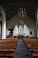
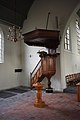
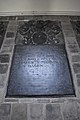
Nederlands: Afbeeldingen van de Martinuskerk ('s Gravenmoer), Kerkdijk 15, 5109 TL 's Gravenmoer. Gelegen in 's Gravenmoer behorende tot de gemeente Dongen in de provincie Noord-Brabant in het zuiden van Nederland. Het is een rijksmonument
|
This is a category about rijksmonument number 18148
|
church building in Dongen, Netherlands  | |||||
| Upload media | |||||
| Instance of | |||||
|---|---|---|---|---|---|
| Named after | |||||
| Location | 's Gravenmoer, Dongen, North Brabant, Netherlands | ||||
| Street address |
| ||||
| Located on street |
| ||||
| Heritage designation |
| ||||
 | |||||
Nederlands: Martinuskerk ('s Gravenmoer), 's Gravenmoer, Dongen (gemeente), Noord-Brabant, Nederland
Subcategories
This category has the following 2 subcategories, out of 2 total.
E
K
- Kerkebos in 's Gravenmoer (26 F)
Media in category "Martinuskerk ('s Gravenmoer)"
The following 15 files are in this category, out of 15 total.
-
 Gravenmoer, 's Hervormde Kerk (PKN), int.1.jpg 6,000 × 4,000; 6.18 MB
-
 Gravenmoer, 's Hervormde Kerk (PKN), int.10.jpg 4,000 × 6,000; 6.11 MB
-
 Gravenmoer, 's Hervormde Kerk (PKN), int.11.jpg 4,000 × 6,000; 6.33 MB
-
 Gravenmoer, 's Hervormde Kerk (PKN), int.2.jpg 4,000 × 6,000; 6.29 MB
-
 Gravenmoer, 's Hervormde Kerk (PKN), int.3.jpg 4,000 × 6,000; 6.2 MB
-
 Gravenmoer, 's Hervormde Kerk (PKN), int.4.jpg 4,000 × 6,000; 6.5 MB
-
 Gravenmoer, 's Hervormde Kerk (PKN), int.5.jpg 4,000 × 6,000; 4.66 MB
-
 Gravenmoer, 's Hervormde Kerk (PKN), int.6.jpg 4,000 × 6,000; 6.37 MB
-
 Gravenmoer, 's Hervormde Kerk (PKN), int.7.jpg 4,000 × 6,000; 5.16 MB
-
 Gravenmoer, 's Hervormde Kerk (PKN), int.8.jpg 4,000 × 6,000; 6.34 MB
-
 Gravenmoer, 's Hervormde Kerk (PKN), int.9.jpg 6,000 × 4,000; 5.69 MB
-
 Interieur naar het oosten met preekstoel - 's-Gravenmoer - 20091588 - RCE.jpg 896 × 1,200; 183 KB
-
 Interieur, aanzicht orgel, orgelnummer 541 - 's Gravenmoer - 20349259 - RCE.jpg 806 × 1,200; 159 KB
-
 Interieur, koperen kroon - 's-Gravenmoer - 20091589 - RCE.jpg 896 × 1,200; 125 KB
-
 Interieur, koperen kroon - 's-Gravenmoer - 20091590 - RCE.jpg 896 × 1,200; 188 KB
,_int.1.jpg)
,_int.10.jpg)
,_int.11.jpg)
,_int.2.jpg)
,_int.3.jpg)
,_int.4.jpg)
,_int.5.jpg)
,_int.6.jpg)
,_int.7.jpg)
,_int.8.jpg)
,_int.9.jpg)


