Category:Markfield
Jump to navigation
Jump to search
English: Markfield is a commuter village in both the National Forest and Charnwood Forest and in the Hinckley and Bosworth district of Leicestershire, England
Main Wikipedia article: Markfield.
village and civil parish in the Hinckley and Bosworth district of Leicestershire, England  | |||||
| Upload media | |||||
| Instance of | |||||
|---|---|---|---|---|---|
| Location | Hinckley and Bosworth, Leicestershire, East Midlands, England | ||||
| Said to be the same as | Markfield (Wikimedia duplicated page, civil parish) | ||||
 | |||||
Subcategories
This category has the following 5 subcategories, out of 5 total.
Media in category "Markfield"
The following 200 files are in this category, out of 313 total.
(previous page) (next page)-
 A glimpse of Bradgate Park - geograph.org.uk - 4342019.jpg 1,600 × 1,136; 754 KB
-
 A House on The Green - geograph.org.uk - 4812308.jpg 640 × 514; 106 KB
-
 A view of Markfield - geograph.org.uk - 514021.jpg 640 × 497; 107 KB
-
 Accident on the A511 Little Shaw Lane - geograph.org.uk - 3732139.jpg 1,600 × 1,180; 737 KB
-
 Allotments - geograph.org.uk - 461624.jpg 640 × 401; 119 KB
-
 Altar Stones Lane - geograph.org.uk - 5118008.jpg 2,000 × 1,500; 634 KB
-
 An unnamed lane of Forest Road - geograph.org.uk - 3497966.jpg 800 × 600; 148 KB
-
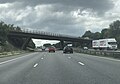
 B591 bridge over the M1 - geograph.org.uk - 2853718.jpg 800 × 579; 91 KB
-
 Bailey-Sim Wood - geograph.org.uk - 205797.jpg 640 × 427; 150 KB
-
 Bardon Hill viewed from Copt Oak - geograph.org.uk - 4343244.jpg 1,600 × 1,200; 565 KB
-
 Billa Barra - geograph.org.uk - 2113109.jpg 1,024 × 768; 187 KB
-
 Billa Barra Hill, The National Forest - geograph.org.uk - 3498264.jpg 800 × 600; 171 KB
-
 Billa Barra Hill, The National Forest - geograph.org.uk - 3498268.jpg 600 × 800; 206 KB
-
 Billa Barra Lane - geograph.org.uk - 2268306.jpg 3,137 × 2,171; 2.8 MB
-
 Billa Barra Lane - geograph.org.uk - 3067608.jpg 640 × 480; 93 KB
-
 BP filling station at Leicester Markfield Services - geograph.org.uk - 3428135.jpg 3,648 × 2,736; 2.07 MB
-
 Bridge north of J22, M1 - geograph.org.uk - 4682508.jpg 640 × 426; 23 KB
-
 Bridge over the M1 - geograph.org.uk - 3856183.jpg 3,774 × 1,982; 3.44 MB
-
 Broad Lane heading north - geograph.org.uk - 3067592.jpg 640 × 480; 70 KB
-
 Building visited frequently by John Wesley, Markfield.jpg 1,075 × 967; 940 KB
-
 Burger King at Leicester Markfield Services - geograph.org.uk - 3059501.jpg 3,648 × 2,736; 2.26 MB
-
 Bus stop and shelter by A511 - geograph.org.uk - 4541581.jpg 1,600 × 1,200; 1.49 MB
-
 Bus stop by A511 close to M1 junction 22 - geograph.org.uk - 4541604.jpg 1,600 × 1,199; 1.57 MB
-
 Captain's Lane, Markfield - geograph.org.uk - 158716.jpg 640 × 427; 151 KB
-
 Car park at Billa Barra Hill Local Nature Reserve - geograph.org.uk - 3732132.jpg 1,600 × 1,177; 662 KB
-
 Car park of Copt Oak inn - geograph.org.uk - 3591195.jpg 1,024 × 768; 160 KB
-
 Celtic cross at St. Peter's Church in Copt Oak - geograph.org.uk - 4343310.jpg 833 × 1,024; 184 KB
-
 Charnwood Forest countryside view - geograph.org.uk - 3732198.jpg 1,600 × 1,234; 536 KB
-
 Charnwood Noon Column - geograph.org.uk - 5417933.jpg 3,000 × 4,000; 1,005 KB
-
 Chitterman Way, Markfield - geograph.org.uk - 158689.jpg 640 × 427; 106 KB
-
 Climbing at Disused Hill Hole Quarry - geograph.org.uk - 4434186.jpg 640 × 434; 87 KB
-
 Coach & Horses - geograph.org.uk - 1198461.jpg 640 × 373; 52 KB
-
 Congregational Church, Main Street, Markfield.jpg 991 × 703; 893 KB
-
 Copt Oak Copt Oak Pub - geograph.org.uk - 2846911.jpg 640 × 480; 126 KB
-
 Copt Oak Road - geograph.org.uk - 2268428.jpg 3,021 × 1,520; 2.1 MB
-
 Copt Oak Road crossing M1 - geograph.org.uk - 5895381.jpg 1,024 × 714; 135 KB
-
 Copt Oak Road goes over the M1 - geograph.org.uk - 3797889.jpg 1,200 × 900; 302 KB
-
 Copt Oak Telecom Masts - geograph.org.uk - 3856187.jpg 2,069 × 1,459; 1.32 MB
-

-
 Cross on the roof of St. Peter's Church - geograph.org.uk - 4343320.jpg 1,600 × 1,501; 393 KB
-

-

-
 Disused Hill Hole Quarry fence - geograph.org.uk - 4812312.jpg 640 × 369; 72 KB
-

-

-

-

-
 Diverted footpath - geograph.org.uk - 5418105.jpg 4,000 × 3,000; 1.81 MB
-
 Dog walker with Great Dane dogs..jpg 5,616 × 3,732; 16.34 MB
-
 Driving north on the M1 southbound - geograph.org.uk - 3903984.jpg 640 × 480; 38 KB
-
 Driving north on the M1 southbound - geograph.org.uk - 3903993.jpg 640 × 480; 46 KB
-
 East along the A511 Shaw Lane - geograph.org.uk - 3732153.jpg 1,600 × 1,158; 705 KB
-
 Electricity pole near Old Rise Rocks - geograph.org.uk - 3732244.jpg 1,538 × 1,600; 850 KB
-
 Entrance to Billa Barra Hill Local Nature Reserve - geograph.org.uk - 2268295.jpg 2,985 × 2,146; 2.79 MB
-
 Farm track west of the M1 motorway - geograph.org.uk - 4072137.jpg 1,600 × 1,200; 762 KB
-
 Farmland near Copt Oak Road - geograph.org.uk - 2268422.jpg 2,123 × 2,404; 1.83 MB
-
 Farmland near Old Rise Rocks - geograph.org.uk - 3732188.jpg 1,600 × 1,200; 732 KB
-
 Farmland off Copt Oak Road - geograph.org.uk - 3067615.jpg 640 × 480; 60 KB
-
 Farmland off Stanton Lane - geograph.org.uk - 3067604.jpg 640 × 480; 124 KB
-
 Farmland, Poplar Farm - geograph.org.uk - 3067612.jpg 640 × 480; 56 KB
-
 Field Head Coach ^ Horses - geograph.org.uk - 2859213.jpg 640 × 480; 103 KB
-
 Field Head Hotel - geograph.org.uk - 2859210.jpg 640 × 480; 117 KB
-
 Field of oil seed rape - geograph.org.uk - 2909839.jpg 3,264 × 2,448; 3.7 MB
-
 Fields alongside the M1 motorway - geograph.org.uk - 4072025.jpg 1,600 × 1,170; 653 KB
-
 Fields between the M1 motorway and Markfield - geograph.org.uk - 4072146.jpg 1,600 × 1,258; 629 KB
-
 Flying Horse Cantonese Restaurant - geograph.org.uk - 513988.jpg 640 × 457; 89 KB
-
 Footbridge over a tributary of Rothley Brook - geograph.org.uk - 5125520.jpg 2,000 × 1,500; 579 KB
-
 Footbridge over the M1 - geograph.org.uk - 3856178.jpg 4,081 × 1,584; 3.08 MB
-
 Footpath from Hill Lane to Cliffe Lane - geograph.org.uk - 5182932.jpg 2,000 × 1,500; 410 KB
-
 Footpath from Markfield Road to the A50 - geograph.org.uk - 5034552.jpg 4,000 × 3,000; 876 KB
-
 Footpath from Thornton Lane to the Leicestershire Round - geograph.org.uk - 5125454.jpg 2,000 × 1,500; 314 KB
-
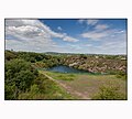
 Footpath past the reservoir - geograph.org.uk - 2268437.jpg 3,131 × 1,928; 2.56 MB
-
 Footpath to Field Head - geograph.org.uk - 4771661.jpg 1,600 × 1,200; 466 KB
-
 Footpath to Field Head - geograph.org.uk - 4771664.jpg 1,500 × 2,000; 804 KB
-
 Footpath to Rise Rocks Farm - geograph.org.uk - 2268497.jpg 1,930 × 1,525; 1.34 MB
-
 Forest Road in Markfield - geograph.org.uk - 1202522.jpg 640 × 384; 61 KB
-
 Forest Road towards Markfield - geograph.org.uk - 2909838.jpg 1,943 × 1,644; 1.18 MB
-
 Former Methodist Chapel - geograph.org.uk - 3360190.jpg 857 × 1,142; 687 KB
-
 Formerly The George Inn until 2004.jpg 991 × 656; 817 KB
-
 Gate along the Leicestershire Round footpath - geograph.org.uk - 4071990.jpg 1,600 × 1,279; 727 KB
-
 GB Railfreight 66720, Markfield,Tottenham engineers' train (9084218989).jpg 3,264 × 2,448; 1.38 MB
-
 Glebe Farm along Whitwick Road - geograph.org.uk - 4343215.jpg 1,600 × 1,002; 344 KB
-
 Grassy Lane towards Markfield - geograph.org.uk - 2909840.jpg 2,172 × 1,802; 1.92 MB
-

-
 Gravestones at St. Peter's Church in Copt Oak - geograph.org.uk - 4343305.jpg 1,600 × 1,200; 610 KB
-
 Gravestones in the north-west corner - geograph.org.uk - 4812318.jpg 640 × 430; 117 KB
-

-
 Hill Hole Nature Reserve.JPG 3,648 × 2,736; 2.02 MB
-
 Hill Hole Quarry - geograph.org.uk - 5071744.jpg 2,000 × 1,500; 461 KB
-
 Hill Hole quarry - the large pool - geograph.org.uk - 3361816.jpg 1,142 × 857; 669 KB
-
 Hill Hole quarry from the summit - geograph.org.uk - 3361827.jpg 1,142 × 857; 630 KB
-
 Hill Hole Quarry, Markfield 22July 2020.jpg 1,075 × 967; 805 KB
-
 Hill Hole Quarry, Markfield.jpg 1,075 × 967; 815 KB
-
 Hillside - geograph.org.uk - 4812320.jpg 640 × 471; 115 KB
-

-
 Hobby Hall along Copt Oak Road - geograph.org.uk - 4056893.jpg 1,600 × 1,213; 662 KB
-
 Horses next to Ashby Road in Markfield - geograph.org.uk - 5165586.jpg 800 × 662; 215 KB
-
 House along Stanton Lane - geograph.org.uk - 2268319.jpg 1,796 × 1,261; 1.02 MB
-
 House construction along London Road - geograph.org.uk - 4072172.jpg 1,600 × 1,223; 414 KB
-

-
 Ivanhoe Way - geograph.org.uk - 5417987.jpg 4,000 × 3,000; 3.29 MB
-
 Ivanhoe Way footpath at Rise Rocks Farm - geograph.org.uk - 3732179.jpg 1,600 × 1,365; 1.01 MB
-
 Ivanhoe Way Footpath to Bardon Hill - geograph.org.uk - 2268507.jpg 2,393 × 2,035; 1.9 MB
-
 Ivanhoe Way Footpath to Bardon Hill - geograph.org.uk - 2268511.jpg 2,930 × 2,398; 2.91 MB
-
 Ivanhoe Way footpath to Bardon Hill - geograph.org.uk - 3732147.jpg 1,600 × 1,119; 863 KB
-
 Ivy Cottage Farm along Copt Oak Road - geograph.org.uk - 2268347.jpg 3,169 × 1,830; 2.43 MB
-
 John Wesley has been here^ - geograph.org.uk - 4812322.jpg 640 × 553; 119 KB
-

-

-
 Lane to Old Rise Rocks - geograph.org.uk - 4056878.jpg 1,600 × 1,183; 399 KB
-
 Launde Road in Markfield - geograph.org.uk - 1198467.jpg 640 × 387; 61 KB
-
 Leicester Road in Markfield - geograph.org.uk - 3426002.jpg 3,648 × 2,736; 2.87 MB
-
 Leicester Road, Markfield - geograph.org.uk - 3360229.jpg 1,142 × 857; 681 KB
-
 Leicester Road, Markfield - geograph.org.uk - 3360235.jpg 1,142 × 857; 635 KB
-
 Leicester Road, Markfield - geograph.org.uk - 3497609.jpg 800 × 600; 143 KB
-
 Leicestershire Round footpath - geograph.org.uk - 4071841.jpg 1,600 × 1,308; 893 KB
-
 Leicestershire Round footpath - geograph.org.uk - 4071903.jpg 1,600 × 1,252; 909 KB
-
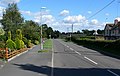 London Road in Markfield - geograph.org.uk - 1202520.jpg 640 × 407; 62 KB
-
 London Road, Markfield - geograph.org.uk - 158695.jpg 640 × 427; 115 KB
-
 London Road, Markfield - geograph.org.uk - 514017.jpg 640 × 438; 115 KB
-

-
 M1 at junction 22 - geograph.org.uk - 3856180.jpg 2,548 × 1,366; 1.87 MB
-
 M1 heading north, Markfield - geograph.org.uk - 2853708.jpg 640 × 480; 45 KB
-
 M1 north near Junction 22 - geograph.org.uk - 2853714.jpg 640 × 480; 42 KB
-
 M1 northbound near Markfield - geograph.org.uk - 2853706.jpg 640 × 479; 47 KB
-
 M1 south of Junction 22, northbound - geograph.org.uk - 2252713.jpg 640 × 433; 32 KB
-
 Main St markfield le67.JPG 3,115 × 2,736; 1.58 MB
-
 Main Street Markfield.jpg 993 × 655; 920 KB
-
 Main Street, Markfield.JPG 3,648 × 2,736; 1.64 MB
-
 MAIN STREET, MARKFIELD.JPG 3,648 × 2,736; 2.55 MB
-

-
 Map of Leicestershire OS Map name 024-SW, Ordnance Survey, 1884-1892.jpg 5,378 × 3,589; 2.86 MB
-
 Markfield (Hill Hole) trig and the toposcope - geograph.org.uk - 3360187.jpg 1,142 × 857; 694 KB
-
 Markfield - geograph.org.uk - 4812324.jpg 640 × 442; 81 KB
-
 Markfield - Trig point at Hill Hole - geograph.org.uk - 6006848.jpg 5,184 × 2,920; 5.28 MB
-
 Markfield and masts - geograph.org.uk - 2909806.jpg 1,177 × 995; 471 KB
-
 Markfield Congregational Church - geograph.org.uk - 3360224.jpg 1,142 × 857; 708 KB
-
 Markfield Congregational Church Hall - geograph.org.uk - 3360219.jpg 1,142 × 857; 690 KB
-

-

-
 Markfield Trinity Methodist Church - geograph.org.uk - 3360212.jpg 857 × 1,142; 630 KB
-
 Markfield war memorial - geograph.org.uk - 4812327.jpg 640 × 500; 146 KB
-
 Markfield, St Michael - geograph.org.uk - 4532935.jpg 1,200 × 1,600; 369 KB
-
 Meadows south of the A511 - geograph.org.uk - 2182924.jpg 1,024 × 768; 306 KB
-
 Mill Hill Lane - geograph.org.uk - 4812328.jpg 640 × 503; 132 KB
-
 Mill Hill Lane Sign - geograph.org.uk - 4812329.jpg 640 × 598; 183 KB
-
 Mobile telephone mast - geograph.org.uk - 4434187.jpg 640 × 579; 100 KB
-
 Narrow lane on the edge of Markfield - geograph.org.uk - 4072156.jpg 1,600 × 1,200; 516 KB
-
 New houses along London Road, Markfield - geograph.org.uk - 5165738.jpg 800 × 528; 125 KB
-
 New path from the car park to Billa Barra Hill - geograph.org.uk - 3427284.jpg 3,648 × 2,736; 2.8 MB
-
 North along Whitwick Road - geograph.org.uk - 3445673.jpg 1,142 × 857; 432 KB
-
 North along Whitwick Road to Copt Oak - geograph.org.uk - 4343204.jpg 1,600 × 1,179; 572 KB
-
 North-east slopes of Billa Barra Hill - geograph.org.uk - 2182901.jpg 1,024 × 768; 317 KB
-
 Northbound M1 near Junction 22 - geograph.org.uk - 2853711.jpg 640 × 480; 39 KB
-
 Outcrop by disused Hill Hole Quarry - geograph.org.uk - 4812330.jpg 640 × 494; 126 KB
-

-
 Path to Grey Lodge Wood - geograph.org.uk - 2909787.jpg 3,001 × 2,447; 2.99 MB
-
 Path to Hill Hole Quarry - geograph.org.uk - 4812331.jpg 640 × 471; 157 KB
-
 Path towards kissing gate on Billa Barra Hill - geograph.org.uk - 3427302.jpg 3,648 × 2,736; 2.92 MB
-
 Priory Lane junction with Whitwick Road - geograph.org.uk - 4541608.jpg 1,600 × 1,064; 1.26 MB
-
 Public Footpath through woodland - geograph.org.uk - 514007.jpg 640 × 480; 173 KB
-
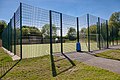 Public sports facility installed in 2019.jpg 991 × 659; 1.06 MB
-
 Queens Head in Markfield - geograph.org.uk - 5165579.jpg 800 × 614; 146 KB
-
 Ratby Lane enters Markfield - geograph.org.uk - 2909799.jpg 2,949 × 2,435; 2.9 MB
-
 Ratby Lane heading towards Markfield - geograph.org.uk - 2909783.jpg 2,271 × 1,916; 1.92 MB
-
 Ratby Lane near Markfield - geograph.org.uk - 2909796.jpg 3,263 × 2,088; 2.78 MB
-
 Ratby Lane, Markfield - geograph.org.uk - 514020.jpg 640 × 480; 97 KB
-
 Rise Rocks Farm - geograph.org.uk - 2268505.jpg 3,264 × 2,326; 3.11 MB
-
 Road Bridge Over M1 Near Markfield - geograph.org.uk - 5895383.jpg 1,024 × 626; 111 KB
-
 Rose Cottage - geograph.org.uk - 1467660.jpg 640 × 359; 67 KB
-
 Rose Cottage - geograph.org.uk - 4812332.jpg 640 × 517; 123 KB
-
 Rose Cottage sign - geograph.org.uk - 4812333.jpg 640 × 444; 80 KB
-
 Scrap Yard by Disused Hill Hole Quarry - geograph.org.uk - 4434188.jpg 640 × 489; 108 KB
-
 Seating for north westerly view from Billa Barra Hill - geograph.org.uk - 3427308.jpg 3,648 × 2,736; 2.88 MB
-
 Shaw Lane - geograph.org.uk - 2182942.jpg 1,024 × 768; 281 KB
-
 Slip road from A50 - geograph.org.uk - 461621.jpg 440 × 640; 107 KB
-
 Small field near Rise Rocks Farm - geograph.org.uk - 3732164.jpg 1,600 × 1,166; 644 KB
-
 Small footbridge along the Leicestershire Round footpath - geograph.org.uk - 4071853.jpg 1,237 × 1,600; 763 KB
-
 South-west corner of churchyard - geograph.org.uk - 4812334.jpg 640 × 456; 124 KB
-
 Southbound along the M1 motorway - geograph.org.uk - 4056854.jpg 1,600 × 1,266; 491 KB
-

-
 St Michael and All Saints Church, Markfield .jpg 988 × 659; 1.08 MB
-
 St Peter's church - geograph.org.uk - 4628271.jpg 2,000 × 1,500; 400 KB
-
 St Peter's Church, Copt Oak - geograph.org.uk - 3497926.jpg 800 × 600; 143 KB
-
 St Peter's Church, Copt Oak - geograph.org.uk - 3497927.jpg 800 × 600; 158 KB
-
 St. Peter's Church in Copt Oak - geograph.org.uk - 4343318.jpg 1,600 × 1,287; 649 KB
-
 St. Peters Church in Copt Oak - geograph.org.uk - 4343302.jpg 1,600 × 1,242; 519 KB
-

-
 Stanton Lane heading north - geograph.org.uk - 3067610.jpg 640 × 480; 75 KB
-
 Stoney Lane bridge - geograph.org.uk - 2909824.jpg 1,926 × 2,041; 1.89 MB
-
 Thatched cottage - geograph.org.uk - 462135.jpg 640 × 494; 108 KB
-
 The A511 Shaw Lane - geograph.org.uk - 2268339.jpg 2,903 × 1,724; 2.11 MB
-
 The Bulls Head - geograph.org.uk - 3360191.jpg 1,142 × 857; 687 KB
-
 The Bulls Head - geograph.org.uk - 5070781.jpg 2,000 × 1,500; 240 KB
-
 The Bulls Head Public House (cropped).jpg 991 × 655; 952 KB
-
 The Bulls Head Public House.jpg 993 × 658; 960 KB
-
 The Bulls Head, Little Markfield - geograph.org.uk - 3497960.jpg 800 × 600; 143 KB
-
 The Bulls Head, Little Markfield - geograph.org.uk - 3497973.jpg 600 × 800; 152 KB
-
 The Bulls Head, Markfield.jpg 1,075 × 937; 627 KB
-
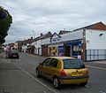
 The Coach and Horses, Markfield - geograph.org.uk - 3497603.jpg 800 × 600; 135 KB


.jpg)


_trig_and_the_toposcope_-_geograph.org.uk_-_3360187.jpg)


.jpg)


