Category:Maria Magdalenakerk (Goes)
Jump to navigation
Jump to search
| Object location | | View all coordinates using: OpenStreetMap |
|---|
church in Goes, The Netherlands  | |||||
| Upload media | |||||
| Instance of | |||||
|---|---|---|---|---|---|
| Named after | |||||
| Location | Goes, Zeeland, Netherlands | ||||
| Street address |
| ||||
| Architectural style | |||||
| Heritage designation |
| ||||
 | |||||
Nederlands: Grote of Maria Magdalenakerk, Goes
|
This is a category about rijksmonument number 16375
|
| Address |
|
Subcategories
This category has only the following subcategory.
I
Media in category "Maria Magdalenakerk (Goes)"
The following 115 files are in this category, out of 115 total.
-
 2014 Stadhuis (Goes) (1).jpg 1,570 × 1,477; 486 KB
-
 Aanzicht noordertransept - Goes - 20079465 - RCE.jpg 894 × 1,200; 242 KB
-
 Aanzicht van de noordertranseptgevel - Goes - 20079437 - RCE.jpg 811 × 1,200; 189 KB
-
 Aanzicht vanuit het zuidwesten - Goes - 20079416 - RCE.jpg 1,200 × 822; 285 KB
-
 Aanzicht zuidertransept en schip - Goes - 20079444 - RCE.jpg 951 × 1,200; 214 KB
-
 Aanzicht zuidzijde - Goes - 20079413 - RCE.jpg 1,200 × 899; 251 KB
-
 Dakruiter detail- kop in eikenhout - Goes - 20326373 - RCE.jpg 898 × 1,200; 125 KB
-
 Dakruiter detail- koppen in eikenhout - Goes - 20326372 - RCE.jpg 914 × 1,200; 153 KB
-
 De Grote- Of Maria Magdalenakerk te Goes2.jpg 6,933 × 4,949; 26.13 MB
-
 Detail ingangspartij noordertransept - Goes - 20371252 - RCE.jpg 1,200 × 783; 206 KB
-
 Detail torentje - Goes - 20326156 - RCE.jpg 1,200 × 794; 140 KB
-
 Detail van een raamtracering in kalksteen - Goes - 20079435 - RCE.jpg 933 × 1,200; 264 KB
-
 Exterieur OVERZICHT NAAR HET WESTEN - Goes - 20261912 - RCE.jpg 1,153 × 1,200; 262 KB
-
 Exterieur OVERZICHT ZUIDWEST ZIJDE - Goes - 20299032 - RCE.jpg 1,184 × 1,200; 310 KB
-
 Exterieur TEKENING NAAR C. PRONK - Goes - 20261915 - RCE.jpg 1,200 × 968; 243 KB
-
 Exterieur WESTGEVEL - Goes - 20307124 - RCE.jpg 956 × 1,200; 237 KB
-
 Exterieur ZUIDGEVEL - Goes - 20307127 - RCE.jpg 1,200 × 960; 307 KB
-
 Exterieur ZUIDGEVEL - Goes - 20307128 - RCE.jpg 960 × 1,200; 265 KB
-
 Exterieur ZUIDOOST GEVEL MET KOOR - Goes - 20307126 - RCE.jpg 1,200 × 957; 257 KB
-
 Exterieur ZUIDWEST GEVEL - Goes - 20307125 - RCE.jpg 1,200 × 956; 247 KB
-
 Gebrandschilderd raam, sluiting noordbeuk - Goes - 20079433 - RCE.jpg 891 × 1,200; 277 KB
-
 Gevel van het noordertransept - Goes - 20079420 - RCE.jpg 902 × 1,200; 281 KB
-
 Gezicht op het zuidertransept vanuit het oosten - Goes - 20079414 - RCE.jpg 906 × 1,200; 225 KB
-
 Goes Grote Kerk Sint Maria Magdalena 1.jpg 4,163 × 3,166; 5.89 MB
-
 Goes Grote Kerk Sint Maria Magdalena 2.jpg 4,472 × 3,282; 7.22 MB
-
 Goes Grote Kerk Sint Maria Magdalena 3.jpg 4,570 × 3,281; 5.73 MB
-
 Goes Grote Kerk Sint Maria Magdalena 4.jpg 3,395 × 4,074; 5.42 MB
-
 Goes Grote Kerk Sint Maria Magdalena 5.jpg 4,550 × 3,049; 6.56 MB
-
 Goes Grote Kerk Sint Maria Magdalena 6.jpg 2,455 × 3,779; 4.57 MB
-
 Goes Grote Kerk Sint Maria Magdalena 7.jpg 4,436 × 2,726; 5.55 MB
-
 Goes Grote Kerk Sint Maria Magdalena 8.jpg 4,546 × 3,386; 6.25 MB
-
 Goes Grote Kerk Sint Maria Magdalena Chor 1.jpg 4,519 × 3,121; 5.97 MB
-
 Goes Grote Kerk Sint Maria Magdalena Chor 2.jpg 4,203 × 2,301; 3.86 MB
-
 Goes Grote Kerk Sint Maria Magdalena Fassade 1.jpg 3,406 × 3,821; 5.48 MB
-
 Goes Grote Kerk Sint Maria Magdalena Fassade 2.jpg 4,504 × 3,330; 6.72 MB
-
 Goes Grote Kerk Sint Maria Magdalena Fassade 3.jpg 3,352 × 4,340; 6.71 MB
-
 Goes Grote Kerk Sint Maria Magdalena Fassade 4.jpg 3,410 × 4,564; 8.09 MB
-
 Goes Grote Kerk Sint Maria Magdalena Fassade 5.jpg 4,498 × 3,446; 6.72 MB
-
 Goes Grote Kerk Sint Maria Magdalena Fassade 6.jpg 4,489 × 3,128; 6.86 MB
-
 Goes Grote Kerk Sint Maria Magdalena Fassade 7.jpg 4,439 × 3,240; 7.02 MB
-
 Goes Grote Kerk Sint Maria Magdalena Fassadenfenster.jpg 3,254 × 4,564; 7.74 MB
-
 Goes Grote Kerk Sint Maria Magdalena Querschiff 1.jpg 3,267 × 4,158; 6.07 MB
-
 Goes Grote Kerk Sint Maria Magdalena Querschiff 2.jpg 3,354 × 4,539; 5.69 MB
-
 Goes Grote Kerk Sint Maria Magdalena Querschiff 3.jpg 3,293 × 4,366; 6.04 MB
-
 Goes Grote Kerk Sint Maria Magdalena Querschiff 4.jpg 4,434 × 3,348; 5.97 MB
-
 Goes Grote Kerk Sint Maria Magdalena Querschiff 5.jpg 4,516 × 3,421; 4.32 MB
-
 Goes Grote Kerk Sint Maria Magdalena Vierungsturm 1.jpg 3,392 × 4,296; 5.04 MB
-
 Goes Grote Kerk Sint Maria Magdalena Vierungsturm 2.jpg 4,570 × 3,418; 4.7 MB
-
 Goes karken.jpg 500 × 281; 103 KB
-
 Goes Korte Kerkstraat.jpg 1,536 × 2,048; 640 KB
-
 Goes, Grote of Maria Magdelenakerk foto7 2009-09-25 16.11.JPG 3,456 × 2,592; 983 KB
-
 Goes; Grote kerk a.jpg 5,196 × 4,810; 2.3 MB
-
 Goes; Grote kerk b.jpg 4,468 × 5,075; 2 MB
-
 Goes; Grote kerk c.jpg 4,355 × 4,981; 2.35 MB
-
 Goes; Grote kerk d.jpg 4,995 × 5,208; 3.14 MB
-
 Goes; Grote kerk e.jpg 3,656 × 4,576; 1.66 MB
-
 Grote of H. Margaritakerk Goes.jpg 3,000 × 4,000; 3.96 MB
-
 Grote of Maria Magdalenakerk, Goes. 2006 - panoramio - Mark Faasse.jpg 2,048 × 1,536; 1.32 MB
-

-
 Het koor vanuit het noorden - Goes - 20079422 - RCE.jpg 1,200 × 904; 237 KB
-
 Het koor vanuit het zuidoosten - Goes - 20079415 - RCE.jpg 900 × 1,200; 270 KB
-
 Kerkgoes.jpg 1,190 × 1,246; 696 KB
-
 Koor gezien vanuit het noorden - Goes - 20325258 - RCE.jpg 1,200 × 880; 198 KB
-

-
 Lichtbeuk van het noordertransept vanuit het westen - Goes - 20079419 - RCE.jpg 1,200 × 892; 306 KB
-
 Luchtbogen aan de noordzijde van het koor - Goes - 20326371 - RCE.jpg 904 × 1,200; 221 KB
-
 Luchtbogen na de restauratie - Goes - 20079424 - RCE.jpg 885 × 1,200; 235 KB
-
 Luchtbogen zuidzijde koor - Goes - 20079418 - RCE.jpg 1,200 × 881; 269 KB
-
 Luchtbogen zuizijde koor vóór de restauratie - Goes - 20079423 - RCE.jpg 899 × 1,200; 233 KB
-
 Luchtboog gerestaureerde zuidzijde - Goes - 20326163 - RCE.jpg 889 × 1,200; 192 KB
-
 Maria Magdalenakerk (Goes)01.JPG 1,562 × 1,361; 547 KB
-
 Maria Magdalenakerk (Goes)02.JPG 1,726 × 1,493; 689 KB
-
 Maria Magdalenakerk (Goes)03.JPG 2,048 × 1,536; 1.48 MB
-
 Maria Magdalenakerk (Goes)04.JPG 2,048 × 1,536; 1.58 MB
-
 Maria Magdalenakerk (Goes)05.JPG 2,048 × 1,536; 1.49 MB
-
 Maria Magdalenakerk (Goes)06.JPG 2,048 × 1,536; 1.46 MB
-
 Maria Magdalenakerk (Goes)07.JPG 2,048 × 1,536; 1.49 MB
-
 Maria Magdalenakerk (Goes)08.JPG 2,048 × 1,536; 1.48 MB
-
 Maria Magdalenakerk (Goes)09.JPG 2,048 × 1,536; 1.33 MB
-
 Maria Magdalenakerk (Goes)10.JPG 2,048 × 1,536; 1.5 MB
-
 Maria Magdalenakerk (Goes)11.JPG 2,048 × 1,536; 1.51 MB
-
 Maria Magdalenakerk (Goes)12.JPG 2,048 × 1,536; 1.61 MB
-
 Maria Magdalenakerk (Goes)24.jpg 1,977 × 1,653; 868 KB
-
 Maria Magdalenakerk (Goes)25.jpg 2,151 × 1,871; 1.1 MB
-
 Maria Magdalenakerk church Goes 2020.jpg 4,208 × 3,120; 6.72 MB
-
 Maria Magdalenakerk Goes - Clocktower.jpg 2,103 × 2,625; 1.75 MB
-
 Maria Magdalenakerk Goes interieur met orgel.jpg 1,153 × 2,048; 403 KB
-
 Maria Magdalenakerk Goes.JPG 2,816 × 2,112; 2.47 MB
-
 Maria Magdalenakerk Goes.jpg 2,816 × 2,112; 2.38 MB
-
 Maria Magdalenakerk, Korte Kerkstraat (Goes).jpg 1,777 × 1,532; 693 KB
-
 Maria Magdalenakerk1.JPG 2,304 × 1,728; 1.2 MB
-
 Maria Magdalenakerk2.JPG 2,304 × 1,728; 1.32 MB
-
 Maria Magdalenakerk3.JPG 1,728 × 2,304; 1.34 MB
-
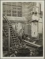
 Muur noorderdwarsschip tijdens restauratie - Goes - 20323253 - RCE.jpg 873 × 1,200; 199 KB
-
 Omloop topgevel ingang marktzijde - Goes - 20326370 - RCE.jpg 903 × 1,200; 186 KB
-
 Oostgevel noorderdwarsschip tijdens restauratie - Goes - 20323266 - RCE.jpg 848 × 1,200; 170 KB
-
 Oud-Nederlandsche steden in haar ontstaan, groei en ontwikkeling (1909) (14579551449).jpg 2,300 × 3,374; 1.17 MB
-
 Overzicht ingangspartij noordertransept - Goes - 20371251 - RCE.jpg 783 × 1,200; 246 KB
-
 Overzicht noordertransept - Goes - 20371248 - RCE.jpg 783 × 1,200; 198 KB
-
 Overzicht raam noordertransept - Goes - 20371250 - RCE.jpg 783 × 1,200; 259 KB
-
 Overzicht topgevel noordertransept - Goes - 20371249 - RCE.jpg 1,200 × 783; 173 KB
-
 Overzicht vanuit het zuidwesten - Goes - 20079436 - RCE.jpg 1,200 × 894; 263 KB
-
 Overzicht vanuit het zuidwesten - Goes - 20079445 - RCE.jpg 1,200 × 955; 194 KB
-
 Overzicht zuidwestgevel met vieringtoren - Goes - 20352790 - RCE.jpg 1,200 × 945; 221 KB
-
 Portaal in de noordertranseptgevel - Goes - 20079439 - RCE.jpg 809 × 1,200; 228 KB
-
 Portaal zijgevel hervormde kerk aan einde van straat - Goes - 20319032 - RCE.jpg 873 × 1,200; 182 KB
-
 Raamkopfragmenten oostgevel noorderdwarsschip - Goes - 20323270 - RCE.jpg 1,200 × 852; 182 KB
-
 Schip en transept vanuit het noorden - Goes - 20079417 - RCE.jpg 1,200 × 906; 257 KB
-
 Steunbeer zuiderzijbeuk koor tijdens restauratie - Goes - 20326157 - RCE.jpg 914 × 1,200; 256 KB
-
 Tekening van gebrandschilderd raam (thans verdwenen) - Goes - 20079438 - RCE.jpg 811 × 1,200; 260 KB
-
 Toeristische infoborden Goes 37.jpg 5,472 × 3,648; 11.74 MB
-
 Top van de gevel van het noordertransept - Goes - 20079421 - RCE.jpg 896 × 1,200; 224 KB
-
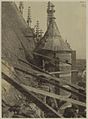 Traptoren noorderdwarsschip tijdens restauratie - Goes - 20323267 - RCE.jpg 884 × 1,200; 175 KB
-
 Untitled Panorama08.jpg 5,602 × 6,644; 25.03 MB
-

_(1).jpg)


,_RP-P-OB-89.083.jpg)


01.JPG)
02.JPG)
03.JPG)
04.JPG)
05.JPG)
06.JPG)
07.JPG)
08.JPG)
09.JPG)
10.JPG)
11.JPG)
12.JPG)
24.jpg)
25.jpg)


.jpg)


_(14579551449).jpg)


_-_Goes_-_20079438_-_RCE.jpg)


