Category:March 2017 in York
Jump to navigation
Jump to search
Deutsch: Bilder, die im März 2017 in York aufgenommen worden sind. Bitte beachten Sie, dass dies weder das Datum des Uploads noch das Datum des Scannens eines Fotos ist.
English: Images/pictures taken in York during March 2017. Note this is not the date of the upload, nor the date a photo was scanned.
Español: Fotografías o imágenes tomadas en York durante marzo 2017. No es la fecha de subida ni escaneo, sino la fecha en que las fotografías o imágenes se crearon.
Esperanto: Bildoj faritaj en York en marto 2017. Tio ne estas la dato, kiam la bildoj estis alŝutitaj aŭ skanitaj.
Français : Photographies ou images prises en York durant mars 2017. Ce n'est pas la date du téléchargement ou du scan.
Galego: Fotografías ou imaxes tomadas en York durante marzo 2017. Non é a data de subida nin escaneamento, senón a data na que se crearon as fotografías ou imaxes.
Italiano: Fotografie o immagini scattate a York nel marzo 2017. Nota bene: la data non si riferisce né a quella di upload né a quella in cui la foto è stata digitalizzata.
Norsk bokmål: Bilder tatt i York i løpet av mars 2017. Merk at dette ikke er datoen for opplasting, eller når et bilde har blitt skannet.
Norsk nynorsk: Bilete teke i York i løpet av mars 2017. Merk at dette ikkje er datoen for opplasting, eller når eit bilete har vorte skanna.
Русский: Изображения, сделанные в York в течение март 2017 (не дата загрузки изображения).
Українська: Зображення, зроблені в York протягом березень 2017. Зауважте, що це не дата завантаження чи дата сканування фотографії.
| March 2016 | ← | March 2017 | → | March 2018 | |||||||
| Jan | Feb | Mar | Apr | May | Jun | Jul | Aug | Sep | Oct | Nov | Dec |
| 97 | 103 | 184 | 159 | 99 | 93 | 245 | 157 | 52 | 238 | 65 | 151 |
|---|---|---|---|---|---|---|---|---|---|---|---|
Subcategories
This category has the following 2 subcategories, out of 2 total.
Media in category "March 2017 in York"
The following 182 files are in this category, out of 182 total.
-
 A glimpse of Cheesecake Farm - geograph.org.uk - 5314652.jpg 1,024 × 768; 313 KB
-
 A good walk spoiled^ - geograph.org.uk - 5324730.jpg 1,024 × 768; 318 KB
-
 A host of golden daffodils - geograph.org.uk - 5330958.jpg 800 × 600; 176 KB
-
 All Saints Church, Pavement, York - geograph.org.uk - 5322946.jpg 3,672 × 4,896; 5.47 MB
-
 All Saints, Pavement, York - geograph.org.uk - 5310412.jpg 1,000 × 1,500; 257 KB
-
 Approaching Cheesecake Farm - geograph.org.uk - 5314694.jpg 1,024 × 768; 204 KB
-
 Approaching the golf course on Heslington Common - geograph.org.uk - 5323679.jpg 1,024 × 768; 193 KB
-
 Approaching Walmgate Bar - geograph.org.uk - 5310904.jpg 1,600 × 1,067; 330 KB
-
 Baile Hill, York - geograph.org.uk - 5322934.jpg 4,089 × 3,553; 4.52 MB
-
 Bank Island - geograph.org.uk - 5316598.jpg 1,024 × 768; 156 KB
-
 Bridge by Fir Tree Farm - geograph.org.uk - 5325205.jpg 1,024 × 717; 193 KB
-
 Bridleway alongside Fulford Golf Course - geograph.org.uk - 5324923.jpg 1,024 × 768; 265 KB
-
 Bridleway and Heslington Tillmire - geograph.org.uk - 5325284.jpg 1,024 × 768; 231 KB
-
 Bridleway bridge over Tillmire Drain - geograph.org.uk - 5325192.jpg 1,024 × 768; 189 KB
-
 Bridleway by the A64 - geograph.org.uk - 5323692.jpg 1,024 × 768; 350 KB
-
 Bridleway on Heslington Tillmire - geograph.org.uk - 5324932.jpg 1,024 × 768; 268 KB
-
 Bridleway to Heslington - geograph.org.uk - 5325295.jpg 1,024 × 768; 261 KB
-
 Bridleway to Heslington - geograph.org.uk - 5325301.jpg 1,024 × 768; 268 KB
-
 Bridleway to Langwith House - geograph.org.uk - 5325847.jpg 1,024 × 768; 300 KB
-
 Bridleway to Langwith Lodge - geograph.org.uk - 5323709.jpg 1,024 × 768; 198 KB
-
 Bridleway to Langwith Stray - geograph.org.uk - 5323684.jpg 1,024 × 768; 249 KB
-
 Bridleway to Langwith Stray - geograph.org.uk - 5325774.jpg 1,024 × 768; 179 KB
-
 Broad Highway - geograph.org.uk - 5316077.jpg 1,024 × 768; 188 KB
-
 Broad Highway - geograph.org.uk - 5316084.jpg 1,024 × 768; 159 KB
-
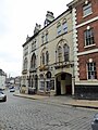
 Burns Hotel, York - geograph.org.uk - 5325015.jpg 3,456 × 4,608; 3.13 MB
-
 Castle Green - geograph.org.uk - 5330939.jpg 800 × 384; 80 KB
-
 Church of St Lawrence, York - geograph.org.uk - 5320879.jpg 1,024 × 684; 264 KB
-
 Cinder Lane, York - geograph.org.uk - 5322916.jpg 4,896 × 3,672; 4.86 MB
-
 City Wall in Tower Gardens, York - geograph.org.uk - 5322930.jpg 4,896 × 3,672; 5.86 MB
-
 City walls at York - geograph.org.uk - 5310428.jpg 1,600 × 1,067; 382 KB
-
 Clifford's Tower - geograph.org.uk - 5322928.jpg 4,896 × 3,672; 6.17 MB
-
 Clifford's Tower - geograph.org.uk - 5330933.jpg 800 × 600; 133 KB
-
 Clifford's Tower, the keep of York Castle - geograph.org.uk - 5310191.jpg 1,600 × 1,079; 223 KB
-
 Clifford's Tower, York - geograph.org.uk - 5322937.jpg 4,896 × 3,672; 5.77 MB
-
 Clifton Methodist Church, York - geograph.org.uk - 5309878.jpg 1,000 × 1,459; 199 KB
-
 Coffee Yard, York - geograph.org.uk - 5324084.jpg 3,456 × 4,608; 3 MB
-
 Countess of York, National Railway Museum - geograph.org.uk - 5322920.jpg 4,896 × 3,672; 5.74 MB
-

-
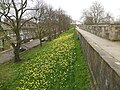
 Daffodil time on York city walls - geograph.org.uk - 5320770.jpg 1,024 × 684; 266 KB
-
 Dame Judi Dench Walk, York - geograph.org.uk - 5322971.jpg 3,672 × 4,896; 5.96 MB
-
 Dickson's Tillmire - geograph.org.uk - 5325252.jpg 1,024 × 768; 267 KB
-
 Dickson's Tillmire and Tillmire Farm - geograph.org.uk - 5325256.jpg 1,024 × 768; 241 KB
-
 Elizabeth II postbox, York Railway Station - geograph.org.uk - 5320363.jpg 1,720 × 2,653; 889 KB
-

-
 Entrance to Museum Gardens, Marygate - geograph.org.uk - 5322959.jpg 4,503 × 3,591; 5.48 MB
-
 Entrance to York Railway Station - geograph.org.uk - 5323878.jpg 3,456 × 4,608; 4.79 MB
-
 Exit from York Railway Station - geograph.org.uk - 5320366.jpg 2,848 × 2,136; 927 KB
-
 Fairway on Fulford Golf Course - geograph.org.uk - 5325781.jpg 1,024 × 768; 225 KB
-
 Field edge and drain near Cheesecake Farm - geograph.org.uk - 5313953.jpg 1,024 × 768; 270 KB
-
 Field edge and lone tree - geograph.org.uk - 5314681.jpg 1,024 × 768; 201 KB
-
 Field edge near Wheldrake - geograph.org.uk - 5314643.jpg 1,024 × 768; 217 KB
-
 Field edge track to an area of woodland - geograph.org.uk - 5314693.jpg 1,024 × 768; 215 KB
-
 Field of oilseed rape - geograph.org.uk - 5316059.jpg 1,024 × 768; 163 KB
-
 Fields off Langwith Stray - geograph.org.uk - 5323703.jpg 1,024 × 768; 191 KB
-
 Fir Tree Farm - geograph.org.uk - 5325207.jpg 1,024 × 768; 228 KB
-
 Flat fields and Coronation Plantation - geograph.org.uk - 5325769.jpg 1,024 × 768; 195 KB
-
 Flooded Carrs - geograph.org.uk - 5316992.jpg 1,024 × 768; 157 KB
-
 Flying buttresses on York Minster - geograph.org.uk - 5310457.jpg 1,000 × 1,500; 326 KB
-
 Foot Tunnel Under Railway at York - geograph.org.uk - 5322922.jpg 3,672 × 4,896; 6.73 MB
-

-
 Footpatb to Elvington - geograph.org.uk - 5314684.jpg 1,024 × 768; 194 KB
-
 Footpath at Cheesecake Farm - geograph.org.uk - 5314653.jpg 1,024 × 768; 212 KB
-
 Footpath to Elvington - geograph.org.uk - 5314672.jpg 1,024 × 768; 197 KB
-
 Footpath to Wheldrake - geograph.org.uk - 5316041.jpg 1,024 × 768; 129 KB
-
 Footpath to Wheldrake - geograph.org.uk - 5316062.jpg 1,024 × 768; 151 KB
-
 Former Fire Station, York - geograph.org.uk - 5322941.jpg 4,896 × 3,672; 5.38 MB
-
 Foss Islands chimney - geograph.org.uk - 5310381.jpg 1,000 × 1,500; 164 KB
-
 Fulford Golf Course - geograph.org.uk - 5324920.jpg 1,024 × 768; 225 KB
-
 Grange Farm - geograph.org.uk - 5325863.jpg 1,024 × 768; 146 KB
-
 Half Moon Court at York Castle Museum - geograph.org.uk - 5323857.jpg 4,896 × 3,672; 5.46 MB
-
 Heart of Yorkshire Window, York Minster.jpg 3,215 × 5,585; 19.22 MB
-
 Heslington across the fields - geograph.org.uk - 5323721.jpg 1,024 × 768; 196 KB
-
 Heslington Tillmire - geograph.org.uk - 5324925.jpg 1,024 × 768; 155 KB
-
 Hot air balloon over Fulford - geograph.org.uk - 5325778.jpg 1,024 × 768; 107 KB
-
 Ing Marsh, Wheldrake - geograph.org.uk - 5313985.jpg 1,024 × 768; 125 KB
-
 Jorvik Viking Centre, York - geograph.org.uk - 5322927.jpg 3,672 × 4,896; 5.63 MB
-
 Korean War Memorial, Memorial Gardens, York - geograph.org.uk - 5322924.jpg 3,672 × 4,896; 5.66 MB
-
 Landscape on the edge of Wheldrake - geograph.org.uk - 5314637.jpg 1,024 × 768; 193 KB
-
 Langwith Lakes and Langwith House - geograph.org.uk - 5323697.jpg 1,024 × 768; 237 KB
-
 Langwith Stray - geograph.org.uk - 5325857.jpg 1,024 × 768; 320 KB
-
 Lendal Bridge over the River Ouse - geograph.org.uk - 5309865.jpg 1,600 × 1,050; 419 KB
-
 Lendal Bridge, York - geograph.org.uk - 5322968.jpg 4,896 × 3,672; 5.98 MB
-
 Leonard Scales Lane - geograph.org.uk - 5316033.jpg 1,024 × 768; 128 KB
-
 Leonard Scales Lane - geograph.org.uk - 5316036.jpg 1,024 × 768; 180 KB
-
 Looking toward Leemen Road from National Railway Museum - geograph.org.uk - 5322917.jpg 4,896 × 3,672; 5.57 MB
-
 Memorial to The Second Division, Dean's Park, York - geograph.org.uk - 5323182.jpg 4,896 × 3,672; 5.81 MB
-
 Merchant Adventurers' Hall, York.jpg 3,264 × 2,448; 2.57 MB
-
 Merchant Taylors' Hall, Aldwark - geograph.org.uk - 5322979.jpg 4,896 × 3,672; 6.02 MB
-
 Minster Yard, York - geograph.org.uk - 5323860.jpg 4,896 × 3,672; 6.23 MB
-
 Monk Bar - geograph.org.uk - 5310442.jpg 1,000 × 1,437; 202 KB
-
 Mount Parade, York - geograph.org.uk - 5323170.jpg 4,896 × 3,672; 6.53 MB
-
 Mount Pleasant Farm - geograph.org.uk - 5313959.jpg 1,024 × 768; 206 KB
-
 Multanglar Tower, York - geograph.org.uk - 5322947.jpg 4,896 × 3,672; 6 MB
-
 Narrow Gauge Railway at The National Railway Museum - geograph.org.uk - 5322921.jpg 4,896 × 3,672; 5.75 MB
-
 National trust Gift Shop, York - geograph.org.uk - 5322975.jpg 4,896 × 3,672; 5.97 MB
-
 Newton Terrace, York - geograph.org.uk - 5322931.jpg 4,896 × 3,672; 5.92 MB
-
 Off to the next hole - geograph.org.uk - 5325784.jpg 1,024 × 768; 166 KB
-
 Old Fire Station, Clifford Street - geograph.org.uk - 5319273.jpg 1,024 × 725; 160 KB
-
 Park and Ride at Poppleton Bar for York - geograph.org.uk - 5309844.jpg 1,600 × 1,103; 163 KB
-
 Path to Mount Pleasant Farm - geograph.org.uk - 5314648.jpg 1,024 × 768; 201 KB
-
 Pool on Heslington Tillmire - geograph.org.uk - 5324929.jpg 1,024 × 768; 244 KB
-
 Poppleton Garden Centre - geograph.org.uk - 5309848.jpg 1,600 × 924; 169 KB
-
 Prepared field near Holme Hill - geograph.org.uk - 5323711.jpg 1,024 × 768; 157 KB
-
 Priory Church of the Holy Trinity, York - geograph.org.uk - 5323172.jpg 4,896 × 3,672; 5.87 MB
-
 Public footpath alongside Fulford Golf Course - geograph.org.uk - 5324742.jpg 1,024 × 768; 217 KB
-
 Public footpath alongside Fulford Golf Course - geograph.org.uk - 5324748.jpg 1,024 × 768; 377 KB
-
 Queen's Path, York - geograph.org.uk - 5323881.jpg 3,456 × 4,608; 3.23 MB
-
 Railway Bridge over Leemen Road - geograph.org.uk - 5322923.jpg 4,896 × 3,672; 5.92 MB
-
 Raindyle Mill, York - geograph.org.uk - 5323858.jpg 4,896 × 3,672; 6.33 MB
-
 Red Tower - geograph.org.uk - 5330942.jpg 800 × 600; 159 KB
-
 Reel Cinema, York - geograph.org.uk - 5323167.jpg 4,896 × 3,672; 5.91 MB
-
 Regency Chinese Restaurant, Barbican Road - geograph.org.uk - 5320864.jpg 1,024 × 768; 200 KB
-
 River Foss footbridge - geograph.org.uk - 5330945.jpg 800 × 600; 132 KB
-
 River Foss, York - geograph.org.uk - 5322944.jpg 4,896 × 3,672; 5.89 MB
-
 River Ouse - geograph.org.uk - 5322926.jpg 4,896 × 3,672; 5.92 MB
-
 River Ouse Flooding - geograph.org.uk - 5323894.jpg 3,456 × 4,608; 3.04 MB
-
 Scarborough Rail Bridge - geograph.org.uk - 5310170.jpg 1,600 × 1,067; 314 KB
-
 Shallow drain on Heslington Tillmire - geograph.org.uk - 5325812.jpg 1,024 × 768; 196 KB
-
 Skeldergate Bridge, York - geograph.org.uk - 5310271.jpg 1,600 × 1,067; 400 KB
-
 St Martin's Church, Coney Street, York - geograph.org.uk - 5325013.jpg 3,456 × 4,608; 3.74 MB
-
 St Martin-cum-Gregory Church, York - geograph.org.uk - 5323175.jpg 4,896 × 3,672; 6.22 MB
-
 St. Mary's Abbey - geograph.org.uk - 5322952.jpg 4,896 × 3,672; 6.15 MB
-
 St. Mary's Abbey - geograph.org.uk - 5322958.jpg 4,896 × 3,672; 5.27 MB
-
 St. Olave's Church, Marygate - geograph.org.uk - 5322961.jpg 4,061 × 3,365; 4.84 MB
-
 Staycity York - geograph.org.uk - 5323321.jpg 1,024 × 768; 167 KB
-
 Steps to Clifford's Tower - geograph.org.uk - 5330941.jpg 573 × 800; 124 KB
-
 The Artful Dodger Bar, York - geograph.org.uk - 5323174.jpg 3,672 × 4,896; 5.68 MB
-
 The beginning of the footpath to Elvington - geograph.org.uk - 5314632.jpg 1,024 × 768; 218 KB
-
 The Churchill Hotel, York - geograph.org.uk - 5310182.jpg 1,600 × 1,034; 367 KB
-

-
 The Corner Pin, York - geograph.org.uk - 5322925.jpg 4,896 × 3,672; 5.42 MB
-
 The Deanery, York - geograph.org.uk - 5323184.jpg 4,896 × 3,672; 5.42 MB
-
 The Duke of York on Commercial Court, Belfast - geograph.org.uk - 5329012.jpg 1,836 × 1,931; 1.81 MB
-
 The edge of Heslington Tillmire - geograph.org.uk - 5324918.jpg 1,024 × 768; 270 KB
-
 The Flying Scotsman at York - geograph.org.uk - 5322918.jpg 4,630 × 2,981; 4.59 MB
-
 The footpath to Elvington - geograph.org.uk - 5314634.jpg 1,024 × 768; 151 KB
-
 The footpath to Elvington - geograph.org.uk - 5314640.jpg 1,024 × 768; 199 KB
-
 The footpath to Elvington - geograph.org.uk - 5314645.jpg 1,024 × 768; 160 KB
-
 The footpath to Elvington - geograph.org.uk - 5314649.jpg 1,024 × 768; 218 KB
-
 The footpath to Elvington - geograph.org.uk - 5314676.jpg 1,024 × 768; 202 KB
-
 The Hilton, York - geograph.org.uk - 5322943.jpg 4,896 × 3,672; 5.17 MB
-
 The Hospitium, York - geograph.org.uk - 5322965.jpg 4,896 × 3,672; 6.17 MB
-
 The Merchant Adventurers' Hall, York - geograph.org.uk - 5322981.jpg 4,896 × 3,672; 5.81 MB
-
 The Shambles, York - geograph.org.uk - 5323188.jpg 3,672 × 4,896; 5.25 MB
-
 The Swan Public House, York - geograph.org.uk - 5322933.jpg 4,896 × 3,672; 5.07 MB
-
 The Three Cranes Inn, York - geograph.org.uk - 5322973.jpg 3,672 × 4,896; 6.12 MB
-
 The train now arriving at Platform 5 ... - geograph.org.uk - 5320832.jpg 1,024 × 684; 233 KB
-
 The ultimate Jungle Gym^ - geograph.org.uk - 5310239.jpg 1,600 × 1,445; 150 KB
-
 The University of York's Central Hall.jpg 4,608 × 3,456; 3.08 MB
-
 The Waggon & Horses, Lawrence Street (geograph 5320596).jpg 1,024 × 714; 163 KB
-
 Tillmire Drain - geograph.org.uk - 5323669.jpg 1,024 × 768; 214 KB
-
 Tower Gardens, York - geograph.org.uk - 5322935.jpg 4,896 × 3,672; 6.07 MB
-
 Tower Gardens, York - geograph.org.uk - 5322940.jpg 3,493 × 3,356; 4.27 MB
-
 Track through Hardmoor Plantation - geograph.org.uk - 5314185.jpg 1,024 × 768; 185 KB
-
 Track to Noah's Ark Farm - geograph.org.uk - 5314180.jpg 1,024 × 768; 151 KB
-
 Treasure's House, York - geograph.org.uk - 5323185.jpg 4,896 × 3,672; 5.88 MB
-
 Truncated bridleway - geograph.org.uk - 5325311.jpg 1,024 × 768; 213 KB
-
 View from the Central Tower of York Minster - geograph.org.uk - 5313627.jpg 1,600 × 1,518; 339 KB
-

-
 Viewing platform - geograph.org.uk - 5316536.jpg 1,024 × 768; 172 KB
-
 Waitrose, York - geograph.org.uk - 5323727.jpg 1,024 × 768; 102 KB
-
 Wet area by the golf course - geograph.org.uk - 5325796.jpg 1,024 × 768; 256 KB
-
 Wheat field near Grange Farm - geograph.org.uk - 5323717.jpg 1,024 × 768; 131 KB
-
 Wheldrake landscape - geograph.org.uk - 5314106.jpg 1,024 × 768; 178 KB
-
 York Baptist Church - geograph.org.uk - 5323166.jpg 4,896 × 3,672; 6.05 MB
-
 York Castle Museum - geograph.org.uk - 5322929.jpg 4,896 × 3,672; 6.03 MB
-
 York Castle Museum - geograph.org.uk - 5322939.jpg 4,896 × 3,672; 5.79 MB
-
 York City Wall - geograph.org.uk - 5310913.jpg 1,600 × 1,067; 252 KB
-
 York City Wall - geograph.org.uk - 5323859.jpg 4,896 × 3,672; 5.26 MB
-
 York City Walls - geograph.org.uk - 5330931.jpg 800 × 600; 189 KB
-
 York City Walls - geograph.org.uk - 5330946.jpg 800 × 600; 160 KB
-
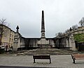 York City War Memorial - geograph.org.uk - 5323164.jpg 4,262 × 3,481; 4.63 MB
-
 York Minster and Dean's Park - geograph.org.uk - 5330955.jpg 800 × 600; 127 KB
-
 York Minster Chief Facade Panorama.jpg 5,091 × 6,981; 30.22 MB
-
 York Minster, North Yorkshire - from the City Walls (32513880464).jpg 5,028 × 3,313; 18.82 MB
-
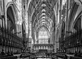 York Minster, North Yorkshire - The Great Quire.jpg 4,979 × 3,615; 14 MB
-
 York Observatory - geograph.org.uk - 5322954.jpg 4,896 × 3,672; 5.3 MB
-
 York Railway Station - geograph.org.uk - 5322919.jpg 4,896 × 3,672; 6.24 MB
-
 York roofscape - geograph.org.uk - 5330935.jpg 800 × 600; 86 KB
-
 York roofscape - geograph.org.uk - 5330947.jpg 800 × 600; 137 KB
-
 York Station - geograph.org.uk - 5309868.jpg 1,600 × 1,061; 356 KB
-
 Yorkshire Museum - geograph.org.uk - 5322950.jpg 4,896 × 3,672; 5.59 MB


.jpg)


.jpg)


