Category:Maps with stereographic projection
Jump to navigation
Jump to search

Maps with stereographic projection:
depending on point of perspective equatorial/polar/other:
- Longitudes: sections of ellipses/strait radial/sections of ellipses
- Latitudes: strait/circles/sections of ellipses
- Global outer curve: none (infinity)
See also:
- Category:Maps with orthographic projection (complete hemisphere)
- Category:Maps with equidistant conic projection (usually without polar zone)
English: This map-projection-related category exists in the following hierarchy:
- Category:Map projections
- Category:Maps by projection
- Category:Stereographic projection in cartography – media related to the Stereographic projection in cartography other than maps
- Category:Maps with stereographic projection (“Category:stereographic projections”) – maps made using the Stereographic projection in cartography
Media in category "Maps with stereographic projection"
The following 43 files are in this category, out of 43 total.
-

-
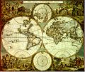
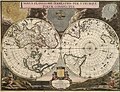 1672 95 Novus Planiglobii Valck'.jpg 8,500 × 6,487; 17.74 MB
-

-
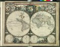
 1794 Samuel Dunn Wall Map of the World in Hemispheres - Geographicus - World2-dunn-1794.jpg 6,000 × 5,054; 8.92 MB
-

-
 APN2002-figure317b.png 492 × 495; 112 KB
-
-
 Blank map of Europe (polar stereographic projection).svg 576 × 333; 1,023 KB
-

-
 BrnBld ArcticCurrents.svg 932 × 903; 62 KB
-
 Confini orientali d'Europa - Urali-Ural-Kuma-Manyc.jpg 546 × 545; 80 KB
-
 Europe large location map.svg 700 × 545; 1.33 MB
-
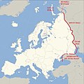
 Europe polar stereographic Caucasus Urals boundary.svg 700 × 545; 1.32 MB
-
 NetzentwuerfeStereographisch.png 342 × 210; 211 KB
-
 Oblique Stereographic with Tissot's Indicatrices of Distortion.svg 1,600 × 1,600; 612 KB
-
 Operational Navigation Chart A-1, 1st edition.jpg 9,254 × 6,693; 10.46 MB
-
 Operational Navigation Chart A-2, 2nd edition.jpg 9,254 × 6,659; 13.7 MB
-
 Operational Navigation Chart A-5, 3rd edition.jpg 9,254 × 6,613; 15.38 MB
-
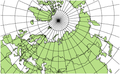
 Polar stereographic projections.jpg 640 × 320; 171 KB
-
 Stereographic Projection Japan.jpg 2,048 × 2,048; 1.14 MB
-
 Stereographic Projection Polar Extreme.jpg 2,048 × 2,048; 1.01 MB
-
 Stereographic Projection Polar.jpg 2,048 × 2,048; 1.09 MB
-
 Stereographic projection SW.JPG 2,060 × 2,060; 930 KB
-
 Stereographic Projection Transversal Extreme.jpg 2,048 × 2,048; 1,018 KB
-
 Stereographic Projection Transversal.jpg 2,048 × 2,048; 1.04 MB
-
 Stereographic Projection Water Hemisphere.jpg 2,048 × 2,048; 1.16 MB
-
 Stereographic projection with Tissot's indicatrix centering 0°N 0°E.svg 3,600 × 3,600; 2.39 MB
-
 Stereographic with Tissot's Indicatrices of Distortion.svg 1,600 × 1,600; 591 KB
-
 USGS-MarsMap-sim3292-20140714-full.png 5,588 × 4,269; 13.27 MB
-
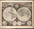
 Nova Orbis Tabula in Lucem Edita.jpg 2,172 × 1,820; 888 KB
-
 1670 Nova Orbis de Wit.JPG 4,566 × 3,880; 15.01 MB
-
 Nova Orbis Tabula in Lucem edita A F de Wit 1680.jpg 2,685 × 2,290; 6.89 MB
-
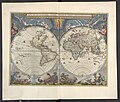
 17th century world map - Nova Totius Terrarum Orbis Tabula.jpg 11,665 × 10,270; 30.36 MB
-

-
 1660 Nova Totius de Wit 12 bladige wandkaart.jpg 3,584 × 2,752; 2.09 MB
-
 Nova totius terrarum orbis tabula auctore F. de Wit RMG F8117.tiff 4,800 × 3,722; 51.11 MB
-

-
 Nova totius terrarum orbis tabula (8429816765).jpg 800 × 678; 170 KB
-
 Ca. 1690 world map - Orbis Terrarum Nova et Accurata Tabula.jpg 7,225 × 6,225; 13.64 MB
-
 Planisphæri Coeleste de Wit.JPG 5,812 × 3,972; 19.07 MB
-
 Planisphæri cœleste.jpg 5,812 × 3,972; 19.07 MB
-
 1680 Planisphaerium Coeleste by Frederik de Wit.jpg 17,663 × 12,168; 51.83 MB
-
 World borders stereo.png 2,500 × 2,500; 805 KB


.1.(1).jpg)


,_RP-P-1891-A-16621.jpg)
.jpg)


.jpg)
.jpg)
.svg)
_cropped.svg)