Category:Maps with latitude and longitude grid
Jump to navigation
Jump to search
Subcategories
This category has the following 2 subcategories, out of 2 total.
L
Media in category "Maps with latitude and longitude grid"
The following 19 files are in this category, out of 19 total.
-
 Aitoff with Tissot's Indicatrices of Distortion.svg 1,600 × 800; 595 KB
-
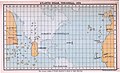 Atlantic Ocean, Toscanelli, 1474.jpg 1,990 × 1,215; 3.01 MB
-
 Gall isographic projection SW.jpg 2,068 × 1,466; 1.77 MB
-
 Indo-Pacific biogeographic region map-en.svg 1,950 × 1,200; 1.48 MB
-
 Indo-Pacific biogeographic region map-fr.svg 1,950 × 1,200; 1.48 MB
-
 Indo-Pacific biogeographic region map-sr.svg 1,950 × 1,200; 1.48 MB
-
 Indo-Pacific map outlines with ASEAN overlay.jpg 1,950 × 1,200; 277 KB
-
 Kavrayskiy VII with Tissot's Indicatrices of Distortion.svg 1,600 × 924; 605 KB
-
 Map projection-Eckert IV.png 1,001 × 502; 55 KB
-
 Map projection-Eckert VI.png 1,001 × 502; 56 KB
-
 Map-Projection-Eckert-I.png 840 × 440; 24 KB
-
 Mollweide projection SW.jpg 2,058 × 1,036; 596 KB
-
 Natural Earth with Tissot's Indicatrices of Distortion.svg 1,600 × 832; 599 KB
-
 Plate Carrée with Tissot's Indicatrices of Distortion.svg 1,600 × 800; 425 KB
-
 Robinson projection SW.jpg 2,058 × 1,050; 637 KB
-
 Wagner-II world map projection.jpg 4,010 × 2,010; 4.14 MB
-
 World map (Mercator projection) Pacific-centric.svg 720 × 661; 713 KB
-
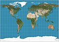
 World map longlat.svg 1,200 × 684; 801 KB
-
 World map Winkel Tripel proj-150Edeg centered.svg 1,950 × 1,200; 1.45 MB


_Pacific-centric.svg)

