Category:Maps showing 843
Jump to navigation
Jump to search
| 843 → |
English: Maps showing the year 843 (i.e. history maps)
See also category: 843 maps. and 840s maps for old maps created in this time.
See also category: 843 maps. and 840s maps for old maps created in this time.
Media in category "Maps showing 843"
The following 4 files are in this category, out of 4 total.
-
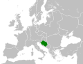 Croatia circa 843 CE.svg 500 × 380; 1.09 MB
-
 De karolingska rikena efter delningen i verdun 843.jpg 911 × 787; 386 KB
-
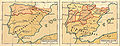 Pyreneiska halvön historisk.jpg 2,031 × 786; 670 KB
-
 West Francia 843.svg 500 × 380; 1.14 MB


